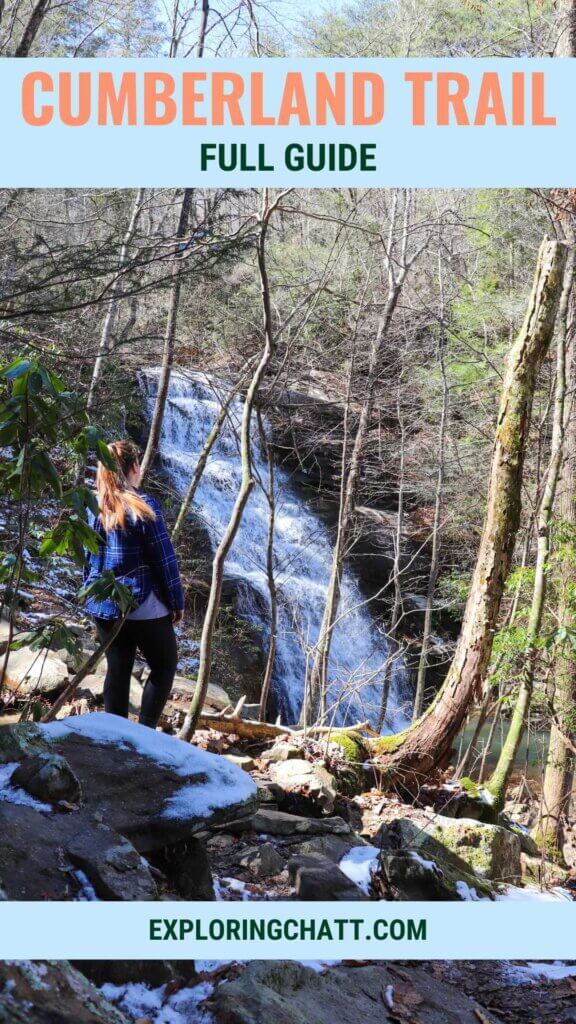
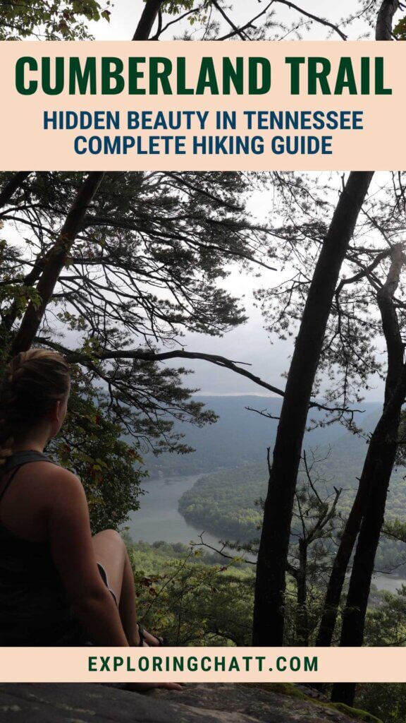
Enjoy hiking on the Cumberland Trail in Chattanooga and beyond or volunteer to help finish building the remaining portions of the trail.
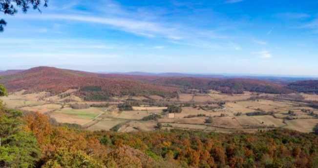
The Cumberland Trail will stretch from Signal Mountain in Chattanooga up over 300 miles into Cumberland Gap National Historical Park in Kentucky once it’s complete. Today, you can hike over 260 miles of completed trail broken into sections. And to really appreciate the fullness of this project, try volunteering to help build the portions of trail that still need to be finished. Continue reading to learn more about the trail sections I have explored already, sections that I still need to hike, and how to get involved as a volunteer.
In a hurry? Pin this post for later:

Cumberland Trails Conservancy
The Cumberland Trail would not exist or near completion without the Cumberland Trails Conservancy. This non-profit organization, previously known as “conference” instead of “conservancy,” works to attain the land and funds necessary to complete and maintain the Cumberland Trail which promotes conservation of the plants and wildlife that call Tennessee and Kentucky home. They recently updated their name as the phase has shifted from attaining more land to now completing and conserving what has already been aquired. The Tennessee Department of Environment and Conservation manages the efforts of the Cumberland Trails Conservancy.
How does the Cumberland Trail Work?
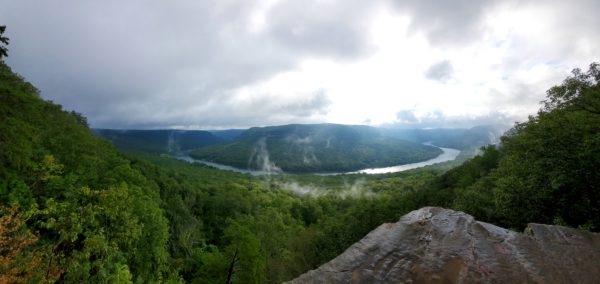
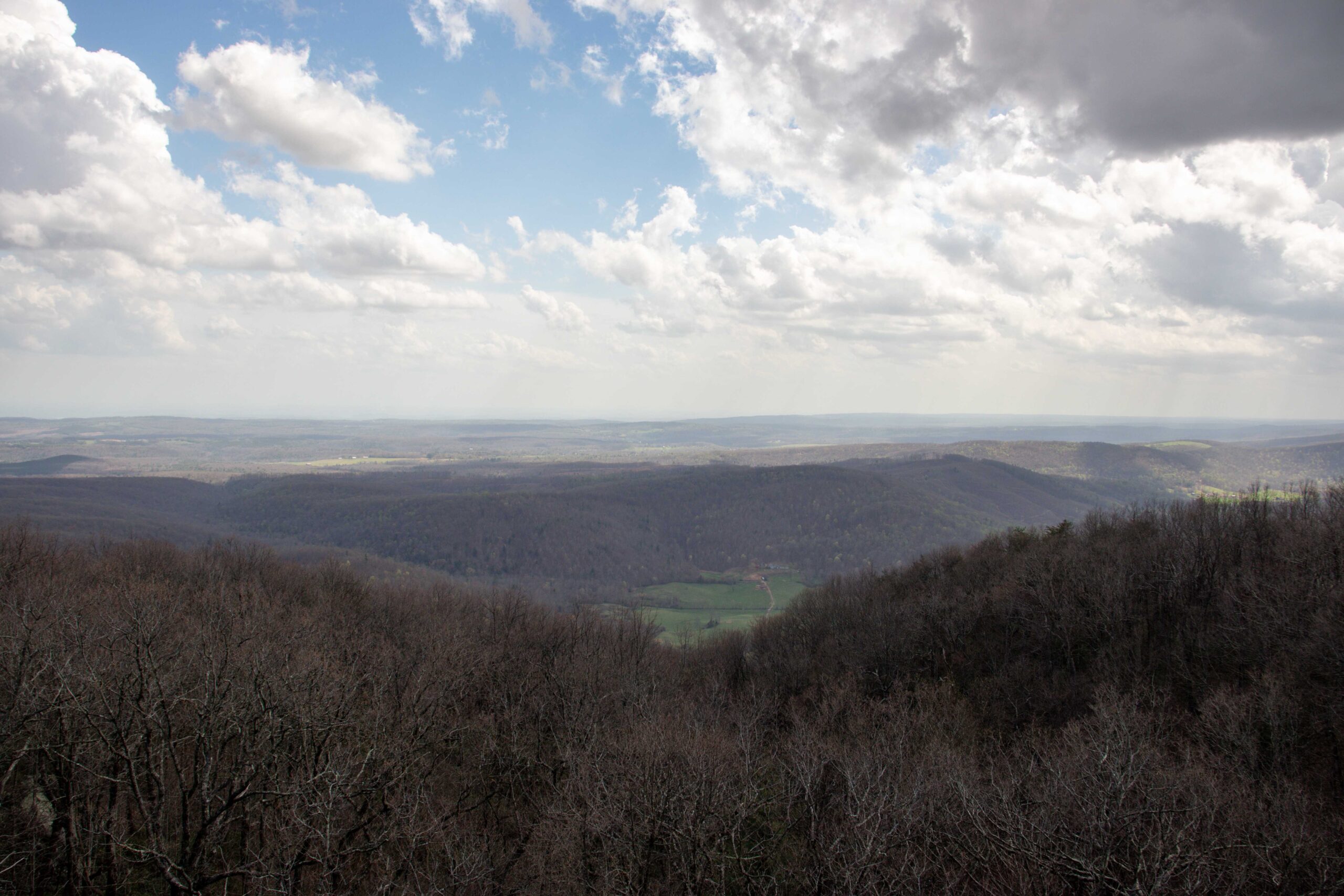
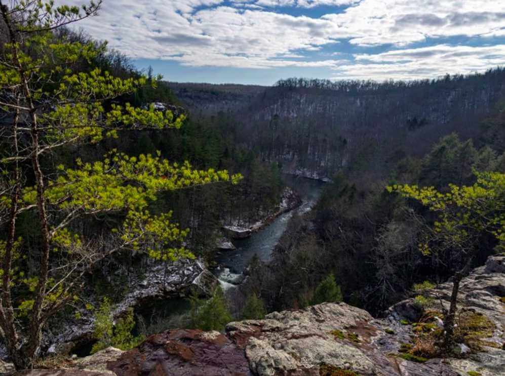
The Cumberland Trail as a whole is technically a state park. The trail is divided into “segments” which are then further divided into “sections” based on the flow of the land. There are currently 12 segments with a total of 30 sections. The Cumberland Trail’s northern terminus is in the Cumberland Gap National Historical Park in Middlesboro, Kentucky while the southern terminus is on Signal Mountain in Chattanooga, Tennessee. Their headquarters is located somewhere in the middle, at the Head of Sequatchie, which I recently explored for the first time and shared in my Head of Sequatchie blog post.
Another point to remember about the Cumberland Trail is that the trail blazes are white. No matter what portion of the Cumberland Trail you’re hiking on, you can rest assured that the white blazes will be the ones to guide your way.
Camping Along the Cumberland Trail
Camping is permitted in designated areas only. Not all sections of the Cumberland Trail have campsites. All campsites are primitive and require a permit. Please register to camp at any of the designated campsite locations on the Friends of the Cumberland Trail Website before your trip.
Volunteer to Help Finish Building the Cumberland Trail
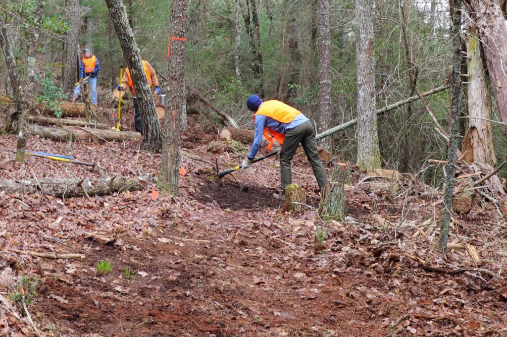
There’s a lot of planning and work that goes into building a sustainable hiking trail. And the Cumberland Trails Conservancy hosts volunteer days so you can get involved and be a part of history. Helping build the trail is hard work, but very rewarding when you get to hike on the trail you helped build after the section is completed and open to the public. Learn more about what to expect as a volunteer and how to get involved in my Volunteering to Help Build the Cumberland Trail blog post.
The Cumberland Trail Details
Before diving in, I want to explain how everything below is laid out. Starting from the southern terminus, we will work our way north on the Cumberland Trail. Each segment will have its sections. And each section will have a photo and the basic info about it. Then there will be a little details paragraph further explaining my experience or what I’ve learned from the Cumberland Trails Conservancy. I used their website for reference and spoke with them about permissions for using their photos, with credit of course, and additional verification of information. I hope this post helps you in your own explorations on the Cumberland Trail.
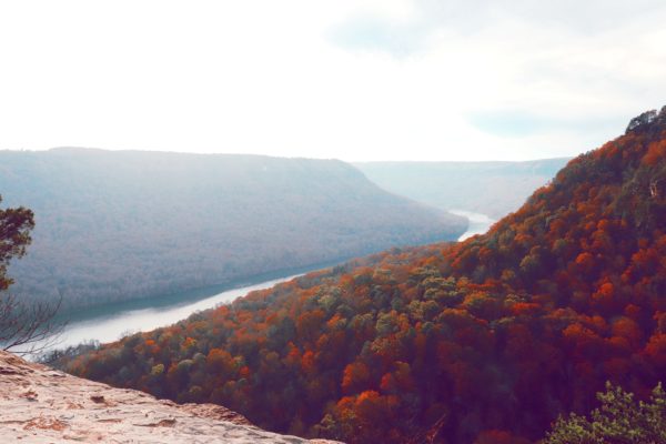
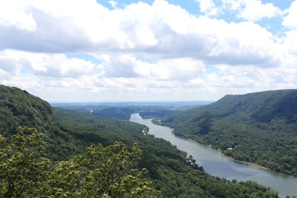
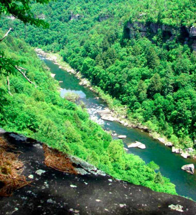
Tennessee River Gorge Segment
This segment of the Cumberland Trail consists of four sections that surround the Tennessee River Gorge.
Pot Point Loop Section
- Length: 11.7miles (loop)
- Elevation Change: 400ft.
- Campsites: 1
- Trail Details: Pot Point Loop Section
- Trailhead:
Snooper’s Rock
HUNTING SAFETY NOTE: This trail is closed during hunting seasons within the Prentice Cooper State Forest.
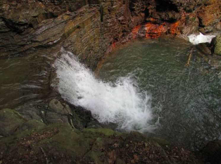
The Pot Point Loop, as the name implies, is a loop on the mountain within the Prentice Cooper State Forest. This hike consists of overlooks, a natural bridge, and a waterfall. Although there’s really only one trailhead for this loop, you can also connect to it from the bottom of the mountain via the Ritchie Hollow Trail. Although technically not part of the Cumberland Trail, I have personally only hiked from the Ritchie Hollow Trail up to Blowing Springs Falls and back which I share in my Ritchie Hollow blog post.
Mullens Cove Loop Section
- Length: 9.8miles (loop)
- Elevation Change: 300ft.
- Campsites: 1
- Trail Details: Mullens Cove Loop Section
- Trailheads:
Mullen’s Cove
Snooper’s Rock
HUNTING SAFETY NOTE: This trail is closed during hunting seasons within the Prentice Cooper State Forest.
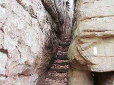
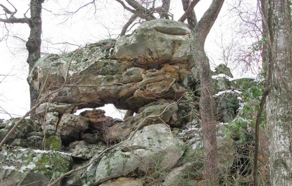
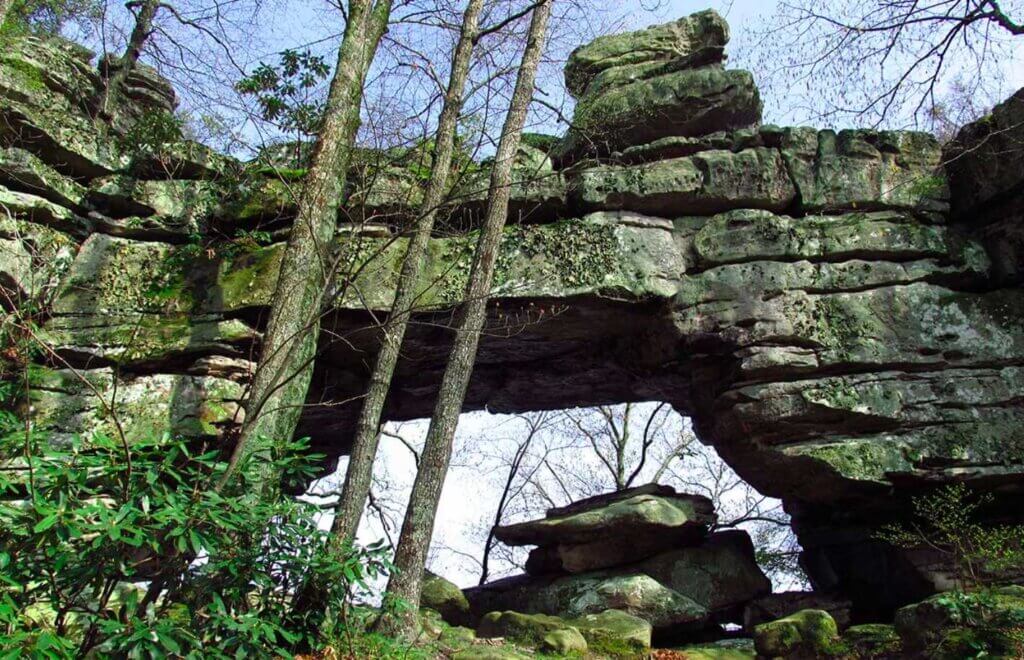
The Mullens Cove Loop is a trail within the Prentice Cooper State Forest. It actually overlaps with part of the Pot Point Loop, making an 8 shape. It also has some amazing views of the Tennessee River Gorge, including the Mullens Cove Overlook and Snooper’s Rock (which you can also access from the closer parking area at Snooper’s Rock Trailhead). This trail also passes an Indian rockhouse (a large stone shelter) and a “stone door.” (“Stone doors” are stairway passages between cracks in the bluff.) This is another section of trail that I have yet to hike.
Poplar Springs Section
- Length: 4.9miles
- Elevation Change: 400ft.
- Campsites: 1
- Trail Details: Poplar Springs Section
- Trailheads:
Mullen’s Cove
Suck Creek Road
HUNTING SAFETY NOTE: This trail is closed during hunting seasons within the Prentice Cooper State Forest.
The Poplar Springs Section of the Cumberland Trail is one of the oldest portions of trail within the Cumberland Trail system. It also has views of the Tennessee River and neighboring mountains as well as some “stone door” passages. The trail starts at the top of the mountain in the Prentice Cooper State Forest and descends to Suck Creek Road. I have yet to hike this section of trail, but I will update you on this when I do.
Signal and Edward’s Point Section
- Length: 8.4miles
- Elevation Change: 400ft.
- Campsites: 2
- Trail Details: Signal and Edward’s Point Section
- Trailheads:
Mushroom Rock
Rainbow Lake
Signal Point
This section begins on Suck Creek Road and heads up Signal Mountain. Along the way it passes Mushroom Rock and North Suck Creek. I’ve yet to explore this portion of the trail, but will fill you in with more details once I do.
I have, however, explored the northern 2 trailheads for this part of the Cumberland Trail. This section of trail has beautiful views of the Tennessee River and neighboring mountains, even from the starting point at the Signal Point Trailhead. From Signal Point you can hike out to Edward’s Point for more breathtaking views and stop at Rainbow Lake along the way. Rainbow Lake also has a trailhead which is actually a shorter hike to Edward’s Point than from Signal Point. Learn more about hiking from Signal Point to Edward’s Point or from Rainbow Lake to Edward’s Point in these blog posts.
North Chickamauga Creek Segment
This segment of the Cumberland Trail only contains one section, the North Chickamauga Creek Section.
North Chickamauga Creek Section
- Length: 8.3miles
- Elevation Change: 500ft.
- Campsites: 1
- Trail Details: North Chickamauga Creek Section
- Trailheads:
North Chickamauga Creek
Barker Camp Road
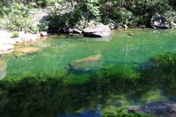
At the base of Mowbray Mountain in Soddy Daisy, Tennessee you’ll find the new Tennessee state park of the North Chickamauga Creek Gorge. This is one of the most popular trailheads of the Cumberland Trail. Enjoy the rapids and blue holes of the North Chickamauga Creek, small waterfalls, overlooks, and an open mine. I have only hiked to a small waterfall on the Hogskin Loop part of this trail within the state park and over to the blue holes which are not part of the Cumberland Trail. I still need to hike further and see all that this section of trail has to offer.
Three Gorges Segment
This Cumberland Trail segment covers three gorges, as the name implies, divided into four sections.
Soddy Creek Gorge Sections (South)
- Length: 4.9miles
- Elevation Change: 450ft.
- Campsites: 0
- Trail Details: Soddy Creek Gorge Section (South)
- Trailheads:
Mowbray Pike
Hotwater Road
Mowbray Pike Trailhead is one of the first sections of the Cumberland Trail that I hiked from when I first moved here. Today it’s still one of my favorite spots as it’s easy to access, has a mountain top view, and mini waterfalls along the creek. However, I’ve only hiked a little ways past the creek. I need to set out and actually hike this trail section in its entirety as it ends at Hotwater Road Trailhead or continues into the Big Soddy Creek Gulf area if you choose. Learn more about the begining of this hike in my fall day on Mowbray Mountain blog post.
Soddy Creek Gorge Section (North)
- Length: 12.1miles
- Elevation Change: 1,200ft.
- Campsites: 0
- Trail Details: Soddy Creek Gorge Section (North)
- Trailheads:
Hotwater Road
Big Soddy Gulf
Heiss Mountain
I have also hiked a small portion of the trail near the Big Soddy Creek Gulf Trailhead. Although the park has many additional trails to hike first in order to access the Cumberland Trail, I have only hiked to the bridge over Big Soddy Creek and back to the trailhead. Big Soddy Creek Gulf is another great park to visit. If you haven’t been before or want to see what is located in the park in detail, you can check out my Big Soddy Creek Gulf Guide.
Possum Creek Gorge Section
- Length: 9.5miles
- Elevation Change: 1,000ft.
- Campsites: 2
- Trail Details: Possum Creek Gorge Section
- Trailheads:
Heiss Mountain
Retro Hughes Road
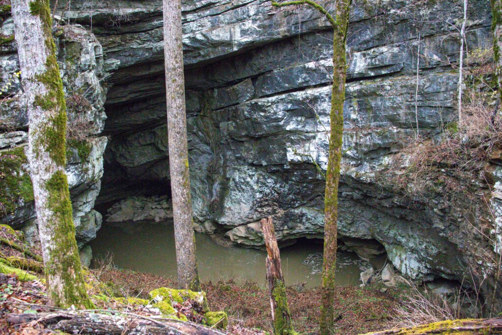
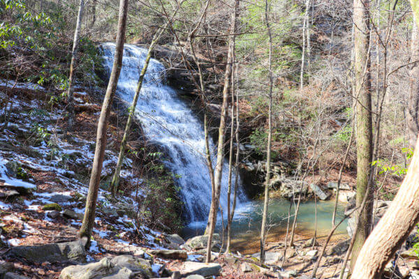
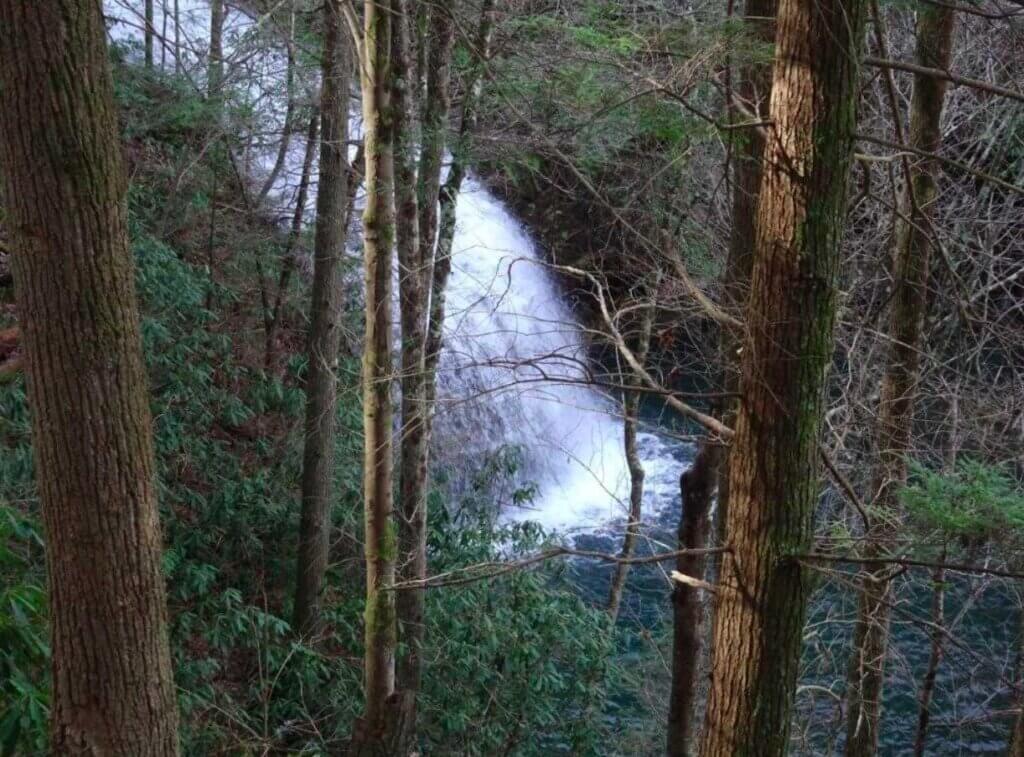
The Possum Creek Gorge section contains lots of climbing up and down mountains in order to cross the gorge. I have actually hiked part of this section starting at the Heiss Mountain Trailhead. This trail is not for the faint of heart as climbing up and down mountains is no easy feat. But the waterfall at the start of the Heiss Mountain Trailhead is worth a visit if you choose not to hike much further. The trail continues to the Retro Hughes Trailhead, but I have yet to hike past Little Possum Creek on this section of the trail.
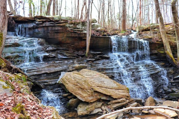
Rock Creek Gorge Section
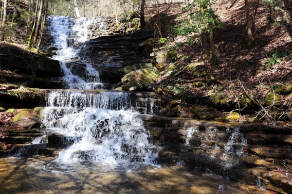
- Length: 5.4miles (includes Rock Creek Loop which is 3.4miles)
- Elevation Change: 300ft.
- Campsites: 1
- Trail Details: Rock Creek Gorge Section
- Trailheads:
Retro Hughes Road
Upper Leggett Road
Lower Leggett Road
Laurel-Snow Segment
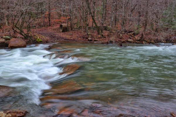
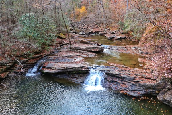
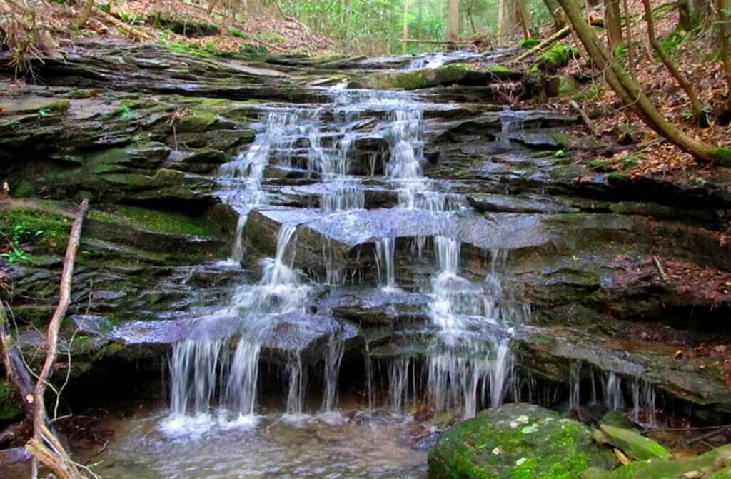
The Rock Creek Gorge Section is like a miniature Tennessee rainforest in the springtime. The hike has creek crossings, small waterfalls, and sticks by the water most of the way. It also has a short spur to Leggett Point which is a nice mountain view overlook. I have actually hiked this entire section! Learn more about the easier Rock Creek Loop portion of this trail in my blog post. Plan a shorter hike to Leggett Point Overlook and back. Or tackle the longer 8 mile trek through the rainforest-like portion of this trail with the Retro Hughes Trailhead hike.
This Cumberland Trail segment covers Graysville Mountain and the Laurel-Snow State Natural Area within its four sections.
McGill Creek Section
- Length: 2.8miles
- Elevation Change: 410ft.
- Campsites: 0
- Trail Details: McGill Creek Section
- Trailhead:
Roaring Creek
The McGill Creek Section is only partially finished. Currently, the Roaring Creek Trailhead is the only trailhead for this section, but there are plans to complete this section to the next trailhead later this year. Here the Cumberland Trail follows Brayton Mountain Road a ways before crossing the road and continuing towards McGill Creek. The trail follows the creek for a little ways before ending, for now, at McGill Creek Falls. This is another section I have yet to hike.
Graysville Mountain Resource Management Area Section
- Length: 9miles
- Elevation Change: 900ft.
- Campsites: 0
- Trail Details: Graysville Mountain RMA
- Trailhead:
Brayton Mountain Road
SR 30
The Graysville Mountain Resource Management Area Section is a finished portion of the Cumberland Trail with the second trailhead off Highway 30. However, the Cumberland Trail Conservancy’s website and map do not reflect this yet. This section of trail covers Graysville Mountain featuring a couple of waterfalls and many overlooks. I have yet to hike any of this section, but I can’t wait to explore it!
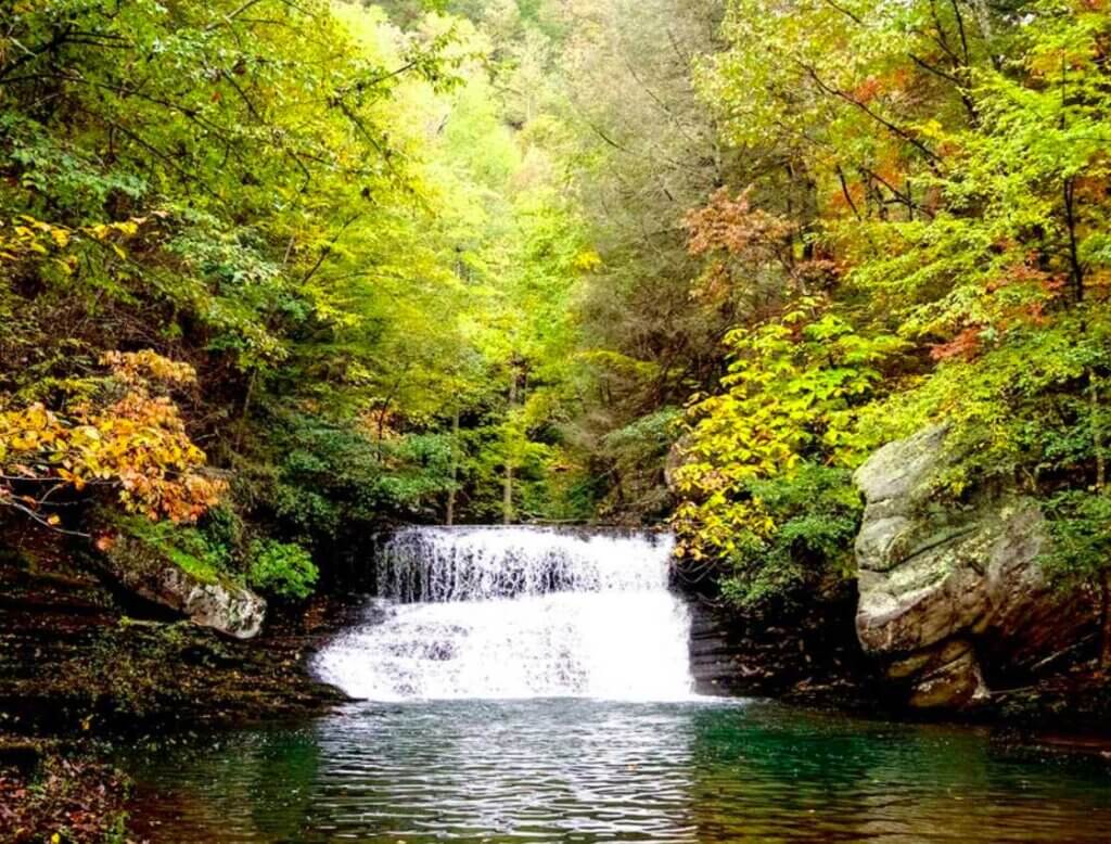
Laurel-Snow State Natural Area Section
- Length: 3.5miles to Laurel Falls (right) or 4.25miles to Bryan Overlook (right) or 5miles to Snow Falls (left)
- Elevation Change: 900ft.
- Campsites: 3
- Trail Details: Laurel-Snow SNA
- Trailhead:
Laurel-Snow
Laurel-Snow State Natural Area is another great park to visit, full of local history, creeks, and waterfalls. I have hiked here a few times, but I’ve only gone up to Laurel Falls and back. I still need to make a day hike to Snow Falls and back, but that will be a long 10-mile hike day. With the experience and knowledge I have of the area, I have also created a Laurel-Snow State Natural Area Guide if you want to learn more.
Laurel-Snow Uplands Section
This section is still under development and the Cumberland Trail does not exist here yet.
Piney River Segment
This Cumberland Trail segment follows its namesake, the Piney River, divided into two sections.
Upper Piney River Section
- Length: about 11miles
- Elevation Change: unknown
- Campsites: unknown
- Trail Details: unknown
- Trailheads:
Pine Creek Road
Piney River
This section is the newest, recently completed section of the Cumberland Trail. I actually got to help build a small portion of this section! You can learn more about this and what all goes into being a volunteer in my Volunteer to Help Build the Cumberland Trail Guide. Currently, this section is not yet mapped or written about on the website. So, we’ll have to wait for those details. In the meantime, I may have the opportunity to hike it myself and share the info with you! But for now, I have yet to explore this section completely.
For clarification, this section follows the Piney River as it flows. Even though it technically goes south to north, this section is called the Upper Piney River Section because it follows the upper part of the Piney River. This portion of the trail meets up with the Lower Piney River Section at a Y intersection by the Piney River.
Lower Piney River Section
- Length: 8.5miles
- Elevation Change: 722ft.
- Campsites: 1
- Trail Details: Lower Piney River Section
- Trailheads:
Piney River
Newby Branch
I have actually hiked part of this section from the Newby Branch Trailhead out to Hemlock Falls and back. It’s actually one of my favorite sections I’ve explored so far on the Cumberland Trail due to its unique waterfalls, swimming holes, and bridges. I still need to go back and hike from the Piney River Trailhead which is much easier to access. You can learn more about my hike in my Newby Branch Trailhead Guide.
For further clarification, the Newby Branch Trailhead follows Duskin Creek until it meets at the Piney River where there’s a bridge crossing and it intersects with the Upper Piney River Section. The two portions of trail continue north to the Piney River Trailhead.
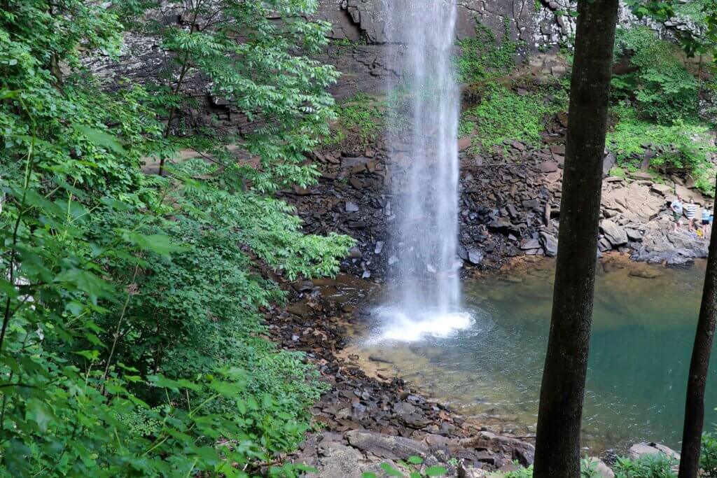
The Falls Segment
This segment of the Cumberland Trail includes two sections with waterfalls, hence the name.
Stinging Fork Section (or Soak Creek Section)
- Length: 5.8miles
- Elevation Change: 851ft.
- Campsites: 1
- Trail Details: Stinging Fork Section
- Trailheads:
Piney River
Stinging Fork Falls
This section also shares a trailhead with Stinging Fork Falls. But the southern trailhead is just up the street from the Piney River Trailhead. Please note the parking area and directions to get to this trailhead in the Trail Details linked above. Starting from the southern end, this portion of the trail climbs up the next mountain and ends at Stinging Fork Falls. This is another hike I have yet to explore but plan to soon!
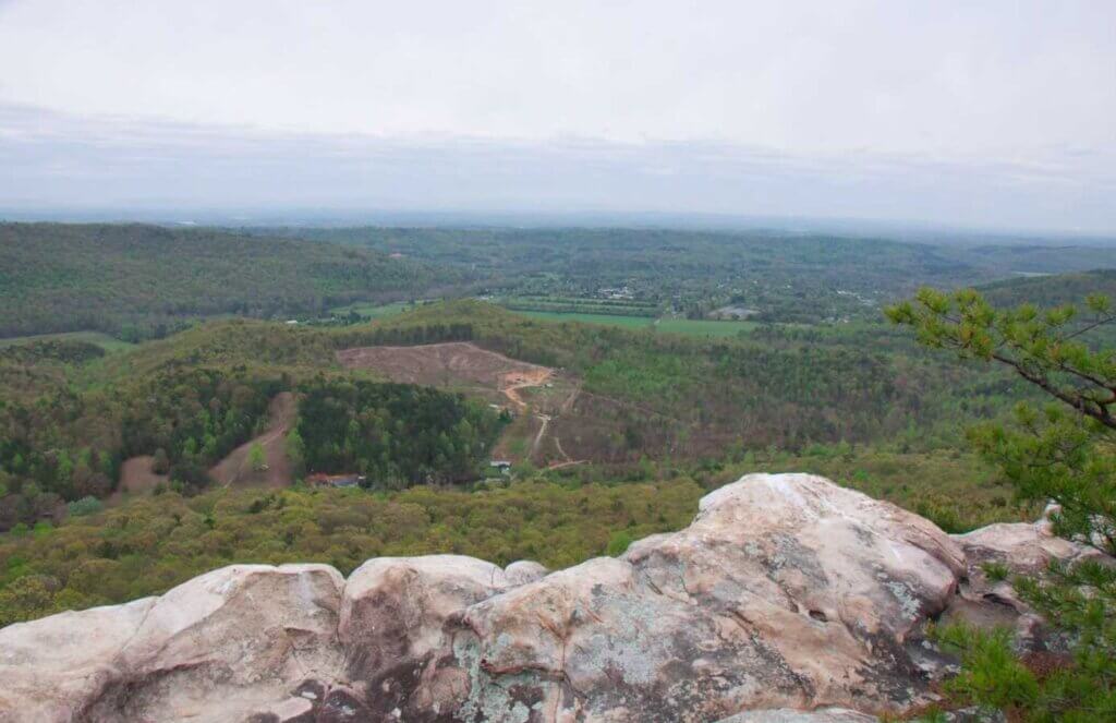
Hinch Mountain Section
- Length: 17.3miles
- Elevation Change: 2,700ft.
- Campsites: 0
- Trail Details: Hinch Mountain Section
- Trailheads:
Stinging Fork Falls
Head of Sequatchie
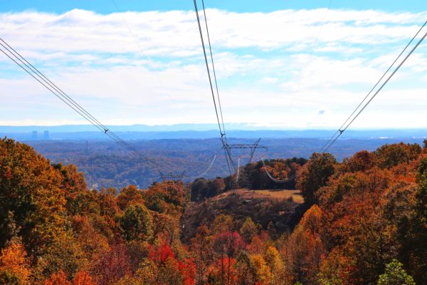
This section is not for the faint of heart. It’s very long and climbs up and down mountains, mainly Hinch Mountain. It features creeks and waterfalls, starting with Stinging Fork Falls which is the southern trailhead for this section. Since the trail is long and ends at Head of the Sequatchie, there’s an option to cut over onto Radar Tower Road and hike the road to the next section of the Cumberland Trail. This is key for through-hikers looking to make the best use of their mileage while completing the Cumberland Trail hike. This trail section is another one I have yet to visit.
Grassy Cove Segment
This Cumberland Trail segment is divided into three sections within the Grassy Cove area.
Brady Mountain Section
- Length: 7.8miles
- Elevation Change: 800ft.
- Campsites: 0
- Trail Details: Brady Mountain Section
- Trailheads:
Happy Top Road
SR 68
The Brady Mountain Section covers hiking over Brady Mountain. This includes mountain top views and hiking through old railroad track beds. I have yet to hike this section, but from what I can tell, it’s easy to accidentally veer off the trail. Be sure to pay special attention and follow the white trail blazes.
Black Mountain Section
- Length: 3.6miles
- Elevation Change: 900ft.
- Campsites: 1
- Trail Details: Black Mountain Section
- Trailheads:
SR 68
Black Mountain Road
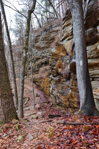
The Black Mountain Section offers a loop trail which is perfect if you want to day hike this section of the Cumberland Trail. The scenic trail features mountain top views, numerous rock formations, a cave, and an old spring house. I have only explored the top of the mountain for this section of the Cumberland Trail which only scratches the surface of this section. Learn more about the additional trails involved in my Black Mountain Hiking Guide.
Ozone Falls Section
- Length: 6.7miles
- Elevation Change: 2,069ft.
- Campsites: 0
- Trail Details: Ozone Falls Section
- Trailheads:
Black Mountain Road
Ozone Falls
This section of the trail descends Black Mountain to Ozone Falls. Although I’ve visited Ozone Falls, I have not hiked much of this trail at all. And from what I’ve read, it would be wise to keep the directions linked above handy on your hike. It seems there’s some easy to mix up spots and a bridgeless creek crossing. There’s also a hunting preserve alongside the trail for a little ways so be cautious here. If you just want to visit Ozone Falls via a short hike, check out my Crossville Day Guide.
Crab Orchard Mountain Segment
This Cumberland Trail segment is divided into two sections that follow Daddy’s Creek.
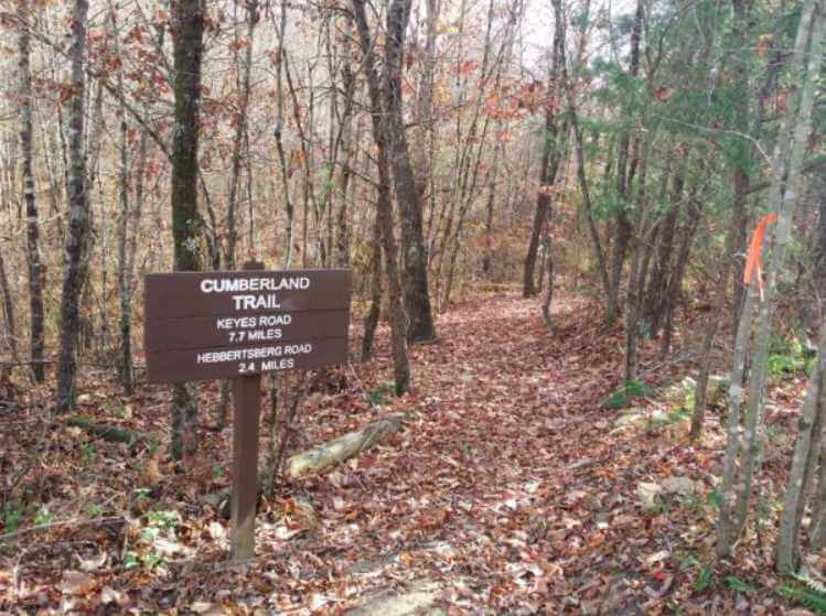
Daddy’s Creek Section
- Length: 7.5miles
- Elevation Change: 324ft.
- Campsites: 1
- Trail Details: Daddy’s Creek Section
- Trailheads:
Hebbertsburg Road
East Keyes Road
HUNTING SAFETY NOTE: Part of this trail is within the Keyes-Harrison Wildlife Management Area and you’ll need to wear blaze orange if you’re hiking through during hunting seasons.
The Cumberland Trail passes a cave and overlook before meeting up with Daddy’s Creek which it follows for a distance. Although this section is technically finished, a 2.5mile stretch of trail that connects the East Keyes Road Trailhead with the Pevine Road Trailhead for the next section is currently underway. Once completed, this additional portion will allow hikers to stay in the woods on a trail rather than walk on the road between the two trailheads. I have yet to explore this section of the Cumberland Trail.
Devil’s Breakfast Table Section
- Length: 7.6miles
- Elevation Change: 1,900ft.
- Campsites: 1
- Trail Details: Devil’s Breakfast Table Section
- Trailheads:
Peavine Road
Daddy’s Creek
HUNTING SAFETY NOTE: Part of this trail is within the Keyes-Harrison Wildlife Management Area and you’ll need to wear blaze orange if you’re hiking through during hunting seasons.
This trail climbs above Daddy’s Creek with a few overlook spots that can be found via their spur trails. You will not be able to drive to the Devil’s Breakfast Table Trailhead during hunting days. The roads will be gated closed. Again, I have not explored any of this section yet.
Obed Wilds and Scenic River Segment
This Cumberland Trail segment is divided into two sections that follow the Obed River and Emory River.
Obed River Section
- Length: 14.1miles
- Elevation Change: 1,200ft.
- Campsites: 2
- Trail Details: Obed River Section
- Trailheads:
Daddy’s Creek
Nemo Bridge
HUNTING SAFETY NOTE: Part of this trail is within the Keyes-Harrison Wildlife Management Area and you’ll need to wear blaze orange if you’re hiking through during hunting seasons.
Most of the Obed River Section goes through the Keyes-Harrison Wildlife Management Area. Another thing to note is that this trail crosses timezone lines so be mindful of when you’re in the Central or Eastern timezone. The trail continues to follow Daddy’s Creek until it turns and begins to follow the Obed River. There’s overlooks, rock shelters, and an old mine on this section of the Cumberland Trail. I have yet to hike here.
Emory River Gorge Section
- Length: 1.3miles
- Elevation Change: 450ft.
- Campsites: 12 campsite area (Rock Creek Campground) at trailhead
- Trail Details: Emory River Gorge Section
- Trailhead:
Rock Creek Campground
The Cumberland Trail crosses Emory River via the iron Nemo Bridge at the start of the Emory River Gorge Section. Unfortunately, this section is very short for now while the northern end is still to be constructed. Again, I have not explored this section of the Cumberland Trail yet.
Bird Mountain Segment
This Cumberland Trail segment is divided into two sections and is considered the ending of the Cumberland Plateau and beginning of the Cumberland Mountains.
Emory Tract Section
- Length: 3.1miles
- Elevation Change: 4,400ft.
- Campsites: 0
- Trail Details: EmoryTract Section
- Trailhead:
Rocky Fork
This section of the Cumberland Trail is also incomplete. Once completed the section will start in Wartburg and climb up Bird Mountain which is inside Frozen Head State Park. Currently only a small portion on top of Bird Mountain is complete, connecting to the next section. And a portion down in Wartburg is also complete, heading towards Bird Mountain. From the Morgan County Visitor’s Center in Wartburg you can take a loop trail up and back down. Or start at Rocky Fork Trailhead for a hike up Bird Mountain and to the currently completed part of the section at the top (turn left). I have not explored either of these trails yet.
Frozen Head State Park Section
- Length: 7.9miles
- Elevation Change: 2,700ft.
- Campsites: 1 (or hike a different trail to Big Cove Campground within the state park)
- Trail Details: Frozen Head State Park Section
- Trailhead:
Rocky Fork
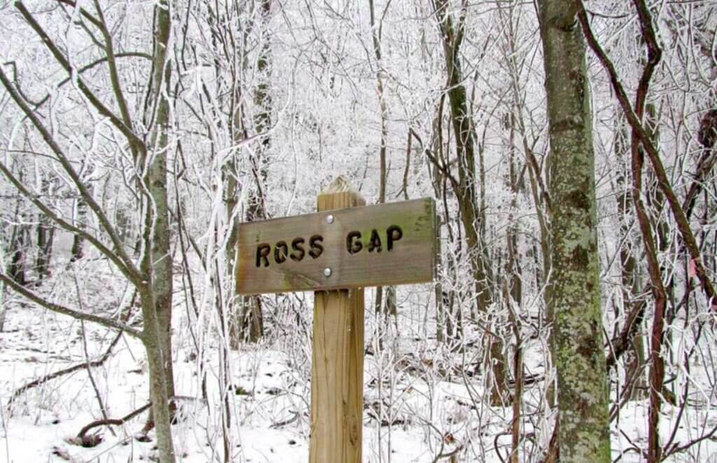
Ross Gap
Bird Mountain Trailhead
As the name suggests, this section of the Cumberland Trail goes straight through Frozen Head State Park. Since this section is inside the state park, pay extra attention to the trail blazes. There are a few intersecting park trails so be mindful not to get turned around. This section can be accessed via Rocky Fork Trailhead, the park’s visitor’s center, or the Big Cove Campground within the park (Bird Mountain Trailhead). Again, I have not explored this section yet.
New River Segment
This segment of the Cumberland Trail consists of three sections through the Cumberland Mountains.
Arch Mountain Section
- Length: 13miles
- Elevation Change: 2,373ft.
- Campsites: 0
- Trail Details: Arch Mountain Section
- Trailheads:
Rocky Fork
Ross Gap
Bird Mountain Trailhead
Smokey Road
HUNTING SAFETY NOTE: Part of this trail is within the North Cumberland Wildlife Management Area and you’ll need to wear blaze orange if you’re hiking through during hunting seasons.
As the Cumberland Trail leaves Frozen Head State Park, it goes into the North Cumberland Wildlife Management Area. The section ends at Smoky Road Trailhead after a wet creek crossing of Smoky Creek. This section appears to be a tough section of trail, and I have not explored it yet.
Lawson Mountain Section
- Length: 9.8miles
- Elevation Change: 1,350ft.
- Campsites: 0
- Trail Details: Lawson Mountain Section
- Trailheads:
Smokey Road
Norma Road
HUNTING SAFETY NOTE: Part of this trail is within the North Cumberland Wildlife Management Area and you’ll need to wear blaze orange if you’re hiking through during hunting seasons.
This section appears to be even tougher than the last with more climbing up and down mountains. The trail follows Cave Branch a little ways before turning to head up the mountain. Then it traverses the mountains with some overlooks, a couple of ponds, and crosses Lick Creek a couple times before ending near New River. Once again, I have not explored any of this section.
Anderson and Cross Mountains Section
- Length: 17miles
- Elevation Change: 2,020ft.
- Campsites: 2
- Trail Details: Anderson and Cross Mountains Section
- Trailheads:
Norma Road
Bruce Gap
HUNTING SAFETY NOTE: Part of this trail is within the North Cumberland Wildlife Management Area and you’ll need to wear blaze orange if you’re hiking through during hunting seasons.
This section is one of the most remote areas of the Cumberland Trail that is rarely trafficked. Because of this, you should expect overgrowth and possibly broken bridges across the branches the trail crosses. But, this section of trail features a mountain top meadow, views, and solitude. I have not explored this section yet.
Cumberland Mountain Segment
This is the north end segment of the Cumberland Trail which is divided into three sections.
Eagle Bluff Section
- Length: 11.7miles
- Elevation Change: 3,446ft.
- Campsites: 1
- Trail Details: Eagle Bluff Section
- Trailheads:
Bruce Gap
Tank Springs
This Cumberland Trail section starts inside Cove Lake State Park and climbs Cumberland Mountain where the trail continues for a long distance across the ridge until it descends and ends at Tank Springs Trailhead. There’s a waterfall, numerous mountain top views, and so many unique rock formations. This is another section I have yet to explore.
Tennessee Valley Divide Section (South)
- Length: 18.5
- Elevation Change: 1,760ft.
- Campsites: 0
- Trail Details: Tennessee Valley Divide Section (South)
- Trailheads:
Tank Springs
Wilson Gap
This is one of the oldest sections on the Cumberland Trail. It was initially built in the 1980s but was left to grow wild in the early 1990s. Because of the age and wild nature of this section of the trail, it’s advised that only experienced hikers brave this section. There are plenty of intersections and places to get lost without proper navigation so please don’t go into this one blindly. I have not had a chance to explore this one yet myself. From what I can tell, the Wilson Gap Trailhead is off the beaten path and may require and off-road vehicle to access.
Tennessee Valley Divide Section (North)
- Length: 7.8
- Elevation Change: 1,000ft.
- Campsites: 0
- Traill Details: Tennessee Valley Divide Section (North)
- Trailheads:
Wilson Gap
Carr Gap
Again, from what I can tell, the Wilson Gap Trailhead is off the beaten path and may require and off-road vehicle to access. This section of the Cumberland Trail continues along the ridge of Cumberland Mountain. Once on top, the hiking is easier and there are various views of the valley below. This is a common ATV trail so be mindful of ATV traffic. I have yet to explore this section.
Conclusion
That wraps up my complete guide to the Cumberland Trail which has 50 trail heads currently, extending over 260 miles through the Tennessee foothills. Please note that the Cumberland Trail is currently incomplete and you cannot hike these miles of trail continuously. As I am able to hike more of the Cumberland Trail, I’ll update this post so stay tuned. Additionally, I’ll share any updates on trail construction. Consider helping further the trail to completion by volunteering to help build the Cumberland Trail. Until then, enjoy exploring Chatt!

More Chattanooga Area Hikes:
Inspired? Pin this post for later:
I connected to your complete guide to the Cumberland Trail via the April newsletter from the CTC. I certainly appreciate the effort involved in compiling info about the CT. Online representation of the CT is lacking at best. More folks like you who realize the CT to be a crown jewel for Tennessee are needed. So, thank you!
Having thru-hiked the trail in the Spring of 2024 (325.5 miles over 23 days) I noted a couple of inaccuracies in your complete guide – the most glaring that it can’t yet be thru-hiked. It can. I did it.
If you are ever interested in hearing from someone who has recently hiked the whole thing; I would welcome the phone call, 812-202-8074, or email.
Again , thank you for promoting the CT!
Thanks Curtis! I appreciate it! That’s awesome that you were able to make the thru-ish hike, haha. It’s a challenging terrain in some areas and even more challenging when you reach those incomplete sections. I’ll reach out to you for verification on making sure the info I share is accurate. Thank you!
Has anyone hiked the new section, Upper Piney River? I’m wondering if there is a flat spot to camp between Bumbee Creek and where it turns uphill, roughly 4 miles from Upper PR TH. Please e-mail me as I may not find this website again.
I am unsure about camping spots on this section, but you can direct this question to the CTC. I will send you an email about this as well.