Laurel Snow State Natural Area is full of raging creeks, flowing waterfalls, and historic remains, making it one of the best hiking areas in the Chattanooga area.
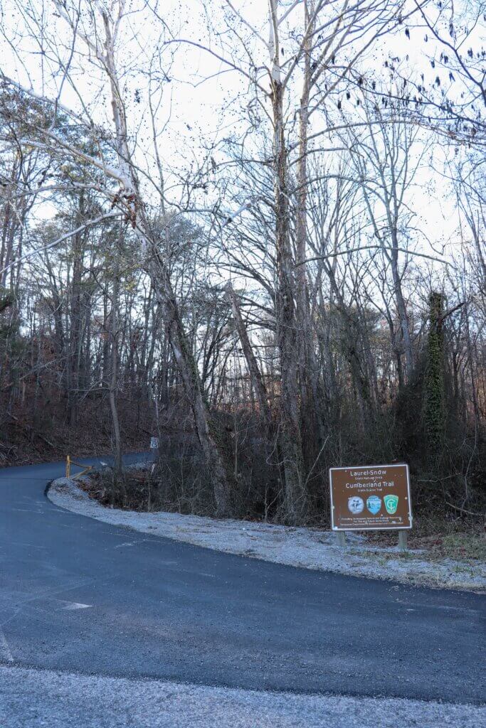
Waterfalls, creeks, an abandoned mine and more are what you’ll find in the Laurel Snow State Natural Area. And with a newly paved driveway and parking area, anyone can now access this amazing park. Keep reading to learn more about this place, why it’s one of the best hikes, and tips for your visit.
In a hurry? Pin this post for later:
Explore Laurel Falls and more in my detailed hiking guide!
This hike to Laurel Falls is featured in my e-book “A Year of Hiking” with all the details, photos, maps, and journal section you need to confidently explore this hiking trail and more all year long.
About Laurel Snow State Natural Area
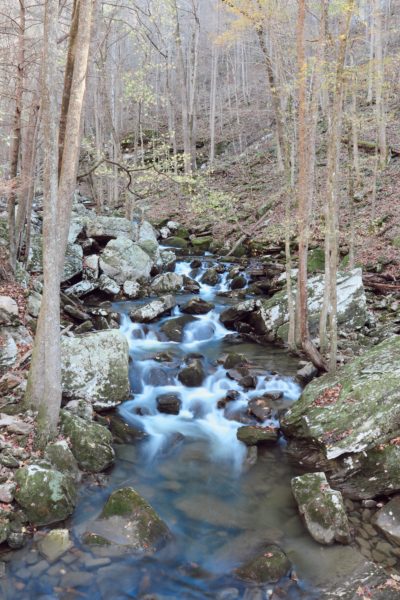
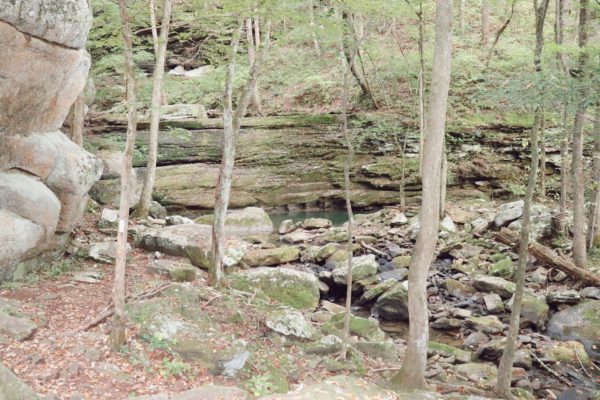
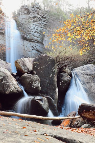
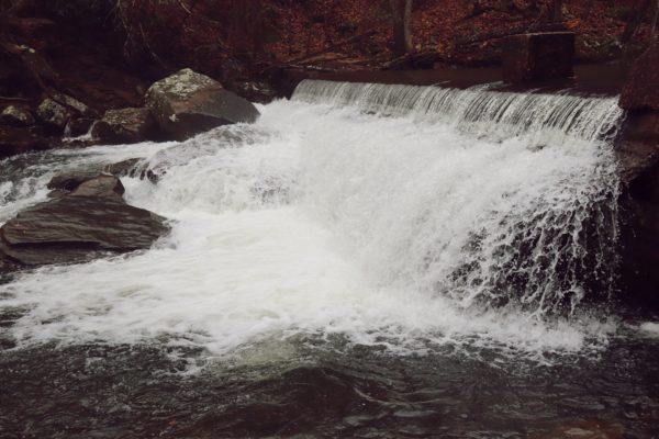
Also known as Pocket Wilderness, Laurel Snow State Natural Area is home to the first designated national hiking trail in Tennessee. The park is rich in history and well-loved by the locals. Some of the trails are part of the Cumberland Trail which is currently comprised of numerous sections to one day make a 300 mile long trail stretching across the Cumberland Plateau through Tennessee. Laurel Snow State Natural Area is 2,259 acres of land including nearly 15 miles of trails and numerous creeks fed by two main waterfalls. These waterfalls are the 80ft Laurel Falls and 35ft Snow Falls.
Hiking at Laurel Snow State Natural Area
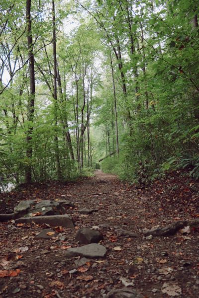
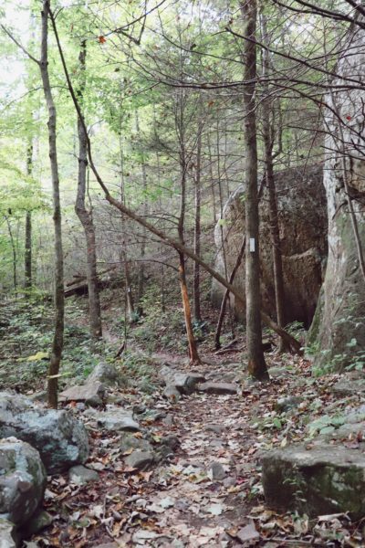
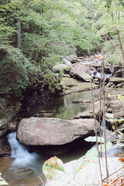
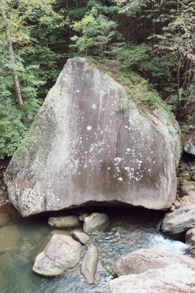
From the trailhead of the Laurel Snow State Natural Area starts the hike down by Richland Creek. This portion of the hike is fairly flat, wide and easy. Along the way are many unique sights to see wrapped in 20th century history. From old pipe and railroad ties to an abandoned coal mine, there’s so much history to explore just in this 2 mile stretch of the Laurel Snow State Natural Area. Just past this section, the trail forks uphill to head toward Laurel Falls and Snow Falls. There’s a 50ft metal bridge that crosses over Laurel Creek. After the bridge the trail splits again to go toward Laurel Falls or Snow Falls.
The Waterfalls and Overlooks of Laurel Snow State Natural Area
Laurel Falls
Laurel Falls is about a 3.5 mile hike from the trailhead. This hike is a bit more strenuous than some of the hiking trails I’ve covered due to the length and incline up the mountain. What I love most about this hike is how the trail is designed. Compared to most up-mountain trails I’ve hiked, this one gradually climbs up via switchbacks. Typically trails up mountains are quite steep and straight up. But this one takes its time, allowing you some gradual incline “plateaus” to catch your breath before the next steep switchback. If it weren’t for the long switchback climb up, the hike would probably be a mile shorter.
Bryan Overlook
If you’re able to go another three quarters of a mile past the falls, the trail continues up the mountain, around the falls, and to Bryan Overlook. The first time I hiked here I forgot to look for this continuation of the trail. But recently I hiked here and finally found it. However, I haven’t had the time to hike to the overlook yet so I’ll have to share about this later when I do.
Explore Laurel Falls and more in my detailed hiking guide!
This hike to Laurel Falls is featured in my e-book “A Year of Hiking” with all the details, photos, maps, and journal section you need to confidently explore this hiking trail and more all year long.
Snow Falls
Snow Falls is about a 5 mile hike from the trailhead making it a more strenuous hike than the one to Laurel Falls. Snow Falls is also a smaller waterfall than Laurel Falls. These two factors make it the less-visited of the two, and I have yet to make the trek out there myself. One day I will and will of course share the experience with you then.
Buzzard Point
Just like the trail by Laurel Falls has Bryan Overlook, the trail by Snow Falls has Buzzard Point. Like I said before, I have yet to hike out in this direction so I haven’t been here yet. But from what I hear, this is the most desirable overlook in the Laurel Snow State Natural Area and worth the longer mileage hike.
The History Preserved in the Laurel Snow State Natural Area
Bowater Logging
Laurel Snow State Natural Area was used for logging back in the mid-1900’s as the Bowater Paper Mill started operating in Calhoun, TN. This mill is still in operation today under the name of Resolute Forest Products. Some of the trails in this park are old logging roads from these old operations.


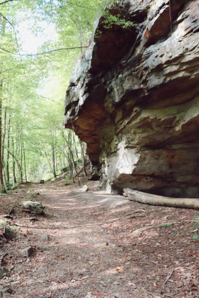
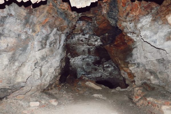
Richland Mine
Another part of history you’ll see on your hike here is the Richland Mine. The mine was for coal and parts of it still remain today. You can walk inside a little ways, but do not go too far. The floor remains slick and dangerous and there’s water in the back from flooding. The main trail into the park used to be a small railway to carry the coal out of the mines. You can even see some of the old railroad ties in a small section on the trail.

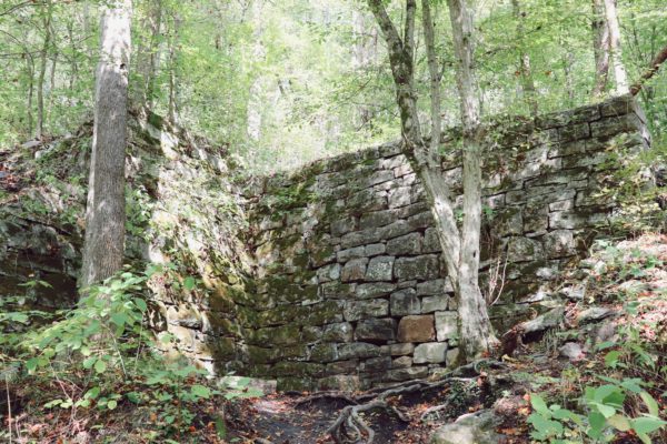
Old Dayton Water Reservoir
This reservoir was created for the town of Dayton in the early 1900’s to provide water to the town by use of Richland Creek. However, by 1965, Dayton had outgrown the use of this water supply and built their own water treatment plant instead. Today, you can still see old pipes leading down the trail from when Dayton still utilized this reservoir.
It’s amazing how well the structure is still standing today. The hike out to it however, has not stood well. The trail is overgrown and pretty much non-existent at this point. Although you can still get out there, I only suggest proceeding with caution as this is not a maintained part of the official trail. Just keep hiking straight instead of going up the main trail at the first switchback junction to find the dam. If you’re not interested in this creekside trail-blazing experience, you can also see the dam from up higher on the first portion of the trail that heads up the mountain via the switchbacks.
Laurel Snow State Natural Area Tips
When to Visit
Fall and Winter are the best seasons to visit, especially if there’s been plenty of rain recently. This ensures that the waterfalls are flowing as well as having more beautiful views to enjoy. If you can go on a weekday or early in the morning on the weekend you’ll be well off. This place is popular so parking fills up quickly and you cannot park on the road. And there’s a newly paved asphalt parking lot and driveway up to the trailhead allowing any vehicle to make the destination. Note that the gates close promptly at 7pm so be sure to be out before you get locked in.
What to Pack
One of my first hikes here turned into a miserable one because it rained the entire time and I was not prepared. I had never hiked in the rain before and did not have the proper attire, shoes, or supplies. You can watch this miserable hike on YouTube to see what I learned. And now, I have the experience to share my must-have hiking essentials. Definitely be prepared for whatever may come your way, especially on these longer hikes.
Trick of the Trail
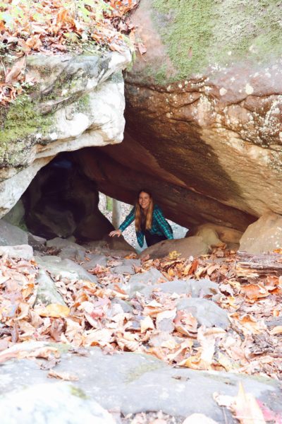
There’s a confusing spot soon after the 50ft metal bridge as you’re headed up to the Laurel Falls section. At this point, you’re on the left side of the creek, following it up the mountain. Soon you will come to a point where there’s a bunch of boulders. Look for the white trail blazes and be sure to follow them. Soon you’ll see a double white blaze on a small tree. This is where you turn left and climb through a small boulder tunnel. As someone who does not like rocks or climbing, I actually do not mind this spot and find it rather fun and another unique characteristic of this trail. It’s not difficult to get through and adds to the adventure of this hike.
Explore Laurel Falls and more in my detailed hiking guide!
This hike to Laurel Falls is featured in my e-book “A Year of Hiking” with all the details, photos, maps, and journal section you need to confidently explore this hiking trail and more all year long.
Closing Thoughts
I’ve hiked to Laurel Falls a couple of times now and along the main trail a few times. Even just to hike here for the views of Richland Creek and the old mine and history of this place make the trip worthwhile. It’s easy to see why Laurel Snow State Natural Area is a favorite hiking location amongst the locals.
I want to hike to Snow Falls and Buzzard Point next time, and Bryan Overlook just beyond Laurel Falls one day. But for now, you can watch my latest hike here on YouTube. Until next time, enjoy exploring Chatt!

Explore more nearby hikes on the Cumberland Trail:
Inspired? Pin this post for later:
This is so beautiful!! Thanks for sharing! I appreciate all the details and I’m looking forward to visiting soon!!
Thank you! I hope you enjoy your visit!