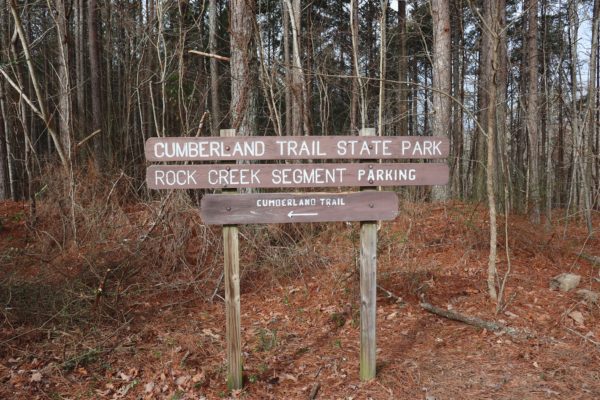
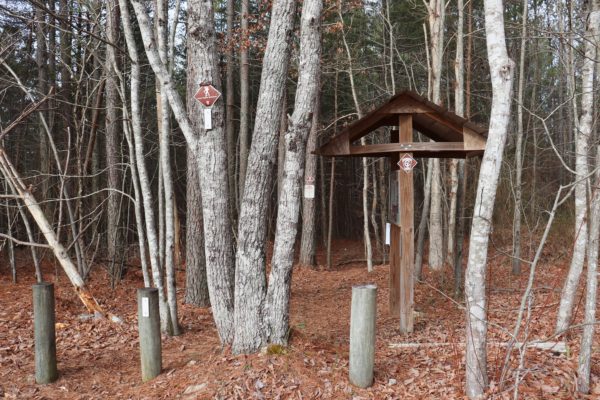
The Upper Leggett Trailhead is where our adventure starts today. And what an adventure this hike is! Numerous creek crossings and waterfalls dot the trail as well as a couple natural bluff overlooks. I’ll share with you everything you need to know about this quiet stretch of the Cumberland Trail.
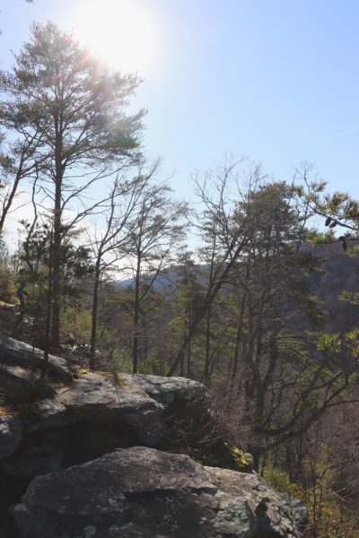
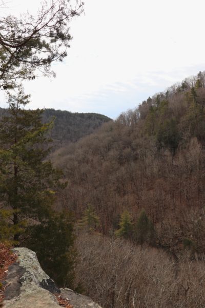
Leggett Point Overlook
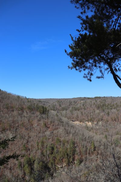
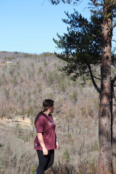
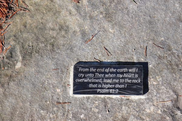
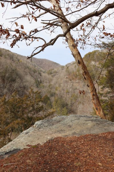
The Leggett Point Overlook is just over half a mile from the trailhead. This natural bluff allows a wide view of the Rock Creek Gorge and surrounding mountains. Although, you probably won’t be able to see much of the creek below, if the water is flowing heavily you’ll be able to hear it. Even though the views are not typical of other overlooks in the area, it’s a nice change of scenery. Most overlooks showcase the city and surrounding suburbs. Meanwhile, this one looks the opposite direction and from it you can mostly see only nature. It’s a great, quiet place to hang out for a while. I visited this point on my first hike here from the Upper Leggett Trailhead.
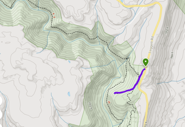
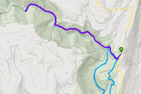
The hike out is quite easy. It’s seemingly flat with a gradual descent. But the illusion of flatness will prove itself on your way back. The gradual incline back can be surprisingly challenging if you’re not used to it. Overall though, if you’re looking for a short family hike to a quiet vantage point, this would be one to add to your list. See the map below for a visual of the hike.
Rock Creek Segment

The Upper Leggett Trailhead is part of the Rock Creek Segment of the Cumberland Trail. If you choose to go to the right instead of straight to the overlook, you’ll find the trail starts to take you down the mountain. It’s drawn out in long switchbacks that help keep the trial from being too steep. Eventually the trail comes alongside Boiling Springs Hollow, a small creek that runs down to flow into Rock Creek.
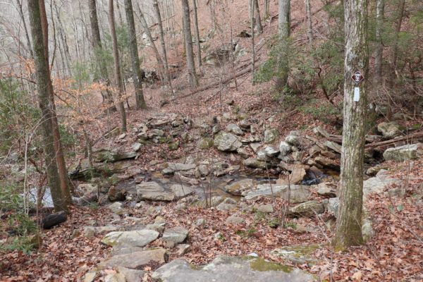
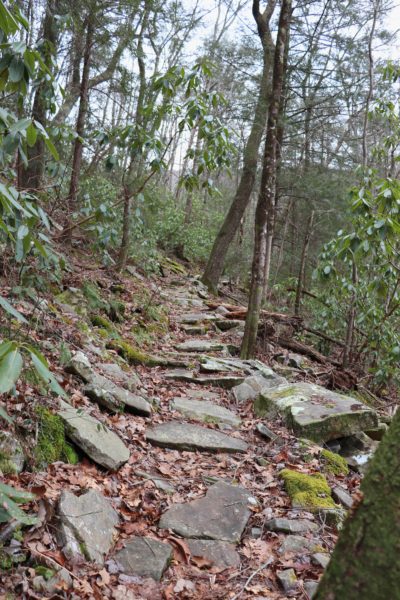
This is part of the trail where I get confused. The trail turns to rocks, leaving the packed dirt trail behind. Because of this, it can be easy to lose the trail. Be sure to watch for the white trail blazes on the trees that always mark the Cumberland Trail. The trail goes left here so that you are hiking parallel to the creek. Not too far down is a creek crossing. Cross the creek to the right to continue the Cumberland trail west or stay on the Rock Creek Loop that will take you down and around to the Lower Leggett Trailhead and back up to where you began. I have not done the loop in full because at this point we chose to cross the creek and head west. On the map below you’ll see the trail we took in purple and the Rock Creek Loop in blue.
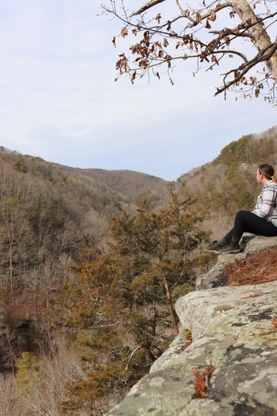
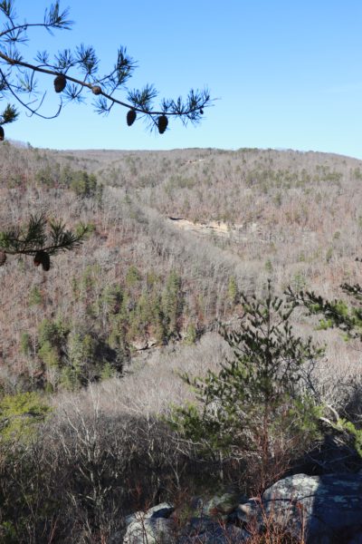
Another Overlook
Along the way, we came across another natural bluff that had a clearly paved trail leading up to it. This overlook might be my favorite on this trail. Mainly because I particularly love the lesser-known and underrated spots. It’s significantly smaller than the Leggett Point Overlook, but the views are about the same. I just find the overlooks on these trails to be more peaceful than most because they overlook mostly nature.
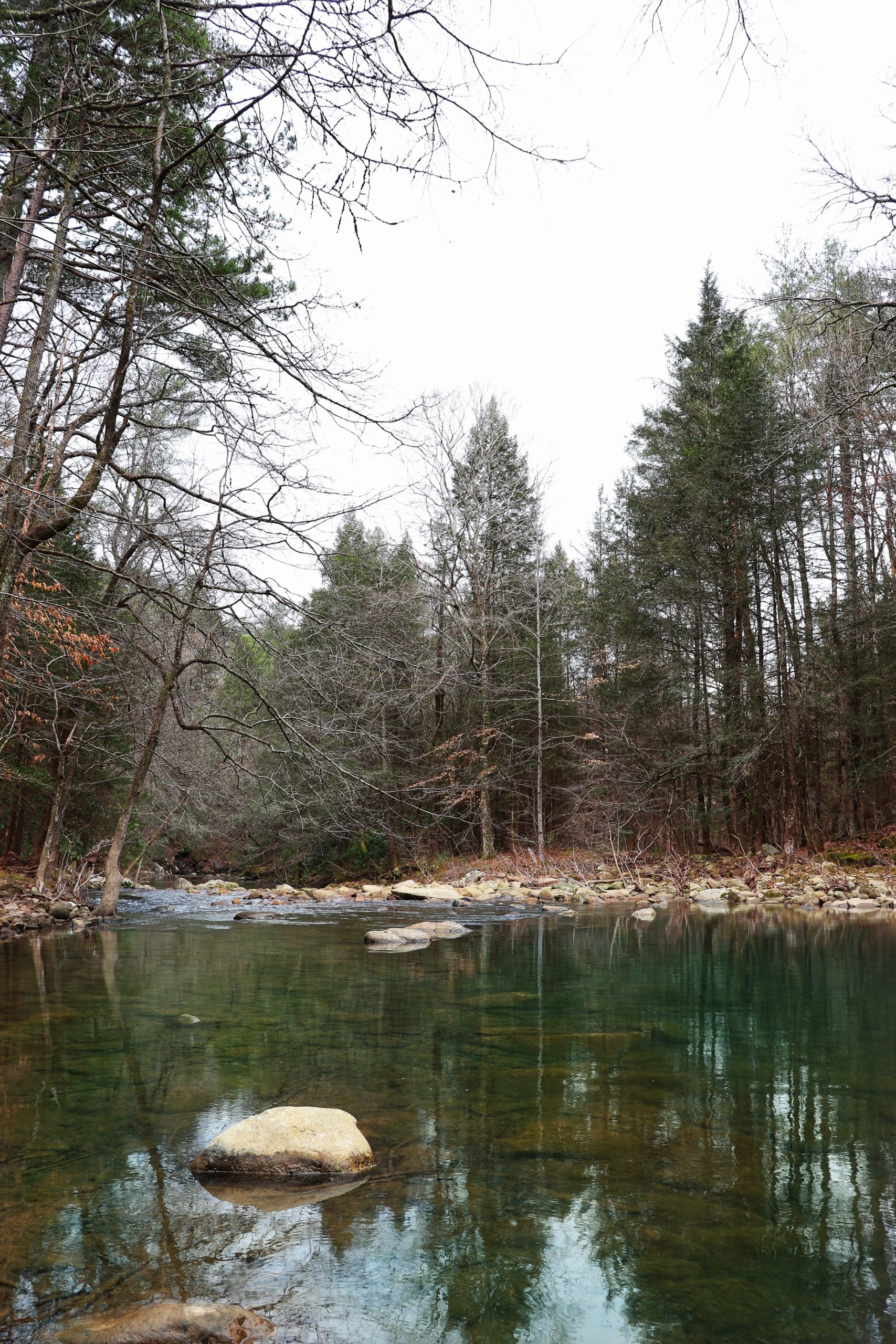
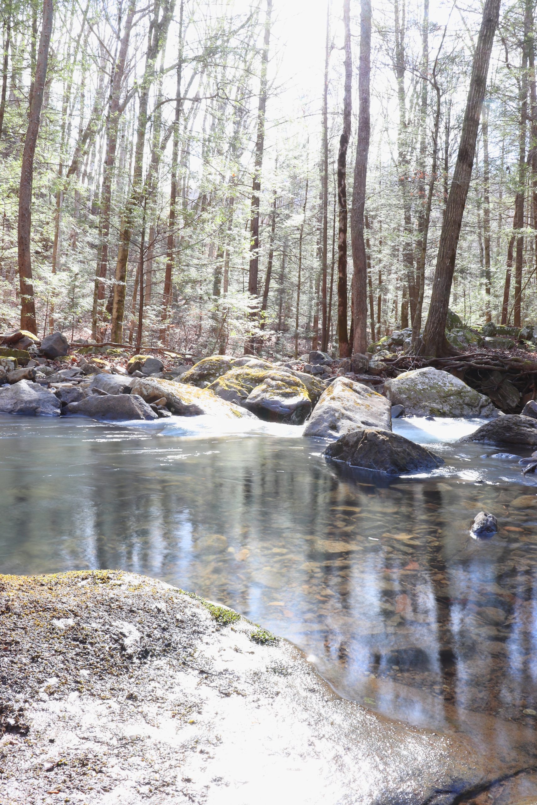
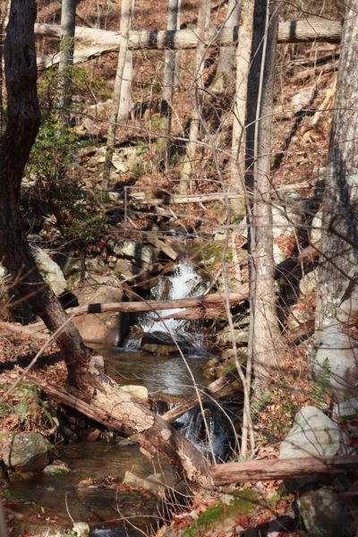
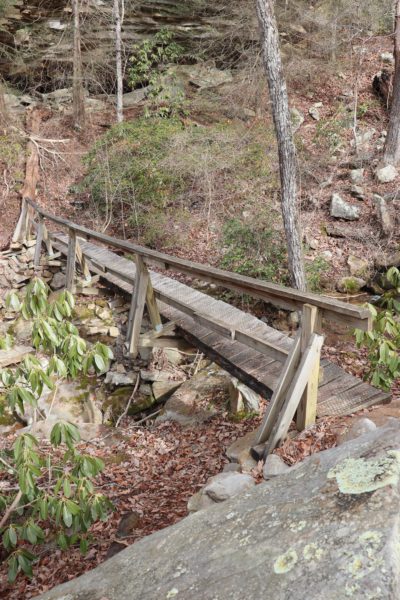
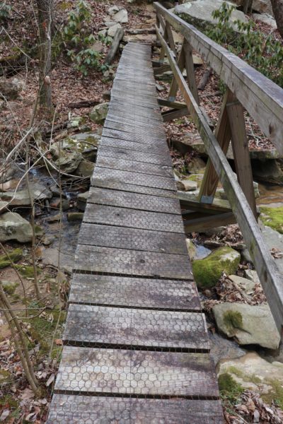
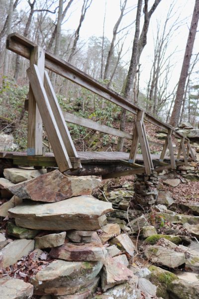
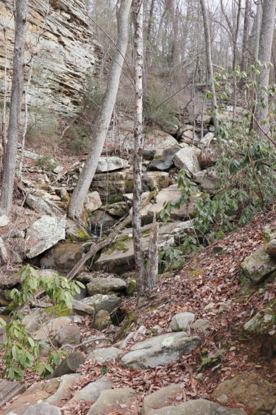
Creek Crossings and Bridges
Besides the one I just mentioned, there are many more creek crossings along this segment of the Cumberland Trail. Proceed with caution because the next one has one of the scariest bridges I’ve ever seen. It’s just a matter of time before this bridge collapses and gives way. The bridge for the creek after it has already passed away. Thankfully, the water was not too high on either of these creeks. This means crossing along the creek’s rocks is doable if need be. If you’re not confident with rickety bridges or rocky creek crossings, I would suggest avoiding this segment of the trail.
Waterfalls
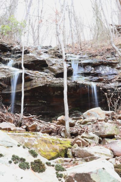
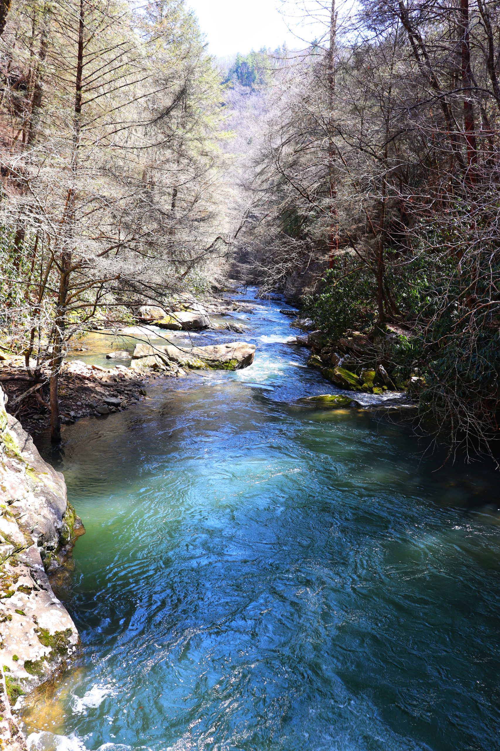
But if you’re up for the adventure, then the best is yet to come. With every creek crossing there’s the potential for waterfalls. Some are small and short while others are heavy-flowing and tall. These waterfalls will vary depending on the weather though. I believe most, if not all of them, are reliant on rain. What I call a “wet-weather” waterfall. This means they will only exist after heavy rainfall. If it hasn’t rained in over a week, the chances are slimmer that there will be any waterfalls to see, although not impossible.
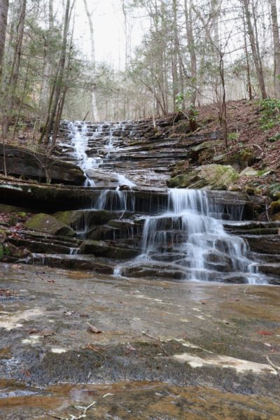
This waterfall stands after the creek that has the fallen bridge. In fact, you have to cross the streams below it as part of the trail. So, if it’s rained a lot, the crossing might be too dangerous. The streams flow over a massive, flat rock that is slick. Proceed with caution to this beautiful waterfall spot. We didn’t hike much further after this before we turned around. But this waterfall was definitely the highlight of the hike for me. It’s roughly 2.5 miles from the Upper Leggett Trailhead.
Where is the Upper Leggett Trailhead?
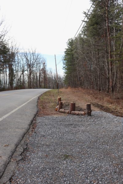
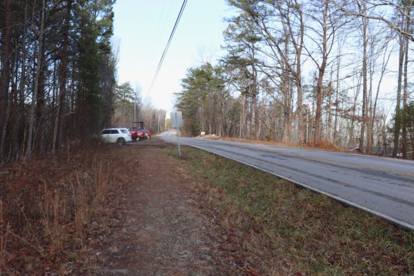
At this point you’re probably wondering where to find this place. I’ll warn you that the parking area is easy to pass. We passed it on our first trip by accident. The trailhead can be found HERE and is easy to get to. Just keep in mind that you’ll be passing the more obviously seen Lower Leggett Trailhead parking lot and continue up the mountain to the Upper Leggett Trailhead. Parking is simply a long pull-off on the left side of the road that accommodates vehicles by pulling straight in. Even though the parking area is long, it can fill up quickly. The first time we went it was late in the afternoon and almost all the spaces were already taken. The next time we went it was late morning and there was only one vehicle already there. It just depends on the weather, season, and time of day that you decide to go that will determine the parking spaces available. And when it’s busy it can be hard to tell, but the trailhead is actually to the far left end of the the parking area. We made a mistake on the first trip and started blazing our own trail through the thorny woods. I do not recommend this. Go to the far left until you see the trailhead map and information stand.
The Hike Overall
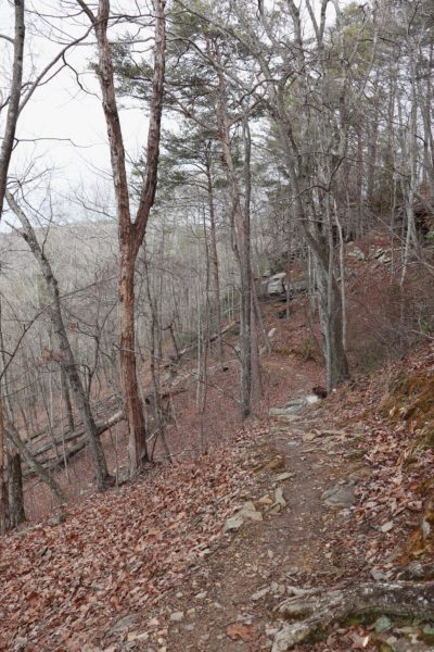
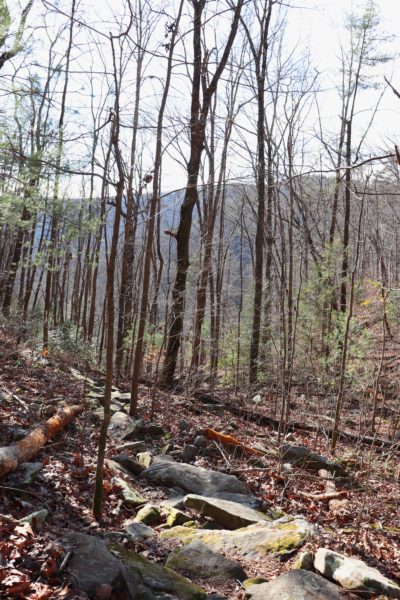
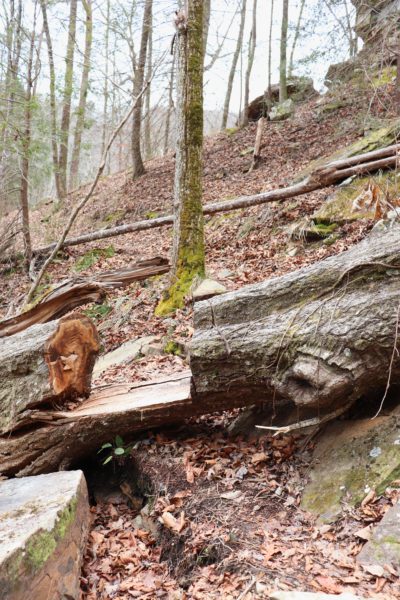
To sum everything up, the hike itself is moderate. The trail is easy to follow, although as you get to the back half I could see where it might become overgrown in the spring and summer months. What makes this trail moderate instead of easy is the elevation gain and loss. Over the roughly 5.5 miles round trip that we hiked the second time around, we went down, then up again, turned around, went down, and lastly had to climb up at the end. It really wore me out simply due to all the hiking uphill and it had been a while since I last hiked any. Below you’ll see a photo of a large fallen tree that has been notched out for the trail. And in the photo next to it is part of the back-end of the trail where I believe it could become overgrown quite easily.
I highly recommend the Upper Leggett Trailhead. Not only are there unique waterfalls and overlooks, the trail itself is well-traveled, yet quiet. Even when there’s lots of cars, it’s likely you’ll still not run into many people on the trails. I believe this is because the trails are long and there’s multiple routes. So, if you’re looking for a quiet and scenic hike, I recommend this one. I can’t wait to hike more of these trails in the fall. I believe it will be a very beautiful fall foliage hike.
For a video tour of the two hikes I took, click HERE. Let me know in the comments below what your thoughts are about this hike, if you’ve been here before, or if you really want to visit now. I’d love to hear from you! Until next time, enjoy Exploring Chatt!