Looking for a hike with some challenging elevation gain and loss as well as access to a beautiful, blue-water creek? Then you need to add Rock Creek Loop Trail to your list.
Rock Creek Loop Trail
The Rock Creek Loop Trail is roughly a 5.7 mile round trip hike from the lower Leggett Road trailhead. This trailhead is also known as the Rock Creek Trailhead. The beauty of this particular hike is that there’s a loop involved so it’s not just a point-to-point hike. The connector trail is just over a mile long which is the part that will take you from the trailhead to the loop and back at the end. See the photo below for what this hike looks like on a map. The hike is highlighted in purple. For the exact location of the trailhead, click HERE.
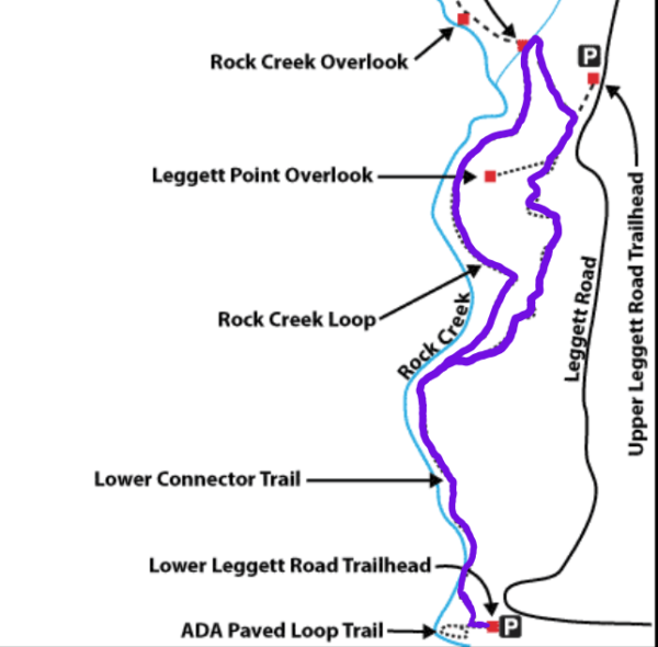
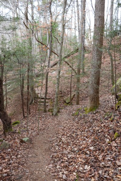
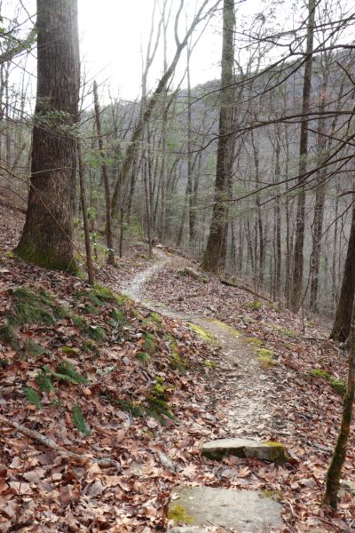
Don’t let the map fool you, this hike has some challenging elevation gain and loss. The connector trail alone takes you up and down a couple of ridges before you really get to reach the creek’s side. The upper half of the loop (closest to Leggett Road) takes you up the mountain before going back down to the lower half of the loop. With all the elevation changes and the length of this roundtrip hike, I would consider this hike to be for someone who is not looking for an easy hike.
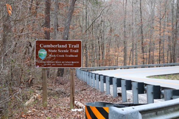
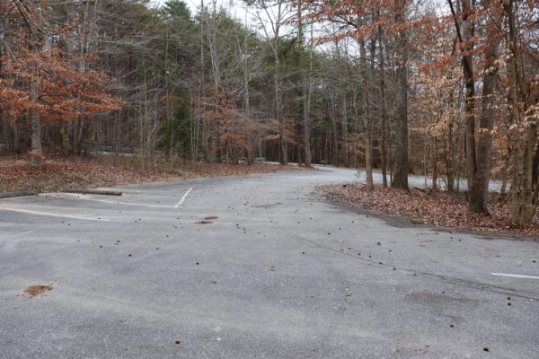
The trailhead parking is easy to find on Leggett Road. The sign stands out right before the road takes a turn up the mountain. Parking can fill up fairly quickly, especially on weekends and if the weather has been nice. As always, I suggest arriving early if possible. This parking lot is one of the most spacious for this section of the Cumberland Trail.
Features of the Rock Creek Loop Trail
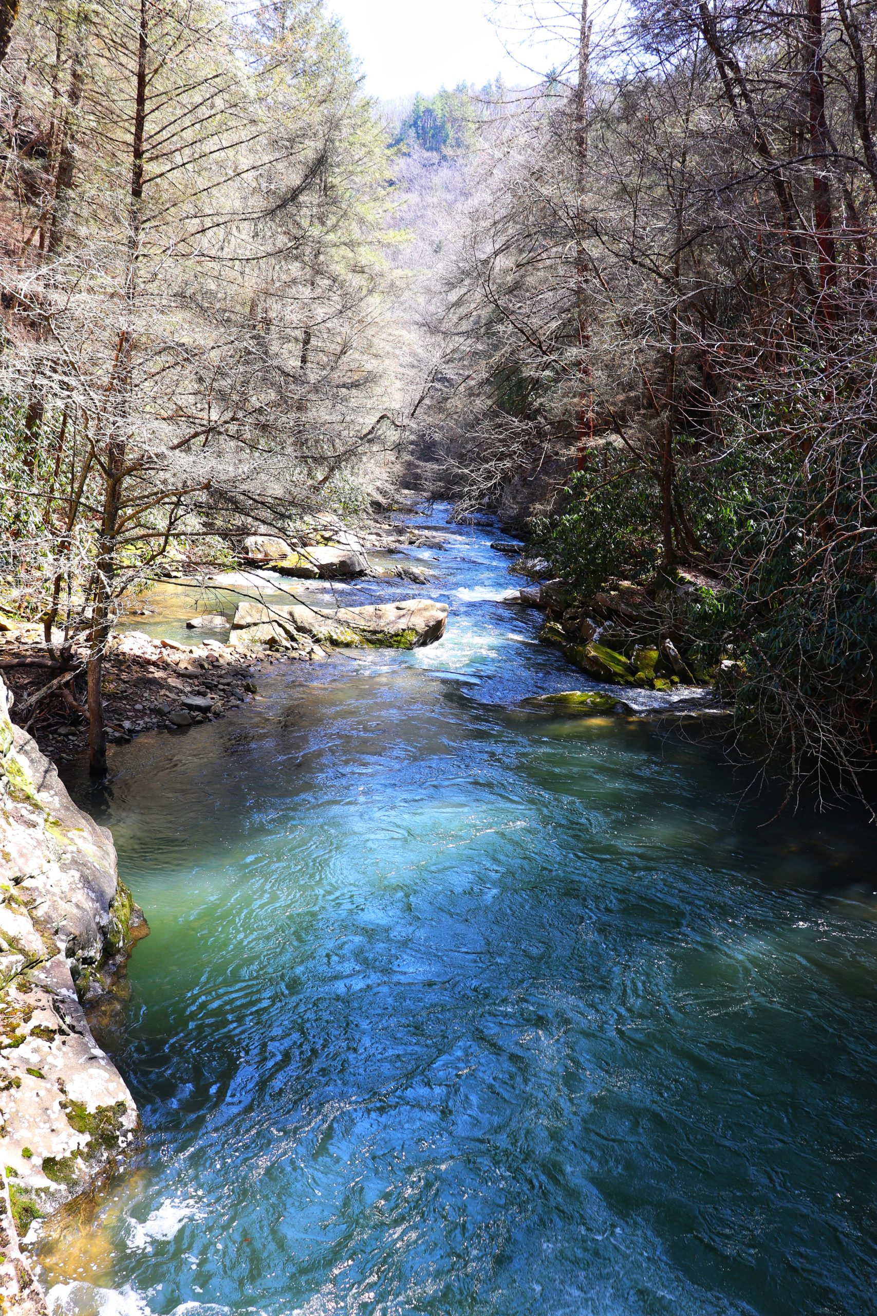
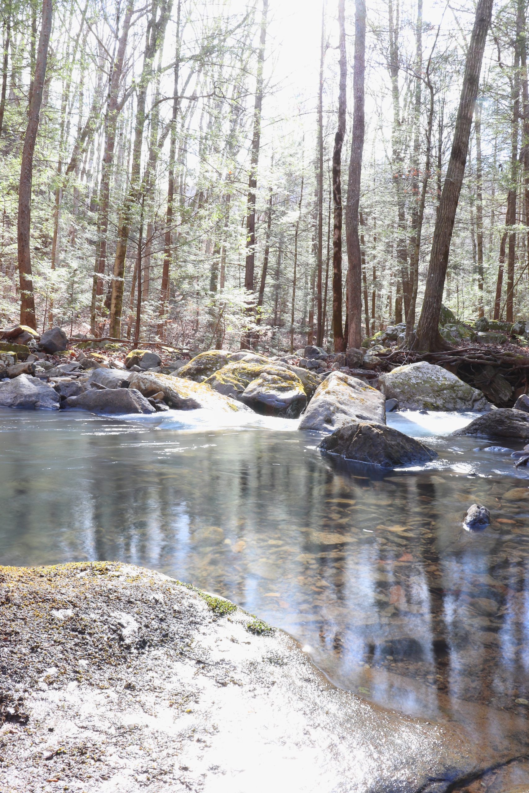
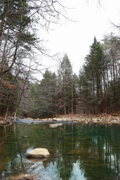
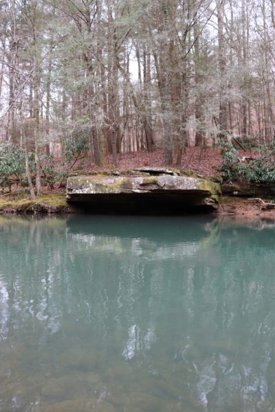
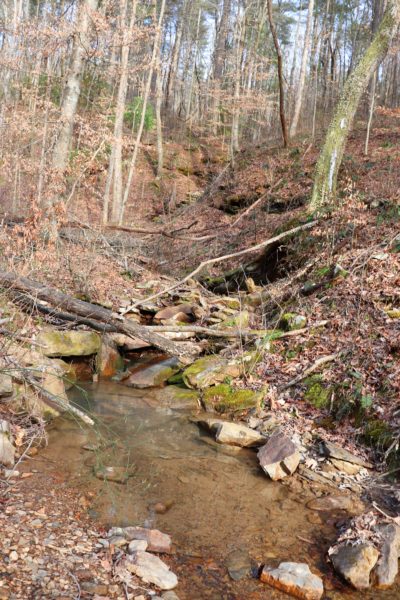
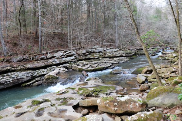
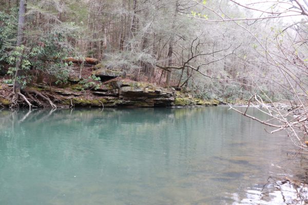
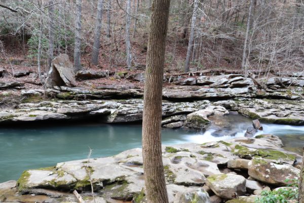
There’s plenty of scenery to be enjoyed on the Rock Creek Loop Trail. If it’s recently rained there are small creek crossings. And even if it hasn’t rained in a while you will probably see the beautiful, blue waters of Rock Creek itself. There are two spots along the trail where you can walk out to the creek’s edge and enjoy the view.
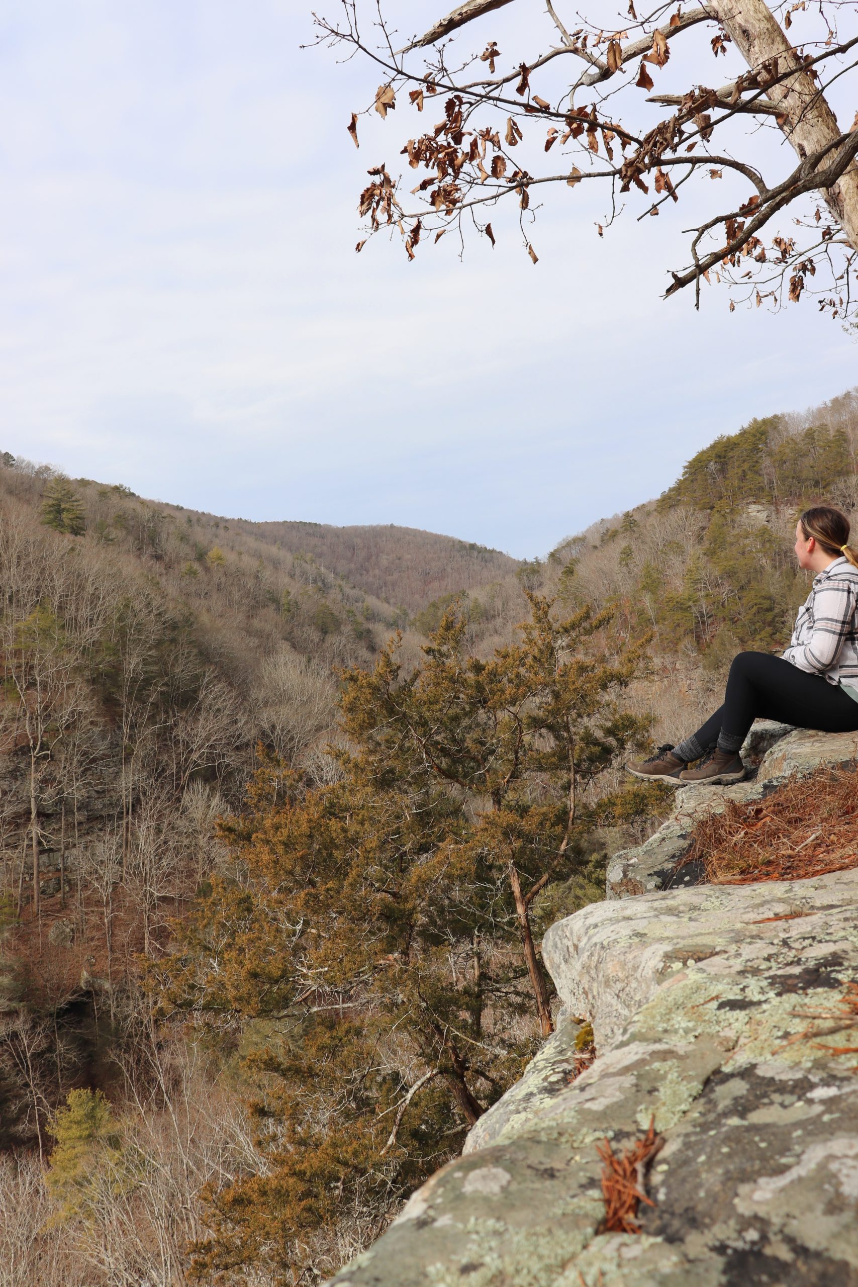
On the upper half of the Rock Creek Loop Trail is the side trail to Leggett Point. This short hike out to the point is worth the sidetrack if you want to see some mountain views. You can even hear Rock Creek below if you listen closely. We didn’t have time on our hike to make the trek to the point and back this trip. For more info about and photos of the overlook, click HERE.
Part of the Cumberland Trail
Rock Creek Loop Trail coincides with part of the Cumberland Trail. It is part of the Rock Creek Gorge Section of the Cumberland Trail. Currently, there are 28 sections of the Cumberland Trail completed. One day the Cumberland Trail will be fully connected and stretch more than 300 miles across the Cumberland Plateau from Tennessee into Kentucky. I’ve enjoyed exploring other sections of the Cumberland Trail on my hikes here while exploring Chatt. If you’d like to explore more Cumberland Trailheads, check out my blog posts below by clicking on a trail name/feature. And to learn more about the Cumberland Trail itself, click HERE.
Other Cumberland Trailheads
- Upper Leggett Road
- Laurel Falls
- Richland Mine (same trail as Laurel Falls)
- Snooper’s Rock
- Big Soddy Creek Gulf
- North Chickamauga Creek
- Edward’s Point and Rainbow Lake
- 3 Trailhead Summaries
Other Tips for This Hike
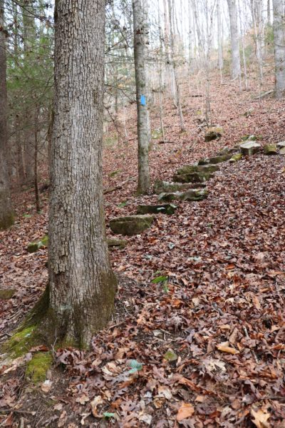
One part of this hike that confused us because we failed to research beforehand were the trailblazes. The Cumberland Trail is typically tagged by white trailblazes on the trees. However, from the trailhead we noticed the trailblazes were marked by blue paint instead. We questioned if we were going the right way because of this. Yes, blue is correct. It turns out that the Cumberland Trail itself is marked with white, while parts of the loop and the connector trail that lead up to the Cumberland Trail are marked in blue.
And if being confused by trailblazes wasn’t enough, we started the hike in the wrong direction! At the beginning of the hike is an asphalt trail. Follow this until you reach the brown, mileage sign. At the mileage sign will be a dirt trail to the right with blue trailblazes. This is the start of the trail. Why this is confusing also is because the asphalt trail continues straight past the sign. We didn’t go down it all the way, but I believe it’s a short loop that goes by the creek.
We had more confusion on this hiking day as well. More than I mentioned here. To get a visual for the Rock Creek Loop Trail and laugh with us as we get lost multiple times, watch the latest YouTube video by clicking HERE. Let me know in the comments below if you’ve hiked this trail before or what your favorite section of the Cumberland Trail has been that you’ve hiked so far. I’m curious to know! Until next time, enjoy Exploring Chatt!