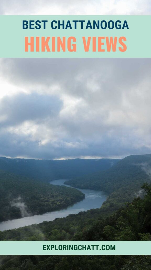
Chattanooga has countless beautiful hiking trails that include breathtaking views from mountain top overlooks.
One of the best things about hiking in Chattanooga is that chances are, you’ll get to see some amazing views. From a challenging hike to enjoy a rewarding view at the end, to an easy jaunt where the view is unbelievable, these are the best Chattanooga hikes with views. Keep reading to learn which hikes to add to your Chattanooga hiking list, how to get to them, tips for the trail, and more. The following hikes are listed in order of driving time from Chattanooga from shortest to longest.
In a hurry? Pin this post for later:

1: Stringer’s Ridge
- Drive from Chattanooga: 10 minutes
- Hiking Distance: 1.75 miles round trip
- Elevation Change: 120 feet
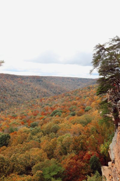
- Starting Location: Stringer’s Ridge
Stringer’s Ridge offers the best view of downtown Chattanooga from the overlook platform along the trail. What I love about this hiking spot is how conveniently close to downtown it is! It’s hard to believe that this wild space is basically in the city. There are a ton of winding trails that intersect in this area, so be sure to plan ahead and be prepared. Check out my Stringer’s Ridge Hiking Guide to better understand the routes to take and what to expect when you hike here.


2: Sunset Rock
- Drive from Chattanooga: 20 minutes
- Hiking Distance: .4 mile from parking lot or 2.4 miles from the shortest hiking option (Craven’s House) both round trip
- Elevation Change: 450 feet from Craven’s House
- Starting Location Parking Lot: Sunset Rock
- Starting Location for Hiking: Craven’s House
Next is Sunset Rock. This has always been a favorite spot of mine, but over the years it’s gained popularity while the parking area has shrunk. Be sure to only park in designated parking on Lookout Mountain, or you will be towed. The hike from the parking area to Sunset Rock is a very short descent. However, due to the parking situation, I highly suggest hiking to this spot instead. Lookout Mountain has numerous trailheads. This means your hike to Sunset Rock can be as challenging or easy as you’d like. To learn more about hiking routes to Sunset Rock, check out my Sunset Rock Hiking Guide.
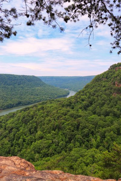
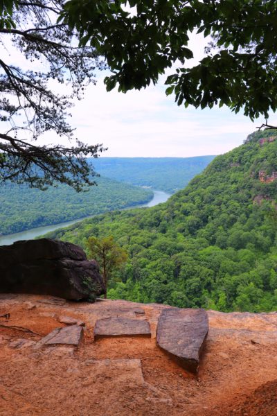
3: Point Park
- Drive from Chattanooga: 20 minutes
- Hiking Distance: 3.4 miles round trip from Craven’s House
- Elevation Change: 550 feet
- Starting Location: Craven’s House
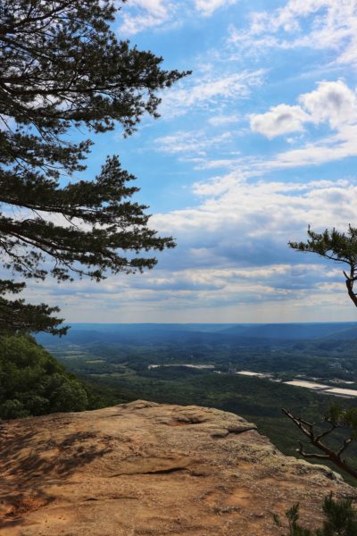
You can access Point Park on Lookout Mountain for a fee at the entrance. Or you can hike into the park from below. You are supposed to pay a fee for entry into the park this way also. However, it is not enforced and requires you to exit the front of the park in order to pay the fee. Honestly, this is just a gray area kind of loophole, so do with this information as you will. But the views from the Point Park overlook tower are some of the best views Chattanooga has to offer. You can easily see downtown Chattanooga, the Tennessee River, and the surrounding landmark areas all from this one spot. Learn more about hiking to Point Park in my Bluff Trail Hiking Guide.

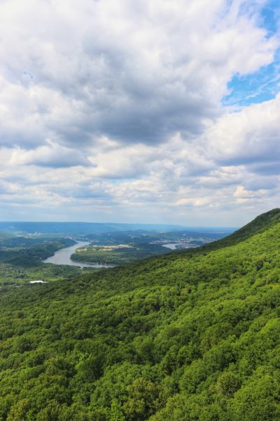
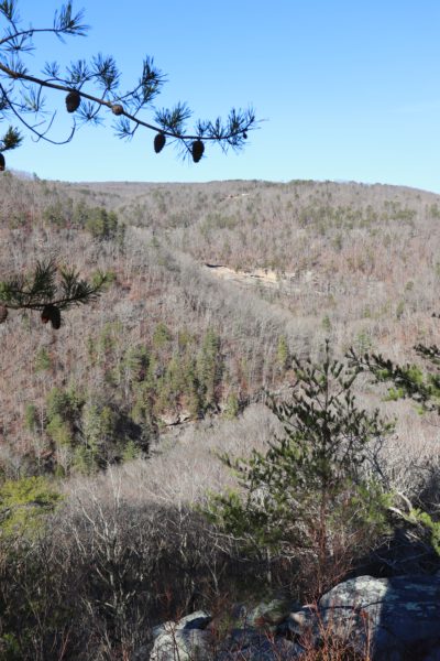
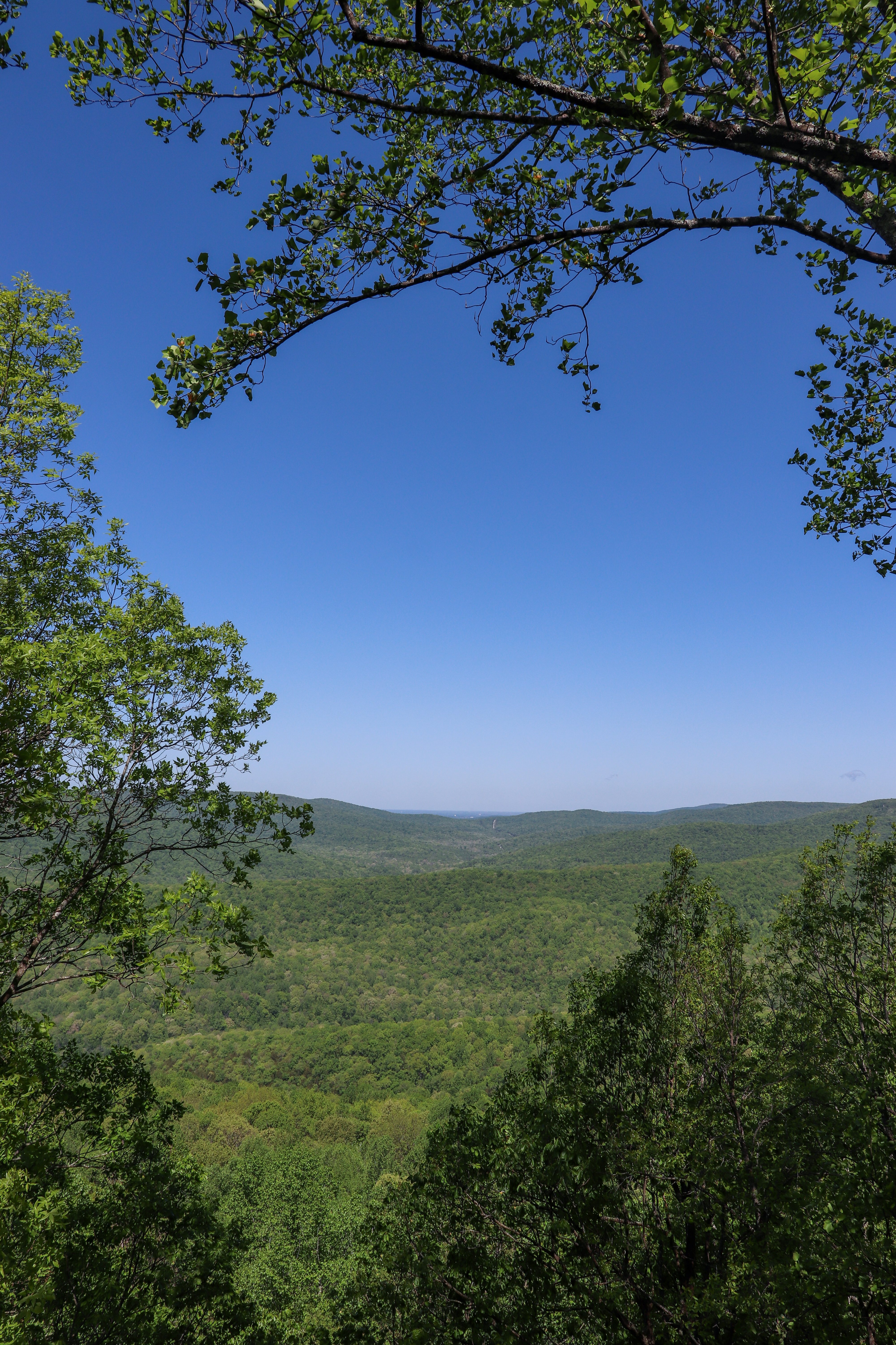
4: Signal Point
- Drive from Chattanooga: 20 minutes
- Hiking Distance: Less than a mile round trip if you turn around at the Julia Falls Overlook
- Elevation Change: 300 feet
- Starting Location: Signal Point
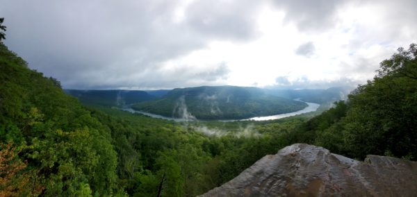
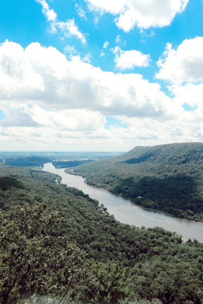
Signal Point, located on Signal Mountain, is a great Chattanooga overlook. Technically, this hike includes two overlooks. Signal Point is the overlook at the trailhead, at the bottom of the hill from the parking lot. The view here is of the Tennessee River Gorge, but if you decide to start the actual hike, you’ll eventually reach the Julia Falls Overlook, which is a better and broader vantage point on the edge of a bluff. The hike to this spot is fairly short but can be a little bit challenging if you’re coming from Signal Point. It’s downhill during the first portion of the hike. Some of the steps that used to make this hike easier have long since washed away. However, the hike is still doable and totally worth it. But Signal Point isn’t the only trailhead to get to this spot. You can also get there from Rainbow Lake. For more info on hiking from Signal Point to Rainbow Lake in my Signal Point Hiking Guide.
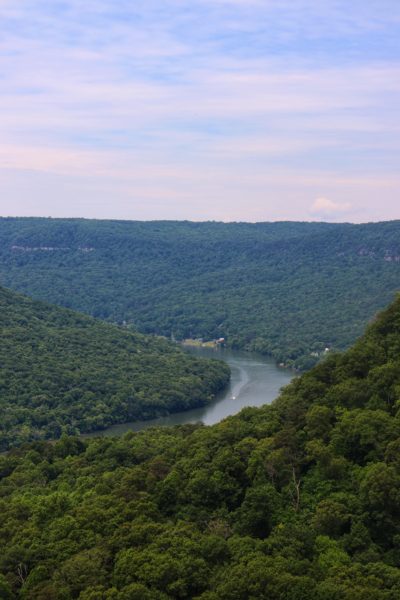
If hiking down this trail seems too daunting for you, you’ll still love the views from Signal Point itself. From this view you can see downtown Chattanooga and Lookout Mountain in the distance to the left. You’ll need to lean out over the wall a little bit to get this view.
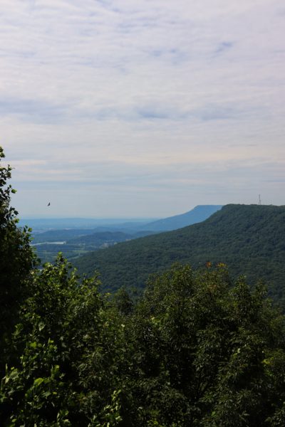
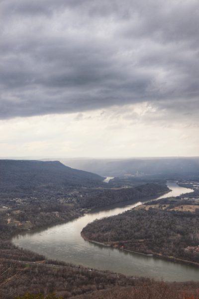
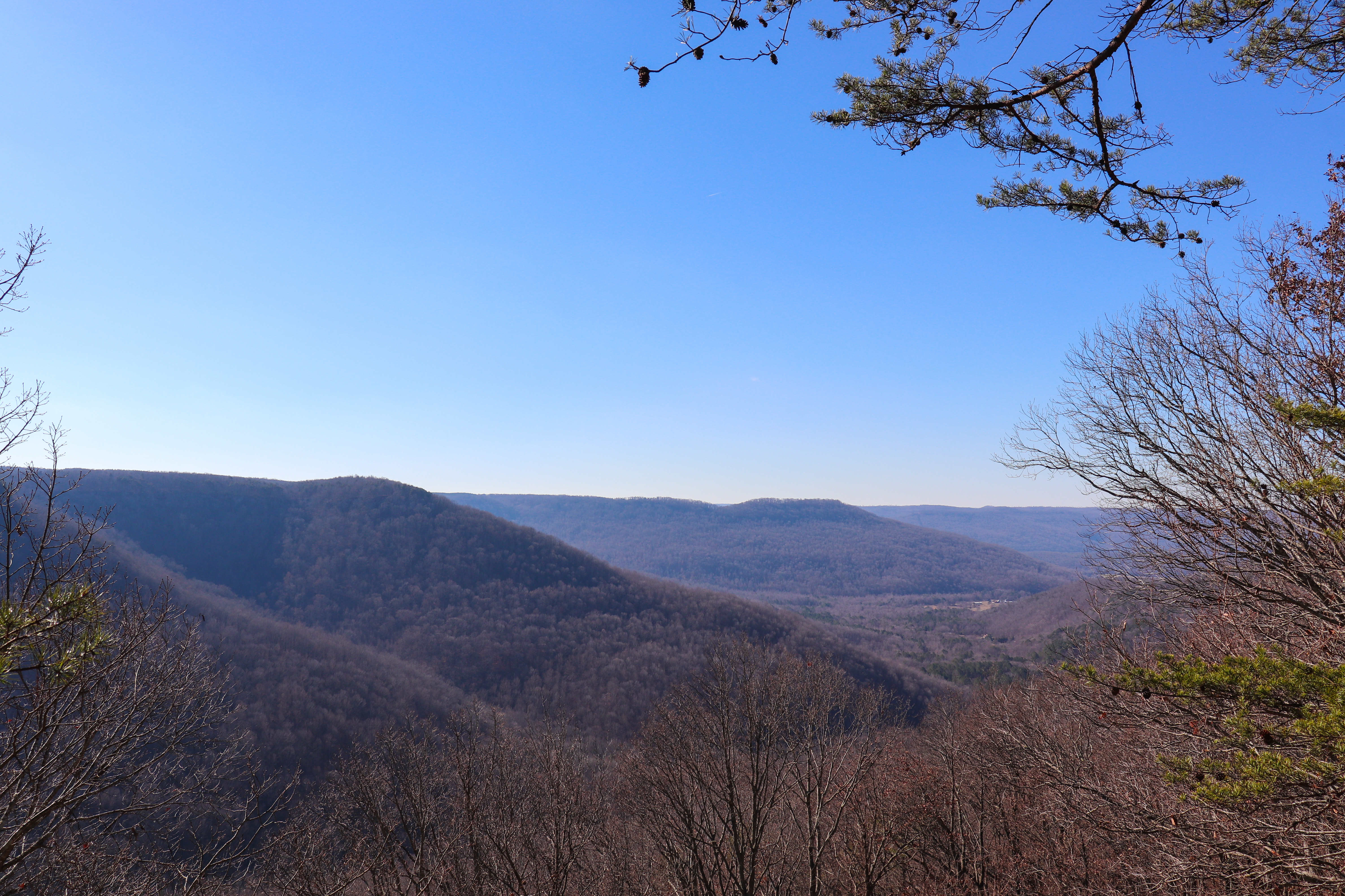
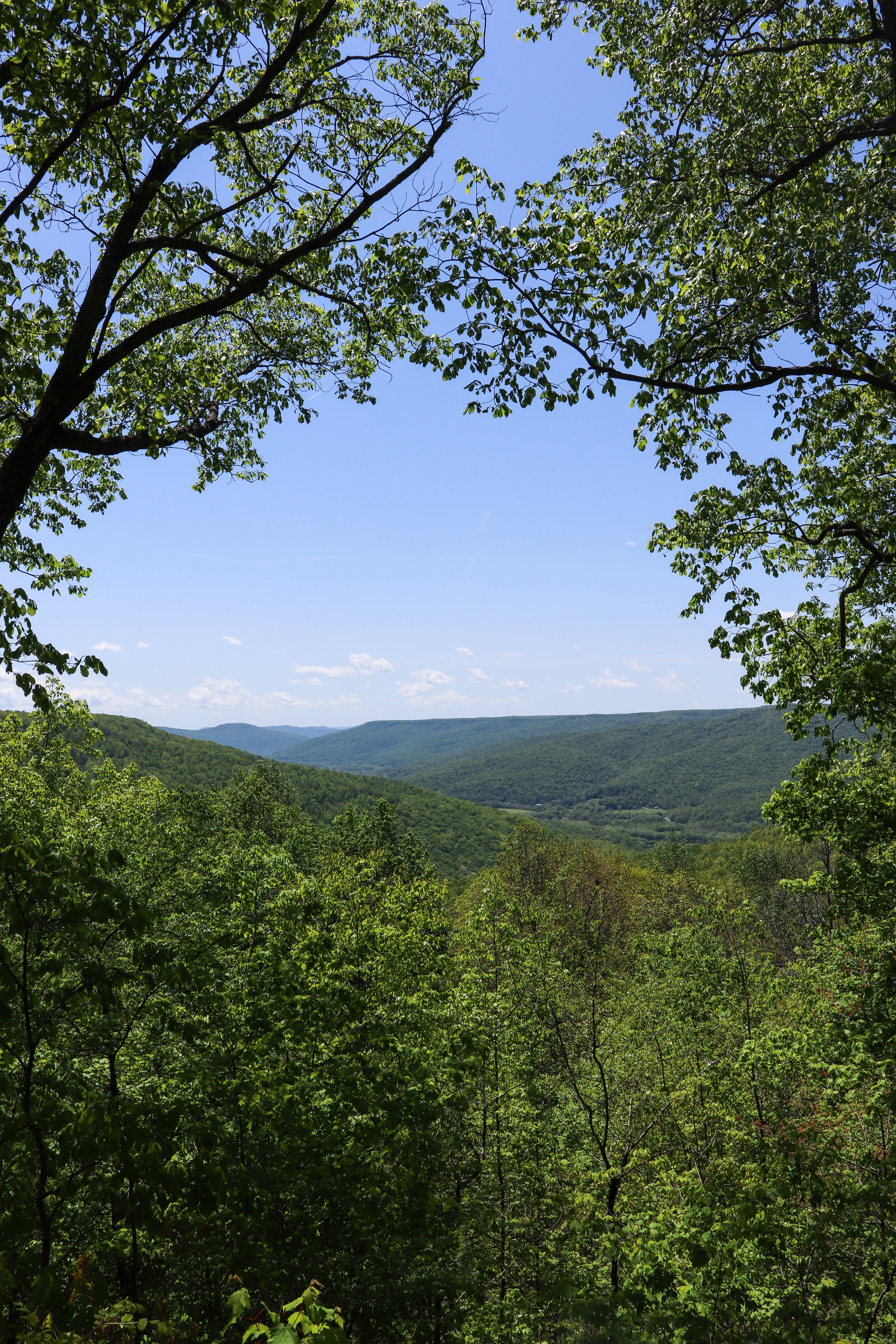
5: Edward’s Point
- Drive from Chattanooga: 20 minutes
- Hiking Distance: 3 miles round trip
- Elevation Change: 300 feet
- Starting Location: Rainbow Lake Trailhead
This one is also on Signal Mountain, near Signal Point. Edward’s Point is about a mile and half hike from Rainbow Lake. The hike is fairly easy with a few flights of stairs. But the view is great. It’s similar to the Julia Falls Overlook view because it’s the bluff next door. From Edward’s Point you can see the Tennessee River below and downtown Chattanooga in the distance. To learn more about hiking to Edward’s Point, check out my Edward’s Point Hiking Guide.
6: TVA Raccoon Mountain
- Drive from Chattanooga: 25 minutes
- Hiking Distance: Depends. Please use the guide linked below.
- Elevation Change: Depends. Please use the guide linked below.
- Starting Location: TVA Raccoon Mountain
TVA Raccoon Mountain has numerous hiking and biking trails. Plus there’s some amazing views and overlooks, including some you don’t even have to hike to. But, if you choose to hike, you will encounter more views hidden along the trails than you might think. Learn more about planning your visit to TVA Raccoon Mountain and how to even spend a full day here exploring in my TVA Raccoon Mountain Guide.

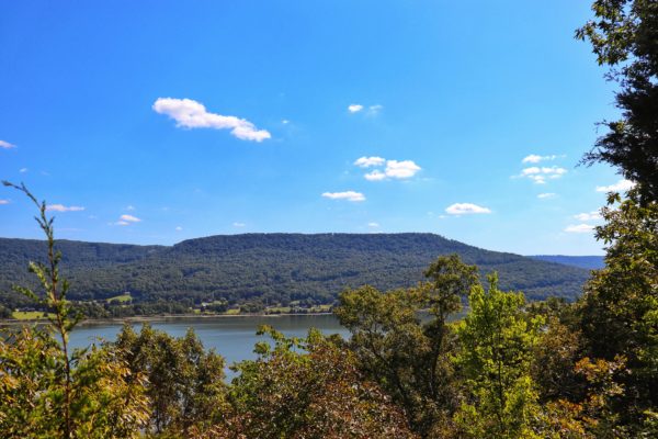
7: Little Cedar Mountain
- Drive from Chattanooga: 25 minutes
- Hiking Distance: 4.5 miles round trip
- Elevation Change: 400 feet
- Starting Location: Little Cedar Mountain
Little Cedar Mountain is a TVA wild area, a small peninsula on Nickajack Lake. It features a loop trail with another smaller loop inside. But on the outer loop trail is a small bluff overlooking the lake. Further down the trail are a few other spots you can enjoy lakeside views from lake level. This is a less popular hiking trail so it’s a great spot for some peace and quiet as you hike and enjoy a Chattanooga hike with views. Learn more about this particular spot and what else you’ll find on this trail in my Little Cedar Mountain Hiking Guide.
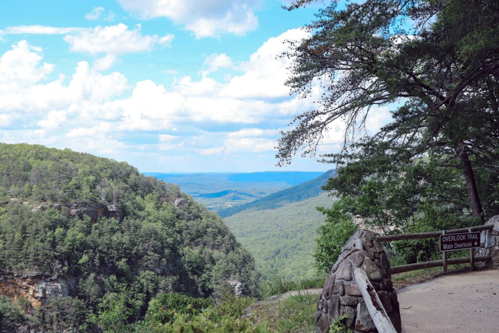
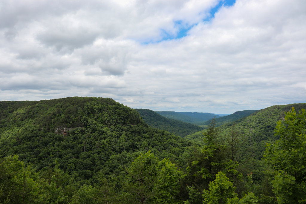
8: Cloudland Canyon
- Drive from Chattanooga: 30 minutes
- Hiking Distance: 1 mile round trip if you just hike the Overlook Trail and not go down to see waterfalls
- Elevation Change: less than 50 feet
- Starting Location: Cloudland Canyon State Park
Further south on Lookout Mountain is the Cloudland Canyon State Park. Since it’s located in Georgia, a small entry fee is required per vehicle. But it’s definitely worth the visit if you’ve never been. The hike to the main overlook is short and easy and showcases a broad view of the Cloudland Canyon, a narrow river gorge with waterfalls and creeks which you can also hike to below. Learn more about this state park and plan your hikes here with my Cloudland Canyon Guide.
9: Leggett Point
- Drive from Chattanooga: 35 minutes
- Hiking Distance: 1.8 miles round trip
- Elevation Change: 180 feet
- Starting Location: Upper Leggett Trailhead
Leggett Point is a short hike on a quiet section of the Cumberland Trail. What I love about this spot is how it’s usually quiet and not crowded. Typically you can enjoy the place all to yourself! Leggett Point is located near the Upper Leggett Trailhead in Sale Creek, TN. This is about a thirty minute drive from Chattanooga, making it an ideal hiking destination that isn’t too far outside of town. Learn more about this hiking spot and what else you’ll find on the same trail in my Leggett Trailhead Hiking Guide.
10: Denny Cove
- Drive from Chattanooga: 40 minutes
- Hiking Distance: 1.5 miles round trip
- Elevation Change: 140 feet
- Starting Location: Denny Cove Trailhead
Best known for Denny Cove Falls, this hiking trail actually has three overlooks as well. The first two have their own trail that forks out from the main one, going the opposite direction from Denny Cove Falls. The last one is actually on the main trail on the way to the waterfall. If you’re looking for hiking views, this is a great hike, plus if you hike to the end, there’s a waterfall! Only if it’s during the wet season or has rained recently though. This waterfall reduces to a trickle in the dry season. Learn more about these overlooks and tips for hiking here in my Denny Cove Falls Hiking Guide.
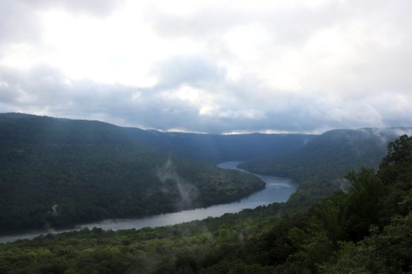
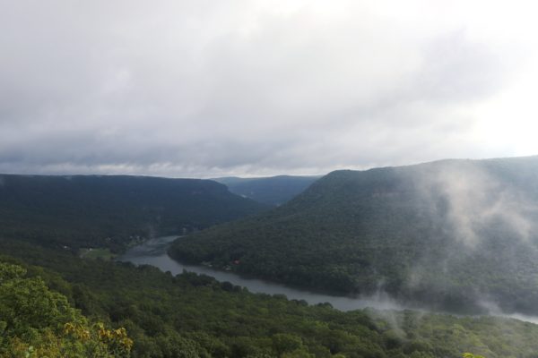
11: Snooper’s Rock
- Drive from Chattanooga: 45 minutes
- Hiking Distance: .5 mile round trip
- Elevation Change: 200 feet
- Starting Location: Snooper’s Rock
Snooper’s Rock is a little more off the beaten path than the previously mentioned. Although it too has gained popularity over the recent years. This photogenic scene can be found deep within the Prentice Cooper State Forest. This means that there are times the area is closed for hunting and you will not be able to hike. Be sure to check hunting dates before you go. Also keep in mind that the drive is a very long and dusty gravel road, but any vehicle should be able to navigate the trip. And there’s options! If you’d like to hike to the rock, you can park in the first parking area at the beginning of the park and hike the Cumberland Trail to Snooper’s Rock. But if you want to keep the hiking to a minimum, you can drive deep into the park and find the parking area for Snooper’s Rock. The hike from here is a very short descent and well worth the gravel drive. For directions about how to get to Snooper’s Rock and tips for your visit, check out my Snooper’s Rock Hiking Guide.
12: Sherwood Loop
- Drive from Chattanooga: 1 hour
- Hiking Distance: 2.75 miles round trip
- Elevation Change: 210 feet
- Starting Location: Sherwood Loop Trailhead
Did you know that Tennessee has its own Sherwood Forest and you can hike in it? Located near Sewanee, TN, this area of the South Cumberland State Park has a few different hiking trails. And the Sherwood Loop is one with a couple of different overlooks, perfect for a Chattanooga hike with views. But the real star of this hike is the natural bridge, which you can also explore while hiking to the overlooks. Learn more about where to find this quiet hike and tips for your exploration in my Sherwood Loop Hiking Guide.
13: Fall Creek Falls State Park
- Drive from Chattanooga: 1 hour & 10 minutes
- Hiking Distance: Depends. Please use the guide linked below.
- Elevation Change: Depends. Please use the guide linked below.
- Starting Location: Fall Creek Falls State Park
I cannot share the best Chattanooga hikes with views without mentioning Fall Creek Falls State Park. Although it’s just over an hour of a drive north of Chattanooga, you can easily spend a satisfactory day hiking and driving around the park, exploring all it has to offer. Known best for its waterfalls, there are many great overlook views within the park as well. Some you can simply drive to, such as Millikan’s Overlook and Buzzard’s Roost. While others you can only hike to, such as the Gorge Overlook Trail that has the Cane Creek Falls Overlook and Rocky Point Overlook. Learn more about how to find these overlooks and plan a fun day at Fall Creek Falls State Park in my Fall Creek Falls One Day Itinerary.
14: Stone Door
- Drive from Chattanooga: 1 hour & 30 minutes
- Hiking Distance: 2 miles round trip
- Elevation Change: 150 feet
- Starting Location: Stone Door
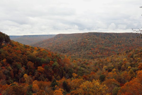
When fall is right around the corner, I highly suggest adding Stone Door to your best Chattanooga hikes with views list. The colors in this area are stunning and the views are breathtaking any time of the year. Now, this hike is about an hour and a half from Chattanooga but totally worth the drive. The hike to the Laurel Gulf Overlook is quite short, easy and boasts amazing views. But if you can venture a little further, you’ll reach Stone Door and get to enjoy a bluff peninsula with views in every direction. For more about planning your trip to Stone Door, check out my Stone Door Hiking Guide.
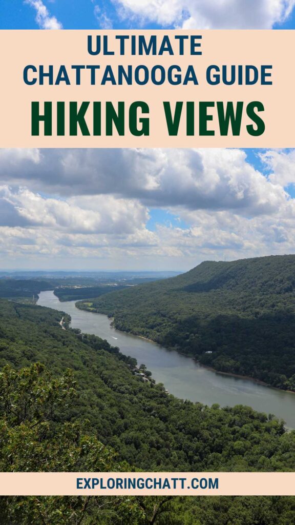
In Closing
As you can see, there are plenty of Chattanooga hikes with views to choose from. Let me know in the comments below which one is your favorite and which one you’re excited to explore next! Be sure to look at each detailed guide associated with each hike to be prepared for the adventure. Until next time, enjoy exploring Chatt!

More Chattanooga Area Hikes and What to Pack to Explore:
Inspired? Pin this post for later: