Enjoy the most picturesque view of the Scenic City of Chattanooga from Stringer’s Ridge.
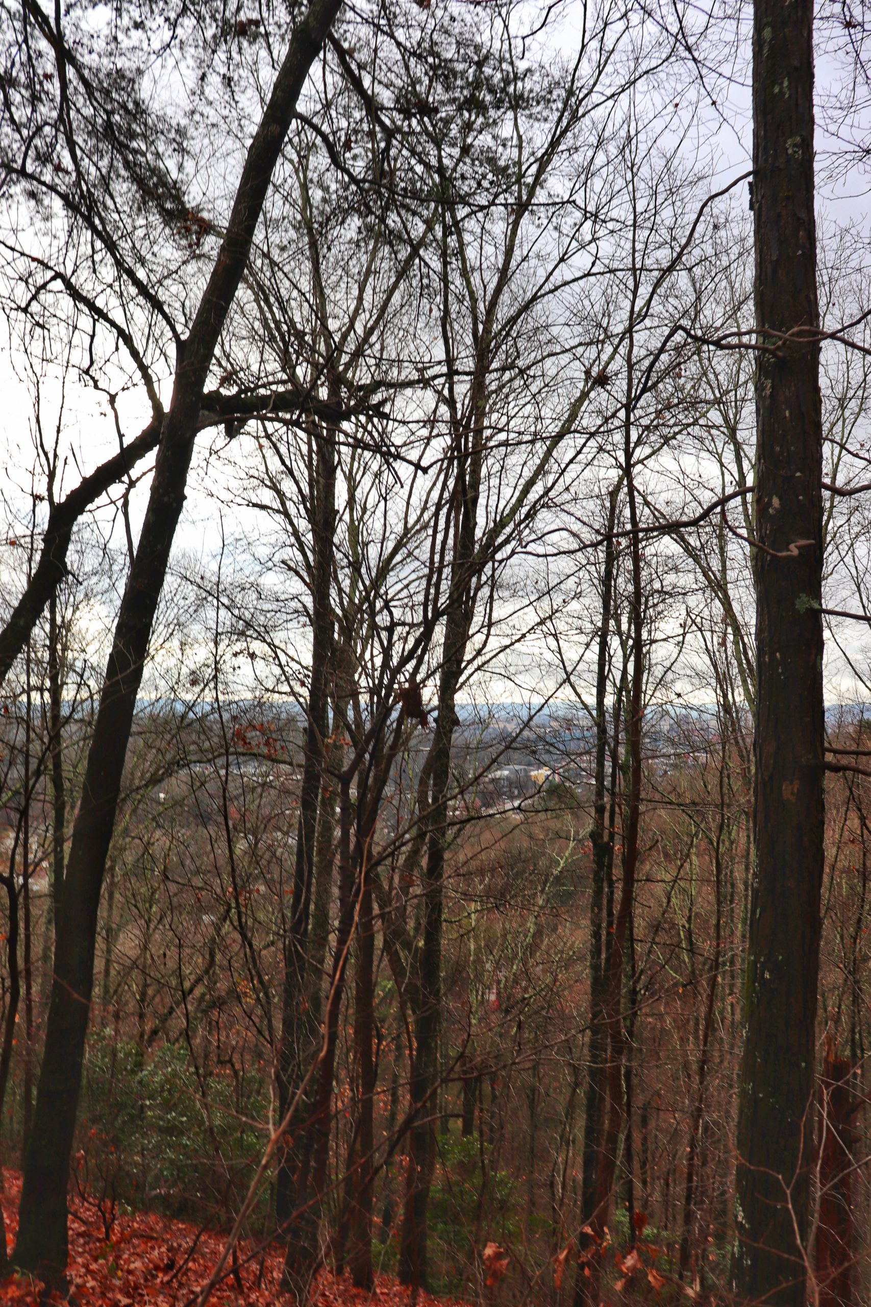
If you’ve been wondering where to find the best view of downtown Chattanooga, the answer is Stringer’s Ridge. But that’s not all. Stringer’s Ridge is home to over 5 miles of hiking and biking trails as well as other views of the area. And the ridge is covered in historical significance.
What Is Stringer’s Ridge
Stringer’s Ridge is comprised of 92 acres right along the edge of downtown Chattanooga. The land was going to be used to build 500 condos back in 2007. But the people of Chattanooga asked The Trust for Public Land and the Tennessee River Gorge Trust to help keep this land protected against urban development. And so they did. In 2013 the park was completed and opened to the public. The trails within are named after various historical figures and places important to Chattanooga. Stringer’s Ridge itself is even named after such, a historical figure, Captain William Stringer. And the first shot to capture Chattanooga for the Union in the Civil War was shot from atop this ridge. There’s a lot of history buried on this ridge and I’m glad that it is now protected and preserved for all to enjoy.
Hiking and Biking
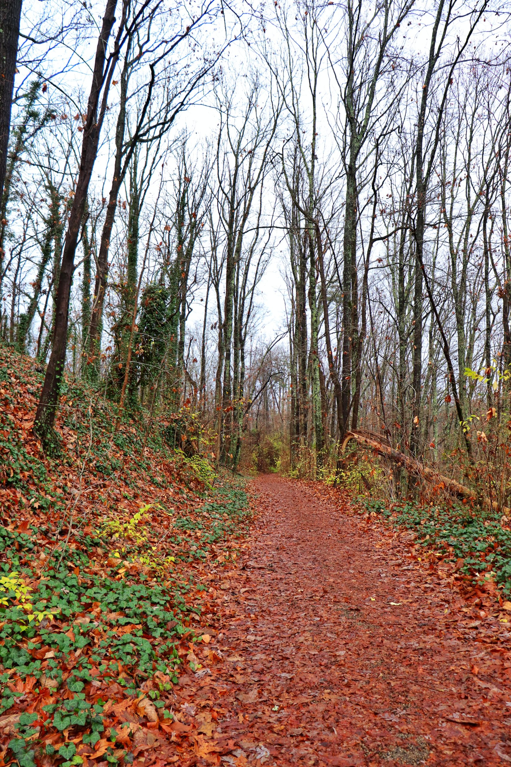
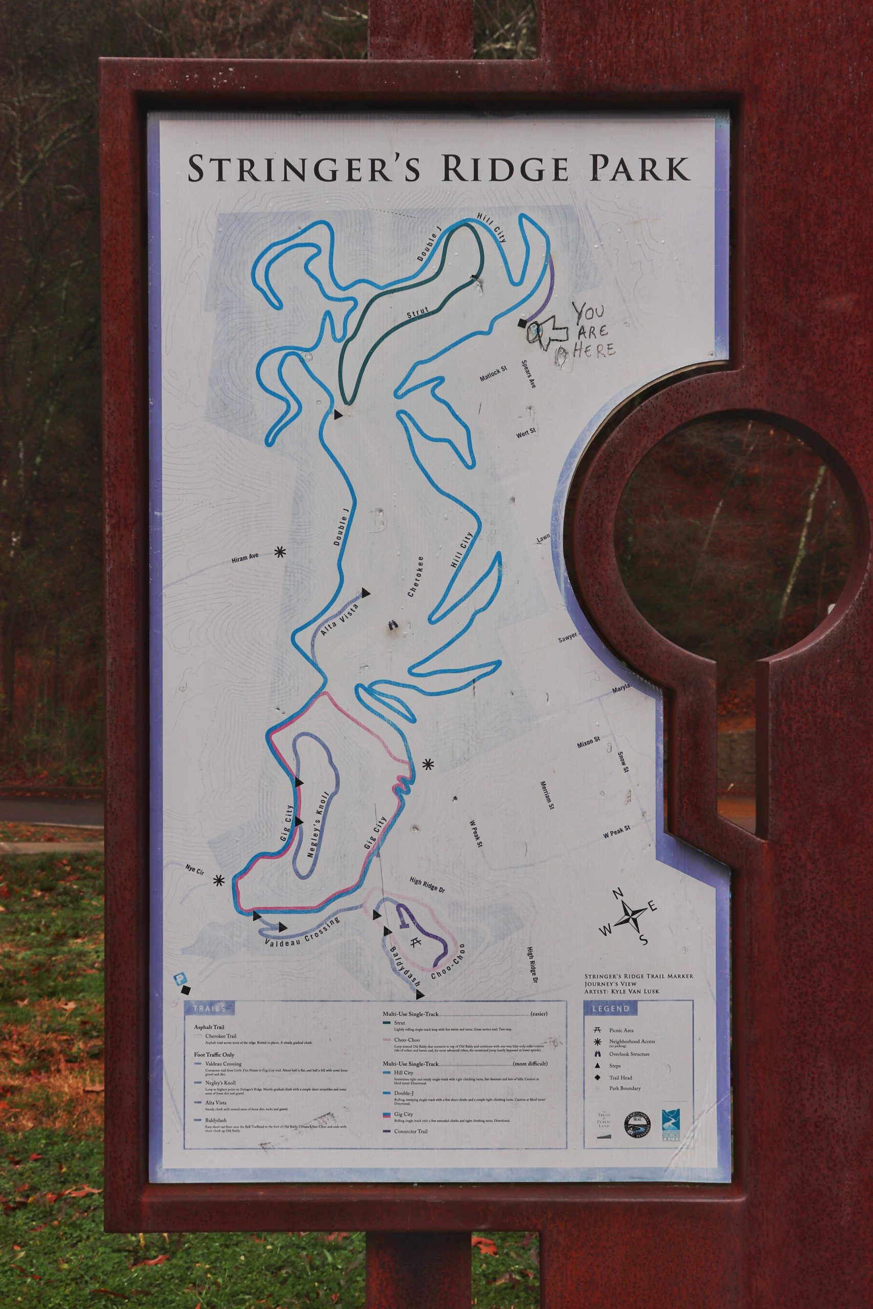
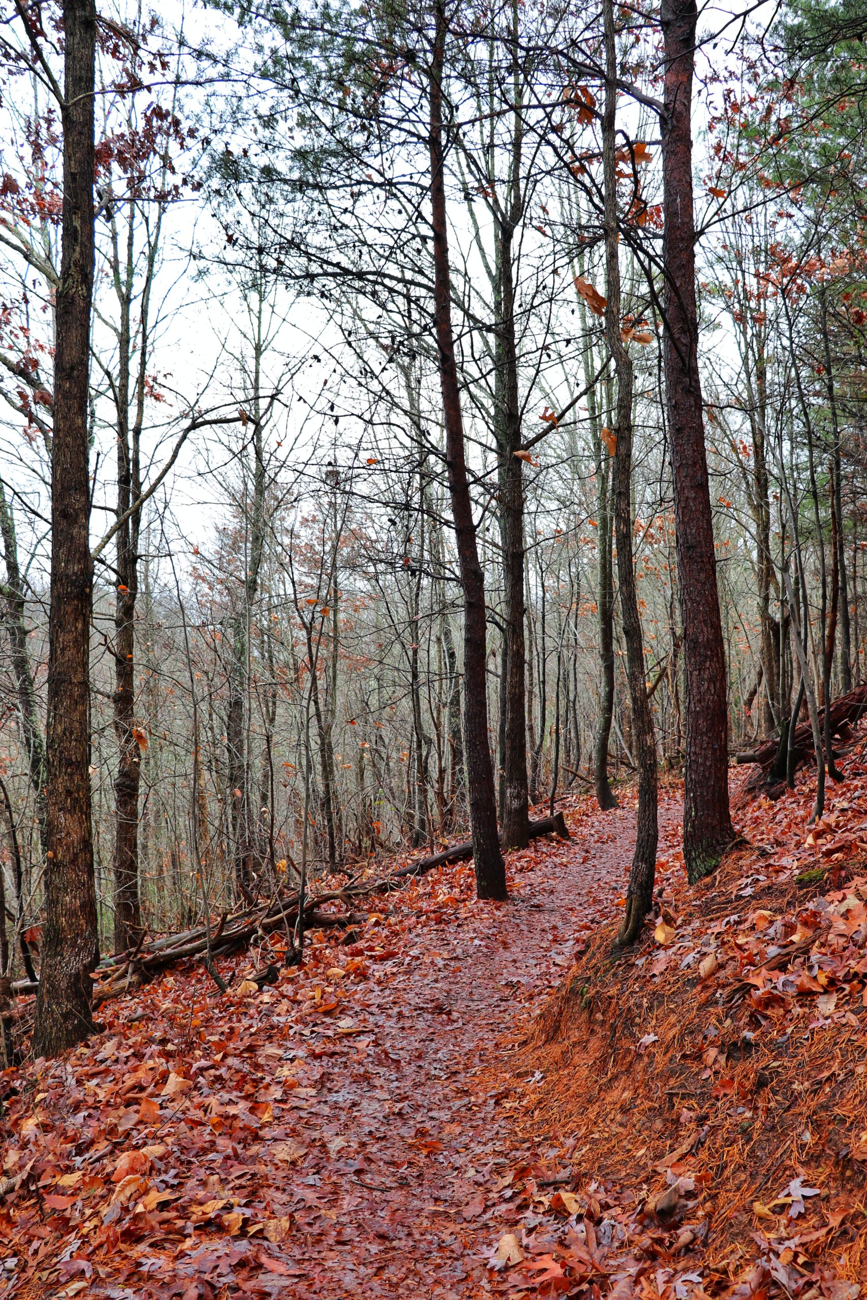
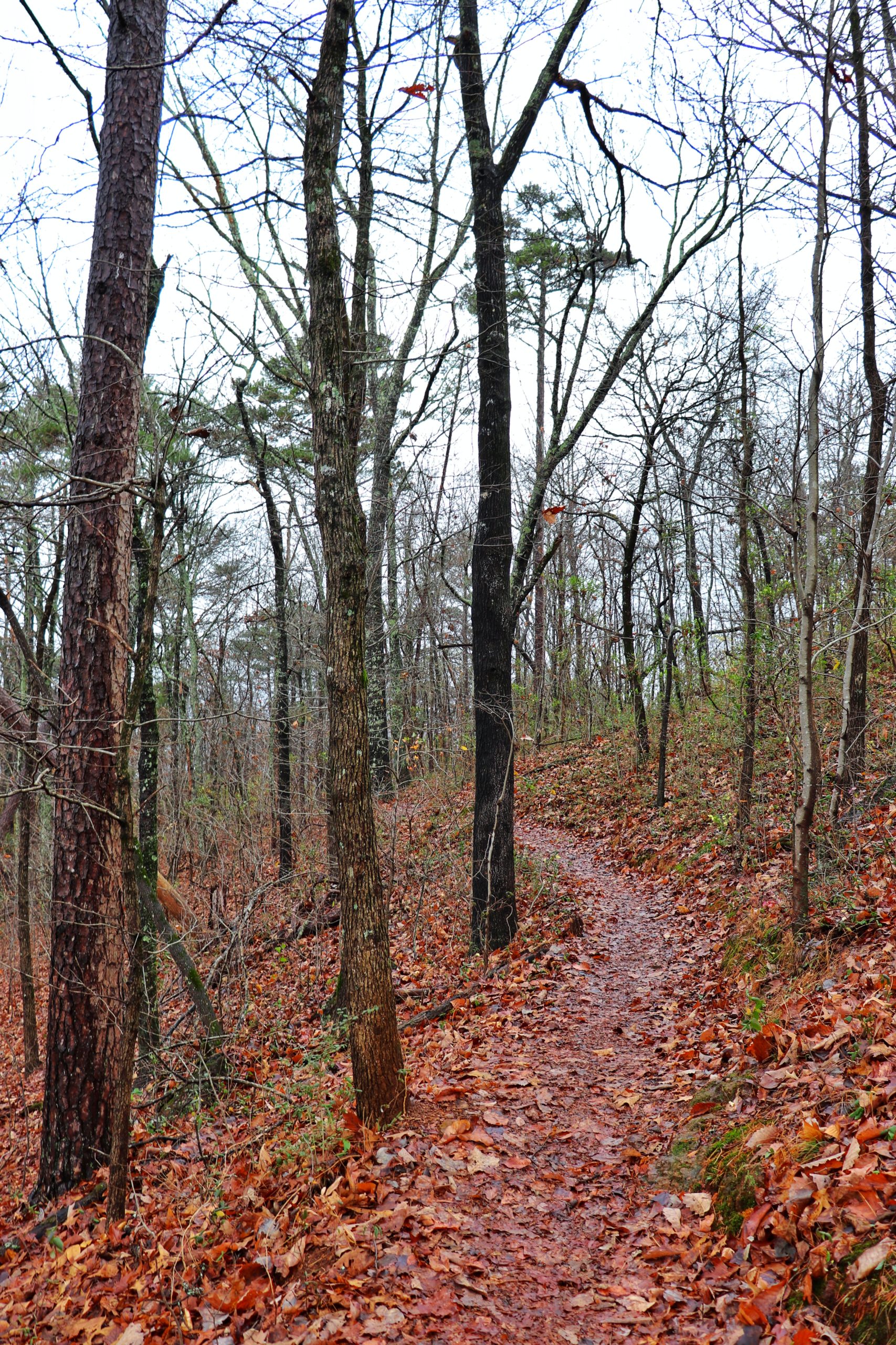
Not only does the park preserve such historic land, it offers over 5 miles of trails for hiking and mountain biking. Some trails are better suited for bikes with built-in jumps and banked curves. All of the trails are hiker friendly with 4 of them being for hiking only. Please note that most of the trails are directional. At the start of each trail will be a sign listing the name of the trail and the direction you must travel it by the day of the week. For example, on Sundays, Tuesdays, and Thursdays only bikes can travel the trails clockwise while hikers will travel counter-clockwise. This allows both bike and foot traffic to share the same trails safely. Both the cyclist and the hiker will be facing each other and be able to avoid collisions much easier than if they were traveling in the same direction.
My Latest Hike at Stringer’s Ridge
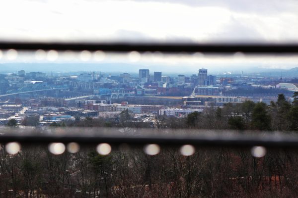
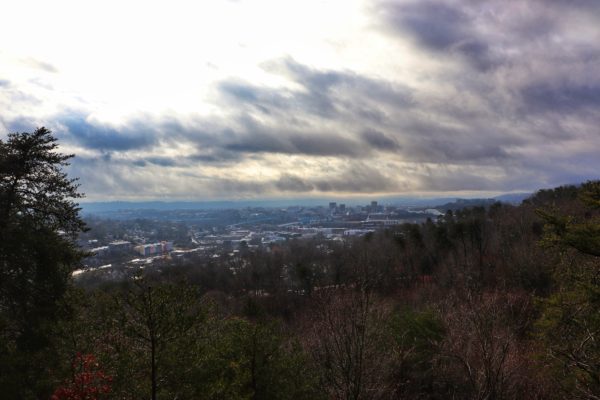
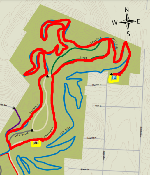
On my last hike here, I met my friend at the Spear’s Avenue Trailhead. At the first fork we veered to the right onto Hill City and then continued onto Double J. Once we reached the large intersection beside Double J, we turned left onto the main Cherokee Trail. Not much further from here is the overlook, the best overlook of downtown Chattanooga. It’s one of the closest and most all-inclusive views you’ll find with free, public access. From here we continued down Cherokee until we reached Strut Trail. We took the right side of Strut back to Hill City and back to the parking lot. Overall our hike was 2.5 miles round trip with 468 feet of elevation gain. Below is the map of the route we took in red. The yellow spots are the parking lot and the overlook.

Newest Addition to Stringer’s Ridge
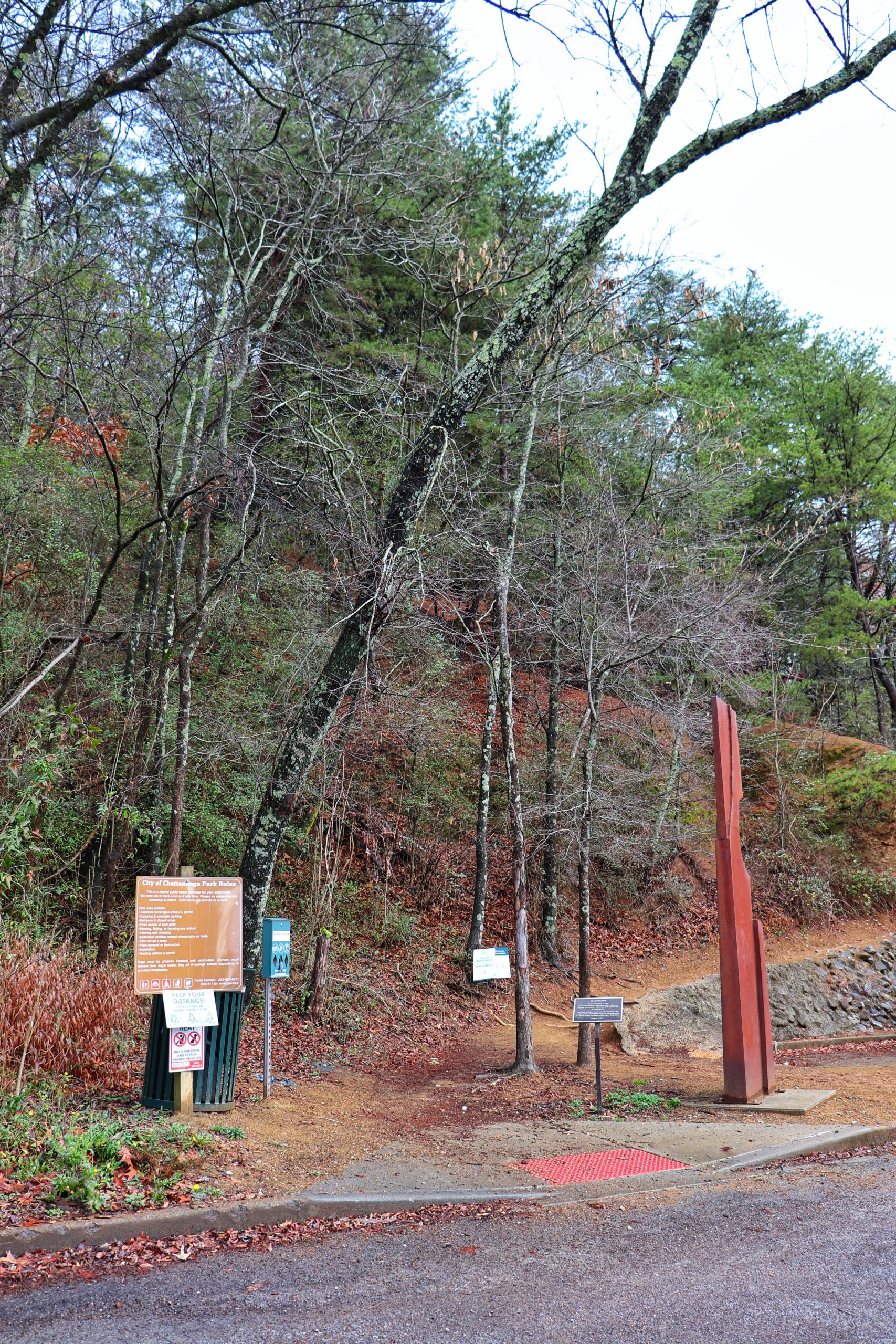
Currently, the Bell Avenue Trailhead (southwest) noted on the map is closed due to a landslide. You will have to use the Spear’s Avenue Trailhead (northeast) instead. Spear’s Avenue Trailhead is one of the only trailheads with public parking. There are other trailheads around the park for nearby residents only. However, just last year the newest addition opened, giving the public another entry point option. White Oak Park now connects to Stringer’s Ridge park via a one mile trail. This adds to the possibilites of exploring as well as a way to connect Red Bank and downtown Chattanooga through nature.
Tips for Your Visit
For a break down of each of the trails and a full map, check out the Stringer’s Ridge Park map. There are copies of the map at most trail intersections although some have faded. Be prepared by having this one already on your phone just in case.

The hardest section of the hike with the most gain and loss of elevation was on the Double J Trail. If you want the easiest route to the overlook, I suggest taking the route we used to come back. Veer to the right at the first split from the parking lot. Then basically make a U-turn onto Strut at the next intersection, taking the left side. Follow the trail until you get to Cherokee and go left on Cherokee. Eventually you’ll see the overlook on your left.
Final Thoughts
Stringer’s Ridge is a great way to get outside while staying close to downtown. It’s amazing how such a beautiful hiking area can be located so close to the city. I’m looking forward to checking out the new connector trail soon! Be sure to watch the video. And let me know in the comments below if you’ve ever hiked or biked at Stringer’s Ridge. Maybe I’ll see you out there!