If you’re looking for a hike but don’t want to scale the mountains, this is the hike for you. It’s unbelievably flat with wonderful views of the water. Here’s Chattanooga’s easiest hike at Harrison Bay.
Harrison Bay State Park

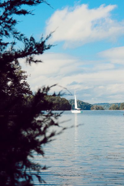
Harrison Bay State Park was the first Tennessee State Park, founded in 1937. Originally it was opened as a TVA (Tennessee Valley Authority) recreational park in the early 1930s. There are 1,200 acres in the entirety of the park with nearly 40 miles of shoreline along the Chickamauga Lake which is part of the Tennessee River. The lake was created when Chickamauga Dam was put in, which helped flood control for downtown Chattanooga. However, with the creation of this lake preventing downtown flooding came the submersion of the town of Harrison. Hence how the park received its name, Harrison, for the town that used to stand nearby, now lost in the waters below.
The park boasts many activities including beaches, volleyball and tennis courts, a golf course, and an Olympic-sized swimming pool. Along with these amenities, there’s hiking, bike riding, fishing, and camping opportunities galore. Not to mention, this park also has one of the most favored marinas in the area and a restaurant, Dockside Cafe.
Bay Point Loop Trail
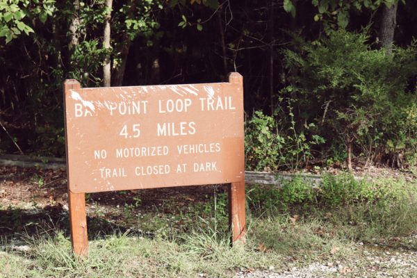
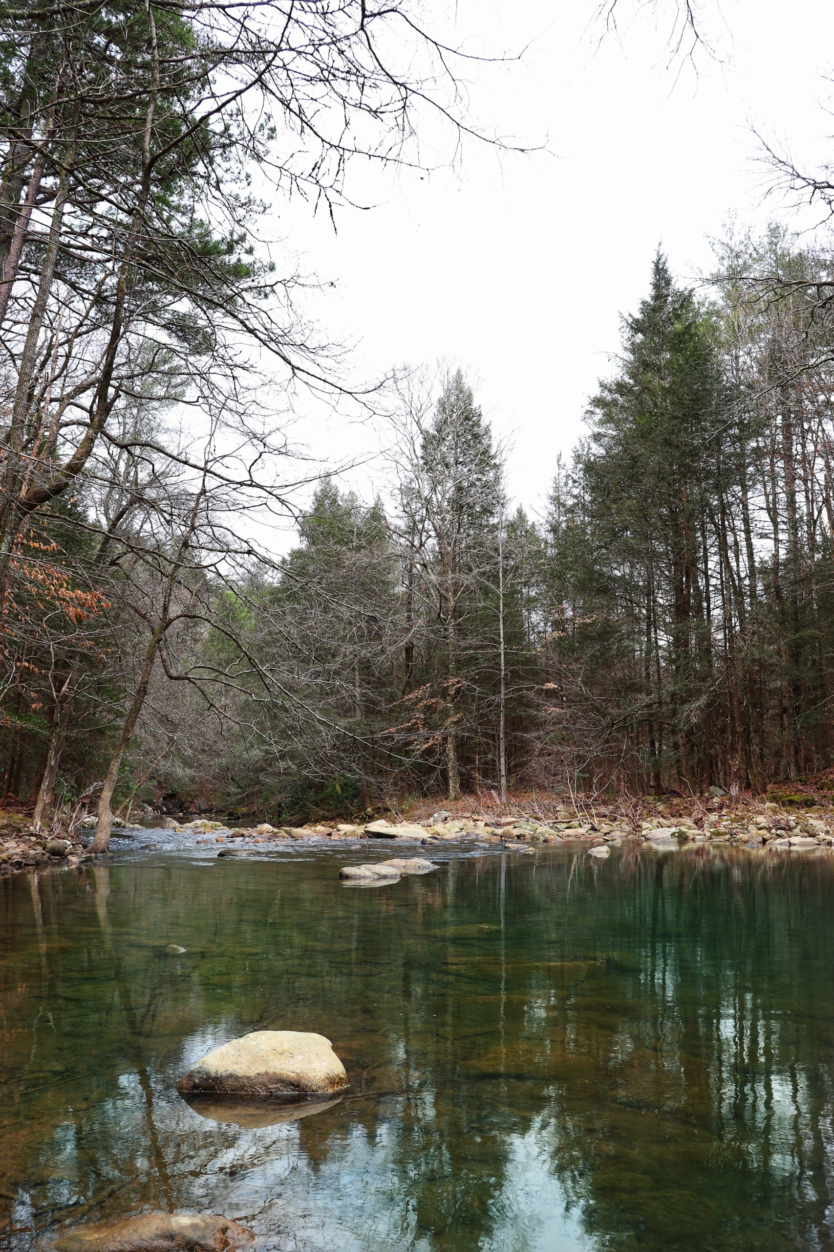
I have visited Harrison Bay State Park a handful of times in the past, but I had never hiked here before this visit. I realized there’s a 4.5 mile trail called the Bay Point Loop Trail and decided to give it a try. The trail runs almost completely along the shoreline with beautiful views of the water. And what makes this Chattanooga’s easiest hike is that it’s practically flat! Getting to the trailhead is simple. Just follow these directions:
- Harrison Bay State Park is off Highway 58. From Highway 153, take Highway 58 about 12 miles north. Turn left onto Harrison Bay Road.
- Follow this road for about one mile and on the left (in the corner of a sharp, right-hand turn) you’ll enter the park entrance.
- Once in the park, you are met with a fork in the road. Take the fork to the left towards the marina.
- Follow this road a ways, you’ll pass the marina and the boat ramp. You’ll end up in the parking lot for boat trailers.
- Head as far to the right as you can. There are car parking spots lined along the trailhead.
- Once you’re done with your hike, remember that this parking area is one way. Exit at the other end, not where you came in. The exit road meets back up with the main road you came in on so you can easily find your way back out.

When we first got on the trail, we were greeted by a group of bike riders. Later in the hike we ran into a small family with young children doing the hike easily by themselves. Of course, 4.5 miles is long, even for a flatter hike, but you can easily make it a out-and-back hike by just turning around at any point. We hiked the entire loop starting to the right side. Most people who hike this all the time prefer to start from the left side. The left half of the trail is not nearly as picturesque as the right half, therefore making the overall hike more rewarding by saving the best for last.
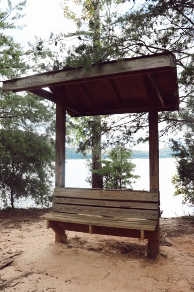
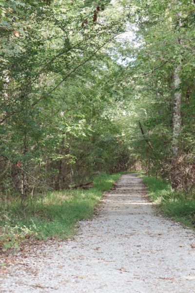
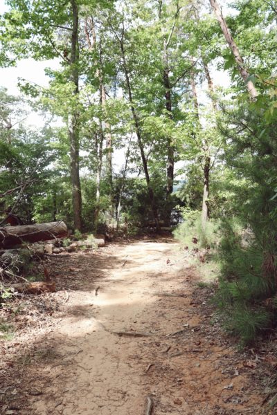
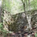
There’s a covered bench (pictured above) on the left half and one on the right half as well. The one on the right half has a clear view of Chickamauga Lake and the Tennessee River. You can rest and watch boaters fly by for quite a while, like we did. The trail is mostly dirt and a little gravel. The only obstacles to really watch out for are tree roots. We did not encounter any fallen trees that had to be climbed over like in previous hikes elsewhere. I’m not sure if this means they maintain this trail well, or if it is because most of the trees in this part are smaller in circumference and not near a steep hill where erosion and lightning cause the most harm. Not too far into the loop on either side, is a cut-through. So, if you want to make it a smaller loop, you easily can. However, I don’t recommend this because you’ll be missing out on all the beautiful water views.
The Star Walk
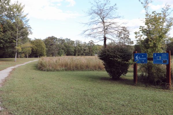
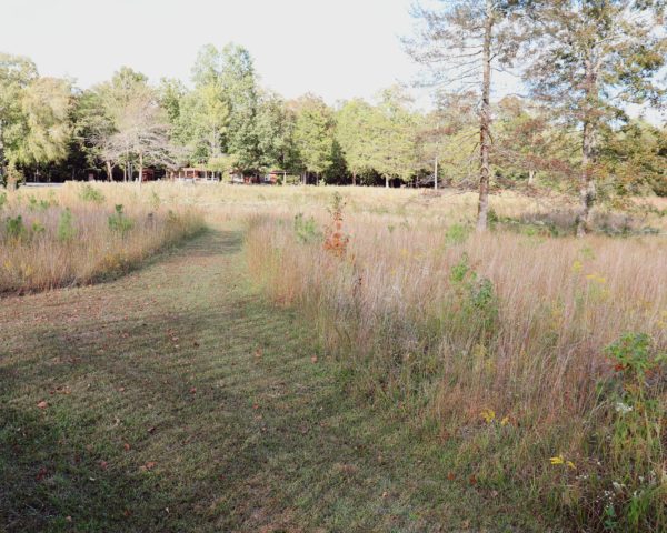
I wanted to include this as it’s a different type of hike that can be enjoyed while visiting the park. It’s a flat area as well so the ease of the walk makes it a great addition to Chattanooga’s easiest hike here in Harrison Bay State Park.
Upon entering the park, you’ll see a gravel walkway to the left with a small gravel parking lot. I always passed by this and never stopped to observe until now. Turns out, the gravel walkway is a half mile walking loop around native grasslands. In 2016, the Barnard Astronomical Society installed the Star Walk. Modeled after the original Grossmogl Star Walk in Austria, it was created to educate and pique interest in everyone to explore astronomy even at a beginner level. You can utilize the functions of this walk at any time, but of course nightfall would be the best time to truly observe the night sky and learn from what the sign topics have to offer.
In Closing
I have not completely done the Star Walk yet, so that is definitely on my list of things I want to try when I come back to the park. Also, I would love to camp here as well as ride my bike along the Bay Point Loop. One day, I’ll be able to check all those items off my list. Until then, be sure to check out my YouTube video recording this adventure with… SPOILER: there’s some deer appearances. Click HERE to watch it.
After you’ve enjoyed Chattanooga’s easiest hike and you are looking for other easy hikes, I highly recommend Benton Falls and the Chickamauga Battlefield which has numerous trails throughout the moderately flat park.
For now, I must head out on my next exploration. So enjoy your weekend and I’ll see y’all next week while Exploring Chatt.
~Amanda