For many years now I’ve wanted to visit the Hiawassee River. So many locals have told me how it’s the best place to raft. Although I haven’t had a chance to try rafting down it yet, I did however get to explore some hiking on the John Muir Trail.
John Muir Trail
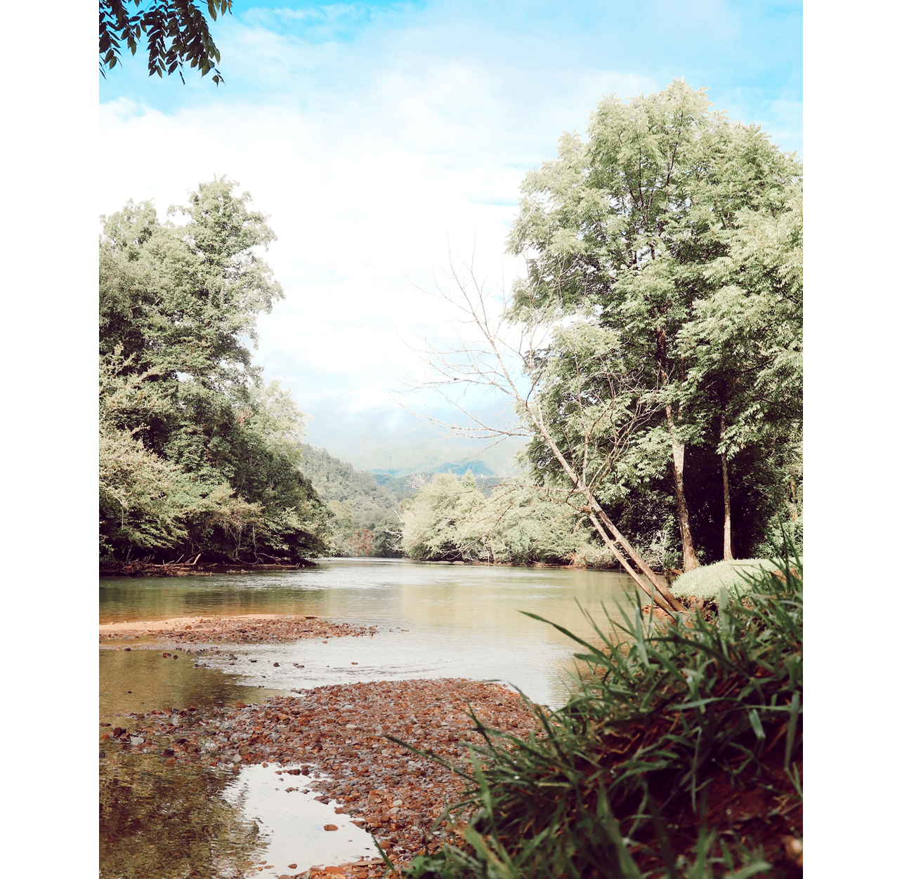
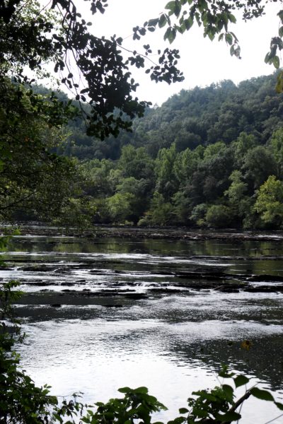
The John Muir Trail is a 21 mile out and back trail that follows the river’s edge near Reliance, TN. It’s a fairly easy trail at the start, nestled between the Hiwassee River and neighboring mountains. Because of its location, there’s not much elevation change keeping the trail pretty flat in the beginning. We only hiked 2 miles in before turning around to head back. We started at the Benton Mackaye Trailhead. Now I know you’re probably wondering how we hiked a different trail from this trailhead, but allow me to explain. The John Muir Trail is 21 miles that eventually splits further upstream and take its own path. The Benton Mackaye Trail overlaps for a while before cutting east to go further into the Appalachian Mountains. The Benton Mackaye Trail is ultimately 300 miles long spanning 3 states.

We ran into a few fallen trees that weren’t too bad. Except one. One was a small challenge to get through because the crown (the leafy branches part of a tree) had fallen across the trail, not the trunk of it. But we made it through fine, both on the way there and back. Other than that, the trail is quite clear and obstacles are easy to get around.
When to Go
We went on a Saturday morning last month and found this to be a perfect time to go. As usual with hiking, the earlier the better. Less crowded and less summer heat.

Beware, the Hiawassee River is dam controlled. This means that the water can rapidly rise without you even realizing it. That’s what happened to us. We were sitting on a log enjoying the river view and a snack. After we finished, we stepped away for a minute. After about 30 seconds, I looked back down to see the log being engulfed by the river. I estimate that the water rose 2 feet within 1 minute! This is when we decided to turn around and head back for fear of that spot where the challenging fallen tree was. The trail appears to never be under water, but there are sections that will get pretty close to the water’s edge. Just keep in mind that the Hiwassee Dam operates on a weather-based schedule that could change any time.
What We Explored
We estimate that our hike was about four miles total on the John Muir Trail. We ate a quick lunch once back to the car and decided to head out and go further downstream on Spring Creek Road. From here, I noticed there were a lot of trail heads. However, they all went straight up the mountain and after our morning hike, we were not prepared for that.

We walked down to the river and I waded into it a little. The cold water felt great after a humid hike. But again, we watched the water rise quickly so we headed back out.
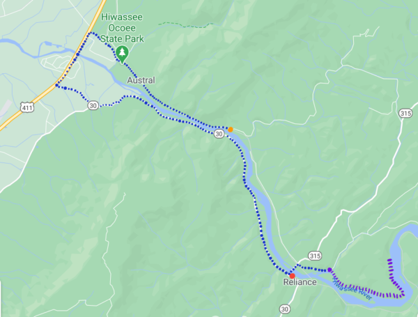
Here is a map showing the John Muir Trail (purple), the Texaco bathroom spot (red), and the place we parked to wade into the river at the end (orange). The route we drove is dotted in blue.
In Closing
I definitely recommend the John Muir Trail. Even though we only got a couple miles in to it, it was very easy on the elevation as it’s mostly flat. Of course there’s some ups and downs the further back you go, but they aren’t too bad.

Keep in mind the river conditions so you’re prepared when the waters rise.
We also saw some backpacking campers headed out to camp. One day maybe I’ll get to try this out too on this trail.
If you’re looking to explore more nearby this trail, check out Benton Falls. This is another easy trail with a beautiful waterfall you won’t want to miss.
Until next time, enjoy Exploring Chatt!
~ Amanda
PS. I’ll be sharing the video adventure of this day on YouTube tomorrow so be on the lookout for that!
Leave a Reply