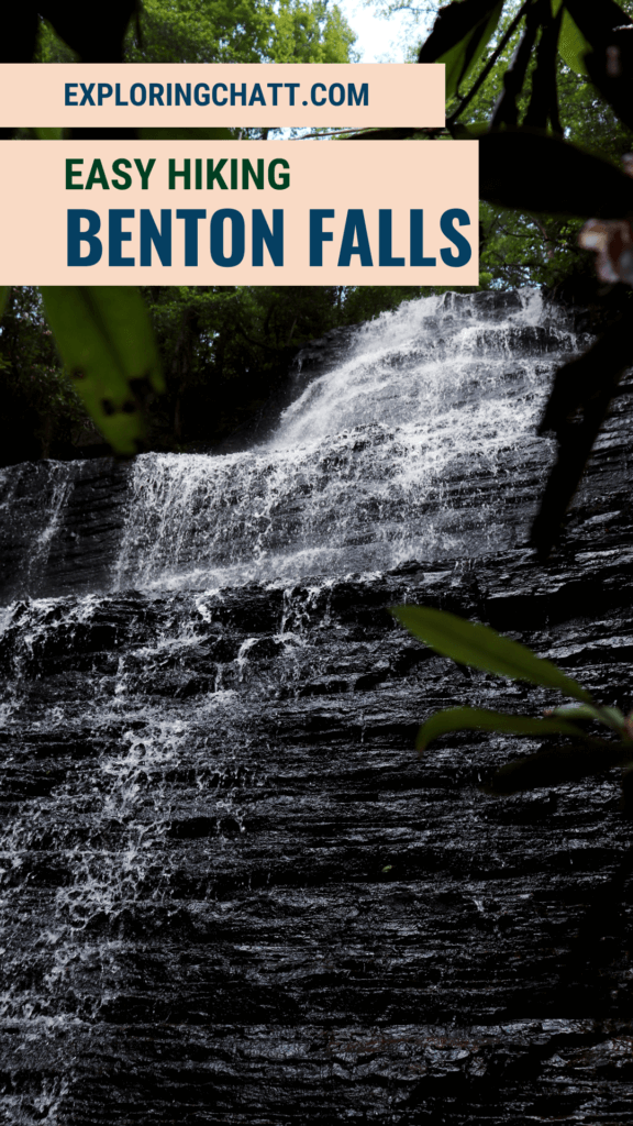
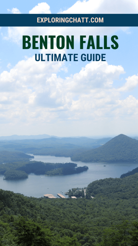
Along the scenic Ocoee River is a nearby mountain that is home to the Chilhowee Recreation Area and the iconic cascading waterfall, Benton Falls.
Benton Falls is a favorite among the locals of the Ocoee River area. Located a little over an hour northeast of Chattanooga, this gem is a must-see. It sits atop a mountain that overlooks the Ocoee Lake below and there’s scenic overlooks along the way. Continue reading to learn the best route to get to the Chilhowee Recreation Area, how to hike to Benton Falls, and other tips for your visit.
In a hurry? Pin this post for later:
Chilhowee Recreation Area
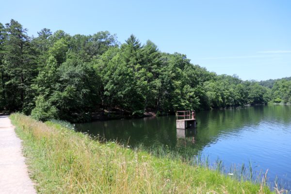
Benton Falls is part of the Chilhowee Recreation Area. This place is within the Cherokee National Forest and features over 25 miles of hiking and biking trails which only scratch the surface of all there is to enjoy here. There is a $3 fee to park for the day, but this gives you access to the beach on the 7 acre McCamey Lake, all the trails, and of course, Benton Falls.
How to Get to Benton Falls
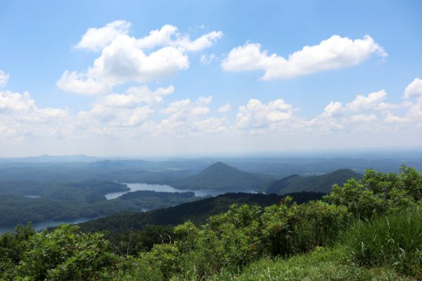
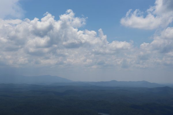
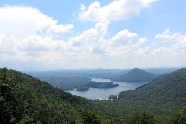
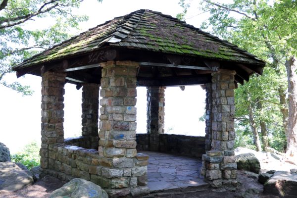
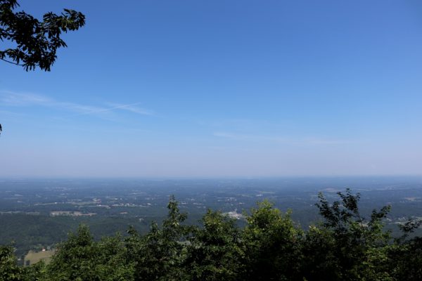
There’s two different ways to drive to Benton Falls when coming from the Chattanooga area. On my first visit, Google Maps took us up Benton Springs Road which is a rather steep and narrow gravel road up the mountain. I do NOT recommend going up this way. Instead, stay on Highway 64 that runs along the Ocoee Lake and River. Off of Highway 64 is Oswald Road which will take you up the mountain and straight to the park. There are also three overlooks on this road which I highly recommend stopping at and enjoying the view (see first three photos below). And right before the park is the Chilhowee Gazebo which is another neat overlook as you can see below (last two photos).
Hiking to Benton Falls
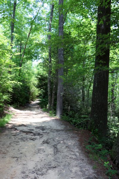
Once you’re in the park, there isn’t a trail sign for Benton Falls so let me help point you in the right direction. You will be starting from the parking lot and walk down the trail that has the lake to your right (see first picture below). At the end of the short trail by the lake, you’ll come up to a fork with a sign that tells you which way the Benton Falls Trail is. From here on out you will easily be able to follow the signs pointing you toward Benton Falls.
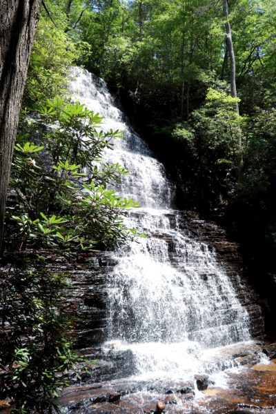
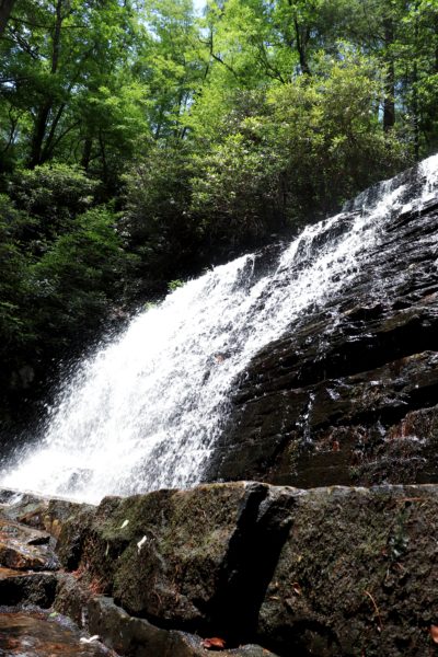
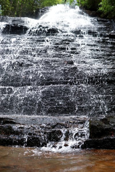
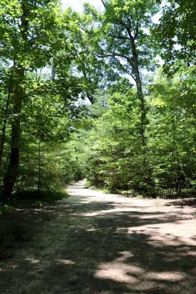
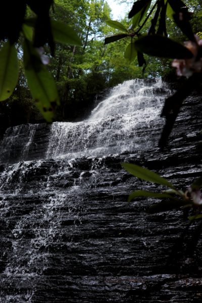
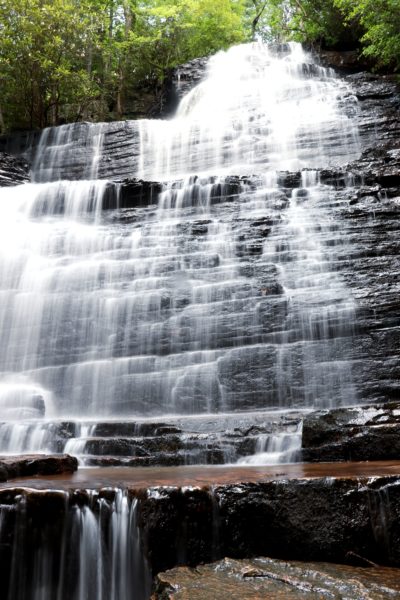
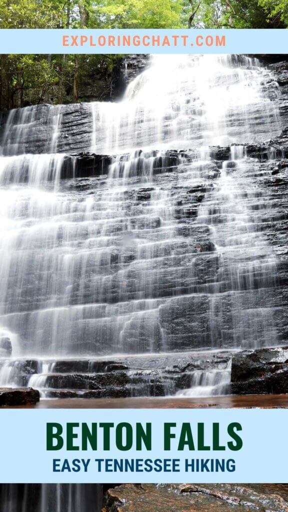
The trail to Benton Falls is easy and moderately flat. It’s a 1.5 mile trail to the falls and back making it 3 miles round trip. The only stairs involved are rock steps down to the base of the 65 foot tall falls. That alone makes this waterfall hike one of the easiest to reach compared to most others in the area that are either loaded with more steps or have high elevation gain and loss.
First Experience Hiking to Benton Falls
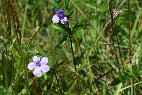
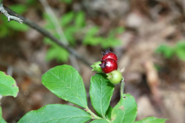
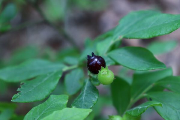
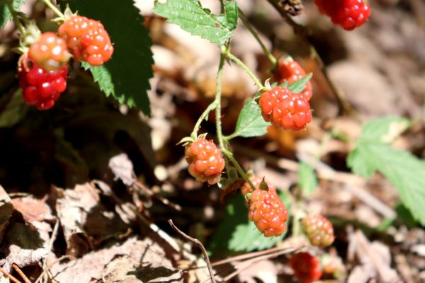
I first did this hike with my parents in early July, and we noticed that there were a bunch of wild blueberry and blackberry bushes all along the trail. Most of them were not close to being ripe yet, but I found one berry of each that was. You’ll have to watch my video to see what I did with them.
Since the trail is mostly flat and sandy, we came across a lot of people biking down it. So, be cautious of this as some of the bikers may not be too cautious of you on foot.
My mom doesn’t like long hikes or lots of stairs and her overall experience here was good. She said it wasn’t too hard and that it was well worth it to see the waterfall. When we went, the water was very low, only a couple feet deep in the deepest spots. But July is in the middle of our driest season so expect more water if you go during a rainy part of the year. As always, make sure you wear good water shoes and be careful as the submerged rocks are slippery. I climbed up onto the bottom ledge at the base of the falls and it’s definitely a neat spot that’s easy to get to. The cold mountain water always feels good after a warm hike down, and I saw some interesting wildlife while I was here as well. But you’ll just have to watch my video to see my experience with that.
Tips for Benton Falls
Arrive early. Benton Falls is a very popular waterfall destination so I recommend getting here as early as possible.
Be mindful of the season. There are restrooms near the trailhead, but they aren’t open year round. Season is early April through late October so if you visit outside of this time frame, you may not have restrooms to use here.
For a longer, 6 mile hike, consider taking my suggested loop hike. Not only does this double the hike length to Benton Falls, but it will take you down additional trails that are less crowded and quieter than the main Benton Falls Trail. Plus you’ll see more scenery including a small creek crossing. Read my loop hike to Benton Falls blog post for more details.
Closing thoughts
If you’re looking for an easy and mostly flat hike, I highly recommend checking out Benton Falls. Flat hikes are extremely rare here in hilly Tennessee so if you prefer flat, you’ll definitely love this one. Benton Falls is a beautiful cascading waterfall and is something that you will just have to experience for yourself in person. Let me know in the comments below if you’ve ever been here before or somewhere similar. I’d love to know what you think! Until next time, enjoy exploring Chatt!

More Hikes in the Chilhowee Recreation Area:
Inspired? Pin this post for later:

Yes, I have been there. Being from Florida it was a great hike, and the falls were very pretty.
Thanks for joining me on the hike!
Unless I was on a different trail, (roughly 1.7 miles to Benton Falls) from a gravel road off of TN 30, I found the trail to be easy but very rocky with a lot of tree roots. I can’t imagine folks taking this trail on a mountain bike, but I could be mistaken. The waterfall was rather unnoteworthy, and I considered dangerous to approach due to very moldy, slippery rocks. Just a word of caution to be careful hiking to the base of the waterfall. Roughly 75 minutes roundtrip.
John
Yes, if you drive up Benton Springs Road, it’s kind of a scary gravel road drive up. I recommend taking Oswald Road up from the Ocoee instead. Plus there’s some scenic overlooks to stop at along the way (also great spots for sunset). I was surprised to see mountain bikers on this trail too with some of the deep rut spots, but it’s doable to some people. If it hasn’t rained in a while, the waterfall might be a little lack-luster for sure, but when it’s rained recently it’s definitely worth the hike in my opinion. And yes, getting to the base can be slick for sure.