Looking for a little slice of Tennessee paradise? I recently just found the Scenic Trail and am blown away. Not only is it unique and beautiful, this place can be somewhat secluded. Which, as we all know, can be hard to find hiking these days.
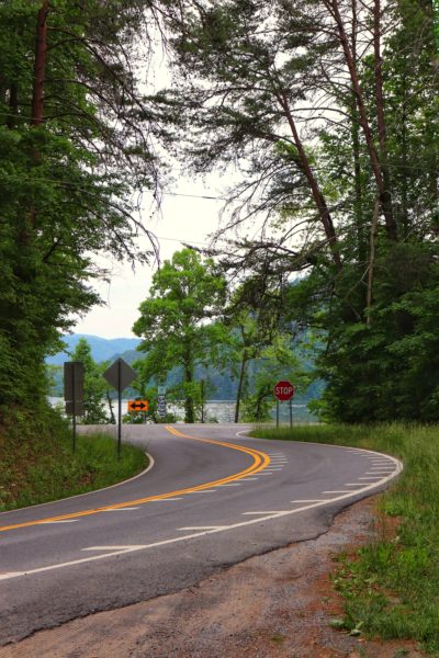
Scenic Trail
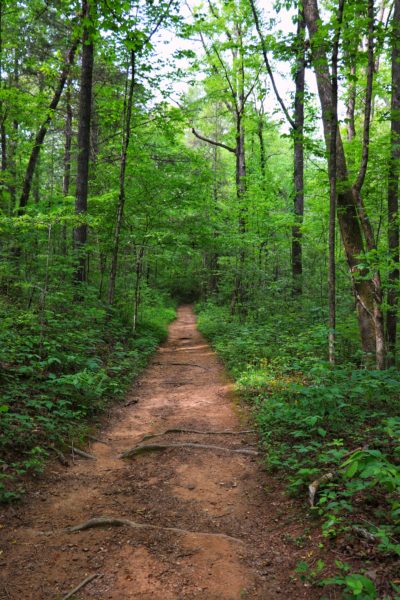
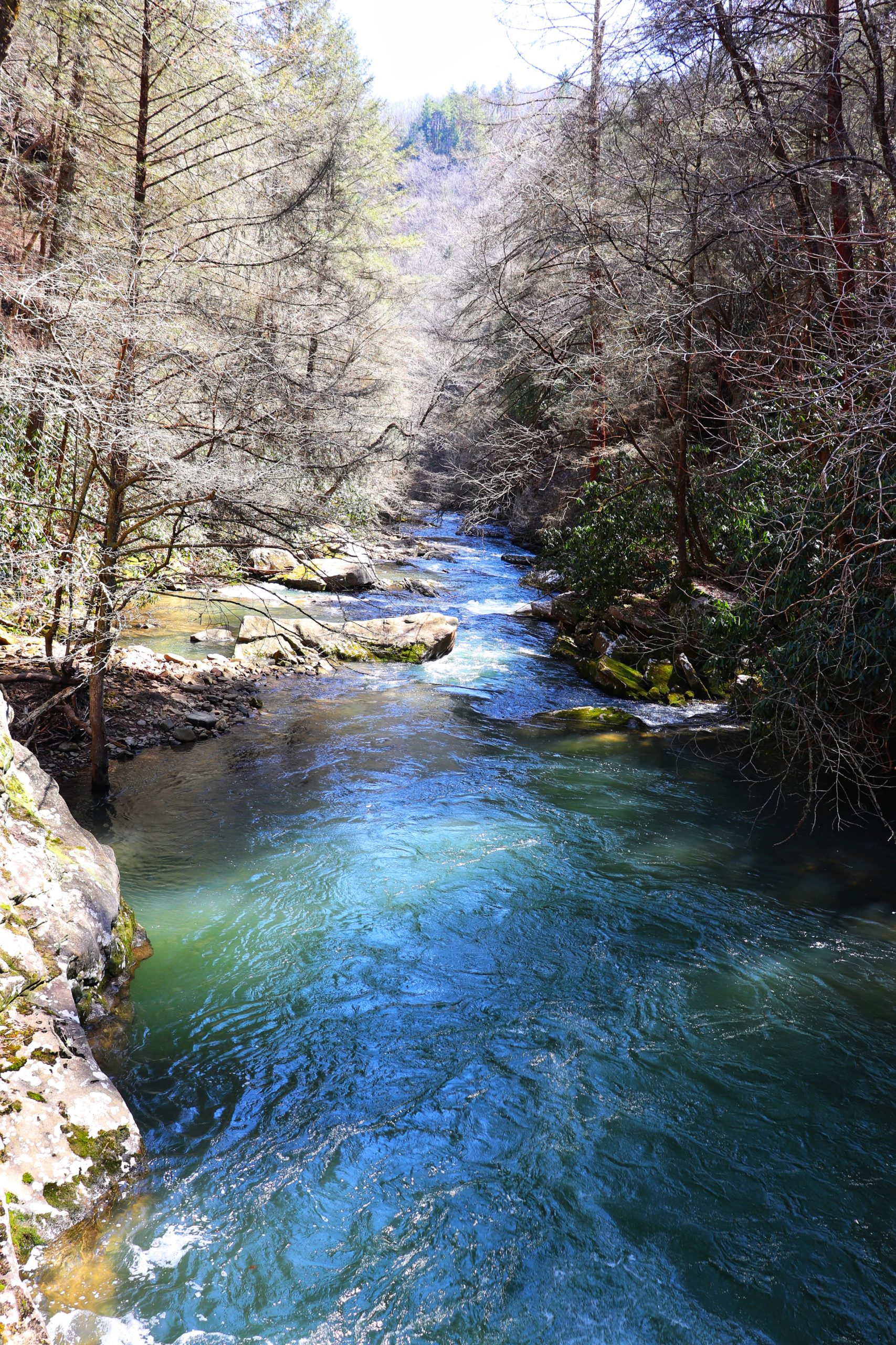
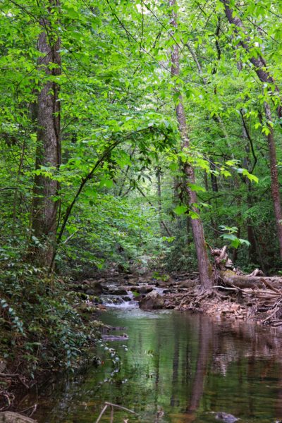
The Scenic Trail, or Spur Trail, is at the base of the mountain and is still part of the Chilhowee Trail System. This 1.7 mile trail follows Rock Creek back to a secluded waterfall. About a third of the way down, the Clemmer Spur Trail intersects. This trail also runs parallel to the Scenic Trail up to this point. So if you want to add a little elevation, you can hike this section as well and turn off at the intersection. The length of the Scenic Trail along with next to no elevation changes makes it a fairly easy hike. The most challenging part are the creek crossings, of which there are two.
What’s the Name of the Waterfall?
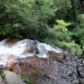
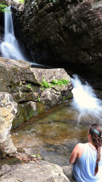
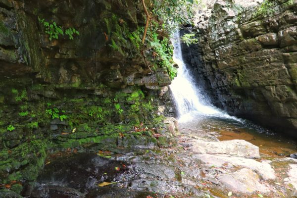
Scenic Trail appears to dead end at a waterfall for which a name has not been completely decided. All Trails calls it Rock Creek Falls, which logically makes the most sense as the waterfall is part of Rock Creek. But the other sources call it Rainbow Falls. And a few call it Rattlesnake Falls, which honestly is a little scary. That name probably comes from its location though, in Rattlesnake Hollow. But whichever name you choose to call them, this waterfall is still one of my new favorites. The mossy rocks sprinkle water over your head as you draw closer to the main attraction. And there, between two rock walls flows the waterfall. It splits into two different falls and concludes into a small but deep pool of water. This entire scene creates a Tennessee paradise feeling that I’ve found unmatched.
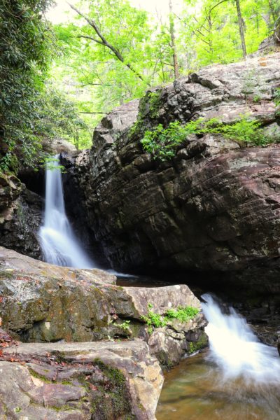
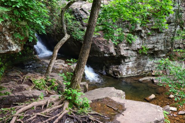
In retrospect, I’ve learned there’s another, larger cascading falls just beyond this one upstream. The trail veers up to the left near the rock wall which will take you there. From what I’ve read, it’s a more challenging stretch that’s steep and can be slippery if wet. And as you near the falls the rocks get larger and hard to climb if you’re short. It appears reminiscent of Benton Falls. Unfortunately, I had no idea this existed until now. So, I will have to check this out on my next hike here. When I do, I’ll be sure to add the update all about it at the bottom of this post.
Creek Crossing
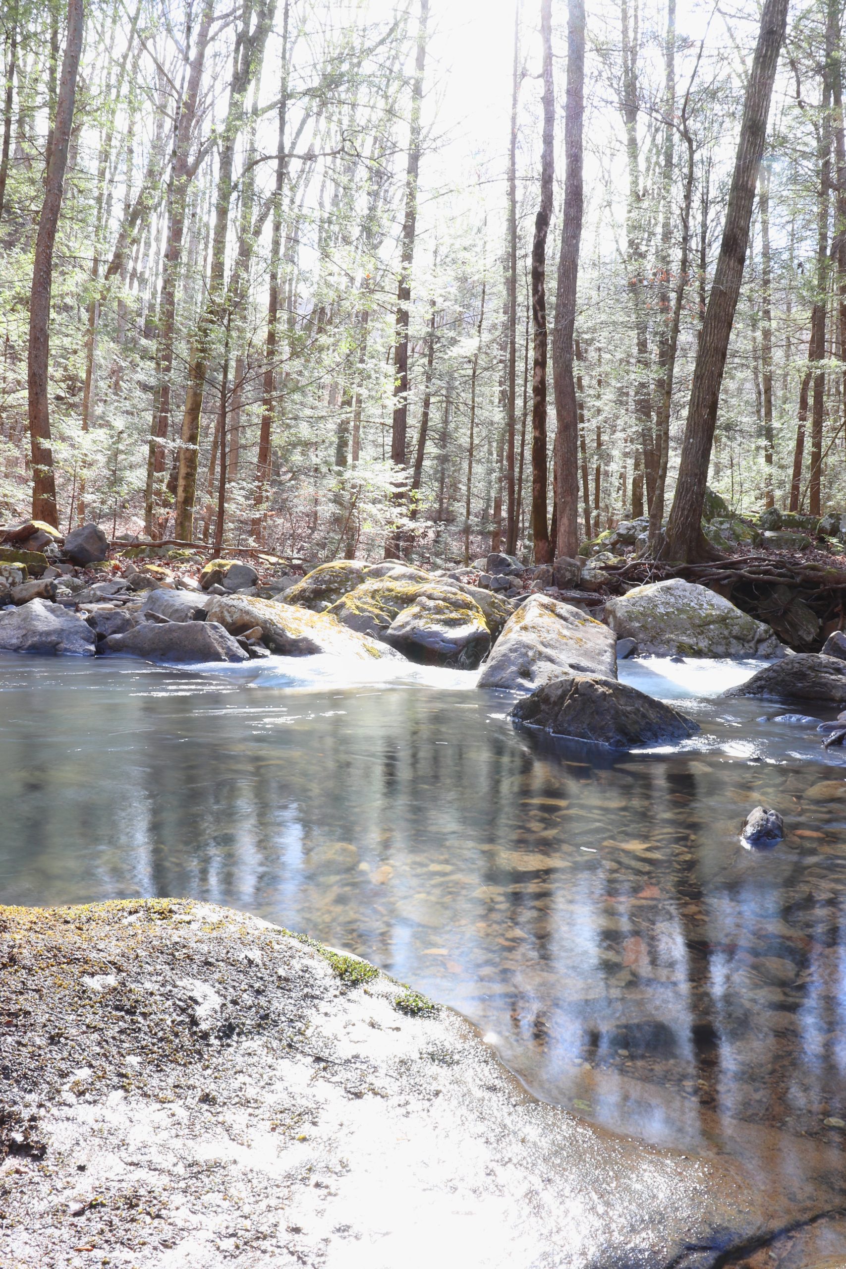
As mentioned earlier, this hike is fairly easy due to it’s somewhat short length and mainly flat ground. The only thing that might make you think twice are the creek crossings. I’m not sure why, but the trail crosses Rock Creek about halfway on the way in, and then back to the other side a little ways before the falls. Why this confuses me is because you start the trail with the creek to your right and at the waterfall it’s to your right as well. So why is there even a need to cross the creek in the first place? This is a question that still remains unanswered.
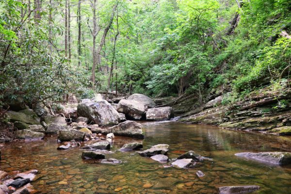
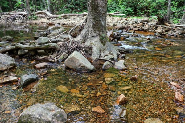
But the fact still remains, you will have to cross the creek twice. I highly recommend preparing to wade through it or at least get wet while trying to rock hop. I personally didn’t take my chances and waded through the foot high water. My friend, however tried to rock hop but was unsuccessful on her return. One of the rocks flipped on her and she had to completely step into the water then. Also note that water levels will vary greatly depending on the season and if it’s rained recently or not. It had not rained in a while when we went so I believe these were lower levels for this location.
Waterfall Tips
While visiting the waterfall, please be careful. The last short stretch of the hike towards the waterfall is on slick boulders. Although they are rather flat and level, they are wet due to the water dripping onto them from the rock wall above. Use extreme caution here so you don’t slip and fall.

Once you arrive to the waterfall, there are some lower boulders closer to the water that you can carefully climb down to. Again, use extreme caution here because they will be slick. It would be easy to accidentally slip into the pool below if you get too comfortable and lose your footing.
All of this to say, you can really enjoy this area, just keep your guard up. It can be a dangerous place if you’re not careful. But if you ARE careful, it’s a wonderful and beautiful place to be.
When to Hike the Scenic Trail
What I love most about this hike is how easy it is to get to a secluded waterfall. Yes, there are easier waterfalls to access, but there’s so much more satisfaction when you have to put in a little work, right?
Depending on when you go, you might have the whole place to yourself. We went around 4:30pm and passed a few people heading back. On our way back we passed a few people heading out. So, even though it was well-known, I believe everyone got a chance to enjoy the waterfall alone. It definitely wasn’t crowded.
Closing Thoughts
Lastly, please be considerate. There were a ton of goldfish snacks scattered all over the place by the waterfall which kind of lessened the experience. I’ve also heard people tend to leave trash along this trail more so than others. So, as a reminder, always take out what you bring in. It really is that simple. Then we can all enjoy places like this for years to come.
Be sure to watch the video version of this hike. Here is where you’ll find the exact location of the trailhead. And here is a map of this trail. Let me know if you have visited or plan to visit this little slice of Tennessee paradise on the Scenic Trail. Until next time, enjoy exploring Chatt!