You need to try this quieter loop hike while visiting the popular Benton Falls near the Ocoee River in Tennessee.
I’m all about finding the path less traveled, especially when it comes to peak hiking season. This loop trail is just that. It’s located within a popular trail system inside the Chilhowee Recreation Area, however not much traffic hits these particular trails. Keep reading to learn more about these secluded trails, how to include a stop at Benton Falls, and what to expect on this hike.
In a hurry? Pin this post for later:
Chilhowee Recreation Area
Clear Creek Trail is inside the Chilhowee Recreation Area. This area is home to over 25 miles of trails within the Cherokee National Forest, the only national forest in the state of Tennessee. Please note that there is a $3 fee to park for the day. Not only are there numerous hiking trails here, there’s Benton Falls, mountain overlooks, and in season a lake with a beachfront and campground. I hope to camp here one day to really enjoy everything this place has to offer.
How to Get There
Chilhowee Recreation Area is located at the top of the mountain beside Ocoee Lake. Be sure to take Highway 64 all the way along the Ocoee Lake to get here. Sometimes GPS maps will try to take you up Benton Springs Road which I do not recommend. This is a gravel road that is pretty rough the entire way up. Instead, stick to Highway 64 which will take you up the mountain via Oswald Road. Plus, there’s three overlooks this way that are worth checking out. If you want to catch the sunset, get to the Sugar Loaf Mountain Overlook early and you’ll be in for a show.
The Loop Hike to Benton Falls
First of all, be prepared with a trail map beforehand. There’s so much happening in this area it can be easy to get lost.
Don’t let this roughly 6 mile hike fool you. I know 6 miles sounds like a lot but with how easy and mostly flat this hike is, it’s really not that bad for a hike in this area. If you can walk 6 miles down a sidewalk, you can do this hike no problem.
I suggest doing this hike counterclockwise. This will be backwards of the way we went, but it will take you by Benton Falls first instead of last so you might have a less crowded experience here. Then you’ll get to finish the hike out on the quieter side of the park.
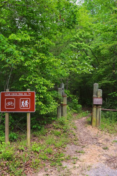
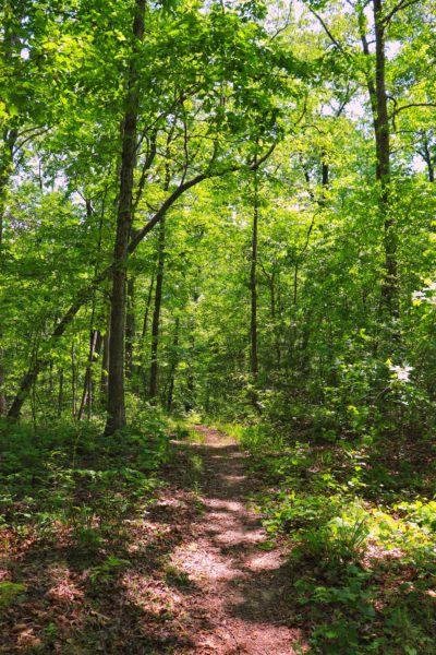
Clear Creek Trail
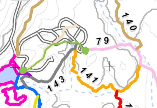
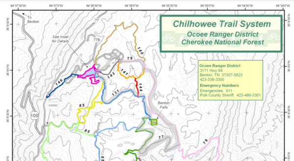
The Clear Creek Trailhead is amongst the campgrounds. I quickly realized on our hike that you’ll want to use a map of the campground and trails to find the trailhead. We accidentally went down a dead end road beside campsites that was not the correct location. The Clear Creek Trailhead is located at the end of Loop E. See the photo below of the map of the campground and the trailhead so you know where to go.
Parking is at the green dot on the left.
Use the campground trails and roads to get to the trailhead at the other green dot on the right.
Clear Creek Trail is shown in light pink, number 79.
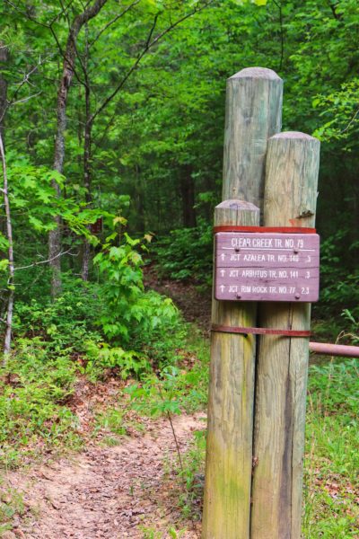
Once you reach the Clear Creek Trailhead, follow the trail all the way to Rim Rock Trail, number 77. Watch out for trail signs along the way. Each one will point you in the right direction as long as you know the name of the next trail you’re looking for.
Rim Rock Trail
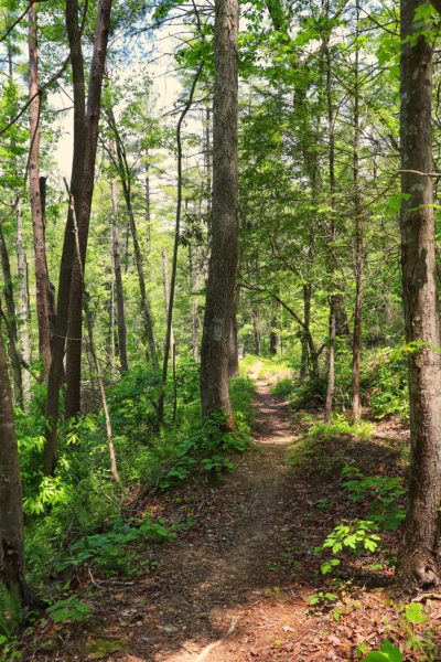
After nearly 3 miles on Clear Creek Trail, you’ll reach an intersection. I have not taken Clear Creek Trail to the bottom of the mountain, but I’ve heard it gets pretty steep on that section. In fact, I believe this is why the trail earns the difficulty rating of…difficult. Which also explains the 1500 feet of elevation loss you’ll encounter if you go down to the bottom. But trust me, the first 3 miles of this trail are really flat and easy at the top of the mountain. Turn right at the start of Rim Rock Trail.
Continuing on our easy theme, the goal is to make this an easy loop hike back to the parking lot. The hardest part of this entire hike is crossing Rock Creek on this trail segment. And honestly, it’s a very easy creek crossing, as far as creek crossings go. I had no trouble crossing safely and staying dry. But if it’s been raining a lot recently you might find it to be a wet crossing.
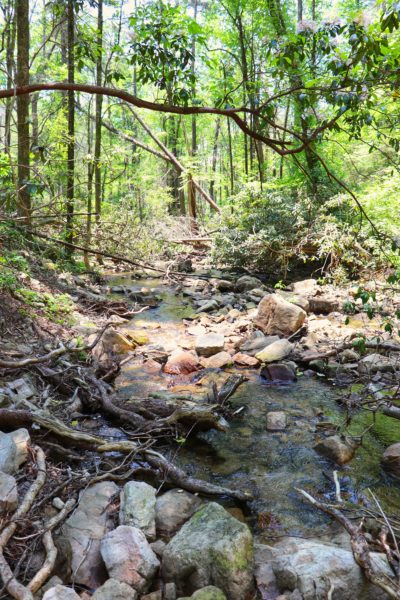
Rock Rim Trail takes you down a gradual decline to the creek and then gradually back up the other side. The inclines here are straight but gradual for about half a mile on each side. These are the only inclines on the entire hike and they are not too difficult. This can be better proven by the fact that the difficulty rating for this mile long trail is…easy.
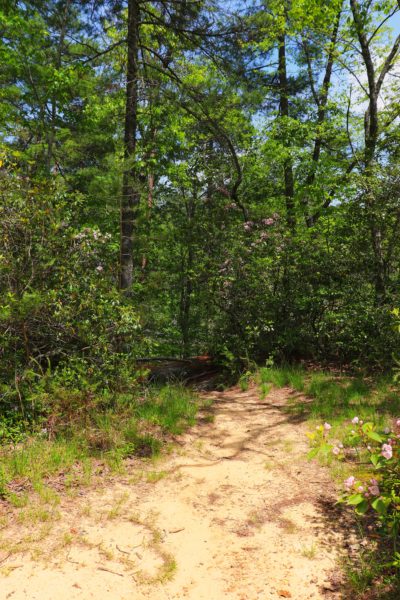
Clemmer Trail
Rock Rim Trail ends at Clemmer Trail which you must take to the right towards Benton Falls. There’s trail signs along the way letting you know how far you are from the falls so it’s easy to find. From the end of Rock Rim Trail to Benton Falls Trail on the Clemmer Trail is roughly .8 miles.
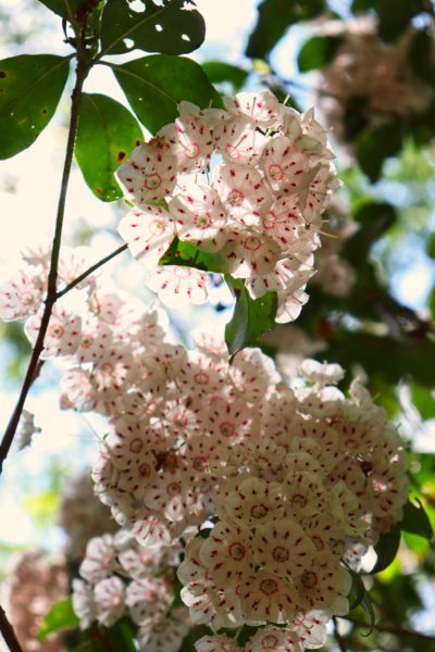
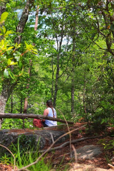
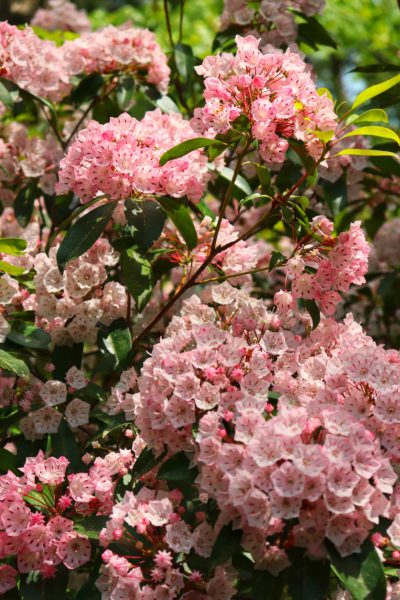
Pictured above you’ll see a big flat boulder that’s the perfect lunch break spot. This is located just behind the trail that goes down to Benton Falls. This is my go-to lunch spot on this hike. There aren’t many boulders in this area so finding a good spot to sit and eat can be difficult.
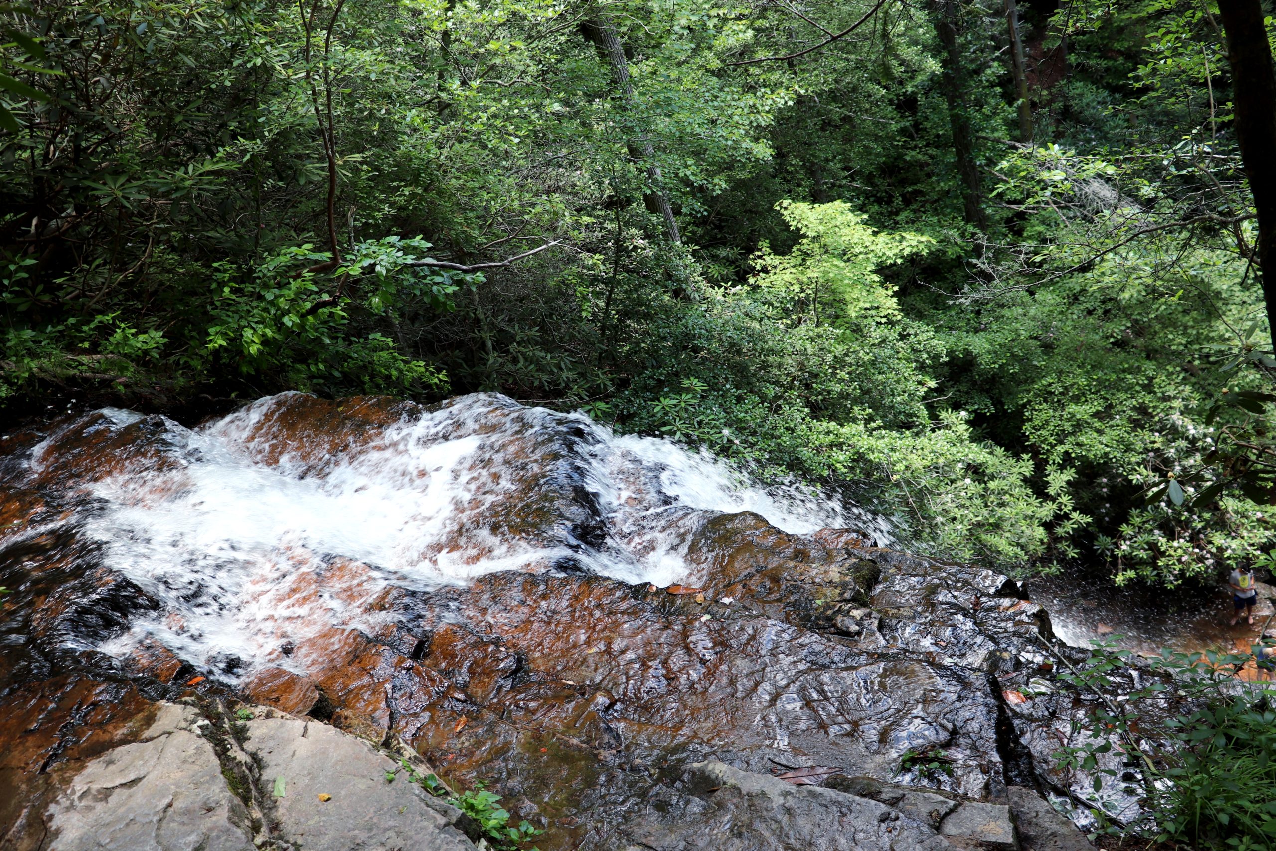
Benton Falls Trail
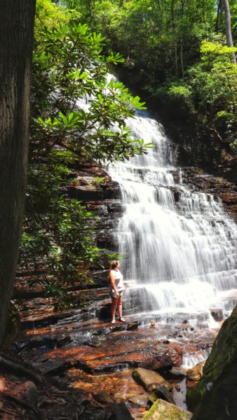
Hiking down to the base of Benton Falls is a short spur down a rock staircase. Benton Falls is a 65 foot tall cascading waterfall that you can walk right up too. The hike down to Benton Falls is just slightly more challenging than the gradual inclines on Rock Rim Trail, just to give you an idea. This hike really is for anyone. The remainder of the hike back to the parking lot on Benton Falls Trail is just over a mile long.
For a better visual of our hike on the map, see the picture below. The quieter loop hike is highlighted in grey. And remember to hike this loop starting with the Benton Falls Trail for a quieter experience overall.
When to Hike the Loop to Benton Falls
Get to the park early. Benton Falls is the main attraction of this park so it gets crowded quickly. Beat the crowds, arrive early, and don’t forget to hike the loop counterclockwise so that you hit the waterfall first. The trailhead for Benton Falls starts at the end of the parking lot where the lake is on the right side of the trail.
You can hike here all year long, but please note that the restrooms are only open during the season (early April through late October). If you plan to take advantage of more in the Chilhowee Recreation Area, please note that the McCamey Lake and campground are also only open in season.
Closing Thoughts
I love hiking around Benton Falls because they are some of the easiest trails in the area. Nearly all the trails on top of the mountain are basically flat which makes it easier to go for miles and miles without being worn out by elevation changes. However, there are still some trails that go down the mountain which I’ve heard are steeper. One day I may attempt these but for now, I will continue to enjoy the easy trails instead.
Be sure to watch the video version of this hike. And if you’re in the area, check out some other great hikes in the Chilhowee Recreation Area below. Have you visited Benton Falls? Let me know your thoughts in the comments. Until next time, enjoy exploring Chatt!

More Hiking in the Chilhowee Recreation Area:
- Shorter Hike to Benton Falls
- Rainbow Falls on the Scenic Spur Trail
- Easy Fall Hiking by Benton Falls
Inspired? Pin this post for later:
Leave a Reply