Little Cedar Mountain Trail is the perfect hiking trail that’s not too far from downtown Chattanooga so you can get away from the crowds.
Finding a hiking spot that’s not overcrowded these days can be challenging. But it’s not impossible. There’s still many unknown hiking trails in the area. And this is one that I consider to be lesser known, even though it’s right next to I24 on Nickajack Lake. Keep reading to see why Little Cedar Mountain Trail is well worth the visit.
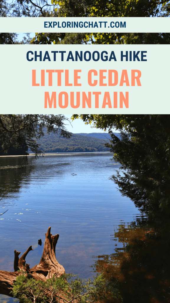
In a hurry? Pin this post for later:
But First, a Little History
Little Cedar Mountain is a small wild area owned by the Tennessee Valley Authority (TVA). Founded by congress in 1933, TVA was created as part of the “New Deal” which President Roosevelt made to help the country get back on its feet from the Great Depression. Tennessee’s rural areas were behind the times in terms of modern day power and the luxuries that come with it. The creation of TVA helped these communities in so many ways. Not only does TVA provide, even to this day, the power needed to enhance daily living in Tennessee and surrounding states, but they also promote good land stewardship. TVA maintains nearly 300,000 acres of land and 11,000 miles of shoreline. With this in mind, TVA is able to focus on generating clean and affordable power while simultaneously taking care of the environment and boosting the local economy with 10,000 jobs.
Little Cedar Mountain Trail
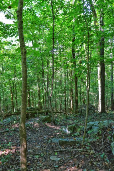
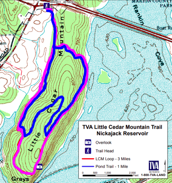
Little Cedar Mountain Trail is a 3 mile loop trail on, you guessed it, Little Cedar Mountain. This small mountain sits alongside Nickajack Lake right off I24. It’s one of the Tennessee Valley Authority’s various small wild areas. These wild areas are designed for low impact exploration of the Tennessee River Gorge. They often include hiking trails and some even have backcountry campsites. Check out the Tennessee Valley Authority’s website to learn more about their small wild areas.
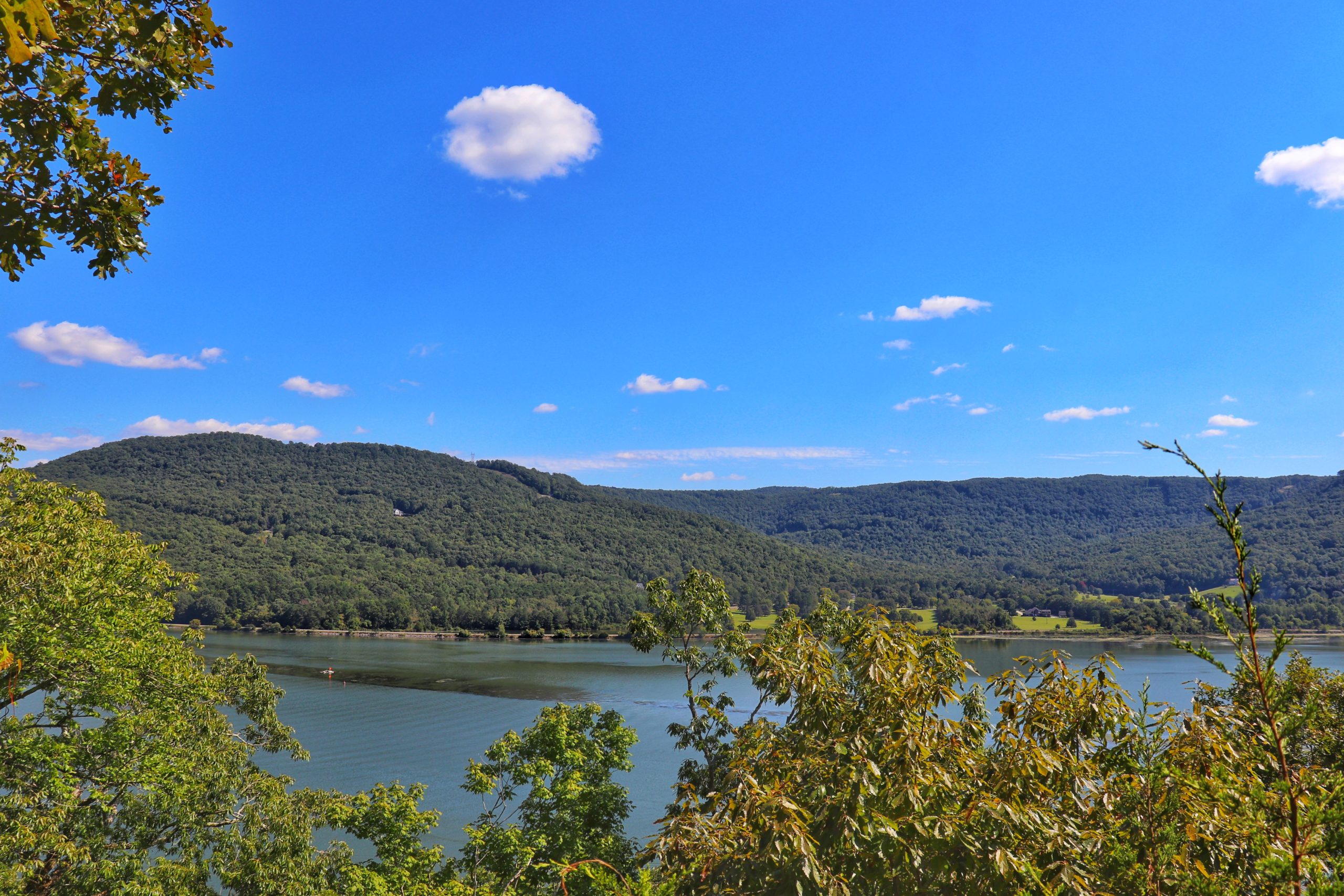
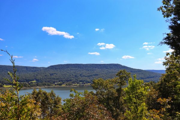
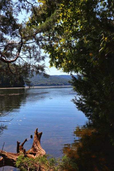
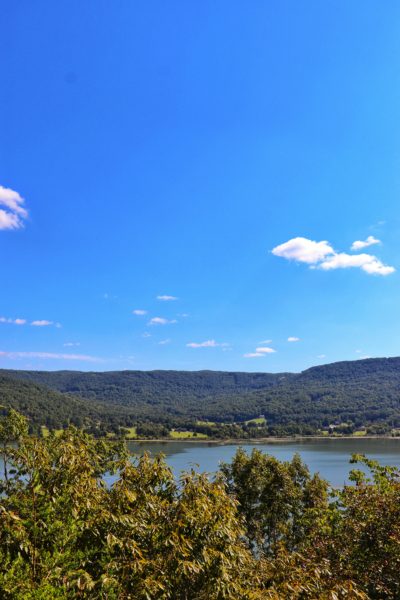
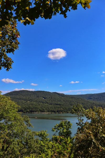
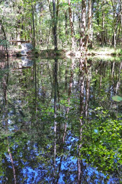
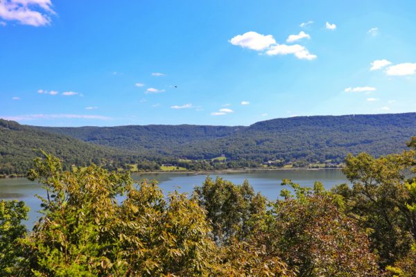
The Little Cedar Mountain Trail will give you water level views of Nickajack Lake as well as higher views from Gray’s Bluff. The trail goes up and down with varying rock steps and earth slopes, but is not overly strenuous compared to most other local hikes. Overall the elevation change for this hike is only 400 feet.
Where to Find Little Cedar Mountain Trail
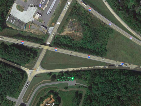
Coming from Chattanooga, getting to Little Cedar Mountain Trail can be a little bit tricky if you are using GPS. You must cross over Nickajack Lake and take the first exit on the other side. This is the exit for State Road 27. Beware, Google will try to send you right back onto I24 to cross Nickajack Lake again. So for your sanity, no, the trailhead is NOT off the side of the on-ramp. It’s actually right past it. So, when the GPS tries to trick you, ignore the part where it says to get on the on-ramp. Instead, drive past the on ramp just a few yards and you’ll see the trailhead entrance to your left. (Reference the sky view photo below for a visual.)
The driveway will end up hugging the on-ramp and at the end you’ll arrive at a rather small parking lot. I was surprised how packed it was on a Saturday afternoon for this being such a little known place. But we were able to get a parking spot just fine and during the hike, we only saw a few people the entire time.
Some people will complain about the interstate traffic noise on this hike. However, I noticed the traffic noise only when we were near the trailhead and by the water. Other than that, I couldn’t even hear it and you’d never guess how close you are to a major highway. For most of the hike all we could hear was nature.
Tips for Hiking Little Cedar Mountain Trail

I’ll start out by suggesting that you take this hike counterclockwise. We actually did this loop trail twice, once in each direction. And I can confirm that counterclockwise is easier. Although, it seems most people go clockwise. The reason counterclockwise is easier is because the elevation changes are less dramatic in this direction. There’s less uphill initially because it starts going up towards the top. Whereas going the other direction goes down to water level before going up to the top. Another reason to go counterclockwise is because there’s a place on the left side of the loop that’s easy to mistake for the trail when it’s really not part of the trail. But if you’re going counterclockwise, this offshoot will be forked behind you so you can’t be confused by it at all.
Our Little Cedar Mountain Trail Hike
Within the outer loop is half of a smaller loop on the back half of the trail. This half loop trail is the 1 mile Pond Trail. You can utilize the use of this trail in your 3 mile hike, but doing so will keep you from seeing one section of the trail, unless you back track. Or, do what we did and do the entire trail twice.
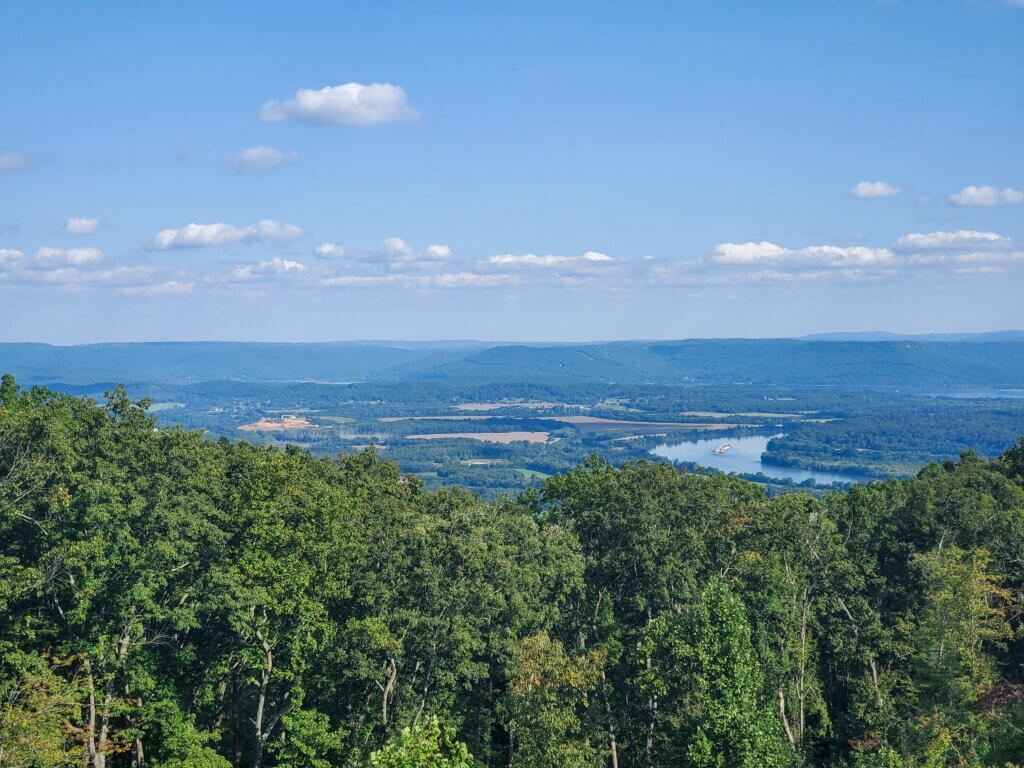
We took the loop trail clockwise, then took the Pond Trail which cut us over to the second half of the outer loop, and we took the outer loop back to the trailhead. Upon completion, we noticed that we completely missed Gray’s Bluff at the furthest point of the outer loop. (See first two photos below of the veiws from Gray’s Bluff.)
So, we decided to do the hike again in its entirety of the outer loop only. But to change things up, we did it counterclockwise. Below is a photo of the routes we took. Blue is the first, clockwise route and pink is the second, counterclockwise route. Be sure to have the trail map with you so you don’t get confused on your hike.
More to Explore Near Nickajack Lake
After our hike, we enjoyed a wonderful dinner with a fantastic view at Top of the Rock Restaurant and Brewery. It’s located in a nice neighborhood, but don’t worry, you can still go in with your hiking attire and be seated for a wonderful dinner. Opt to sit outside and you’ll see the amazing, mountain-top view from the patio. And I can say from experience, both their food and their beer is top notch and a great way to end the day after a nice hike.
You can also camp at Marion County Park or Shellmound Campground. I have yet to try either of these campgrounds but they look wonderful as they both sit on the edge of Nickajack Lake. Both campgrounds seem like the perfect place to camp for a little hiking and paddling getaway on Nickajack Lake.
And if you’re looking for more hiking near the area after a scenic drive, consider checking out Denny Cove Falls, Foster Falls, and Sycamore Falls at the Grundy Day Loop Trail.
Closing Thoughts
The Little Cedar Mountain Trail is well-balanced for a challenging, yet not too challenging hike. Being right next to I24 makes it rather convenient after the scenic drive from Chattanooga. The views of Nickajack Lake and the fact that it’s a little off the beaten path make it an excellent hike to add to your list.
I recommend going in fall or winter so there’s less overgrowth, but more importantly, so you can have a better view from Gray’s Bluff since there’s a few trees in the way. But this hike will also be beautiful in the early spring when the leaves are starting to turn green again.
Here is the exact location of the Little Cedar Mountain Trail. And be sure to watch the video version of my experience of this hike.
What’s your favorite off-the-beaten-path hiking trail? Let me know in the comments below. I’m having trouble picking just one! But this hike is definitely being added to my list. Until next week, enjoy exploring Chatt!

Waterfall Hikes Near This Area:
Inspired? Pin this post for later:

Leave a Reply