Sycamore Falls and the Grundy Day Loop combine to make the best Tennessee summer hike complete with waterfalls, swimming holes, and a cave.
This hike has it all! Everything you need to stay cool this hot, Tennessee summer and more can be found on this hike. Every turn brings new beauty and there’s always a swimming hole or creek nearby. Continue reading to learn more about Sycamore Falls, the Grundy Day Loop, and everything in between.
Grundy Forest State Natural Area
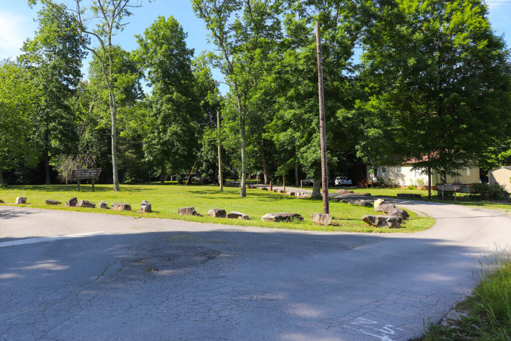
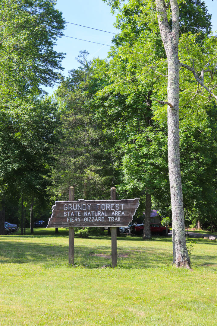
The best Tennessee summer hike begins at the Grundy Forest State Natural Area which is part of the South Cumberland State Park. Located in Tracy City, TN, this 234-acre area contains the Grundy Day Loop hiking trail and the end of the Fiery Gizzard hiking trail.
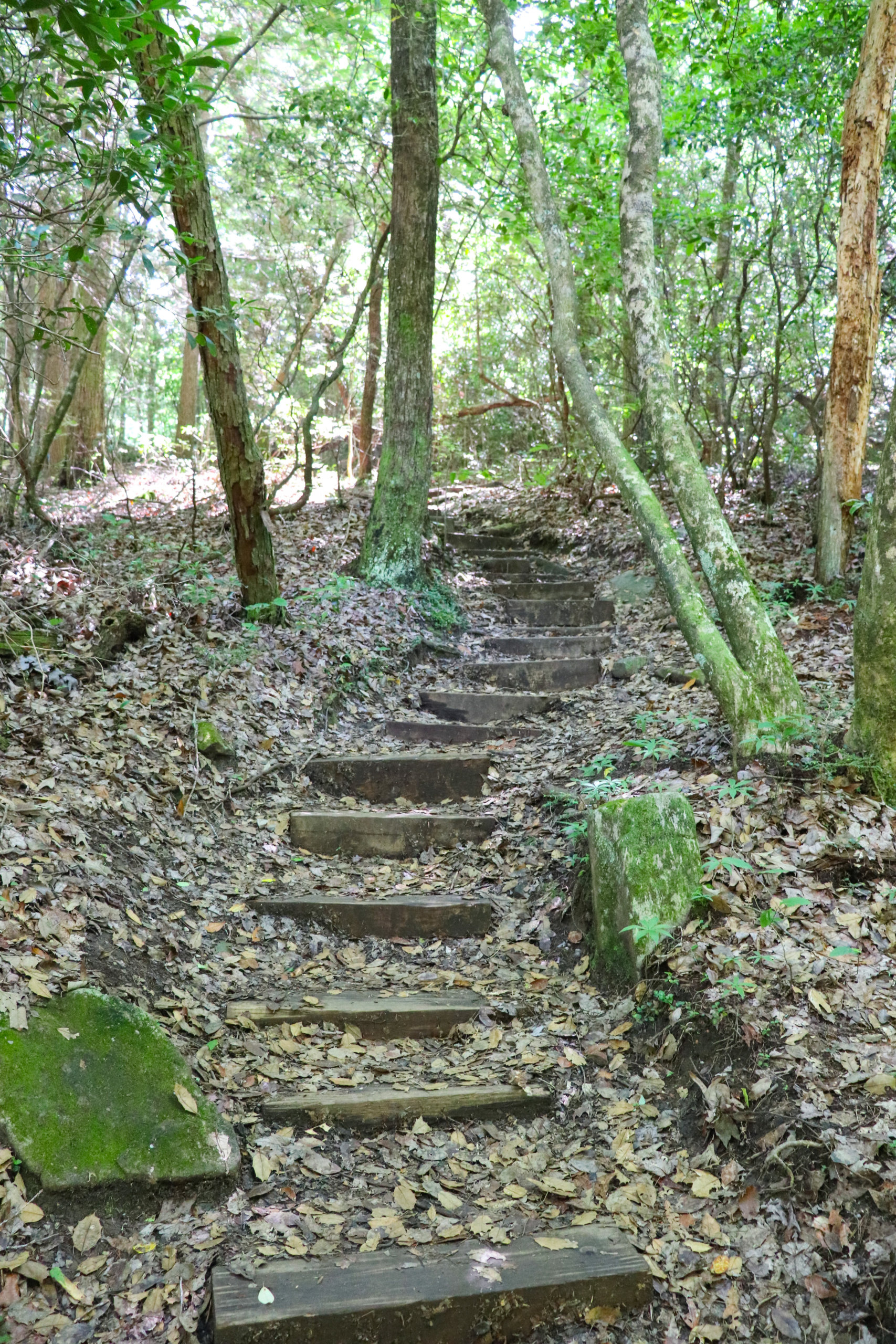
Grundy Day Loop
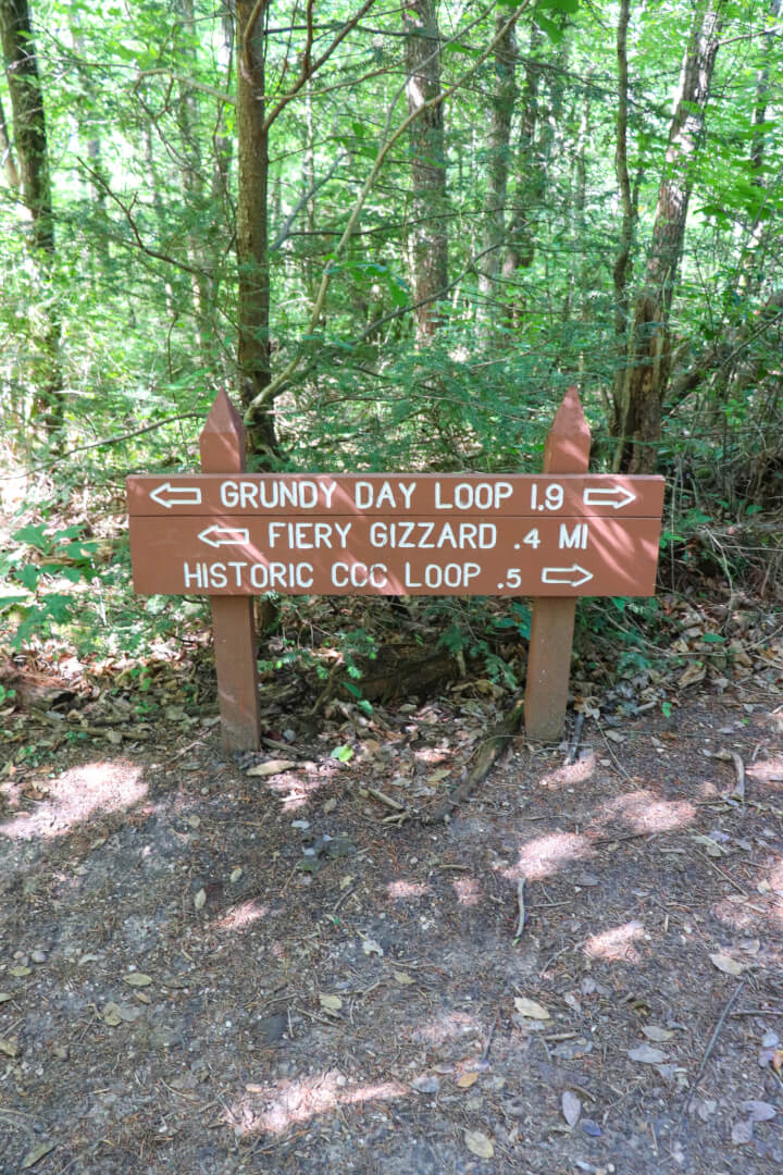
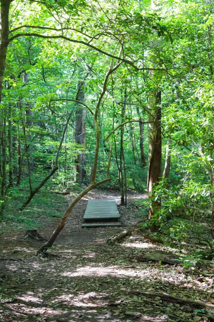
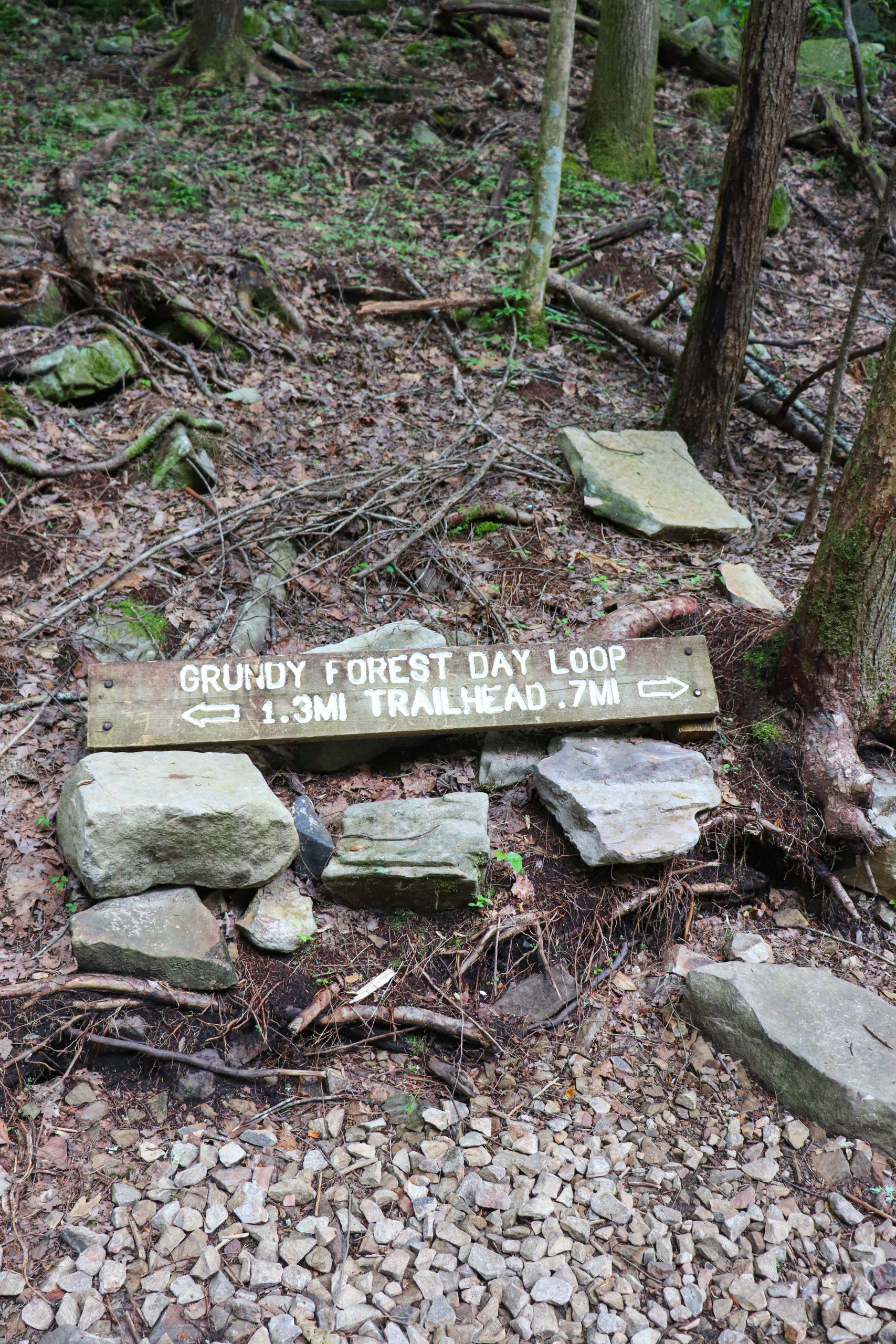
The Grundy Day Loop is roughly 2 miles in length. From the trailhead you’re quickly met with the decision to start to the right or the left. If you start to the right, like I did, you’ll quickly arrive at Schoolhouse Branch where there’s information about an old moonshine still that used to be there. Continue down the trail and always veer to the left to complete the loop. There are campground trails that jut off to the right side of the trail.
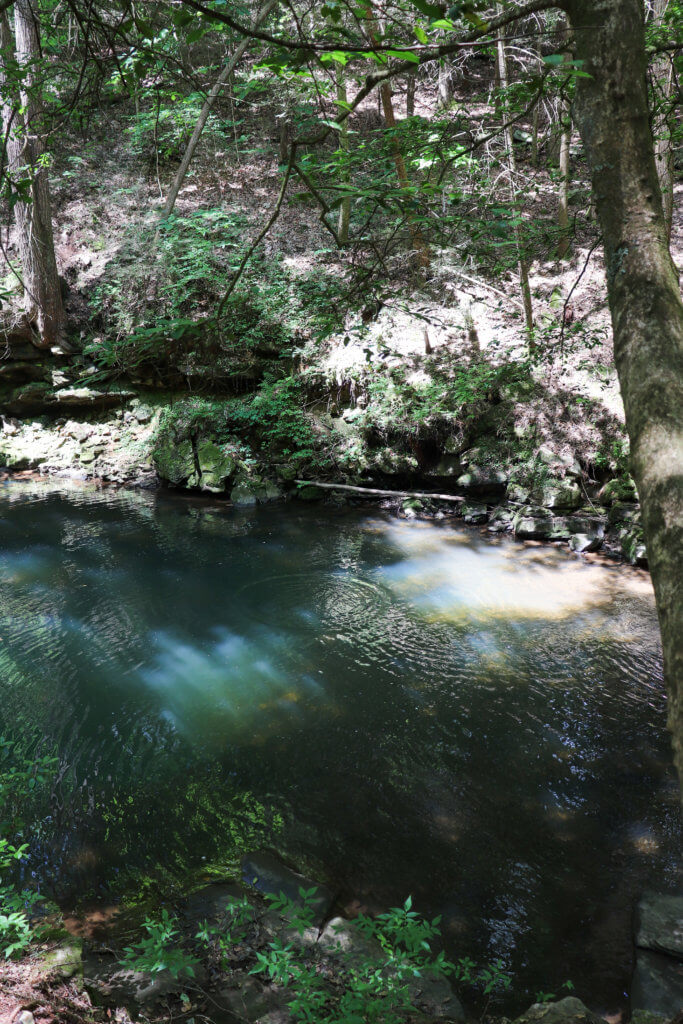
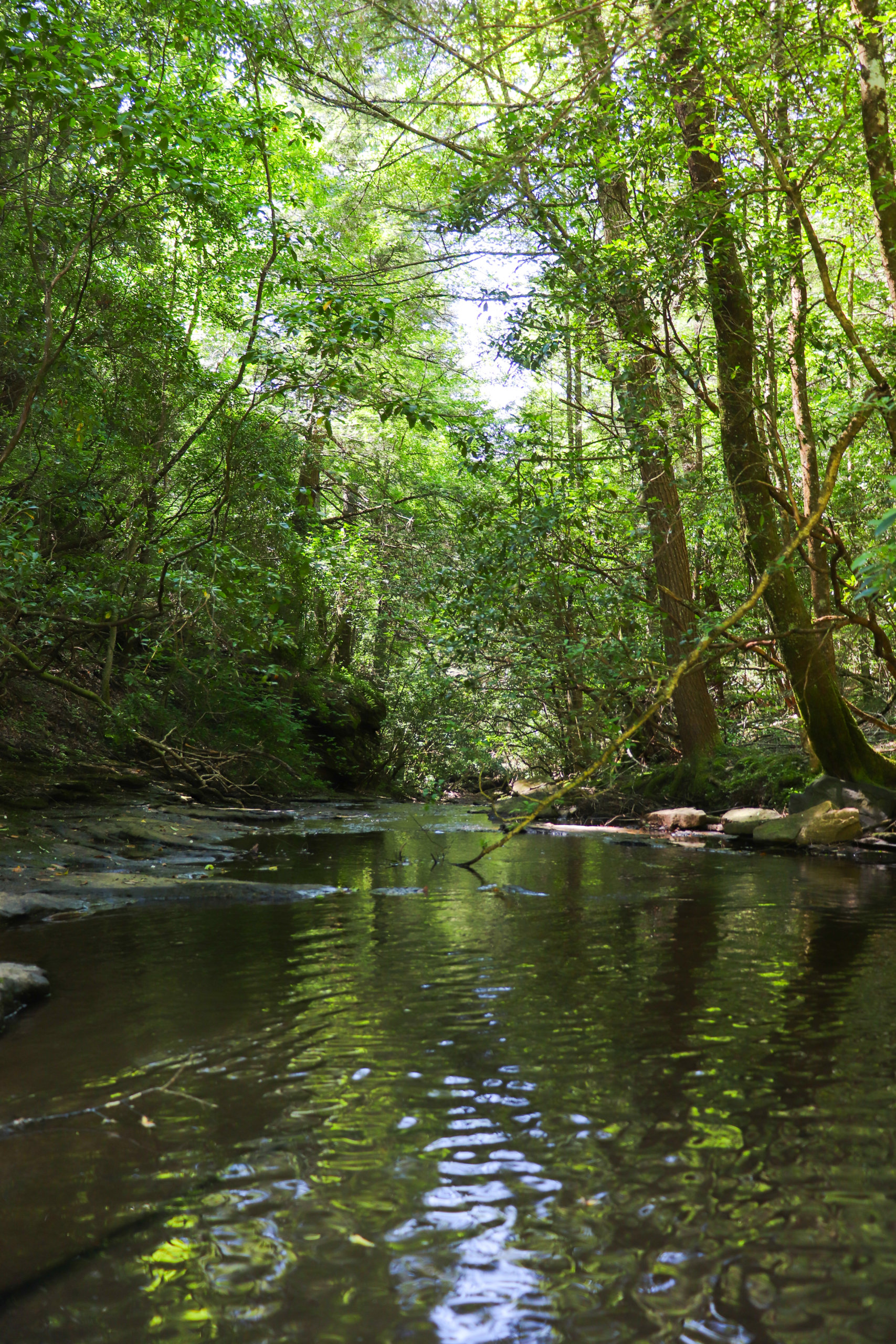
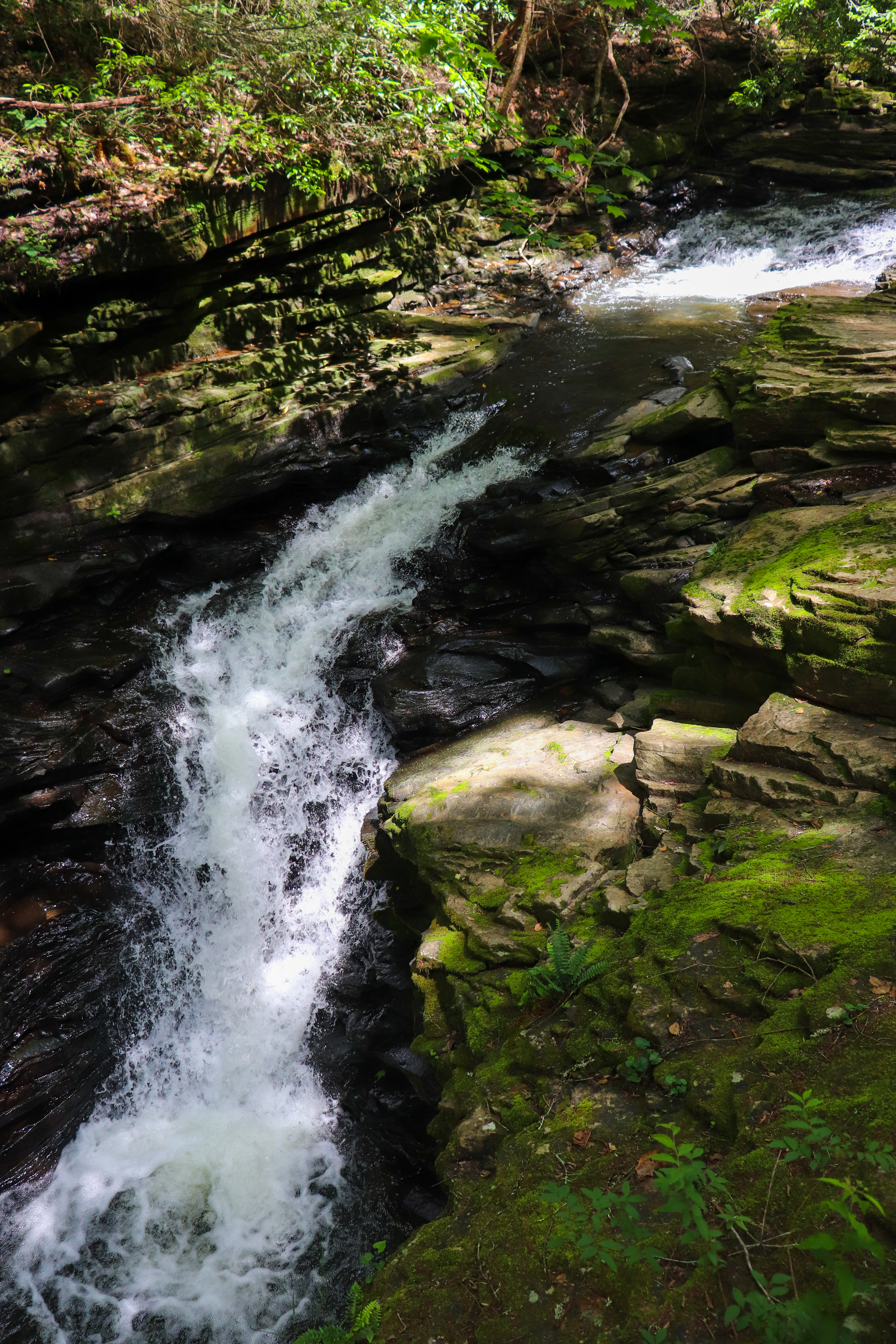
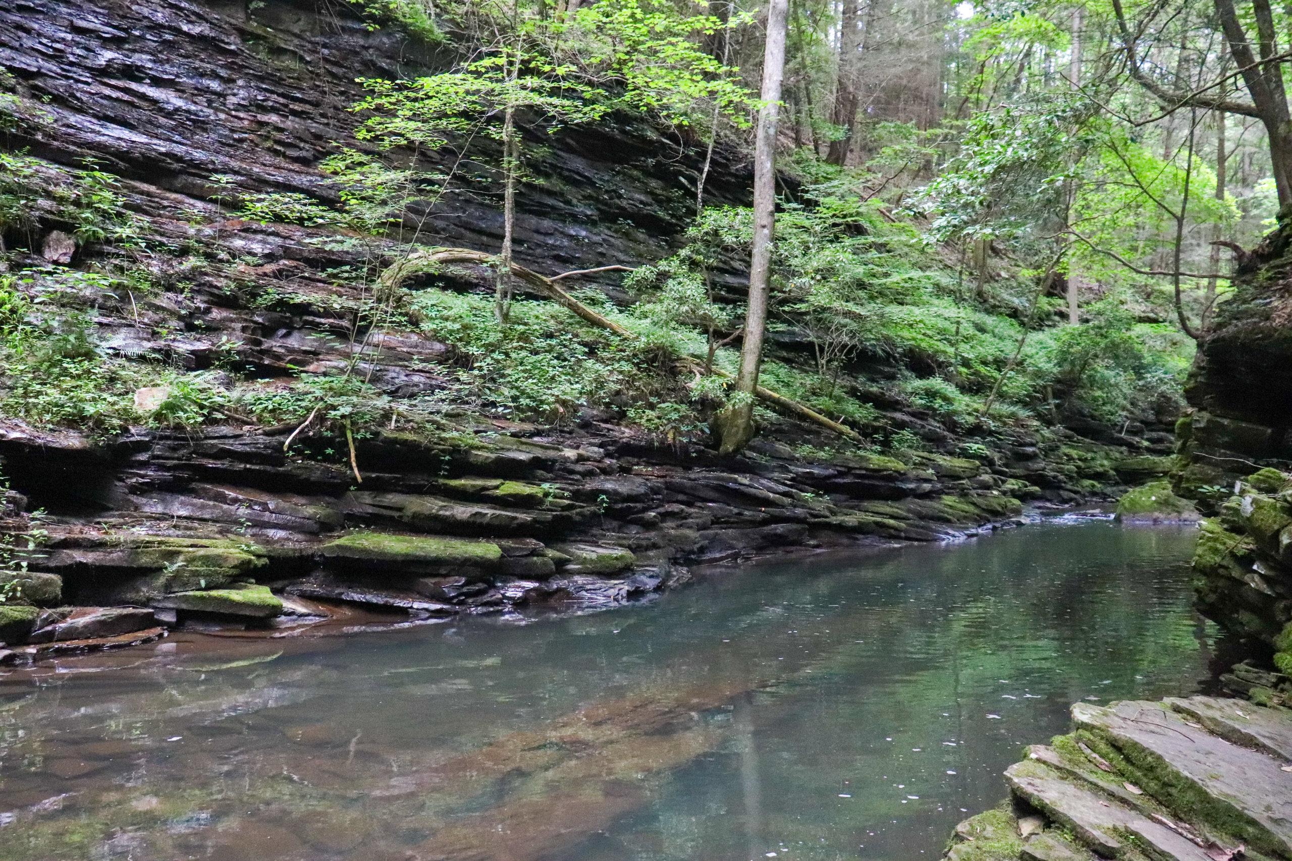
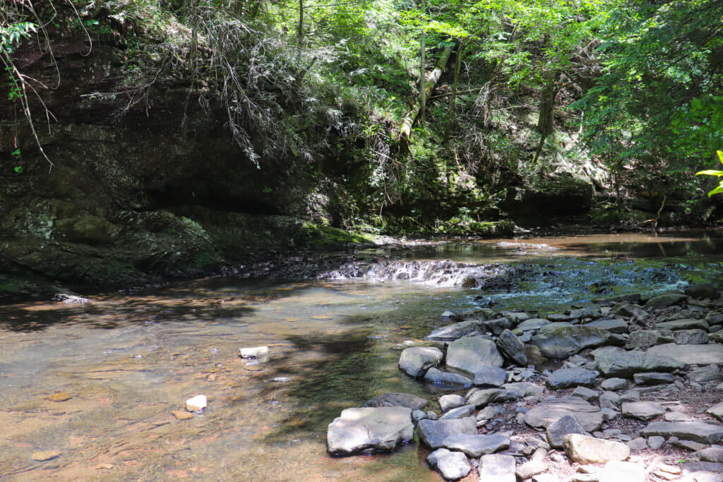
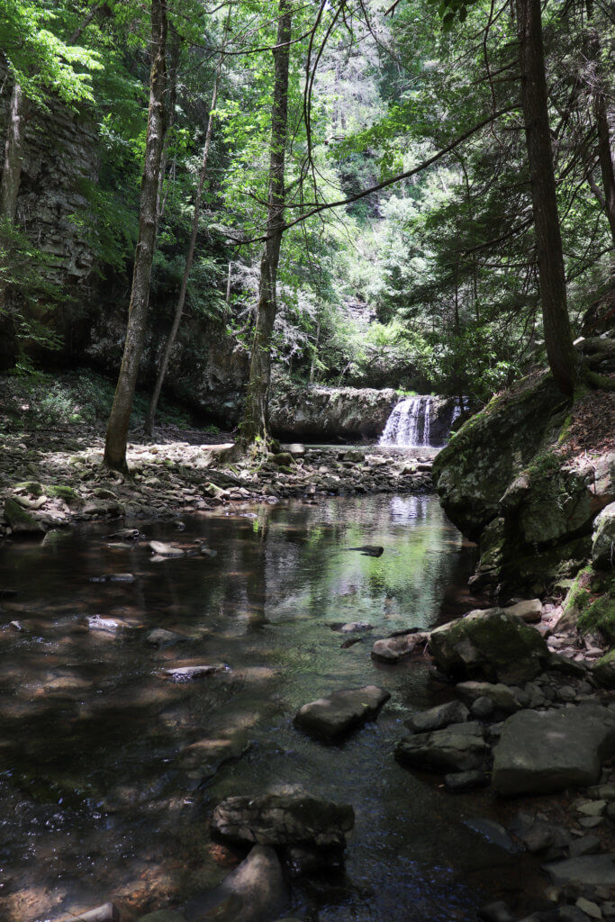
Eventually you’ll descend to Big Fiery Gizzard Creek where there’s places to wade in the shallows or swim in the deep, blue holes. The trail continues to follow the creek and passes Hane’s Hole Waterfall via a bridge view. Soon after this you’ll reach the start of the Fiery Gizzard Trail. From here you can finish the Grundy Day Loop or venture down the Fiery Gizzard Trail to see more Tennessee beauty and Sycamore Falls.
Fiery Gizzard Trail
The Fiery Gizzard Trail is about 12 miles in length. It starts at the Foster Falls Trailhead and ends here at the Grundy Day Loop. Along the way are many waterfalls, campsites, and even an overlook. I have yet to hike any of this trail except for the short hike to Sycamore Falls. One day I hope to go from point to point on this popular trail.
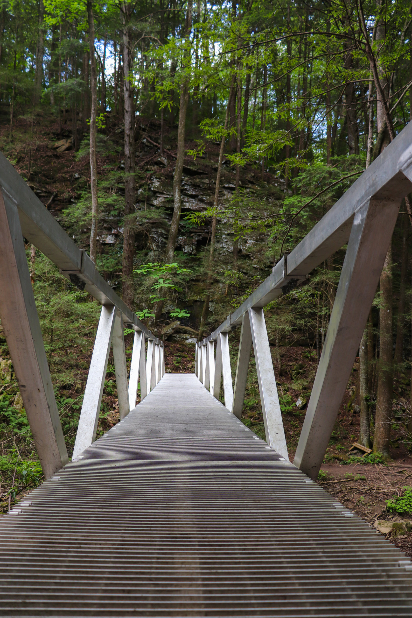
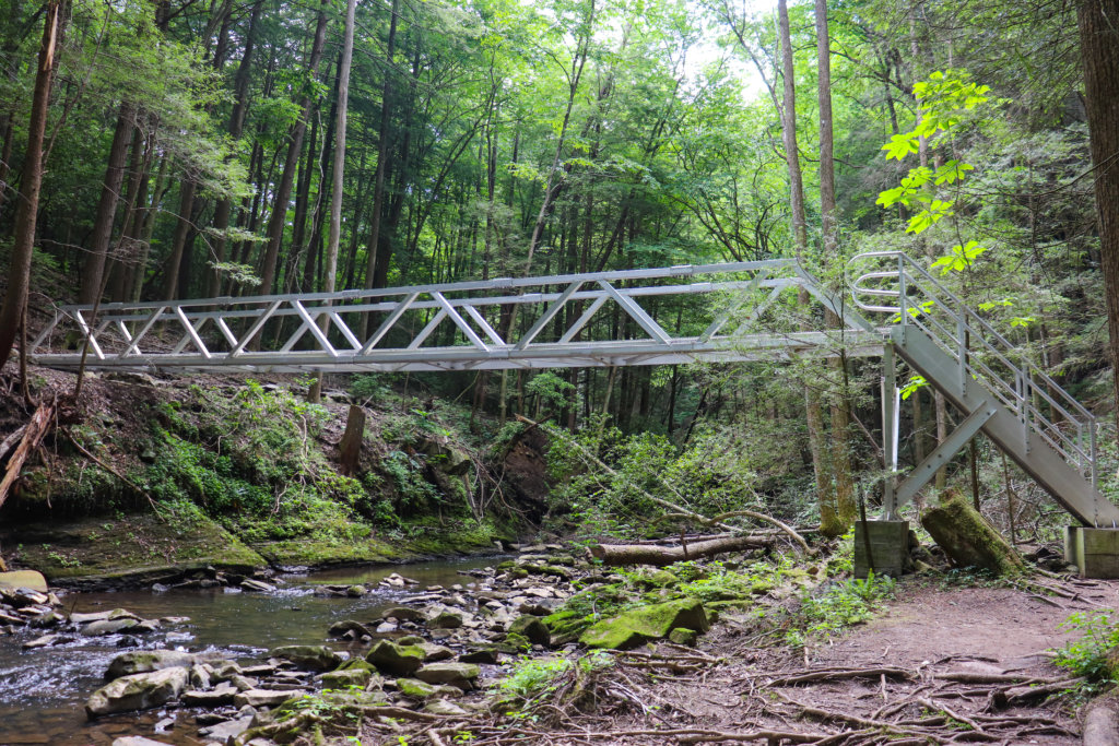
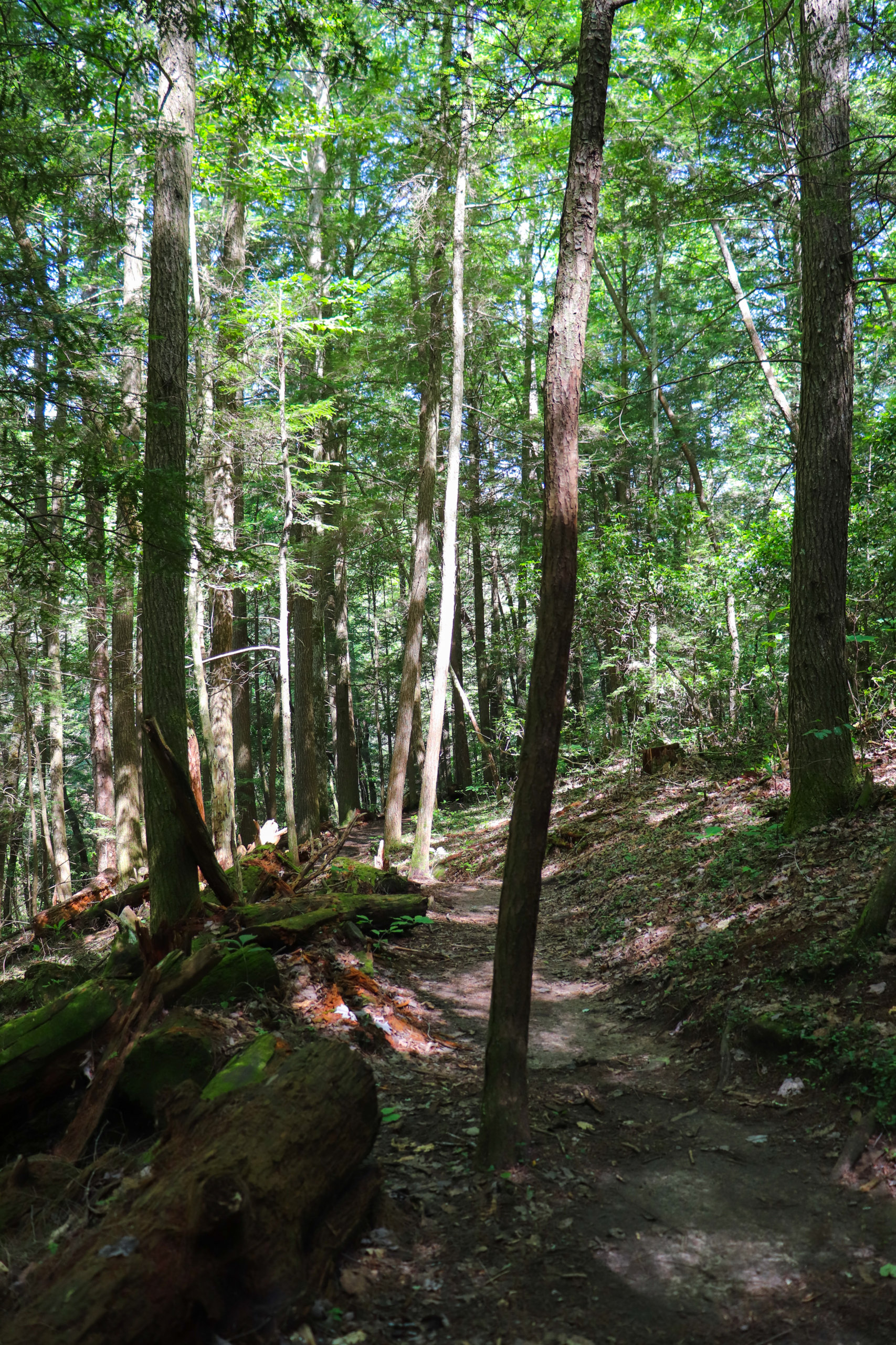
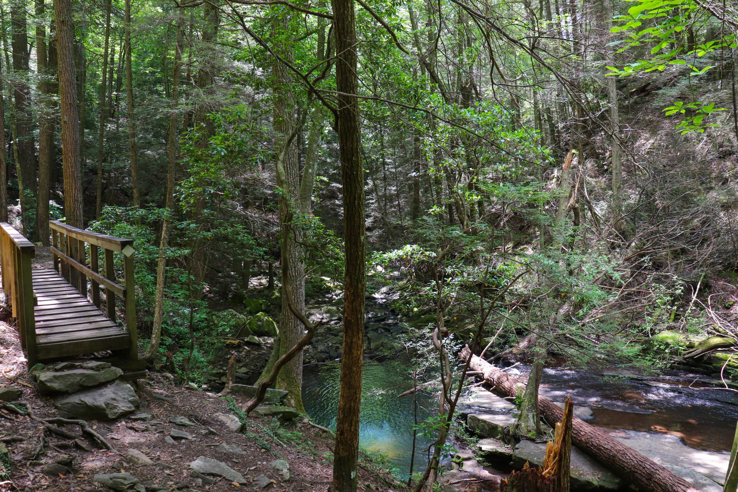
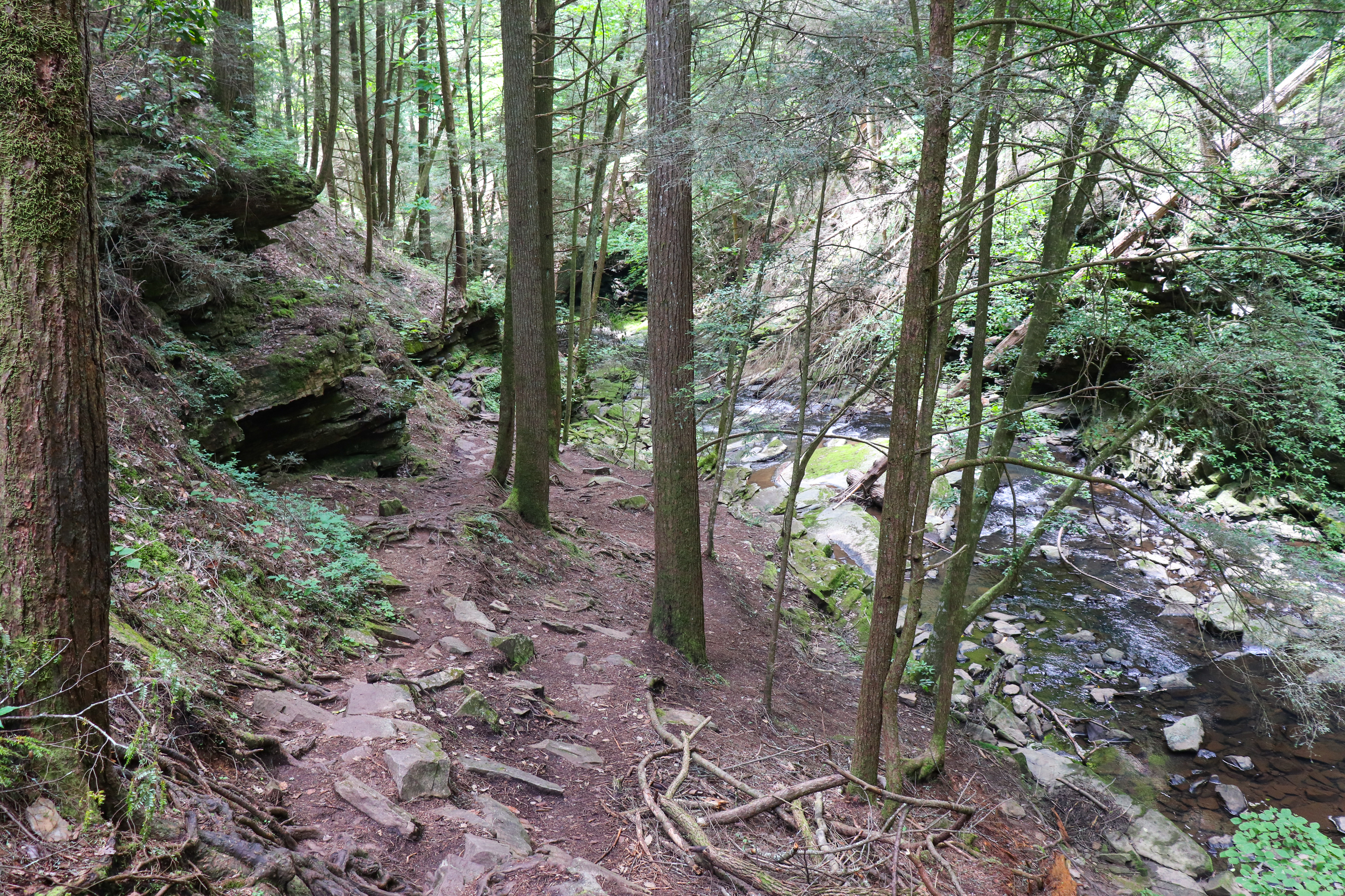
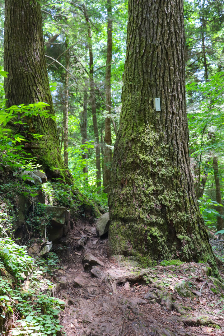
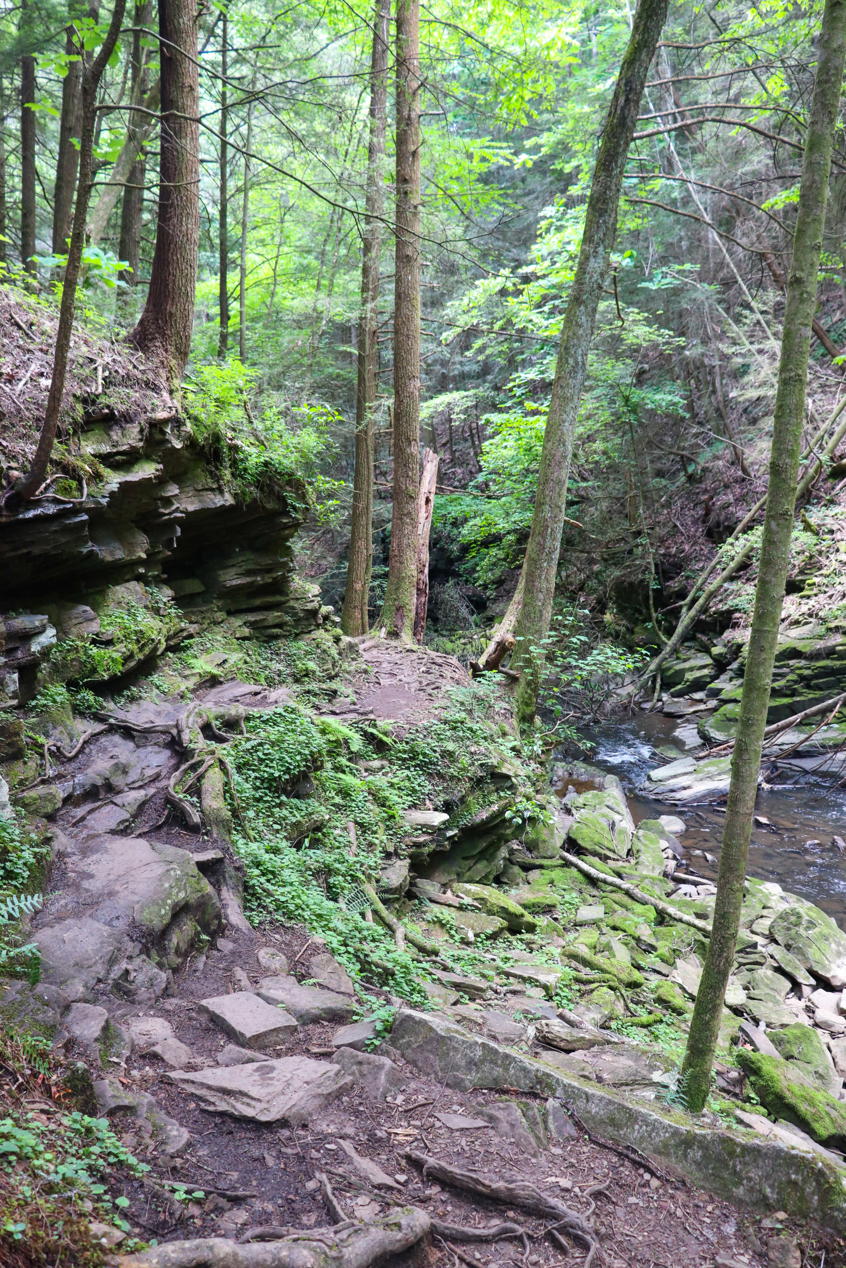
Here the trail starts by crossing a metal bridge with a steep staircase down the other side. After this there’s more places to swim, admire the creek, and take in the waterfalls. The trail can get narrow and has many ups and downs but it’s never very steep. There are a few places where it’s beginning to wash out as trees have fallen making the ground unstable. And there’s a couple rock fields to cross over but they’re not difficult.
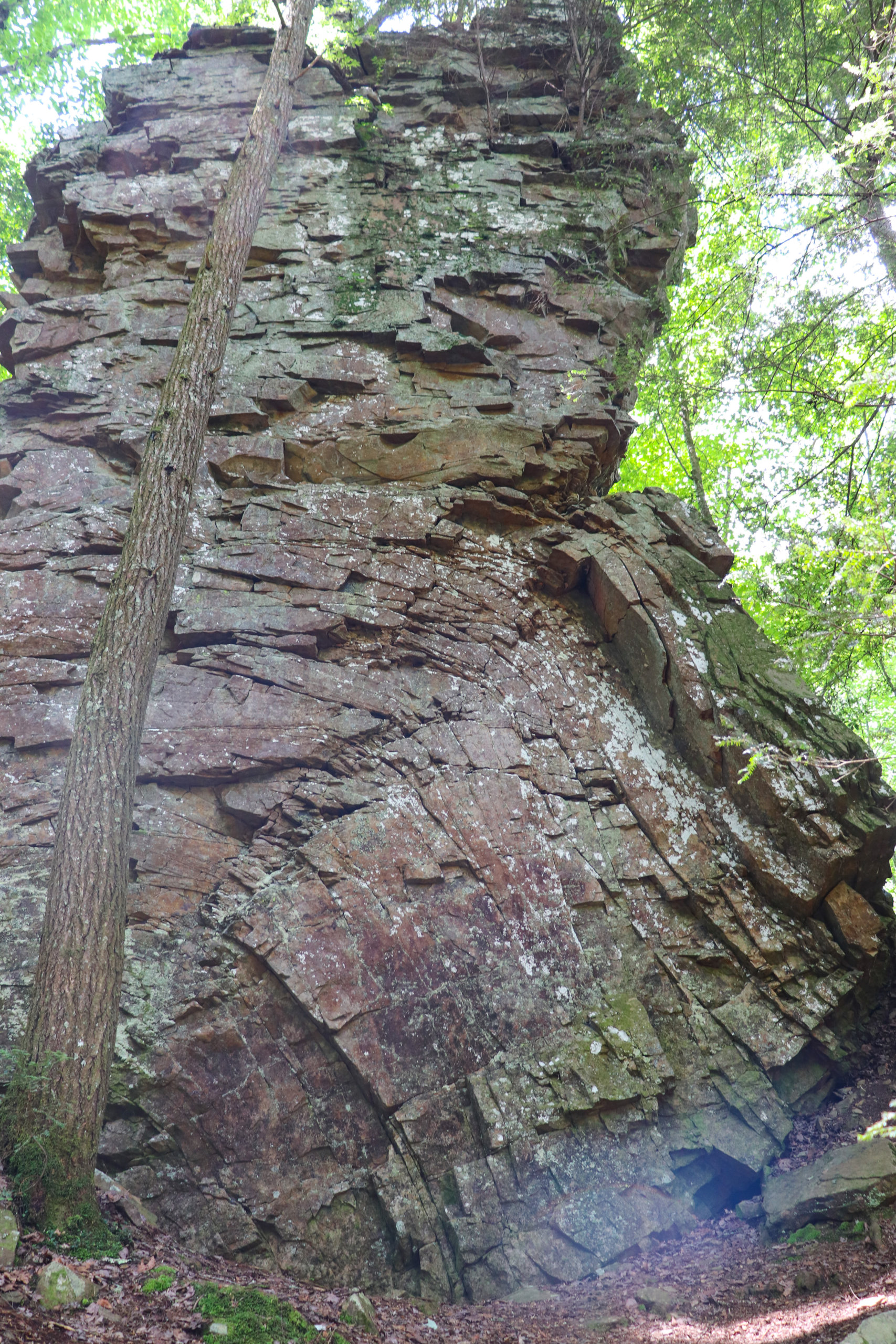
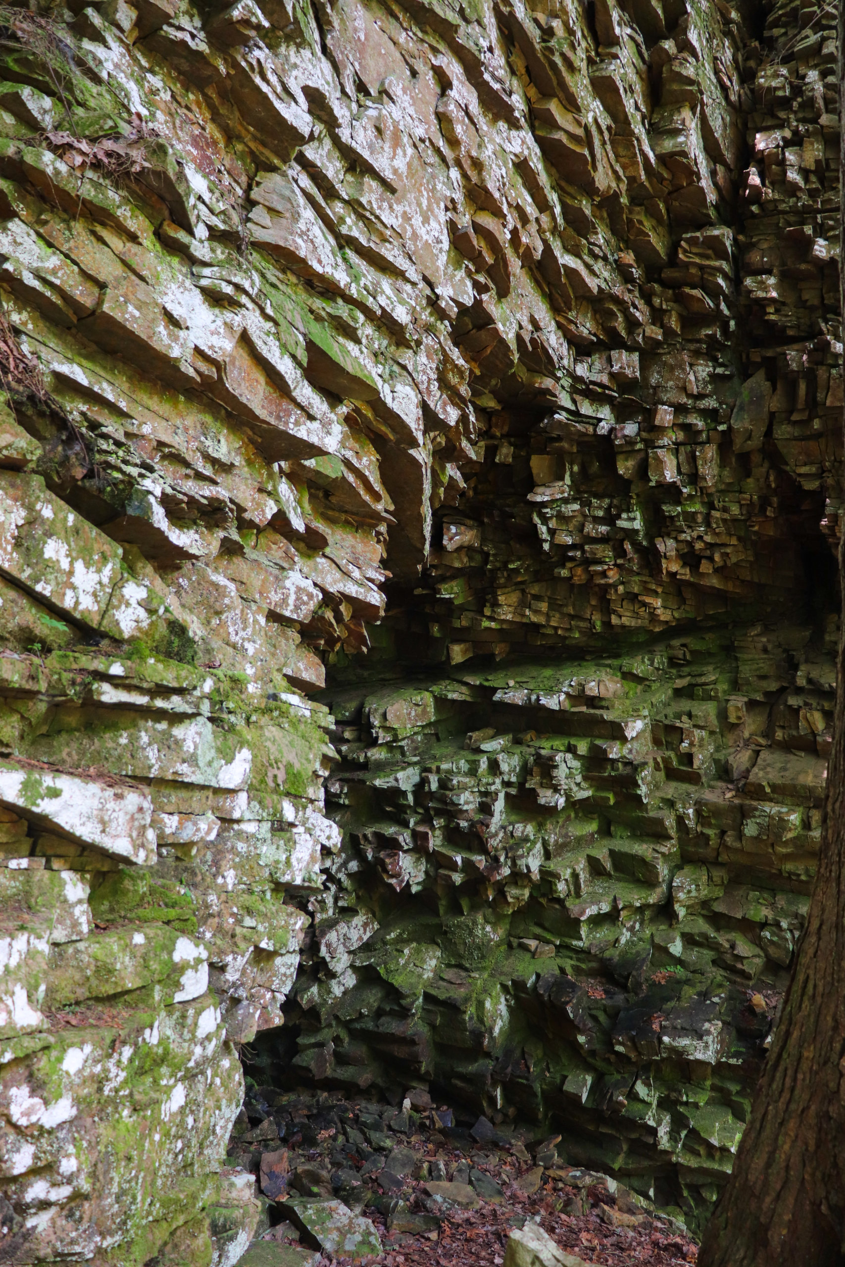
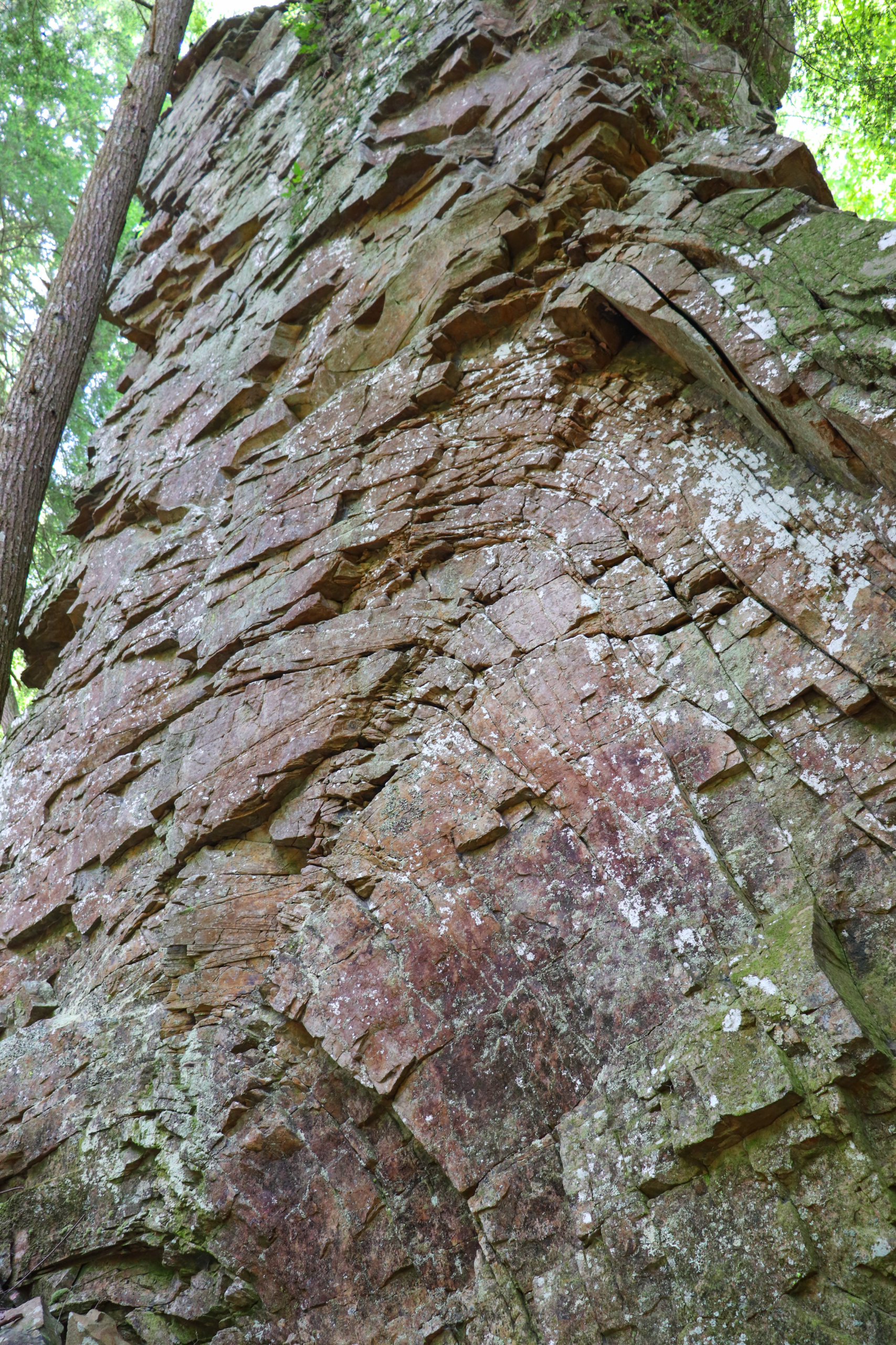
The Chimneys
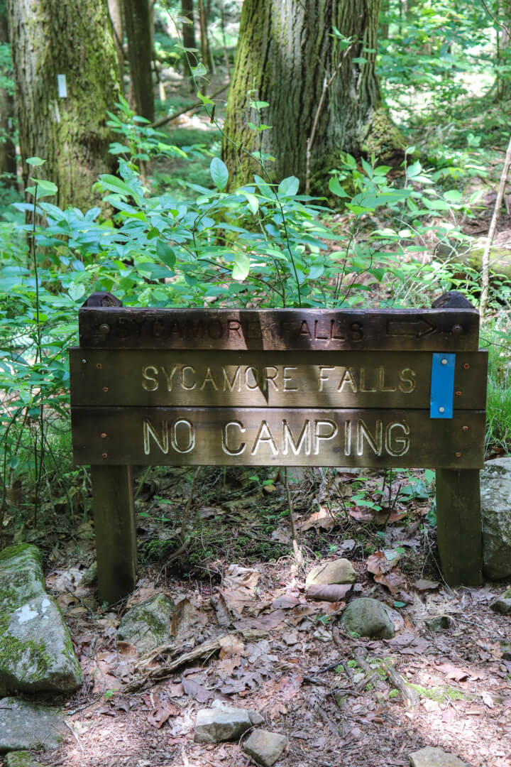
After hiking for a little while, you’ll see information for The Chimneys. This unique rock formation appears to have fallen and frozen in time. You can’t see it very well from the sign, but there’s a rough trail you can take to get a closer look. From there you’ll also see the unique rock cove that’s next to it. Not too much further down the Fiery Gizzard Trail now and you’ll arrive at the sign for Sycamore Falls.
Sycamore Falls
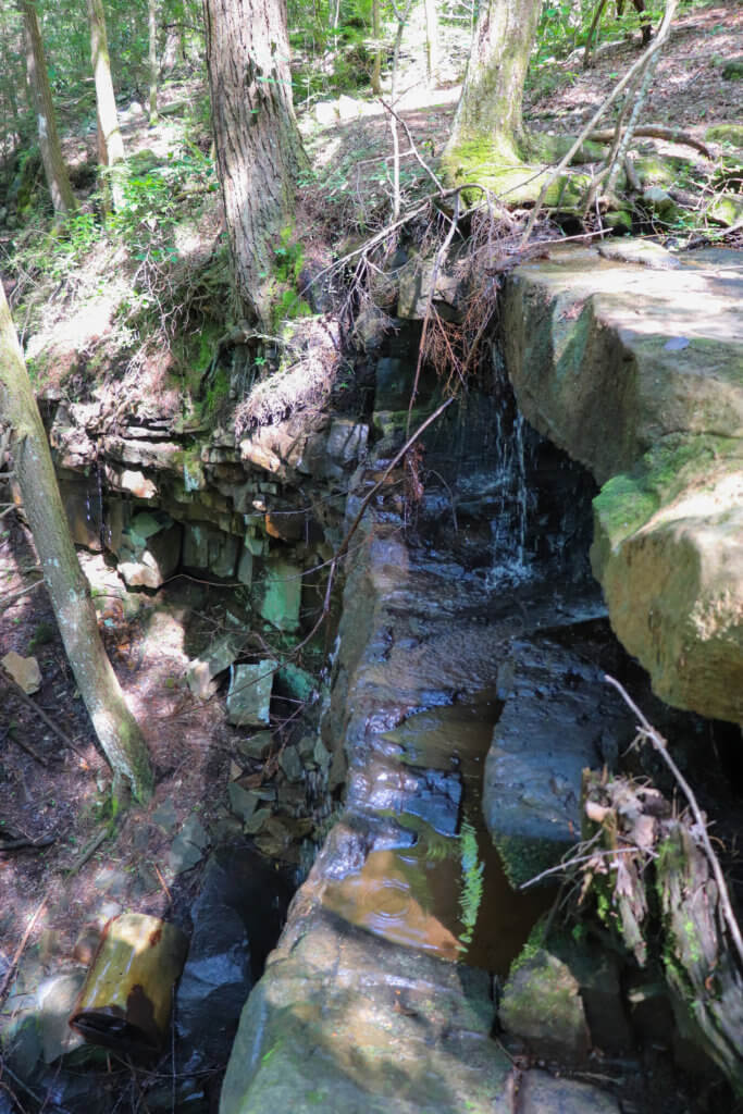
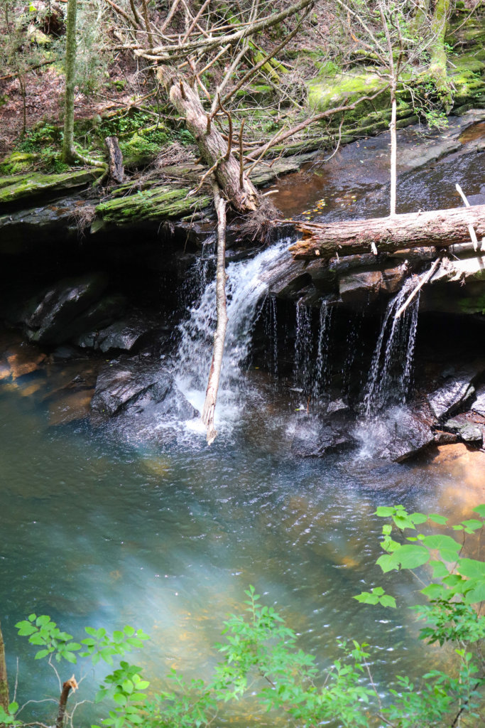
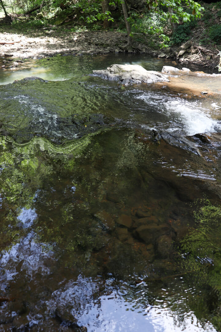
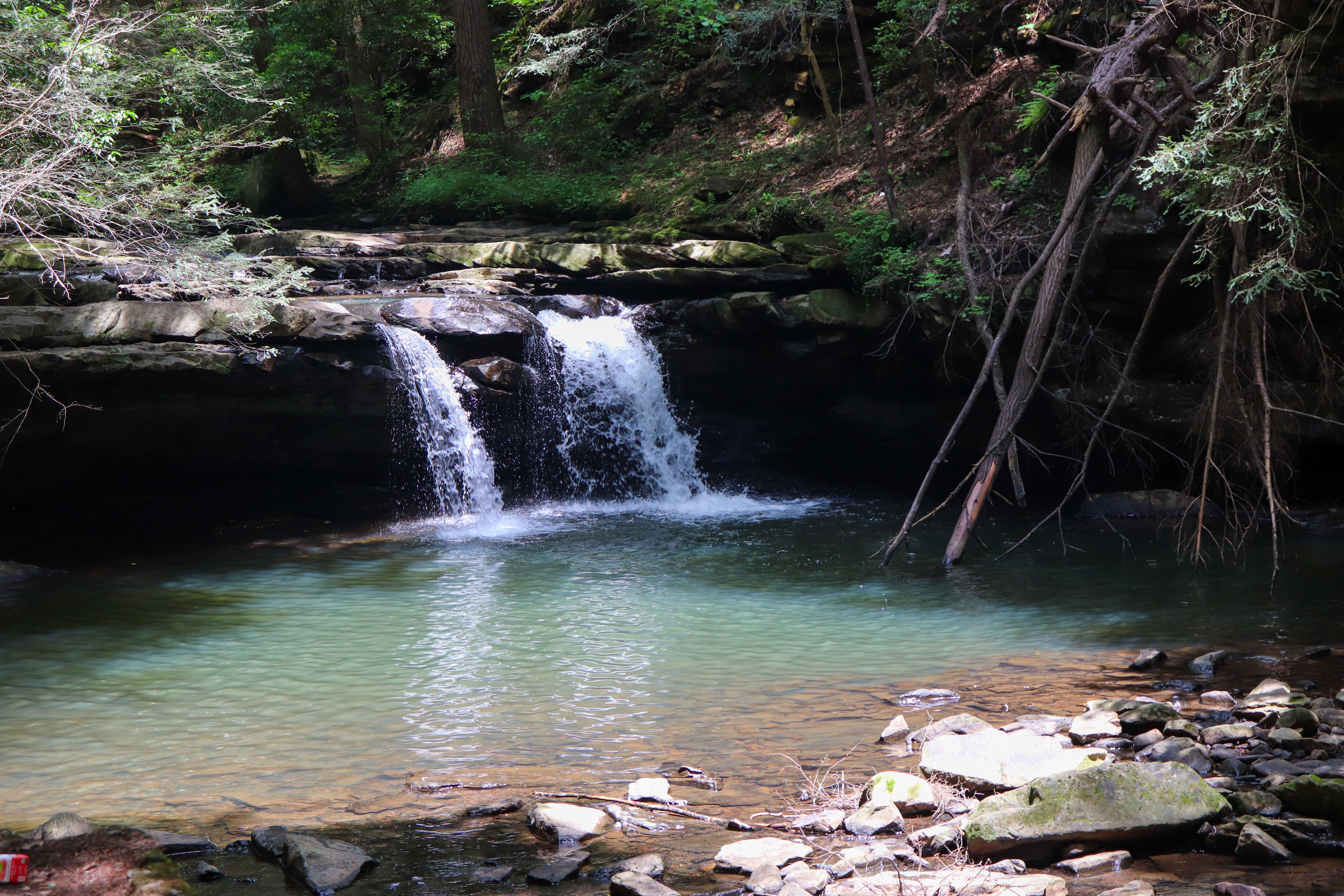
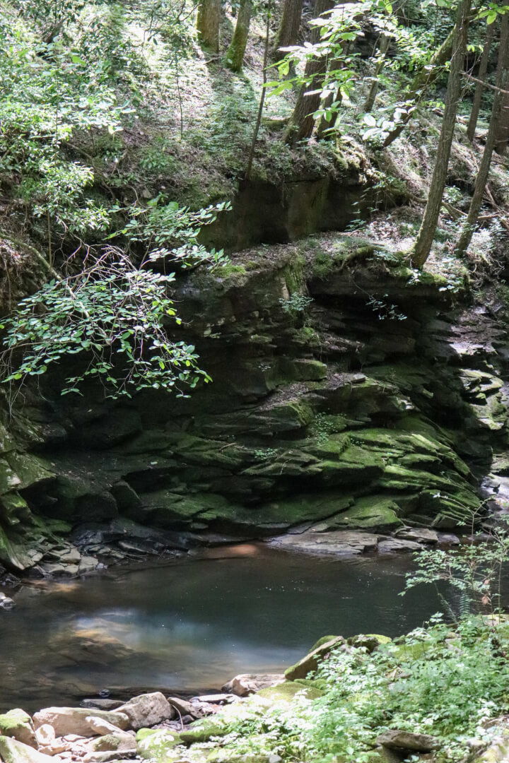
Sycamore Falls is a 12-foot-tall waterfall tucked away in this Tennessee wilderness. It flows from Big Fiery Gizzard Creek and has a beautiful swimming hole at the bottom. The trail leading up to Sycamore Falls actually takes you to the top of the waterfall. Here you can wade in the creek above and enjoy the serenity. Listen to the water flowing and watch small fish try to swim upstream.
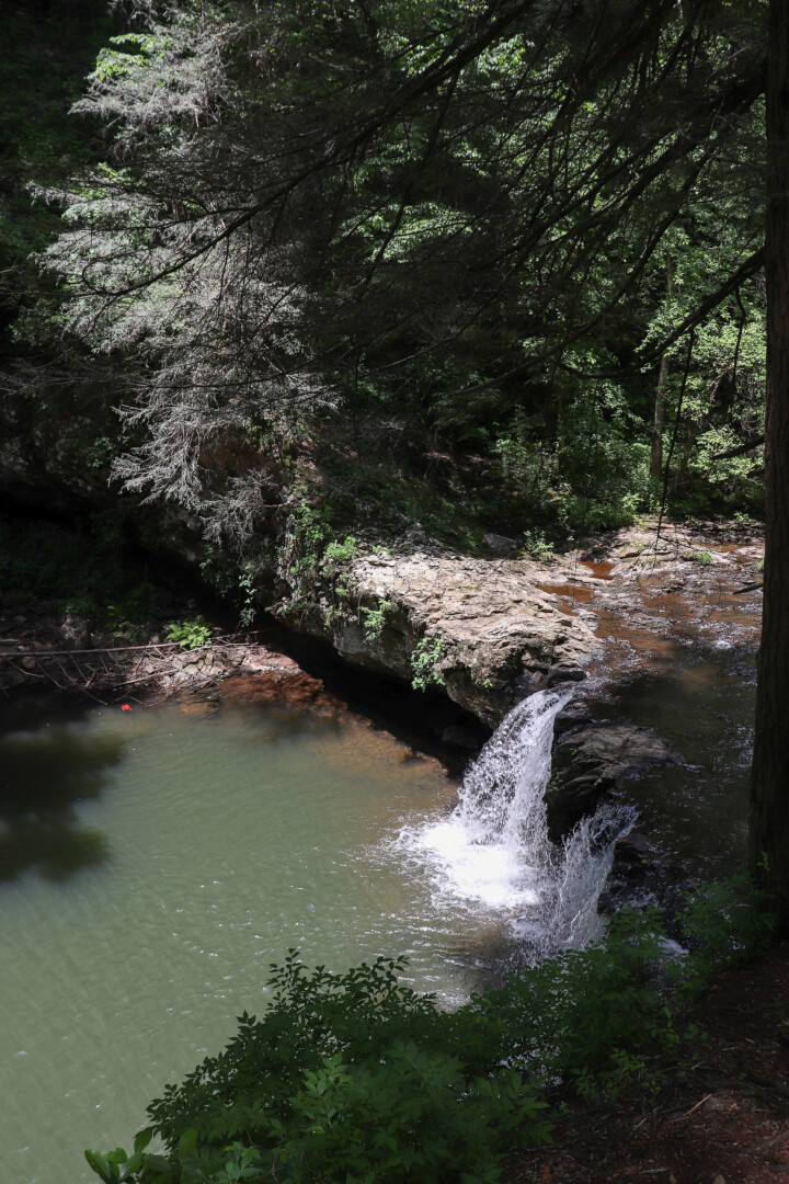
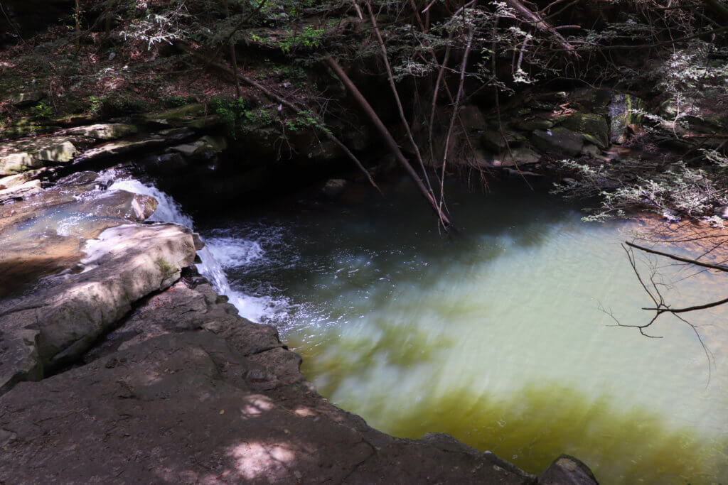
You can also get to the base of Sycamore Falls, but I’m not sure yet what is the best way to do this. Starting from the sign for the waterfall, go left instead of right and continue down the Fiery Gizzard Trail a short distance. Soon you will see another trail to the right that heads towards the waterfall while the main trail continues left. In order to get to the waterfall and swimming hole below, you have to cross the creek. It’s shallow but the rocks are covered in silt making it extremely slippery and dangerous. I was unfortunately unable to make it across. However, I was able to experience the beauty of this spot from a distance, as you can see by the photo below.
The Other Half of the Grundy Day Loop
Coming back over the metal bridge you’re met with the sign that says to go left for the 1.3 mile hike back to the trailhead or right for the .7 mile hike back. Since I came from that left side I went right, and wow, there’s a lot packed into that small section. I also noticed that the mileage on the signs here are inconsistent so my mileage totals for this are just estimates.
Blue Hole Falls with another swimming hole is about halfway through this hiking section. Little Fiery Gizzard Creek continues to display beauty in waterfalls and even a spot that looks like a rock waterslide (watch the video to see that part).
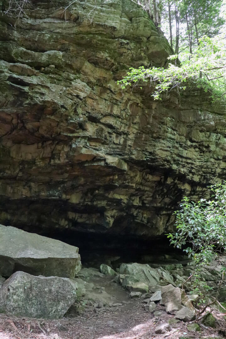
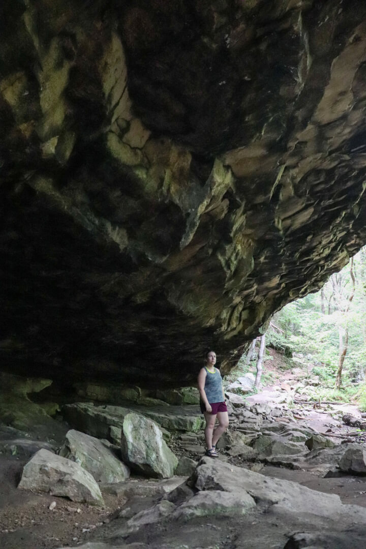
And the most shocking thing is this cave. I don’t know how far back it goes, but there are many, small crevices that are very dark. The trail even has stepping-stones amongst the rocks to take you under the overhang to the other side. This place is massive.
Tips for Your Hike
As with most popular trailheads, this one being no exception, you must arrive early. I arrived at 9AM local time and was barely able to get a parking space on a good-weather Saturday. But, one advantage that I love about the trails in this area is that most of them have nice restrooms, this one included.
Roundtrip my hike was just over 3 miles long. If you’re short on time or don’t want the distance, I suggest taking the left side loop out to Sycamore Falls and back. It’s also the more scenic side of the loop although both sides are well worth experiencing. And if you really just want a swimming hole without much hiking, I suggest taking the left side of the loop and enjoying the Blue Hole Falls. This hike will only be about half a mile in and half a mile back.
In Closing
Sycamore Falls and the Grundy Day Loop are stunning every moment of the hike. And it’s the perfect place for staying cool this summer with countless swimming holes and a creek always flowing beside you. Here is the location of the trailhead so you can start planning for your visit. For more visuals and tips from this hike, be sure to watch the video. And let me know in the comments below, have you visited this Tennessee summer oasis? Until next time, enjoy exploring Chatt!