Enjoy Chattanooga fall colors on foot by hiking some of Chattanooga’s best hiking trails for fall foliage this season.
With the fall season upon us, it’s time to get a plan together so that you can enjoy the best fall colors of the season with these Chattanooga area fall hikes. These are the top five fall hikes I recommend in the Chattanooga area and typically frequent every year for the leaves. Continue reading to learn more about planning Chattanooga fall hikes with peak leaves and the best hiking trails.
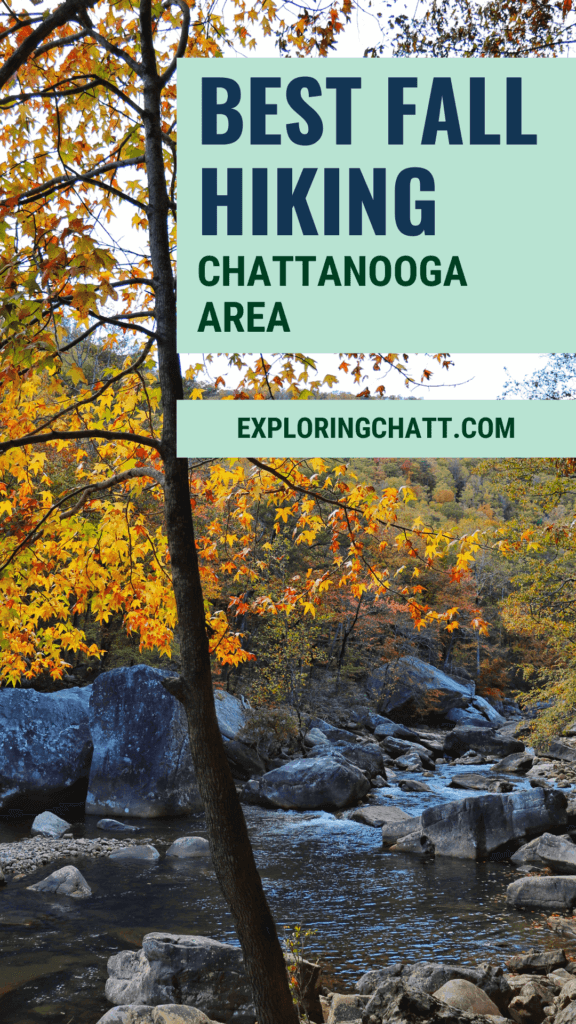
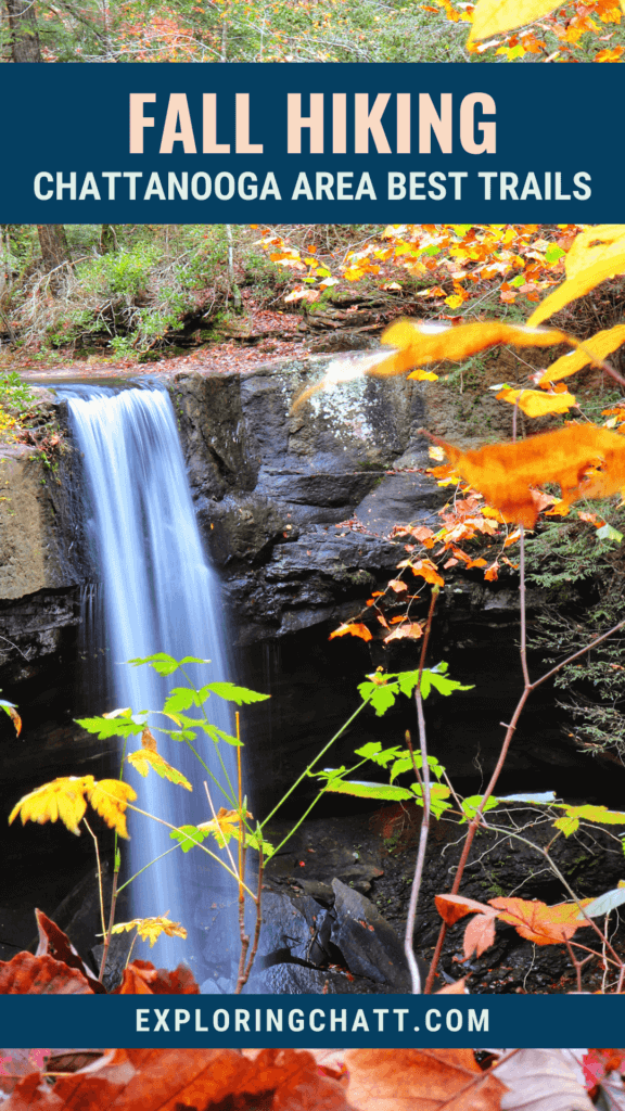
In a hurry? Pin this post for later:

When to Enjoy Chattanooga Fall Hikes
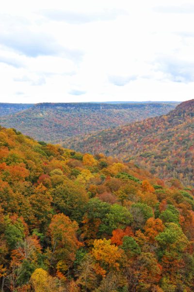
Predicting fall leaves here in Chattanooga can be challenging because there’s a lot of factors such as rain, temperature, and elevation. These factors determine the dates of the week-long phenomenon of peak fall leaves. In Chattanooga, it’s typical for there to be a few days of building up to peak color, a full week of color, and a few days past peak with some late turners. Usually, peak week is the last week of October for the Chattanooga area but higher elevations like the Blue Ridge Mountains or even the Cumberland Plateau peak a week or two prior due to elevation. And again, peak week fluctuates year to year due to the other factors mentioned above. So, don’t be surprised if it’s a week early or a week late. A great resource to help you plan to catch peak colors is the Fall Foliage Prediction Map by SmokyMountains.com. And even if you miss peak week, these hikes still make a beautiful addition to your fall hiking agenda.
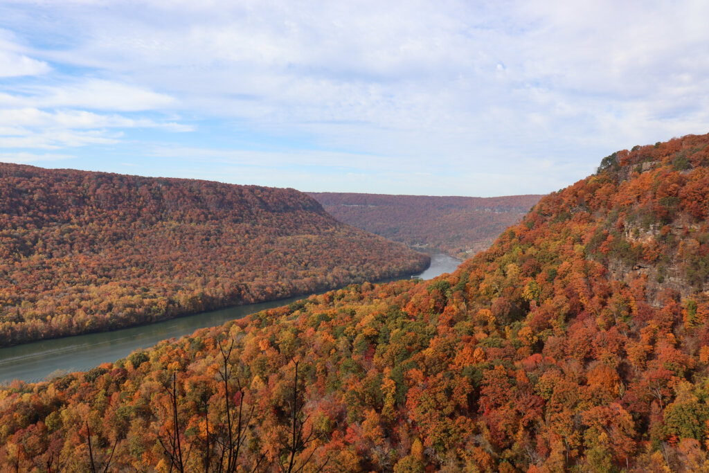
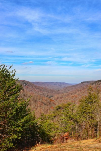
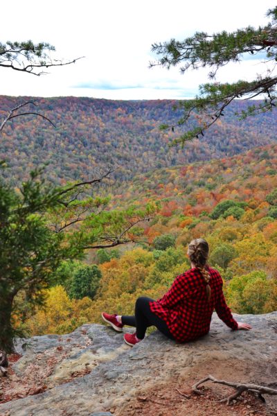
Signal Point to Edward’s Point
- Location: Signal Mountain, TN
- Mileage: 5 miles (less with alternate routes)
- Elevation: 300 feet
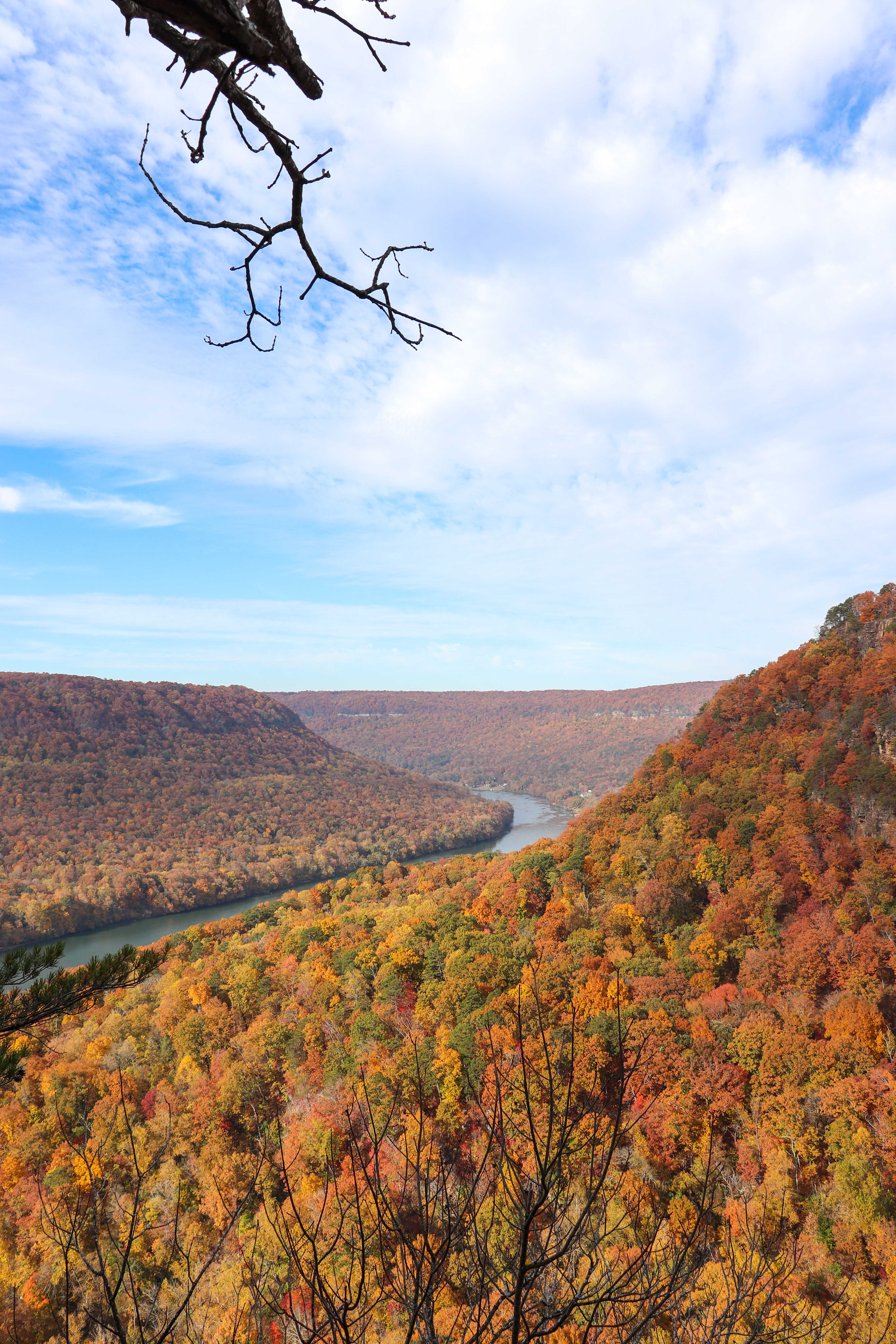
Signal Mountain boasts plenty of fall leaves and views. Signal Point is the southern terminus for the Cumberland Trail which follows the Cumberland Plateau north to Kentucky. To really take advantage of this location, try hiking from Signal Point to Edward’s Point. There’s overlooks at both spots as well as at Julia Falls Overlook along the way. The surrounding mountains covered in fall leaves with the Tennessee River reflecting the blue sky in between makes for the most picturesque Chattanooga fall hike. If you prefer a shorter hike, you can hike from Signal Point to Rainbow Lake or start at Rainbow Lake and hike to Edward’s Point. But to capture the best views and see it all, I suggest doing the full stretch. I have more tips and suggestions for this hike in my Signal Point to Edward’s Point blog post.
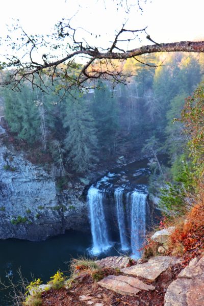
Fall Creek Falls State Park
- Location: Spencer, TN
- Mileage: 2 miles (more if you hike to base of Fall Creek Falls)
- Elevation: 450 feet (more if you hike to base of Fall Creek Falls)
Fall Creek Falls is a favorite amongst the locals for fall hikes near Chattanooga. With nearly 30,000 acres to explore and more than 5 waterfalls to see, it’s no wonder this is a popular destination. I suggest parking at the nature center and starting your hike by walking across the suspension bridge. From here veer to the right to stop by the overlooks. Continue on to eventually reach the Fall Creek Falls overlook. And if you want to hike further, hike down to the base of the falls. I also suggest driving to Millikan’s Overlook on your way out to enjoy a fall overlook. If it’s your first time visiting Fall Creek Falls State Park, I would highly suggest checking out my one day itinerary for the park. This way you can make the most of your time here and see almost everything. And if you have more than a day available, why not make plans to camp here? Camping at Fall Creek Falls State Park is a great experience and allows you to see even more that the park has to offer.
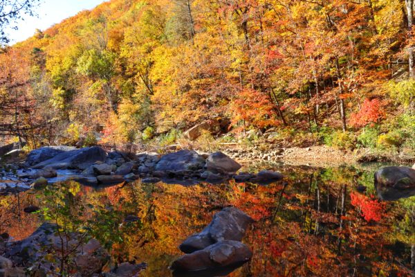
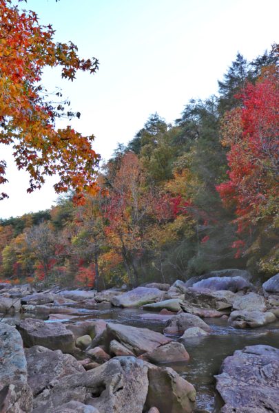
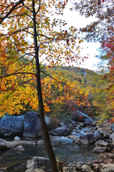
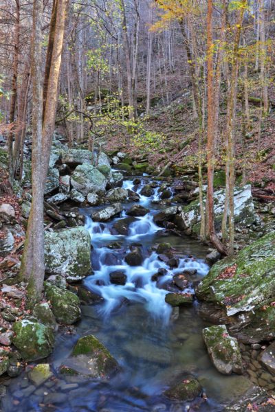
North Chickamauga Creek Gorge
- Location: Soddy Daisy, TN
- Mileage: 3.5 miles
- Elevation: 700 feet
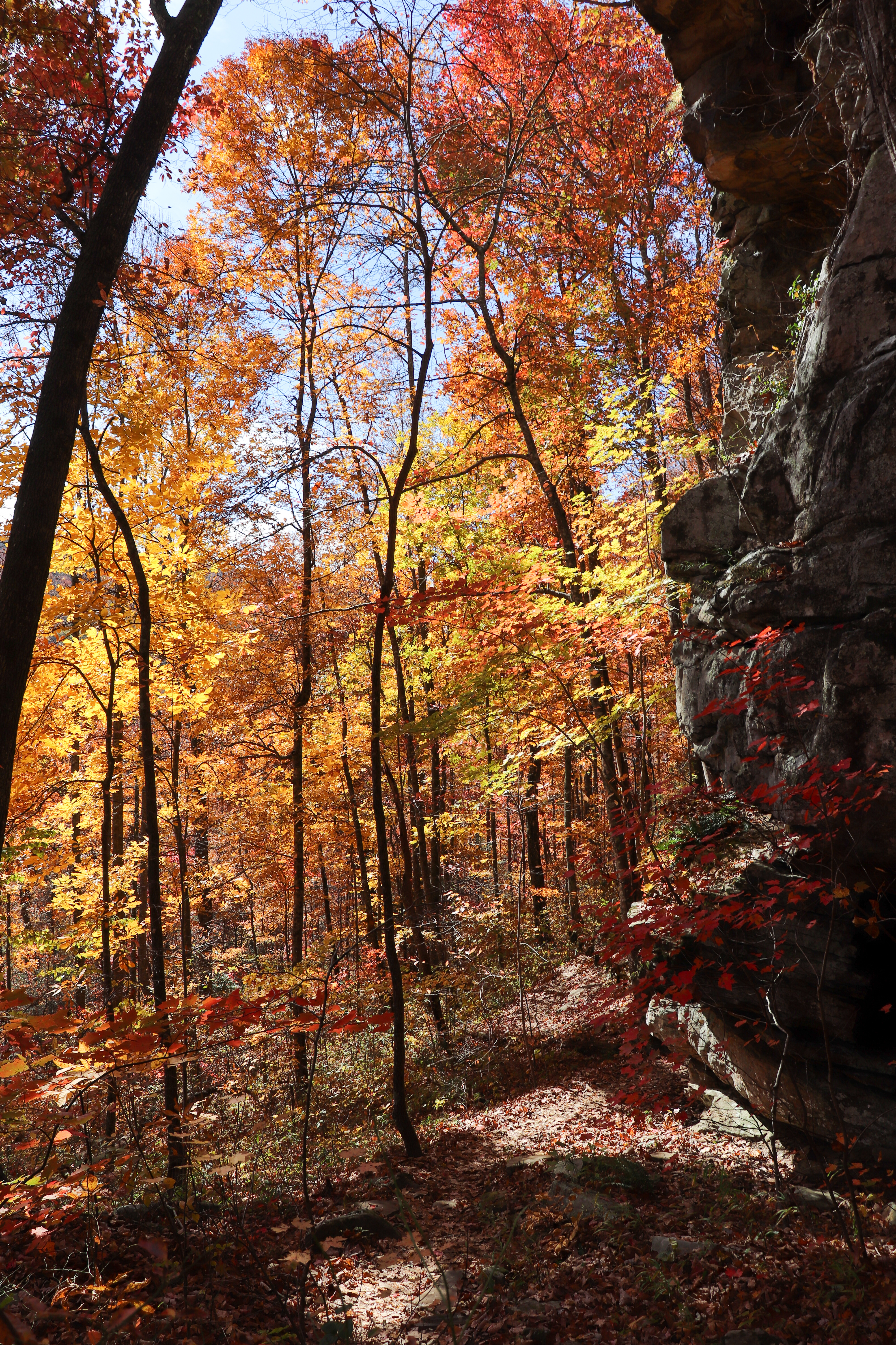
Nestled in the gorge below Mowbray Mountain in Soddy Daisy flows North Chickamauga Creek. Arrive early because this place gets packed quickly. The parking lots alone will provide you with plenty of vibrant, fall colors. Venture further by taking a short trek down to the creek and enjoy sitting on various boulders. Then hike the trail itself as far back as you’d like. The trail, also part of the Cumberland Trail, is over 8 miles long. I would suggest sticking to the main trail to the right of the creek. The split for the “Blue Hole” requires a creek crossing which may be wet. The main trail continues past the split to the right, going up the mountain. If it has rained a good amount recently, a small waterfall will greet you for your troubles. Make a full day of this hike and more with my fall on Mowbray Mountain itinerary.
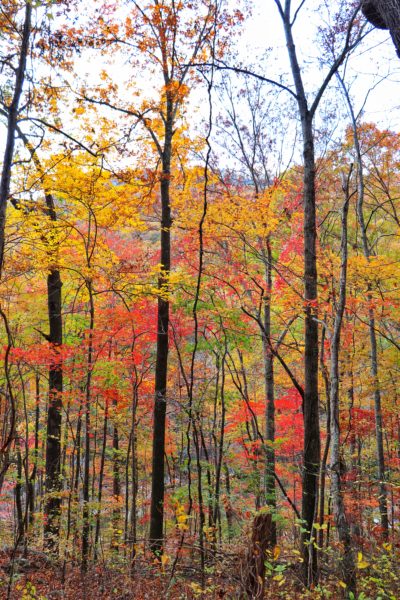
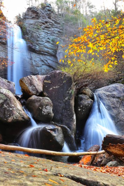
Laurel Snow State Natural Area
- Location: Dayton, TN
- Mileage: 6 miles
- Elevation: 700 feet
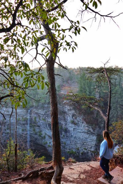
Laurel Snow State Natural Area (also known as Pocket Wilderness) contains nearly 2,500 acres of land in Dayton, TN. The main trail is an old logging road and makes for a fairly easy hike during the first portion. Rock formations to your right and a wide creek to your left create a beautiful atmosphere as you walk beneath the canopy of fall colors. Along the way you’ll even see an old mine entrance. Proceed with extreme caution as it may be damp and slippery inside. Continue your hike by following the signs up the mountain towards Laurel Falls. Snow Falls is a much longer and more difficult hike. But Laurel Falls is easy to reach in a one day, uphill hike. Learn more specifics about this Chattanooga fall hike in my Laurel Falls Hiking blog post.
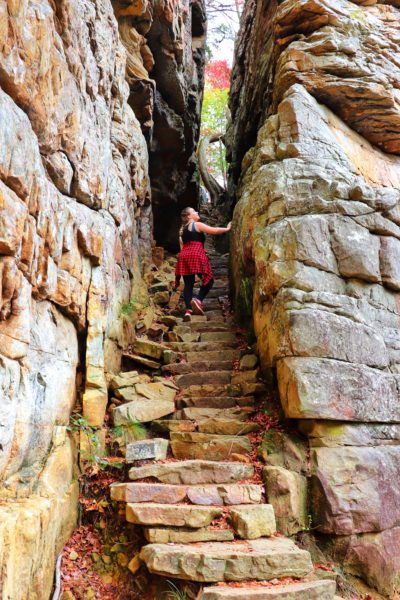
Stone Door at Savage Gulf State Park
- Location: Beersheba Springs, TN
- Mileage: 2 miles
- Elevation: 300 feet
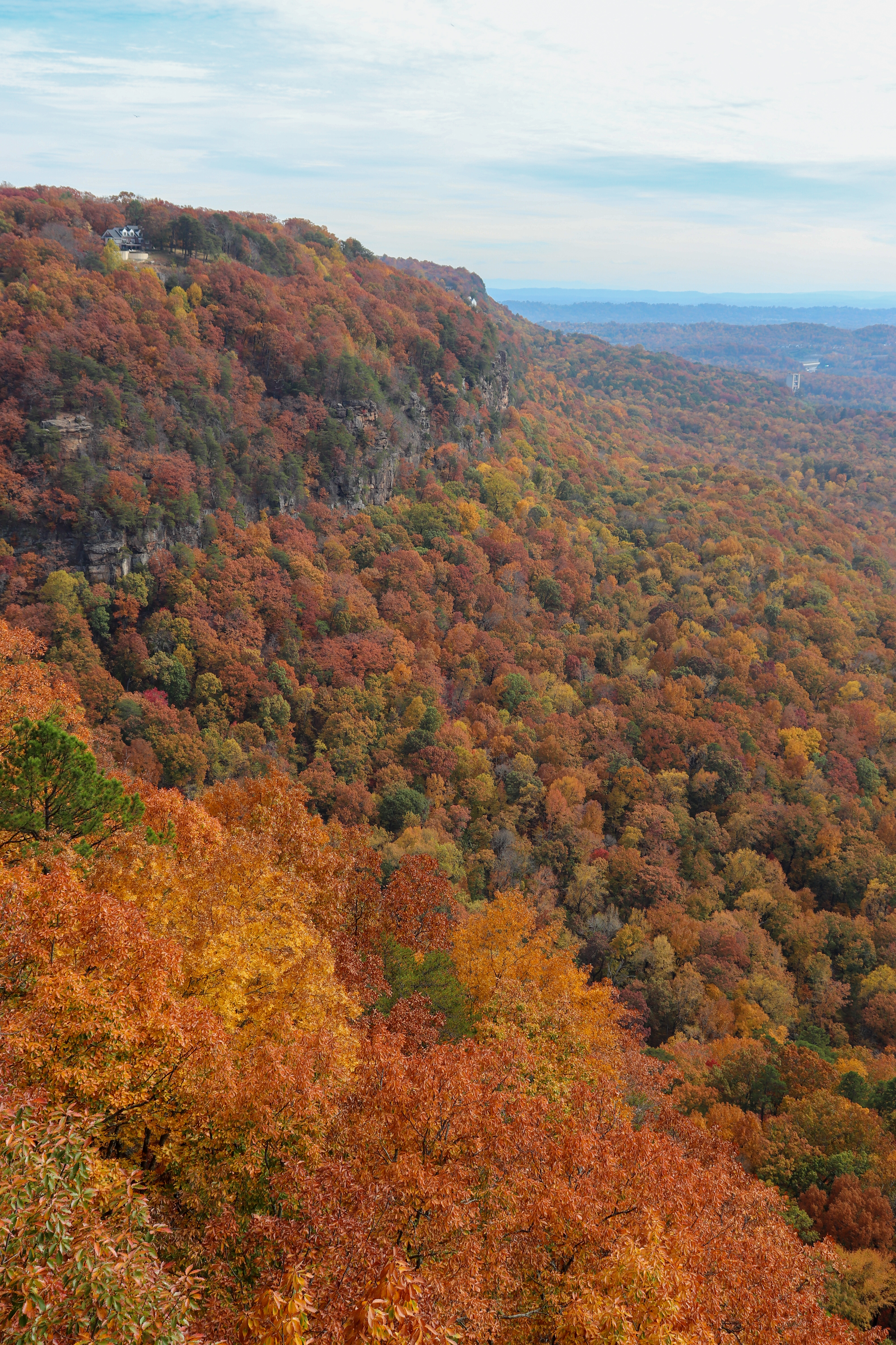
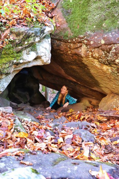
The Great Stone Door might be the furthest drive from Chattanooga, but the beauty of fall in this place makes the trip well worth it. The Stone Door is part of Tennessee’s newest state park, Savage Gulf State Park. This park has 55 miles of trails throughout, including backpacking campsites, making it a great hiking destination for fall. Along the hike on the main trail to Stone Door are various overlooks which are great for seeing fall colors. The hike through Stone Door is also a unique 100 foot tall stone staircase that continues down to another trail below. With waterfalls, mountain views, and rock formations, this place should definitely be on your list. Learn more specifics and tips for this hike in my Stone Door blog post.
Best Chattanooga Fall Hikes
Here’s a list with stats of all the hikes mentioned above to help you plan ahead.
Signal Point to Edward’s Point:
- Location: Signal Mountain, TN
- Mileage: 5 miles (less with alternate routes)
- Elevation: 300 feet
Fall Creek Falls State Park:
- Location: Spencer, TN
- Mileage: 2 miles (more if you hike to base of Fall Creek Falls)
- Elevation: 450 feet (more if you hike to base of Fall Creek Falls)
North Chickamauga Creek Gorge:
- Location: Soddy Daisy, TN
- Mileage: 3.5 miles
- Elevation: 700 feet
Laurel Snow State Natural Area:
- Location: Dayton, TN
- Mileage: 6 miles
- Elevation: 700 feet
Stone Door at Savage Gulf State Park:
- Location: Beersheba Springs, TN
- Mileage: 2 miles
- Elevation: 300 feet
In Closing
There’s plenty of great fall hikes around the Chattanooga area. Have you enjoyed fall hiking at any of these locations before? Or have you enjoyed fall hiking at a different location? Let me know in the comments below. Until next time, enjoy exploring Chatt!

More Ways to Enjoy Fall in Chattanooga:
Inspired? Pin this post for later: