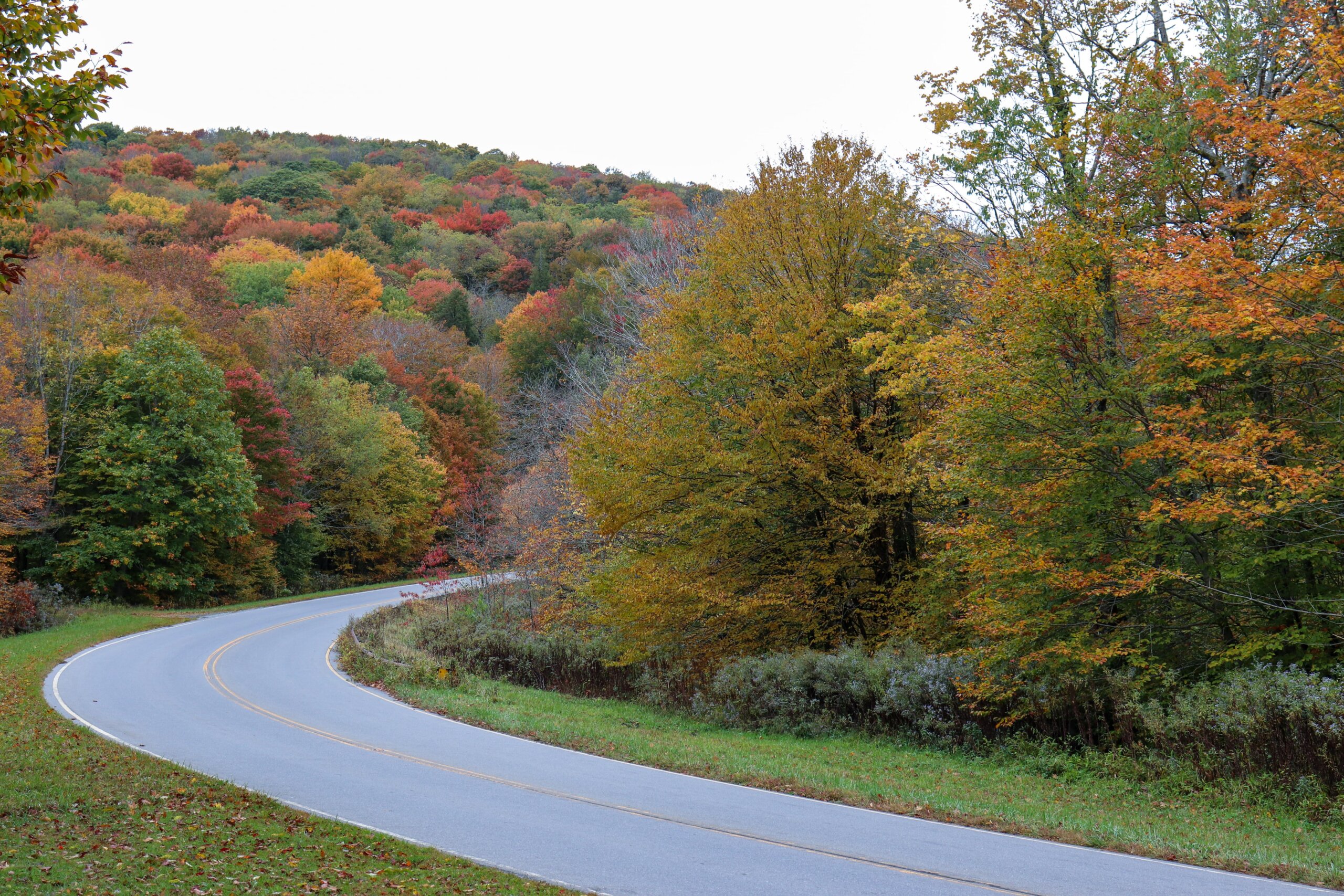
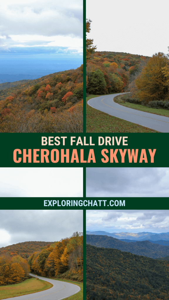
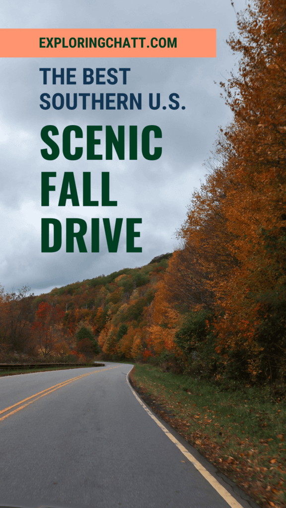
The Cherohala Skyway is one of the best scenic fall drives that often goes unnoticed making it less crowded than you might expect.
Going northeast about an hour and a half drive from downtown Chattanooga will bring you to the real start of the Appalachian Mountains. Tellico Plains marks the start of the 43 mile stretch of road that summits the mountains offering breathtaking views along the way. This is the Cherohala Skyway and it’s one of the best fall drives you’ll find in the area. Continue reading to learn more about this scenic byway, the best route to take, and additional places to check out along the way.
In a hurry? Pin this post for later:

Need a map? Here’s directions:
Purchase a downloadable Google Map with the route and additional stops listed in this post so you’re ready to explore along the Cherohala Skyway!
When to Enjoy a Fall Drive on the Cherohala Skyway
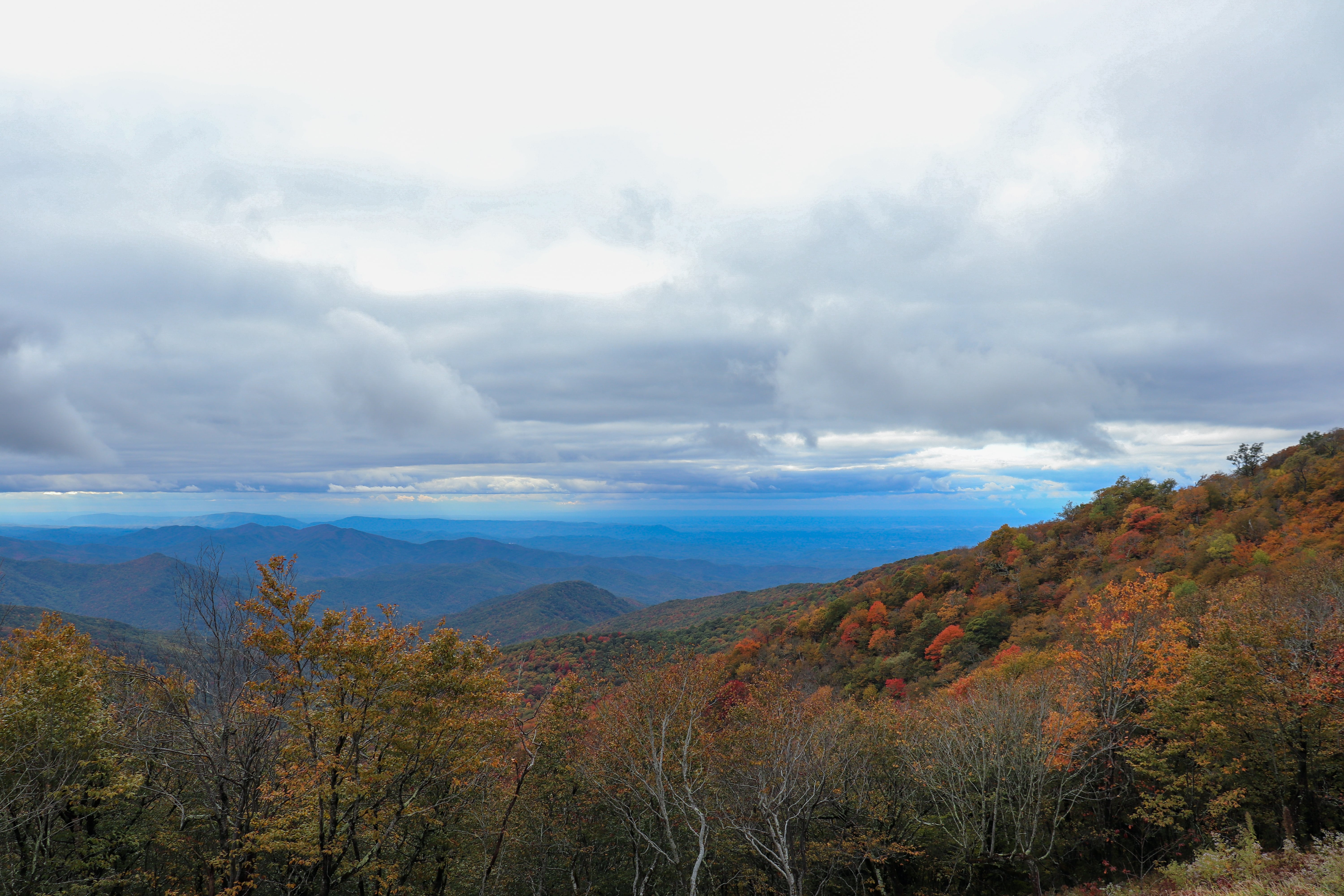
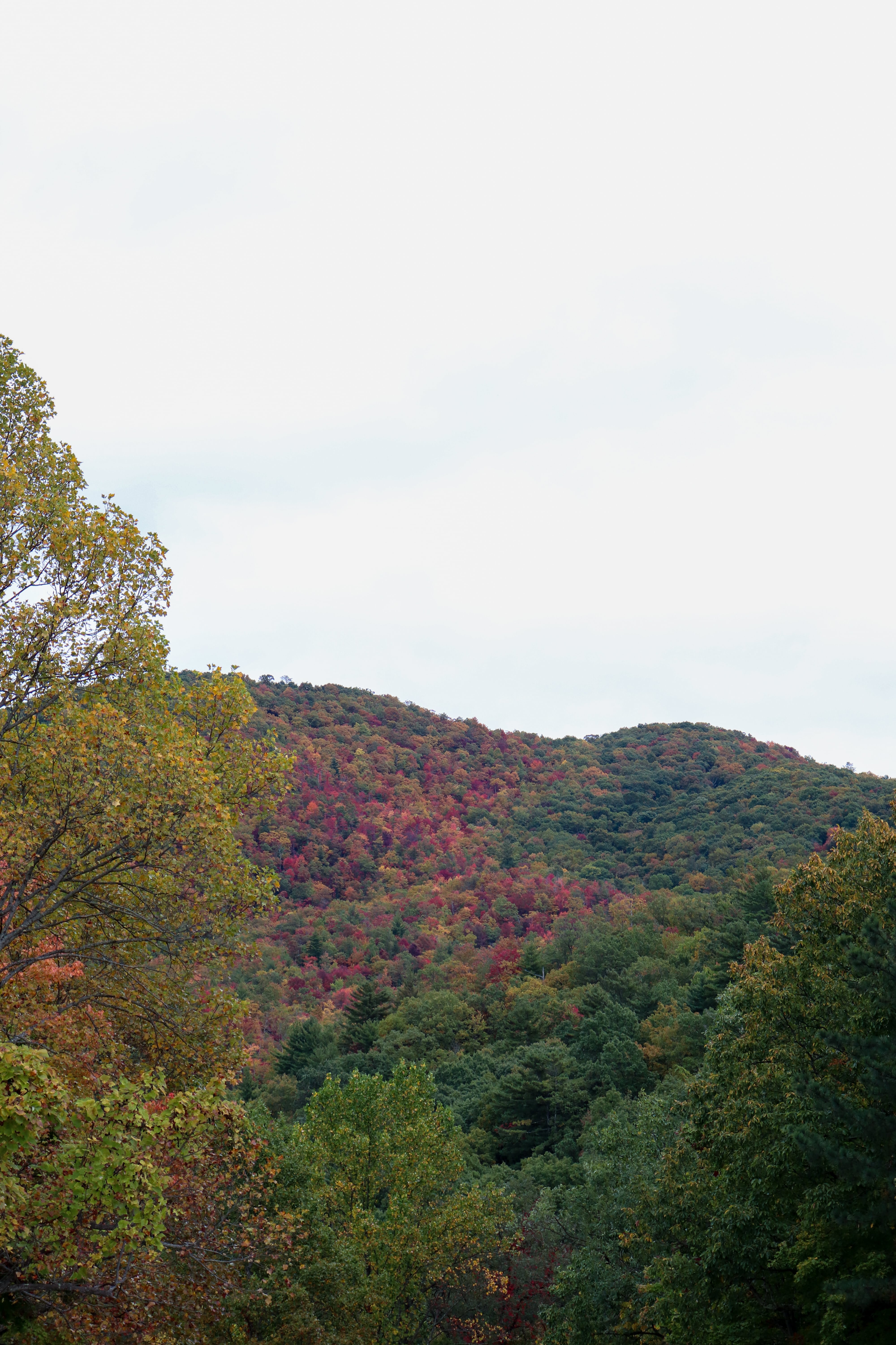
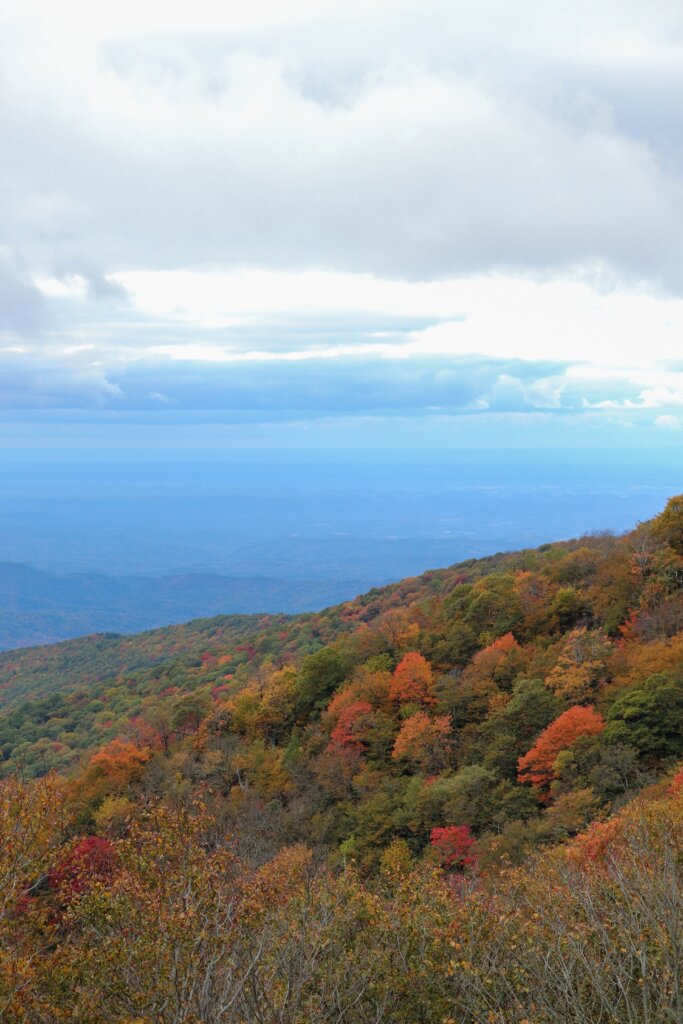
Predicting peak leaves along this drive can be tricky, simply because there’s multiple areas of pre-peak, peak, and post-peak happening at the same time. This is due to the fact that the overall elevation gain on this drive is over 4,500 feet. One of the factors for leaves changing colors is elevation. About every 1,500 feet of elevation gain equals about a week earlier leaf peak. For example, leaves might peak at the range of 3,500 – 5,000 feet above sea level during the week of October 15-21. Meanwhile, the next section below would be 2,000 – 3,500 feet above sea level and peak the following week of October 22-28. Because of this phenomenon, you can actually enjoy more opportunities to see peak leaves on the Cherohala Skyway than you can on our local mountains in Chattanooga. Signal Mountain and Lookout Mountain are entirely in one elevation range. So when their leaves change, it’s quick, all at once, and only lasts about a week for peak. Meanwhile, along the drive of the Cherohala Skyway are 3 elevation ranges. That means that various sections of the drive will be at peak for at least 3 weeks. The typical peak weeks will be around mid-October through early-November. But these weeks can shift earlier or later depending on how much rain has fallen recently and if the temperatures have dropped.
When planning a drive on the Cherohala Skyway, always be mindful of the weather. It is common for the highest elevations of the road to freeze with black ice if the temperatures are cold enough. Remember that whatever the temperature is supposed to be in the valley, the highest peaks of the mountains can be up to 20 degrees colder or more. Plan accordingly and drive cautiously if you encounter ice.
History of the Cherohala Skyway
Back in the late 50s, a group of people inspired by the popular Western at the time “Wagon Train” decided to try their own wagon train. Just like the olden days when new settlers would explore via covered wagons pulled by horses, this group of people created the same nostalgic experience. Interest grew so quickly that there were hundreds of people who showed up to participate in the wagon train across the mountains from Tellico Plains, TN into Murphy, NC via old wagon roads. And when it was all said and done, it became an annual event. This caught the eye of politicians and the plan for a highway connecting these two cities through the mountains was born. However, it took over 30 years of planning and funding to actually get to work on the highway. In 1996 the Cherohala Skyway was finally completed in all 43 miles of two-lane glory.
The Cherohala Skyway Today
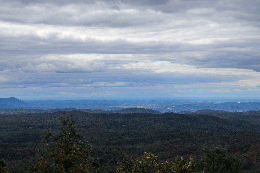
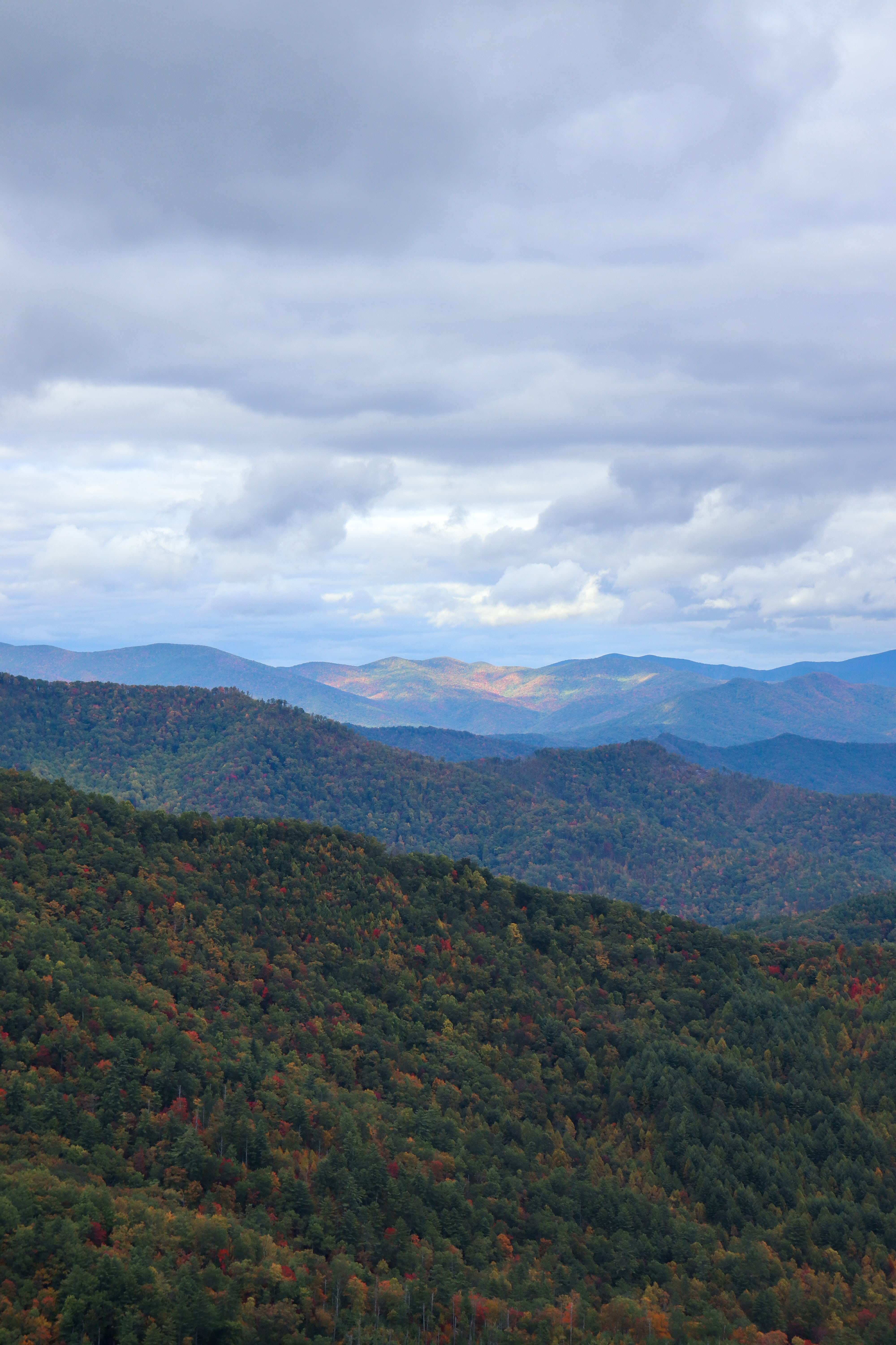
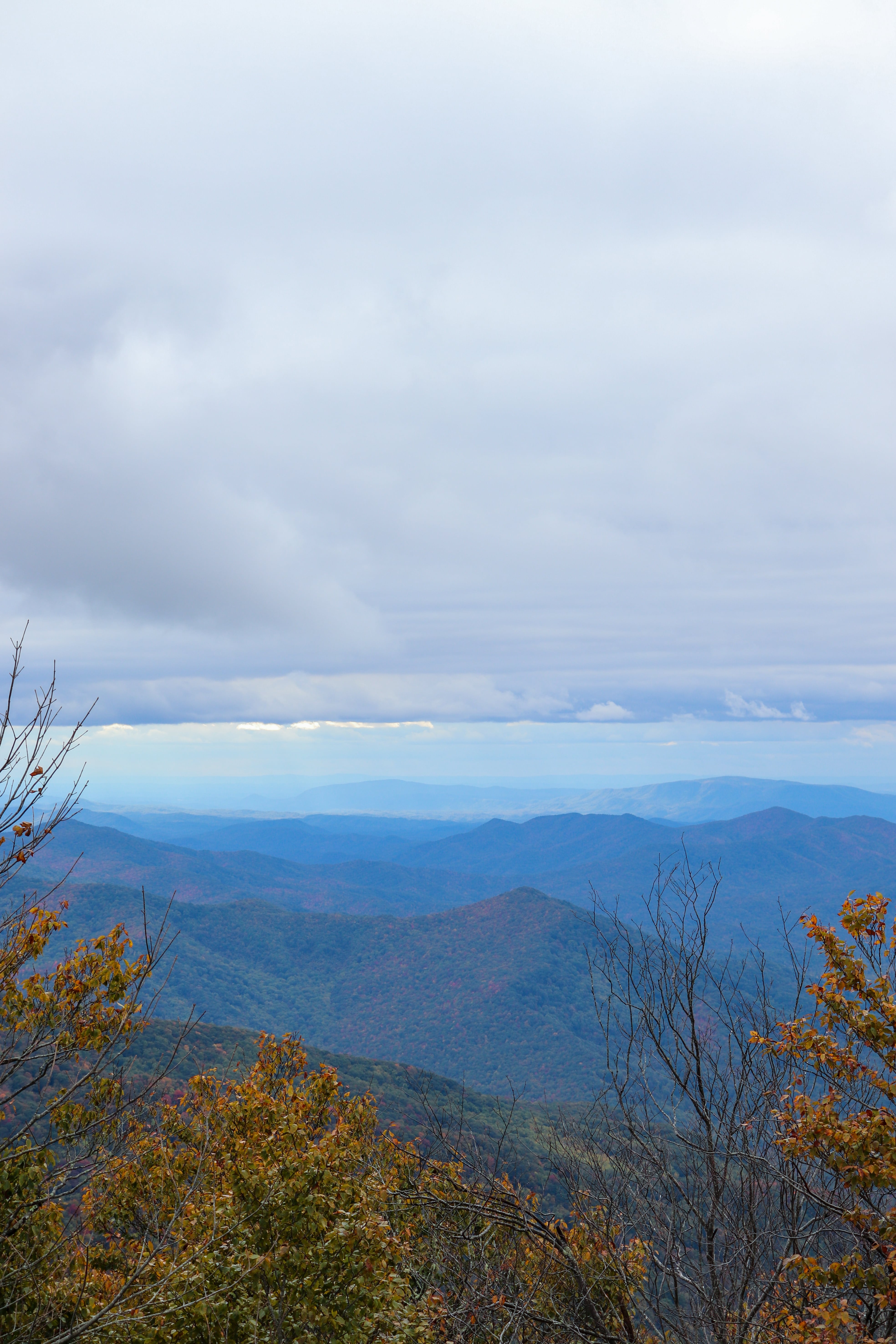
The Cherohala Skyway is now a Scenic Byway just like the Blue Ridge Parkway. Due to its raw Appalachian beauty, it’s considered one of the most scenic drives in the country and Southern region. The official road only goes from Tellico Plains, TN to Robbinsville, NC. During the drive you’ll transition from the Cherokee National Forest to the Nantahala National Forest, hence the road name which is a combination of the two forest names. Overall the Cherohala Skyway ascends nearly 5,400 feet above sea level which earns it the name “mile high legend.” This altitude change also allows for a possible 20 degree temperature difference between the top and bottom. Along the way are plenty of overlooks, hiking trails, picnic areas, and a restroom stop.
How to Drive on the Cherohala Skyway
I suggest starting the drive in Tellico Plains, TN and ending in Robbinsville, NC. However, you are more than welcome to drive this route in reverse too. For time’s sake, we chose this direction so that we could finish in Robbinsville and eat dinner at a local restaurant.
Begin your trip by reaching the Cherohala Skyway Visitor Center. From downtown Chattanooga, the best route is to take I-75, get off the first Cleveland exit, take Hwy 411 through Benton, turn onto Hwy 310 in Etowah, then turn right onto Mecca Pike which will end on Hwy 68 in Tellico Plains.
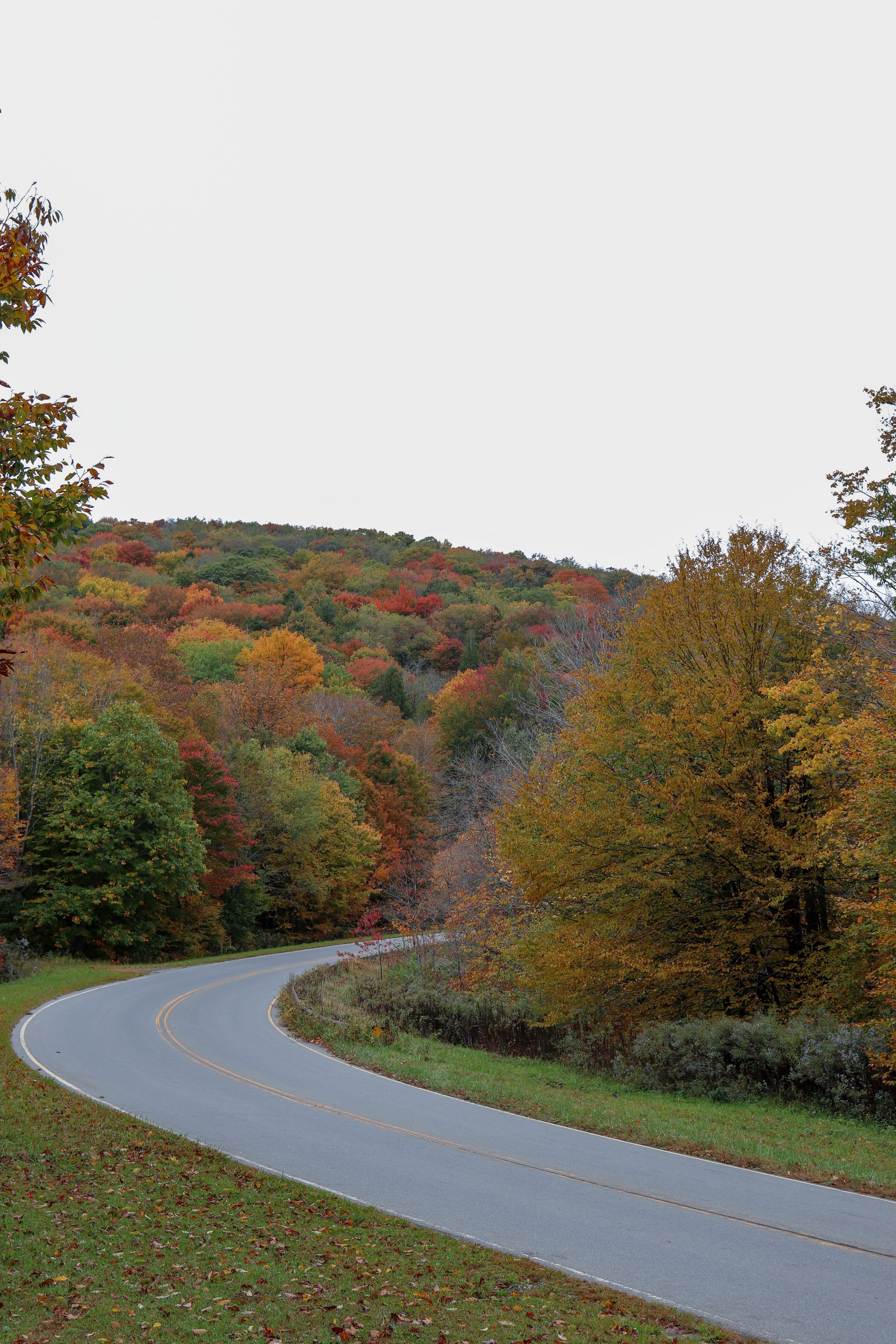
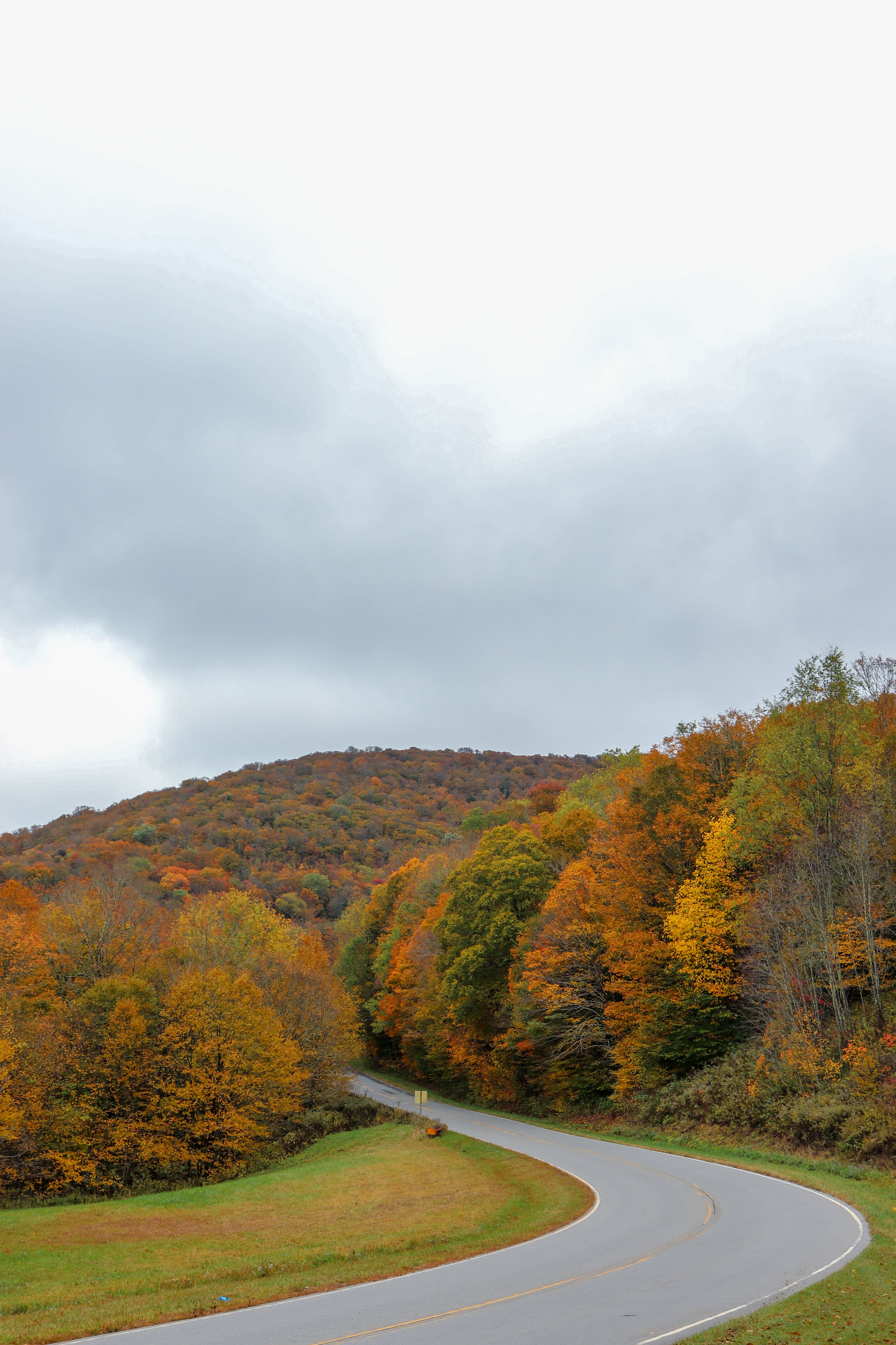
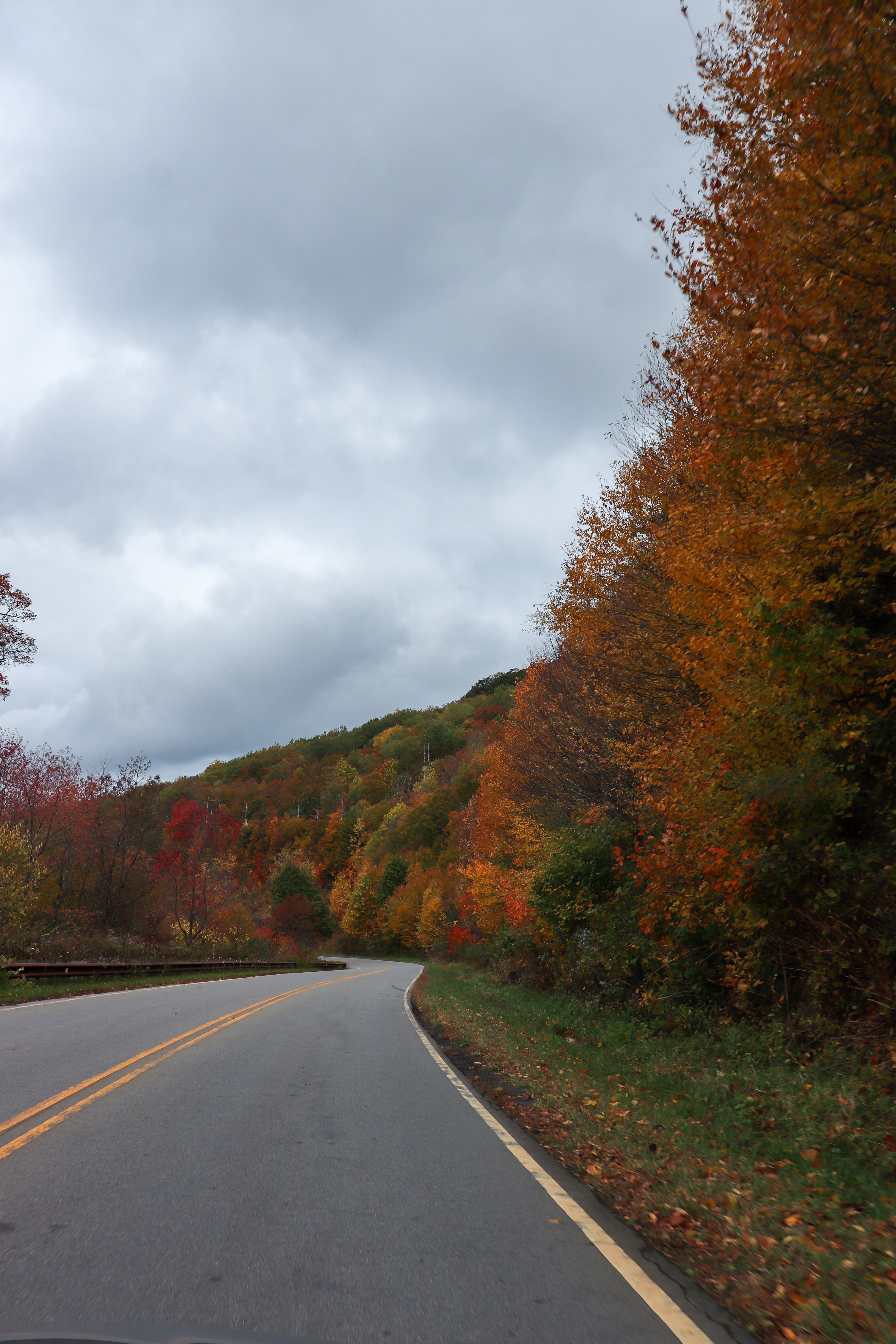
After the Cherohala Skyway Visitor Center, you’ll begin your journey on the Cherohala Skyway. The road follows the Tellico River for a little ways before ascending the mountains. It’s a slow climb and never too steep. In fact, if it weren’t for your ears popping or the bird’s eye views, you may not even realize you’re climbing so high.
During the 43 miles of Cherohala Skyway you’ll enjoy the beauty of fall foliage, breathtaking overlooks, and even hiking trails if you have time and wish to explore on foot.
The Cherohala Skyway ends in Robbinsville, but be sure to stay on the road till it reaches Hwy 129. Snowbird Road will naturally try to take you straight at one point, which is where I got momentarily lost. I suggest making sure your GPS is ready to go for the last portion of the drive.
In Robbinsville you can continue down the mountain into Murphy, NC or head the other direction on the other famous scenic drive “Tail of the Dragon.” Personally, I find the “Tail of the Dragon” to be too crowded most of the time, so just be mindful of that when deciding which route to take. If you choose to take this road, I suggest going on a weekday and in the morning if possible to beat the crowds. In fact, you may prefer to start your drive here instead and end with the Cherohala Skyway. Also note that the “Tail of the Dragon” is a very slow road with hundreds of sharp turns along the way. If you’re prone to car sickness you’ll want to avoid this route.
We chose to head down Hwy 129 towards Murphy and eat dinner at Cafe de Olla Italian. There’s a few other local options (not on Sundays) in town as well as a couple fast food chains. Our dinner was really good and they offer not only Italian but Mexican food as well! Be sure to watch the YouTube video to see what this place and the food look like.
Need a map? Here’s directions:
Purchase a downloadable Google Map with the route and additional stops listed in this post so you’re ready to explore along the Cherohala Skyway!
Hiking Along the Cherohala Skyway

If you’re looking to make a longer day trip of this scenic fall drive, consider adding on a hike. I have yet to try any of these hiking trails but really want to one day. Falls Branch Falls is a decent hike to a large waterfall. Whigg Meadow is another option that takes you to a mountaintop meadow with amazing views. And Santeelah Lake Trail takes you on a loop by Santeelah Lake where you can enjoy the peaceful water views. All these hikes and more can be found right along the Cherohala Skyway.
Another place to explore nearby is the Joyce Kilmer Memorial Forest. As you near the end of the Cherohala Skyway, turn left onto Santeelah Road. Soon you’ll reach the entrance to the Joyce Kilmer Memorial Forest where you can enjoy the loop trail with Little Santeelah Creek and huge, old trees. You can also take Joyce Kilmer Road out around Santeelah Lake to Hwy 129 when you’re done.
If you opt to explore in the Joyce Kilmer Memorial Forest, I also suggest checking out the Maple Springs Observation Deck for even more breathtaking views. I wish we had time for all these add-ons when we went this last weekend but I’ll have to add these explorations another day during another trip.

In Closing
Enjoy this national scenic fall drive and more on the Cherohala Skyway this year. Have you explored this area before? Let me know in the comments below. I’d love to know your thoughts!
Don’t forget to watch the YouTube video for more visuals of what to expect on this drive and where we ate dinner. Until next time, enjoy exploring Chatt!

Need a map? Here’s directions:
Purchase a downloadable Google Map with the route and additional stops listed in this post so you’re ready to explore along the Cherohala Skyway!
More Ways to See Fall Foliage Near Chattanooga:
Inspired? Pin this post for later:
Leave a Reply