Fall Creek Falls is a great place to visit if you’re looking to see multiple waterfalls in one day. With it being just over an hour drive north of Chattanooga, you can be sure to make the most of your day here. Here’s what I did in my one day visit to Fall Creek Falls State Park.
Where to Begin
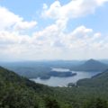
Fall Creek Falls is nearly 30,000 acres of mountainous woods, creeks, and waterfalls. The park has numerous campsites, cabins, a group lodge, an inn, picnic areas, and playgrounds. There’s also a full golf course and a Canopy Challenge Course throughout the forest. You can also rent boats (bring your own trolling motor though), kayaks, canoes, and paddle-boats for the lake. Along with those rentals, there’s 3 trails you can rent a mountain bike for as well.
Because the park is so vast, I found myself confused when I looked at the park map loaded with numerous roads, stopping locations, and over 56 miles of hiking trails. There are many routes into the park. Coming from Chattanooga, the fastest route is to come in from Highway 111. Because we entered this way, we found ourselves coming in on Village Camp Road which takes you right by the Visitor’s Center. We stopped here for a restroom break, browse the gift shop, and to get some more directions. Here is a more simplified map of our route with each of the stops being numbered by order of our arrival to each one. Number 1 is the Visitor’s Center. From there we headed up to the Nature Center as they told us that’s where some of the best falls in the park are located.

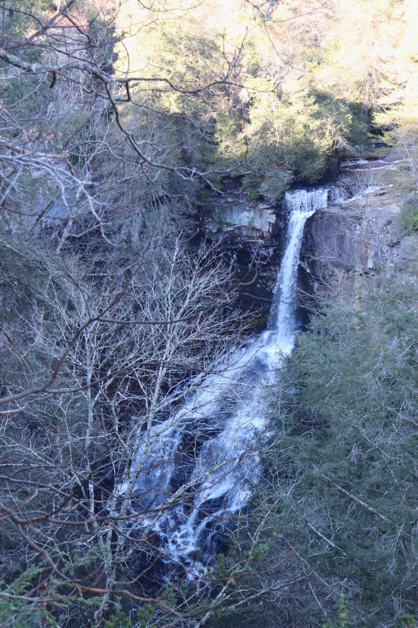
Cane Creek Falls Overlook
Stop 2 can be reached via a short walk from the parking lot of the Nature Center. Here are some of the photos I was able to capture at this location.
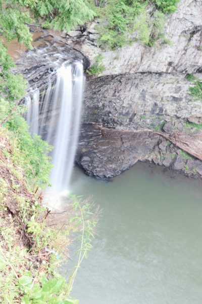
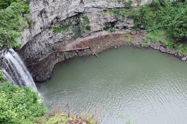
The view of the falls is difficult to see from this side. And there is another skinnier waterfall beside/behind the overlook which is hard to view from here as well. The big waterfall is Cane Creek Falls which stands at 85 feet tall while the skinnier falls (I will share better pictures further down) are Rockhouse Falls which stand at 125 feet tall. They both pour into this same water hole resulting in the merging of Cane Creek and Rockhouse Creek. Hence the name of these two waterfalls. There’s another overlook on the opposite side which has a better view. At the time I visited the suspension bridge over Cane Creek was closed for repair. So, the other overlook was not as easily accessible. I will share more about this overlook at a later date when I can visit the other side.
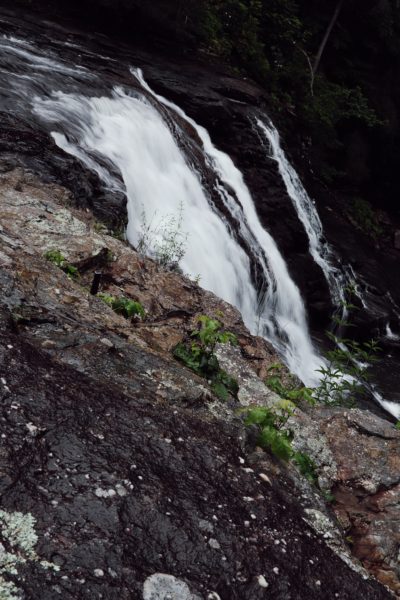
Cane Creek Cascades
Stop number 3 was another short walk from the parking lot. This led us to the Cane Creek Cascades. The 45 foot cascades are just a little ways upstream from Cane Creek Falls and trails provide easy access to the top and bottom of the falls. While I was there, I watched some children using the main bottom ledge of the falls as a slide down into the creek. To get to the base of the cascades is a fairly long staircase down, so be prepared for this if you’re easily winded.
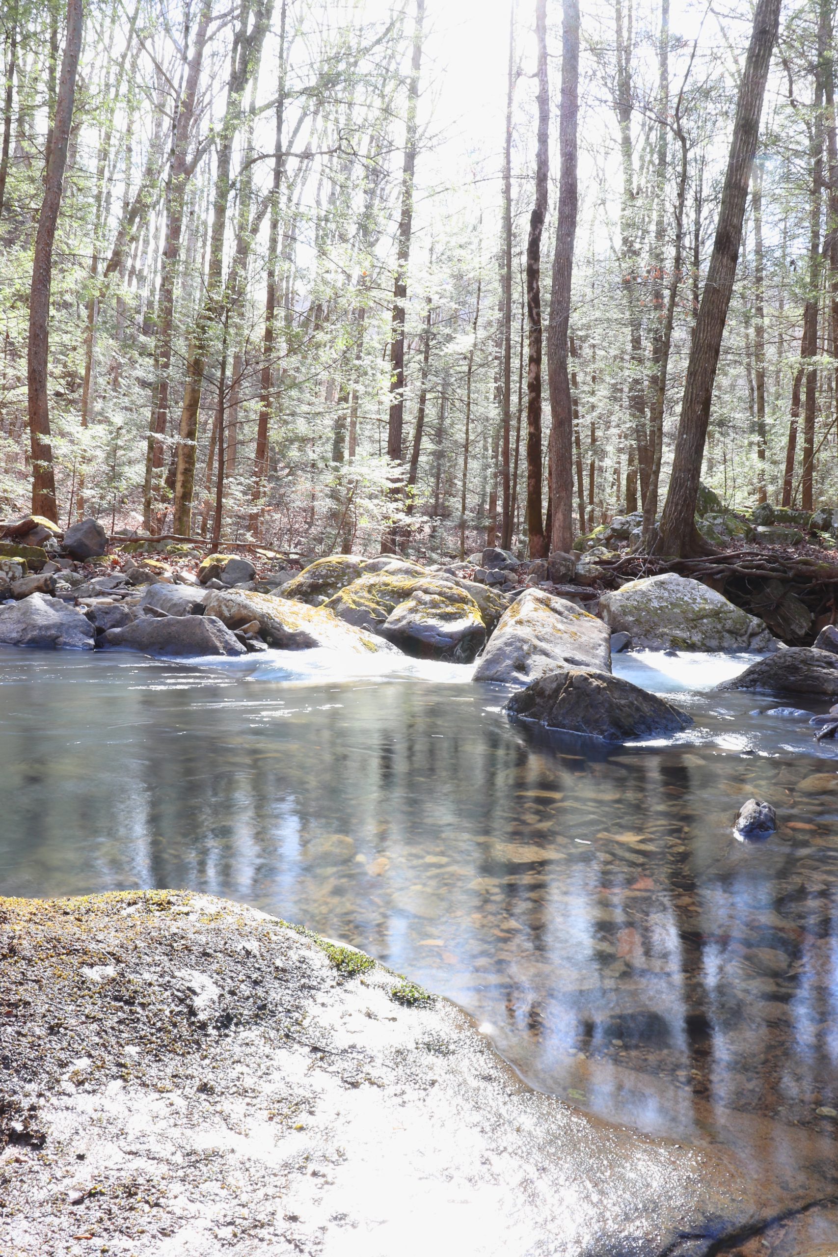
Cane Creek
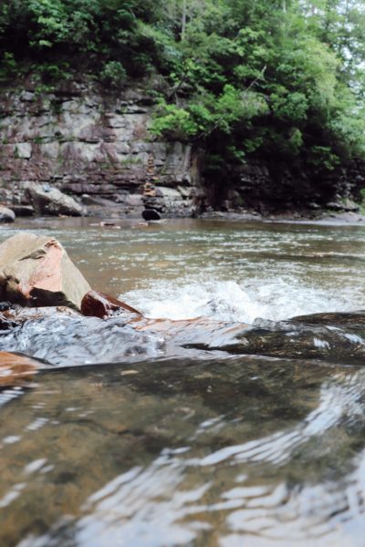
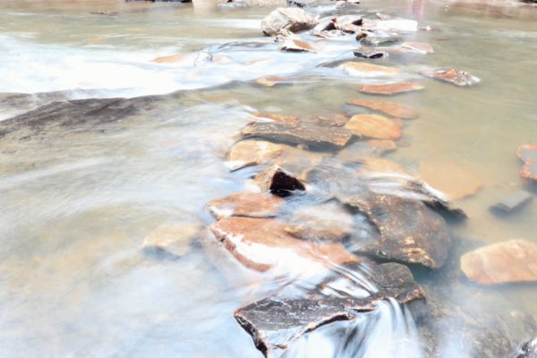
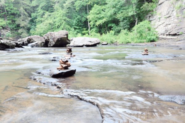
At the base of the cascades is plenty of shallow water where you can enjoy Cane Creek. Just keep in mind, this is still above Cane Creek Falls so be cautious especially with dogs and children so that no one goes too far downstream towards the big waterfall. This area gets busy very quickly in the early afternoon as families love to bring their children to play in the shallow waters offered by this creek. If you decide to venture out, I must stress to wear a good pair of water shoes. The rocky bottom is very smooth and slick from the constant water flow and can cause slips and falls very easily. Just move slow and test your footing.
Top of Cane Creek Falls
This brings me to stop number 4 on my map. This is the view from the top of Cane Creek Falls and where you can get a better view of Rockhouse Falls. I was blown away by this view and had no idea this spot was even so easily achievable. However, I cannot stress enough how cautious you must be to reach this spot. It was late June when I visited and we had just had a full week of rain. In fact, as you could probably already tell, it was overcast and almost rainy this day too. Since it’s summer, the creek wasn’t too high. In the winter months is when it will be highest. I could see where the water line normally is in the winter for this creek and looked to be about 3 feet higher. In which case, you wouldn’t even want to dare wade out into the creek at that point. Since the water is lower now, I was able to safely cross the creek just below the Cane Creek Cascades and then I was able to walk on the other shore on dry rock all the way to the top of Cane Creek Falls. If it is not completely dry rock the entire walk out there, DO NOT DO THIS.

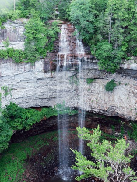
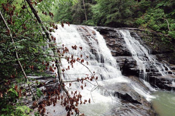
Fall Creek Falls
Fall Creek Falls is actually the name of the main waterfall for this park. Which would explain why the entire park is named after it. So here is the second part of the map to show you how we got here from the Nature Center.

Fall Creek Falls is actually one of the highest waterfalls in the Eastern United States standing at 256 feet tall. Stop 5 was the overlook which is a short walk from the parking lot here at the falls. Stop 6 is the base of the falls which requires a half mile hike down a clearly marked rock path that has handrails most of the way. There are a couple spots that can be slick and dangerous, but overall I’d rank this hike easier than both Foster Falls and especially Greeter Falls. If you haven’t read my post about these two waterfall hikes, click HERE.
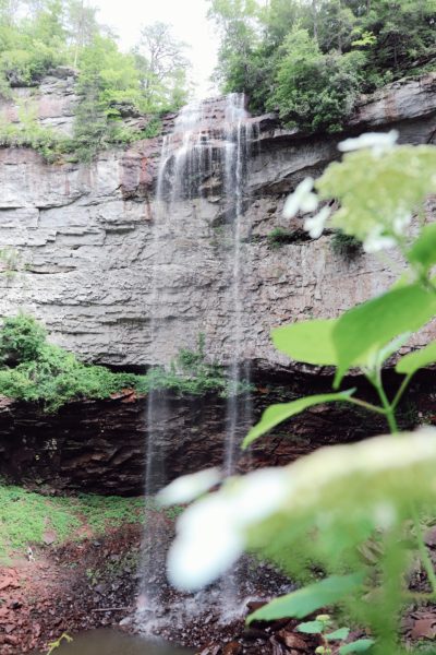
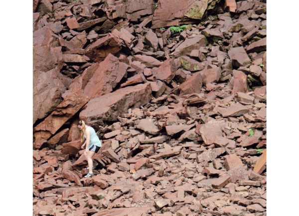
The last time I visited this waterfall was about five years prior and I remember the waterfall being only one stream of water down into a puddle. Very similar in resemblance to Rockhouse Falls. I can’t remember when it was that I went then, I think it was late summer, early fall though. So here is what it looks like in late June after a good rain week. The water at the bottom was probably about three feet deep. In the winter time is when the water will be much higher and falls will be much fuller. As you can see above, I tried hiking down to the base of the falls directly. It’s a challenging hike down all the fallen rocks ranging in all sizes of large and very large. I contemplated getting in the water here but decided not to because I noticed that most of the rocks appear to be high in iron content which resulted in them being very rusty and therefore the water in the pool itself was rusty too. I couldn’t see my feet very well when they were only submerged one foot deep. Since the rocks vary in size, you cannot see what is truly submerged here and it would be very easy to injure yourself on a rock or two that you cannot see. Plus since there’s rust involved, that was my final deciding factor to not go all the way in.
Final Conclusions
I cannot wait to visit Fall Creek Falls State Park again. In fact, while I was there with my friends we were discussing planning a camping trip there so that we have more time to hike and bike and enjoy the park. There truly is so much to do here and you would probably have to stay a week just to see most of it.
I will also add that there is the Cable Trail which is a steep .3 mile trail down the rocky mountainside to the water hole at the base of Cane Creek Falls and Rockhouse falls. There’s a cable to hold onto to help you up and down, hence its name the Cable Trail. We wanted to go down this later in the day but ran out of time and energy after our hike down to Fall Creek Falls. So that is definitely on our list for our next visit too.
Have you visited Fall Creek Falls before? If so, what did you think, and what activities did you do there? Let me know in the comments below. And if not, I highly encourage you to visit.
That’s all for now,
~Amanda
To watch the video experience of this day click HERE.