In short answer, yes, hiking to Sunset Rock is better than driving there. “But why?” You ask. And the reason is actually quite simple. Below I’ll recount the steps we took on our hike so you can do it too. And by the end you’ll understand why hiking to Sunset Rock is better than driving there.
Ruby Falls Trailhead
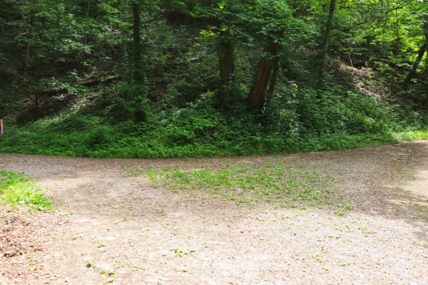
This hike starts at the trailhead located beside Ruby Falls. Parking shouldn’t be an issue because you have to already know this trailhead is here as it’s not visible from the road. Ruby Falls has their own parking lots so they shouldn’t overflow into this area either.
To access the trailhead, you just need to drive as if you’re going to Ruby Falls. Turn into the main parking lot that goes in front of the building. Drive through and at the end you’ll come across a gravel road. Here you’ll turn left and park in the gravel lot at the trailhead. To leave simply follow the gravel road out. This road is a one way street which is why you must access it via the Ruby Falls parking lot.
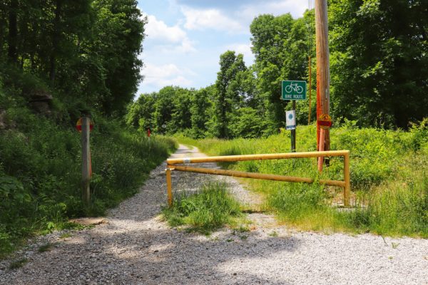
Guild Trail
This trailhead is the halfway start of the guild trail. The Guild Trail really starts closer to the bottom of the mountain in St. Elmo. The Guild Trail is wide and fairly flat.
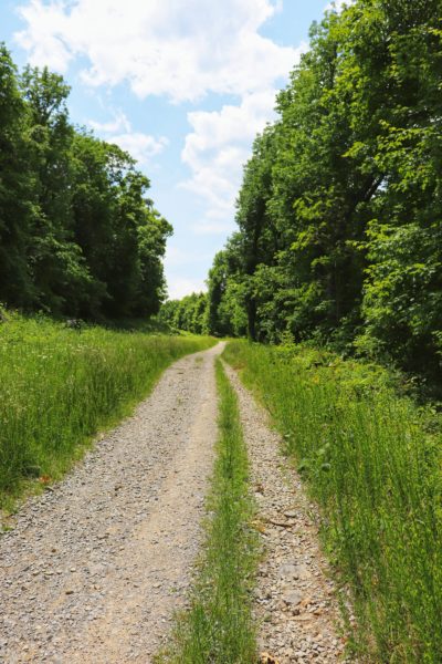
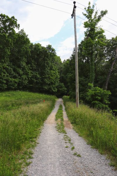
It’s a gravel trail that is accessible to bikes so be aware as you hike here. We only saw a couple bicycles on this entire hike so it’s not too bad. Plus they were all very courteous and we did not feel unsafe at all. Because the trail is wide and gravel, most cyclists are not going to be flying down anyways and there’s plenty of space for both of you.
Upper Truck Trail
As the Guild Trail comes to an end, you will meet the Upper Truck Trail. At this fork you can go right (how we came back) or go left (how we went up). This segment of the Upper Truck Trail is just under a mile long and goes from the bottom of Craven’s House to Gum Spring Trail (which we’ll get to in a minute).
The trail is again wide, fairly flat, and mostly gravel. This is also a bike friendly trail. We went left and decided not to go all the way to Craven’s House. This is an option though if you want to keep the long, steep ascents out of the equation. At the bottom of Craven’s House are about 3 flights of stairs. And that is the bulk of the steepness you’ll have to deal with if you choose this route.
Rifle Pits Trail
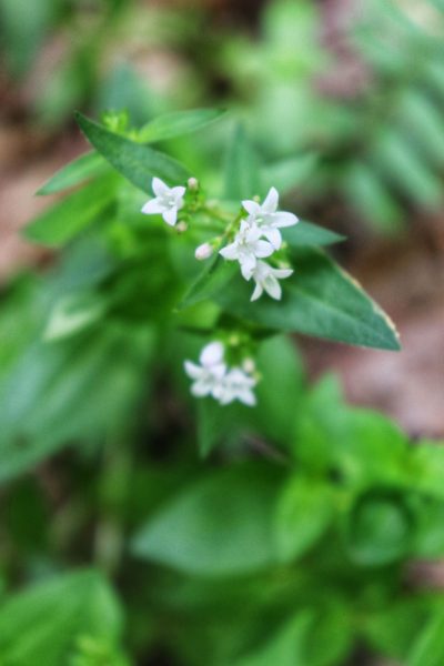
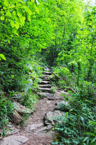
If you’re like us though, we chose the shorter route which is to take the Rifle Pits Trail up to the Craven’s House Trail. This has a longer steep section than the route previously mentioned. The Rifle Pits Trails is more like a hiking trail you would expect. It’s also not heavily traveled so be prepared for some overgrowth to spill over onto the trail. On the other hand, since it’s lightly trafficed, it’s a very peaceful and quiet trail. Which is hard to come by on Lookout Mountain.
Craven’s House Trail
Now we reach the Craven’s House Trail. This is exactly as it sounds. It’s the trail from the Craven’s House. If you go the longer but easier way, this trail starts at the top of Craven’s House. If you take the shorter but more challenging Rifle Pits route, this trail intersects it. Coming from the Rifle Pits Trail you’ll need to basically make a U-turn to turn right onto Craven’s House Trail. The trail goes for about half a mile before it ends at the Bluff Trail.
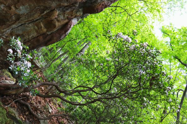
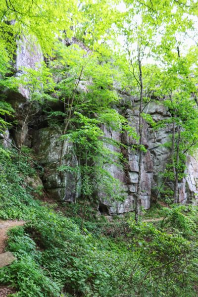
Bluff Trail
At the Bluff Trail you can go left to Point Park (see my post about this route HERE) or right to head to Sunset Rock. At this point you’ll see a map and signage with directions and mileage to help you out if you’re confused yet. This mountain is covered in intersecting trails so it’s easy to lose your bearing if you’re not careful.
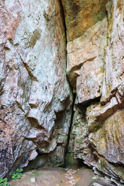
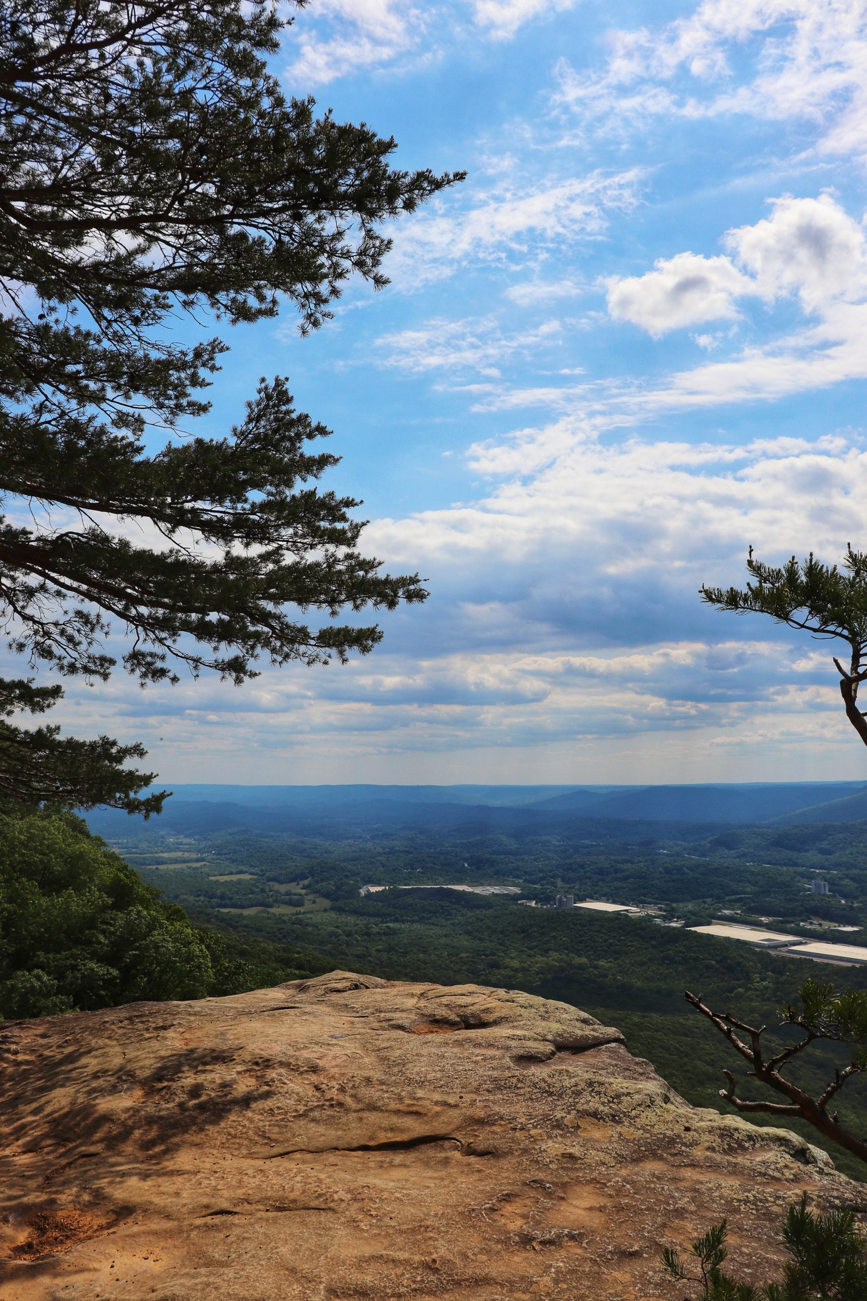
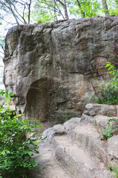
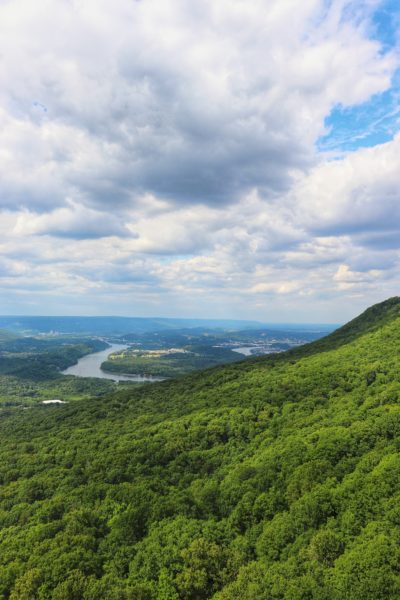
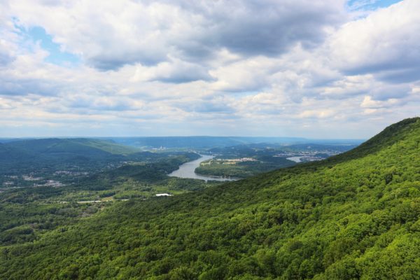
Sunset Rock
When you turn right onto Bluff Trail you only need to go about half a mile before you reach the intersection that take you to Sunset Rock. A sign will point the way up stone steps all the way to the top of Sunset Rock.
Sunset Rock can also be accessed by car and a short hike of .2 miles. But the parking lot for this spot is hard to use. It’s a tiny lot and almost always full. (Read this for more on driving to Sunset Rock and catching the sunset here.)
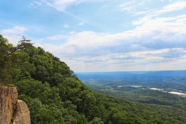
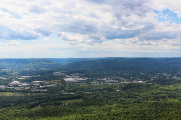
Not only is it easier to find a parking spot at a different trailhead and hike to Sunset Rock, it’s also more rewarding. There’s something about working hard for something that makes you appreciate it more than if you didn’t have to work much for it in the first place. Sunset Rock is the perfect example of this. I hadn’t been here in a long time due to the tiny parking lot, but after hiking to it, which I’ve never done before, I realized it was a more beautiful experience.

Gum Spring Trail
Heading back we took a more direct, albeit steeper route. To get to the Gum Spring Trail from Sunset Rock, hike back down the rock steps that brought you here. But instead of going right at the bottom (where you came from) turn left. Very shortly you’ll come across the right side jut off for the trail which will also be marked by a sign.
The Gum Spring Trail is just over a half mile long and takes you down the mountain side. It intersects with the Upper Truck Trail before continuing down the mountain. Take the Upper Truck Trail by turning right onto it and soon you’ll reach the fork from your hike in. Veer to the left to get back on Guild Trail and head back to the trailhead.
Our Hike to Sunset Rock
I know words aren’t the best way to share directions. So here’s a map of the hike we took there and back. The color key is below to help give you a better visual. The purple is our trip TO Sunset Rock and the orange is our way FROM Sunset Rock. The pink is the alternate route I mentioned that goes by Craven’s House.
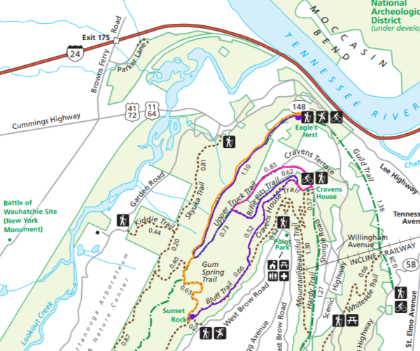
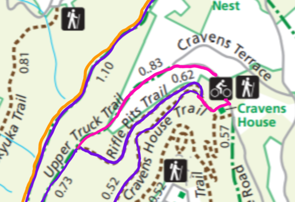
Here’s a better close up of the way we went (purple) and the alternate, easier route by Craven’s House (pink). If steep trails are difficult for you, I highly suggest the pink route and follow this same route on the way back. Do not take the orange way back as it’s the most steep.
Overall mileage for this hike one way:
- PURPLE -hike TO Sunset Rock roughly 3.5 miles
- ORANGE -hike FROM Sunset Rock roughly 2 miles
- PINK -Craven’s House alternate route roughly 4 miles
Tips for this Hike
I would suggest doing this hike in reverse for the sake of avoiding steep downhills. Keeping the steepness to uphills only is challenging but also easier on your knees. Gum Spring Trail is steeper than the Rifle Pits Trail. But if you want to avoid all steepness, definitely take the Craven’s House alternate route instead. This translates the steep hills into stairs which are much easier on the body.
As I explained earlier, this mountain is teeming with trails so it can be easy to get confused as to which trail you’re on or where you’re headed. For this reason, I highly suggest downloading the trail map before you head out.
Closing Thoughts
I hope to hike to Sunset Rock more often now that I know how much more rewarding it is. Have you hiked to Sunset Rock instead of driving there? Let me know in the comments below.
To watch a more visual summary of this trip, check out the YouTube video. Until next time, enjoy exploring Chatt!

Leave a Reply