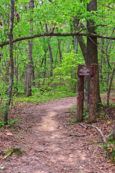
The hike to Big Laurel Falls was my first “hard” rated hike according to All Trails. Even the sign at the trailhead says it’s strenuous. However, I did not find this hike to be any more difficult than others I’ve been on recently. And the best part is the reward that awaits you at the bottom. Any difficulty is worth this, trust me.
Virgin Falls State Natural Area
Big Laurel Falls is located in the Virgin Falls State Natural Area. The 1,157 acre area is located near Sparta, TN. Numerous caves, waterfalls, and creeks fill the acreage. In 1973 the Bowater Pulp and Paper Corporation made this area a “Pocket Wilderness”. I’ve visited another original Bowater Pocket Wilderness last year which you can read more about in this Laurel-Snow blog post and Laural Falls blog post.
The state of Tennessee purchased the land in 2012. It is now maintained by the Fall Creek Falls State Park, although it is not considered to be a part of the park. One of many things that makes this place unique are the backpacking campsites. There are 14 in total scattered in clusters throughout the area. If you’d like to camp here, be sure to reserve your site. The campsites are Cable Crossing, Martha’s Pretty Point, Virgin Falls, and Caney Fork which will be found near the bottom of the list.
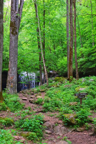
Big Laurel Falls
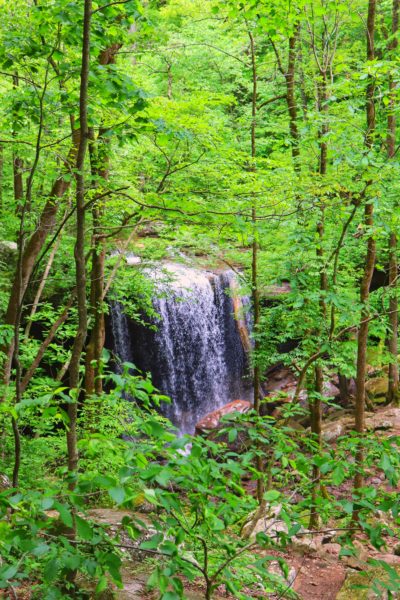
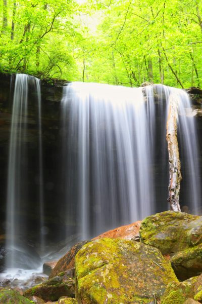
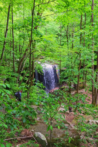
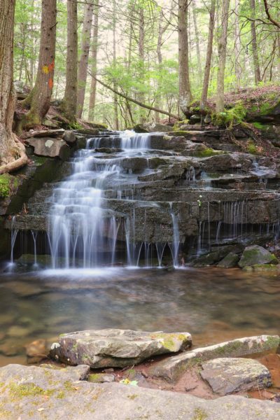
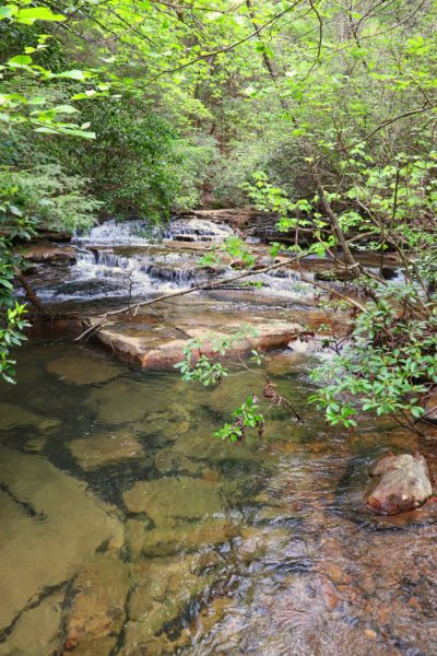
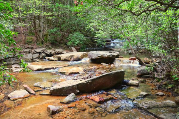
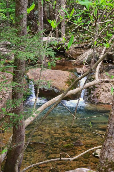
Yes, Virgin Falls might be the main attraction here, but Big Laurel Falls is more favored between the two waterfalls by many due to its shorter hike. This 40-foot waterfall spills from Big Laurel Creek and marks the halfway point to Virgin Falls.
My friend and I had every intention to hike to Virgin Falls on this day. Sadly, we did not have enough time so we took the advice given us to hike to at least the halfway point, Big Laurel Falls. If you only have 4-5 hours to hike, then hiking to Big Laurel Falls is the one for you.
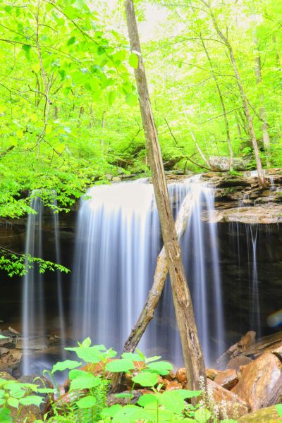
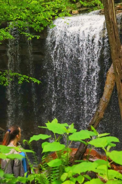
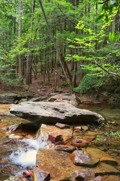
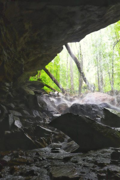
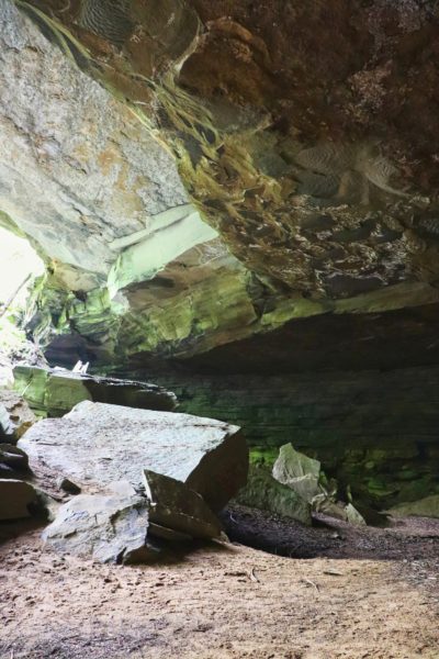
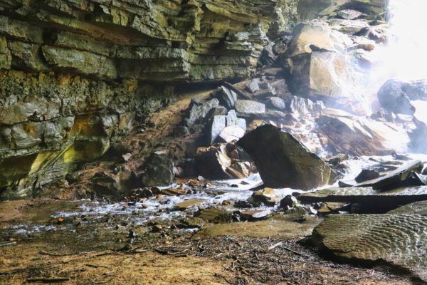
Big Laurel Falls is very unique because the water falls over a long ledge which forms a cave beneath it. Because of the way the land is shaped, the lowest part of the ground is actually behind the waterfall. So, instead of flowing outward like most waterfalls do, this one actually goes backwards and flows beneath the ledge and down into a small hole inside the cove below. This makes Big Laurel Falls one of the craziest waterfalls I’ve ever experienced.
How to Get to Big Laurel Falls
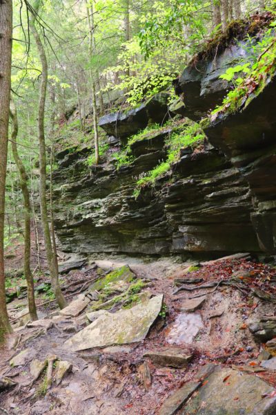
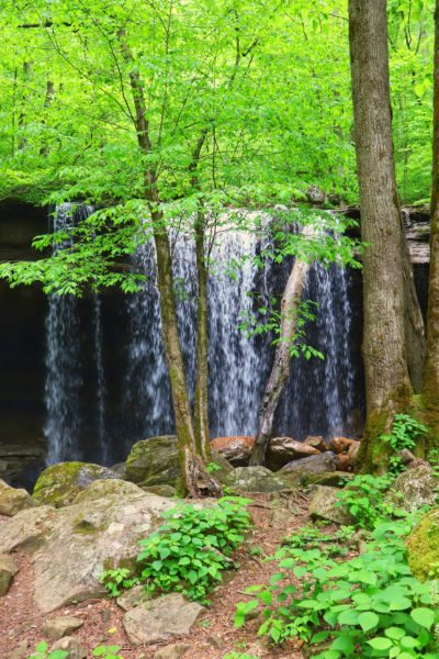
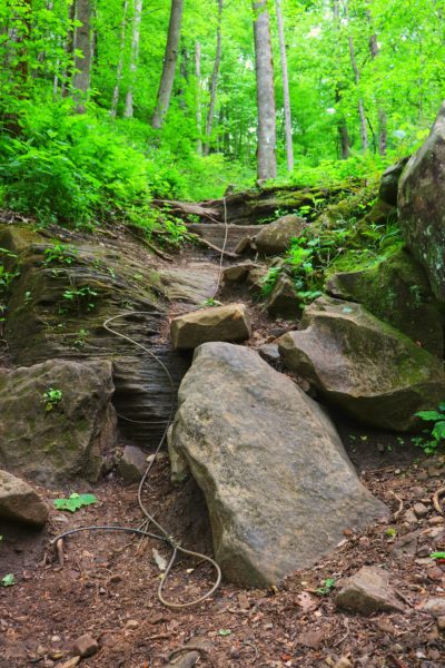
To get down to the actual waterfall you can take a shortcut trail that people have made. It juts off the main trail and is very steep down. If you’re like me and want to opt for staying on the main trail, you’ll pass this jut off and keep hiking past the falls. Soon you will come across a series of boulders you must climb down. Don’t let this intimidate you. There’s a cable to help you descend and it’s really not as bad as it looks. See the photo below of what it looks like once you’re down and the entrance to the falls from the main trail. In the last photo you’ll see people hiking down the steep shortcut trail.
Big Branch Falls
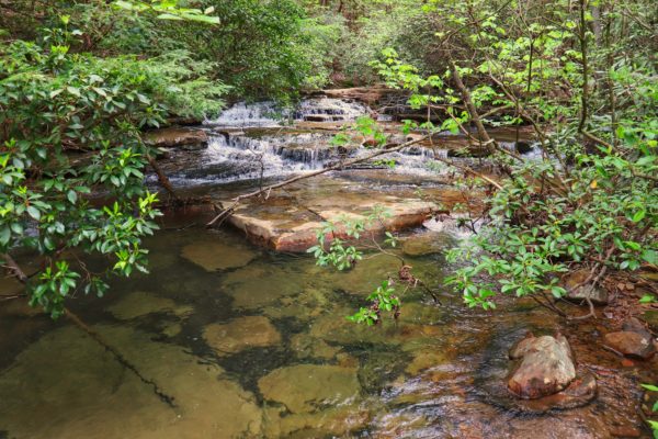
I can’t forget about the smaller, 15 foot waterfall, Big Branch Falls. This waterfall is right beside the trail and you’ll come across it early on in your hike. There’s some great areas around here to hang out if you’d like. I wanted to but we had to keep moving as time was slipping away. Although it is a smaller waterfall, this spot is very neat as well.
How to Prepare for the Hike
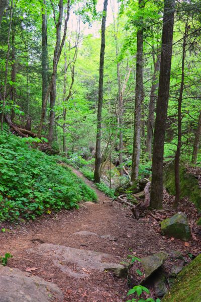
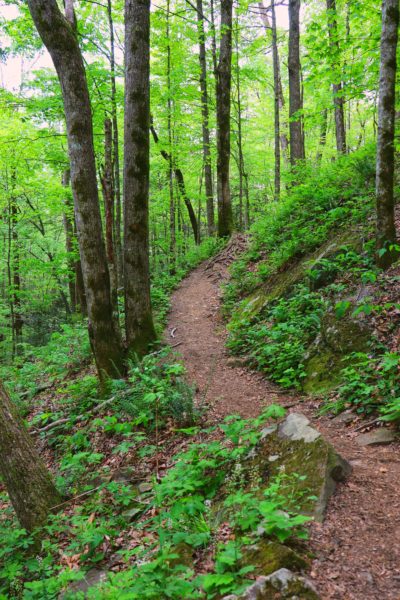
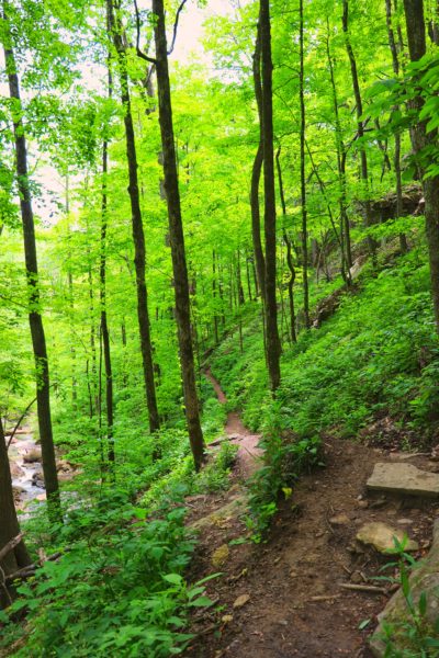
The hike to Big Laurel Falls is approximately 2.5 miles from the trailhead. The main reason this hike is considered more difficult is due to the hike back. It is all uphill. So, the hike down is fairly easy. But coming back, be prepared to take breaks and don’t push yourself too hard. There’s a few steep sections and some with steps. But for the most part the incline is more gradual, although constant.
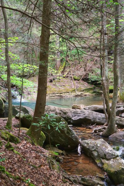
There’s a cable crossing at Big Laurel Creek about a mile and a half in. If it has rained recently or there’s a potential for high water, do not attempt this hike. When we went the water was at a perfect level to cross. But I can see how dangerous it would be if the water levels were much higher as they would be during rainy seasons.
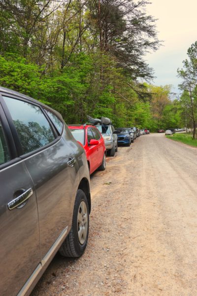
Be prepared for the uphill hike back, pack plenty of food and water, and you’ll be good to go on this beautiful hike to Big Laurel Falls. As I always say, arrive early. By the time we got there, the parking lot was greatly overflowed and it wasn’t even noon yet!
Also note, there’s actually a couple porta potties in the parking lot at the trailhead. I didn’t bother to see how they were, but I figured this offers more than most trailheads around here do in the way of restrooms.
Below Big Laurel Falls
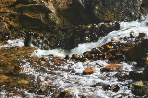
At Big Laurel Falls, if you proceed with extreme caution, you can carefully hike into the cove where the waterfall goes. I’m not gonna lie, this is one of the scariest places I’ve been. The ground is really soft from all the water and there’s no telling if or when the ground might open up and take you downstream underground. Plus, the ledge overhead might drop slabs, crushing or trapping you inside. Are you scared yet? Because these realizations while I was standing in the potential danger zone really terrified me. (Watch my video to see first hand how scared I was!)
Did I find going inside worth it? Yes, of course I was dying to see where the water went. Would I go in again? Probably not. And if you don’t want to, you can admire these photos instead so you don’t have to risk your own life either. Below is a photo of where the water rushes into a manhole sized hole that goes who knows where.
My Overall Experience
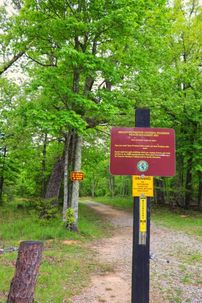
“It’s not as bad as I thought.” That is my conclusion of the entire thing. My friend and I both have heard the horror stories of people getting lost out here and getting hurt. There’s a helicopter landing area right by the trailhead too, which will add to anyone’s paranoia of these stories happening to them. But the reality is, the trail is well marked and if you go in spring and summer, you can’t lose the trail because the green forest floor will show you the way.
Also, that helicopter landing area isn’t even there for that reason. It’s there because it’s part of the Bridgestone/Firestone Centennial Wilderness Wildlife Management Area. Which is a massive area of land used to maintain wildlife and plants. This includes boosting populations of endangered species of both plants and animals. And one of their main tools in doing this is fire. Controlled fires promote a healthy forest and habitat for all sorts of plants and animals.
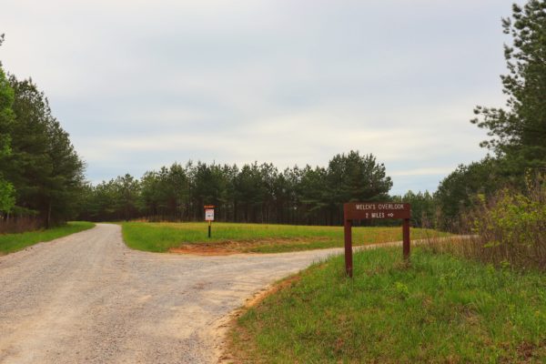
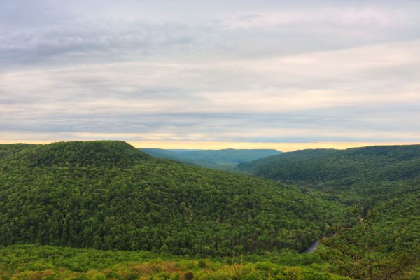
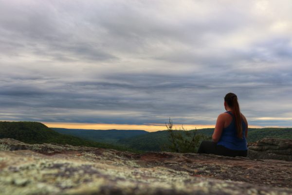
Welch’s Overlook
And that brings us to Welch’s Overlook. This overlook is a 2 mile drive from the trailhead and is located on part of the land that is the Bridgestone/Firestone Centennial WMA.
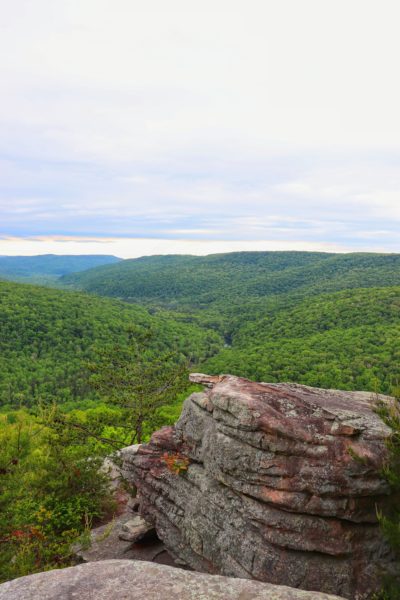
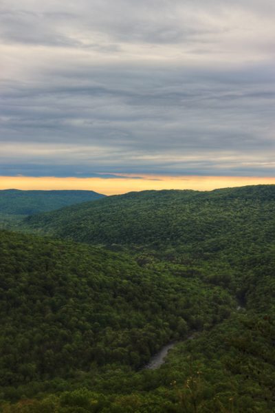
Welch’s Overlook is a great spot to catch the sunset after your hike. We wanted to do this, but as usual, it just didn’t work out. We didn’t have time to wait till sunset and it was really cloudy anyways. But next time we are hoping for clear skies and making a point to watch the sunset here.
Final Thoughts
Hiking to Big Laurel Falls is definitely worth the drive. This is pretty far from Chattanooga for a hike, but I believe it is worth visiting despite the distance. It’s about a 2 hour drive from downtown Chattanooga, but the drive is full of scenic farmland views. So, if you’re up for a mini road trip and a full day of hiking to see a waterfall like you’ve never seen before, definitely add Big Laurel Falls to your list. You won’t regret it.
Click HERE to watch my YouTube video of our adventure. Here’s the exact location of the Virgin Falls trailhead. And here it is for Welch’s Overlook. My friend and I want to go back and hike the entire trail to Virgin Falls next time. Until then, enjoy exploring Chatt!
Great Site! Love the detail on how far and if stairs.. I visited Gatlinburg area. I was told of a water fall, Greeniar / Big Creek. I can not seem to find any information on it. Looking forward to coming up in Spring after the leaves start coming out.. Hope to find some moderate hiking or for the wife. Thank you, David
Thanks! I haven’t done a whole lot of exploring in the Gatlinburg area yet but as I do, I will add all the info to the blog. Big Laurel Falls is one of the harder hikes for sure, but perfect for spring as there’s lots of wildflowers in the area. Spring is also good for waterfall hikes before they dry out in the summer time. Denny Cove is a good, moderate waterfall hike I would recommend. I have a guide on my site for it as well: https://exploringchatt.com/hike-to-denny-cove-falls-this-winter/