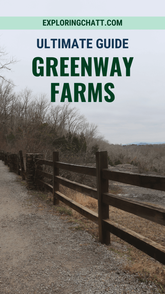
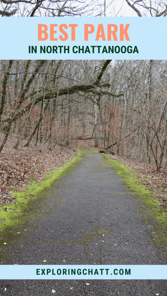
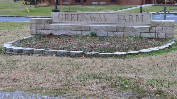
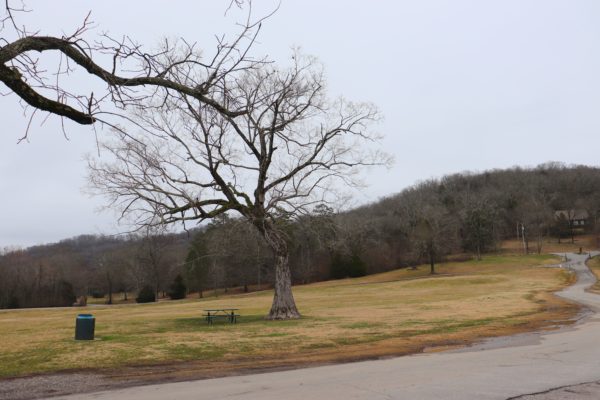
Greenway Farms is a park located in North Chattanooga that contains grassy hills, a dog park, numerous trails, kayak launches and more.
Located in Hixson, just north of downtown Chattanooga, is a well-loved park called Greenway Farms. Many people visit this park for hiking and paddling or to let their dogs enjoy the fenced-in dog park. And if you’re looking to get outside after it rains, I cannot recommend this place enough. Continue reading to see what all this park has to offer and why it’s the best park in north Chattanooga.
In a hurry? Pin this post for later:
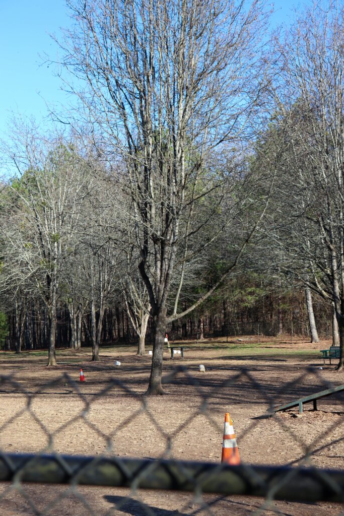
Greenway Farms Dog Park
Greenway Farms is a popular spot for dog owners. The dog park features two fenced-in areas. One is for smaller dogs only to run around freely. The other side is for either larger or smaller dogs to also run freely and have fun on the ramps. Both areas also have water for the dogs. Outside of these areas, dogs are welcome to walk on leash through the park with their owners.
The Trails at Greenway Farms
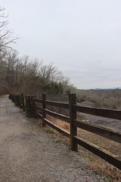
Greenway Farms is also loved for its various trails. Hiking, walking, and biking can all be enjoyed here. Below is a breakdown of the trails and what to expect from each.
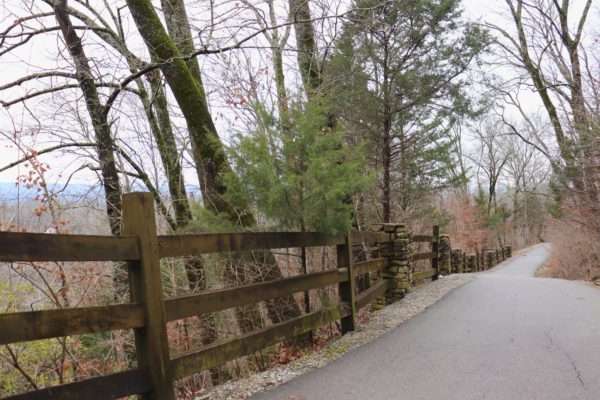
The Main Trail
Asphalt, Gravel, Dirt
Mostly Hilly, Some Flat, a Couple Steep Inclines
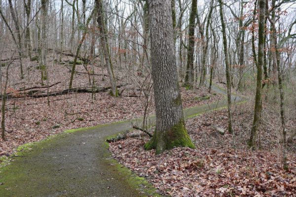
What I consider as the “Main Trail” starts at the front of Greenway Farms right by the Hamill Road entrance. If you follow the trail backwards toward Hamill Road, it’s a short distance asphalt trail that ends at the Bethel Bible Village property. Please respect the owners and do not trespass. If instead you walk away from Hamill Road, the first portion of the trail follows the creek at a distance and takes you towards the back of the park via a gravel trail and a couple of bridges.
At the back of the park is another parking area and the start of the next section. This is a there-and-back, 1.25 mile trail that quickly turns into asphalt as you go uphill. It plateaus and takes you back downhill as it continues through the woods a short distance from North Chickamauga Creek. This trail consists of gravel and asphalt and that is why this park trail makes for a great hike after it rains. No need to worry about slipping in mud or getting too dirty.
About halfway down the trail is a split where a narrower asphalt trail goes up a little higher to run parallel to the main trail. It doesn’t last too long before the two meet up again. Soon after this there’s a fork, that if you look almost behind you to the left, you’ll see this sign (below).
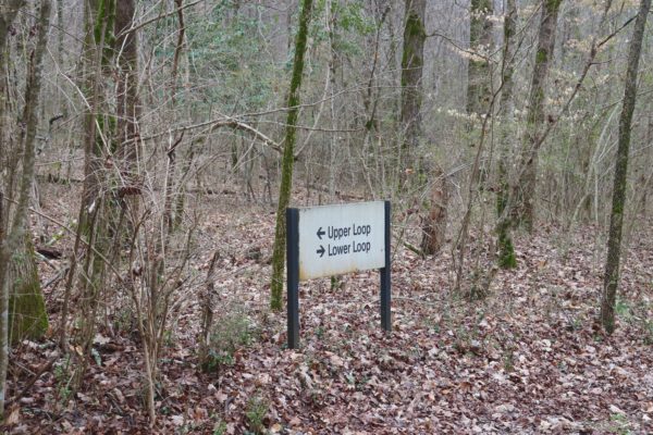
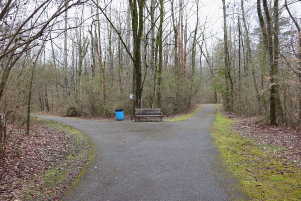
You can take either trail here and you’ll end up at the old park entrance. That’s why the sign is backwards. If you take the Lower Loop you’ll come out behind the restrooms. If you take the Upper Loop you’ll come out on a bridge close to the creek. At the old park entrance you’ll find picnic shelters, restrooms, a small field, and the old parking lot. There’s also a spot where you can walk down to the creek.
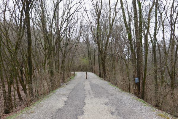
The Flat Dirt Trail
Dirt
Flat
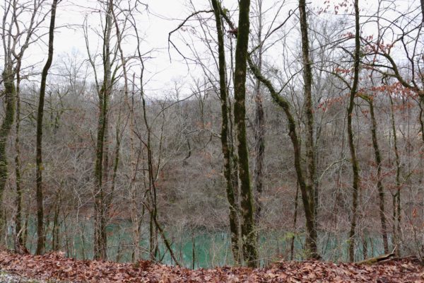
This trail doesn’t have an official name but “Flat Dirt” describes it well. You’ll find this trail on the backside of the huge, hilly field that centers the park. The trail is a big loop with three entrance and exit points off the gravel part of the Main Trail. This trail is about 1.5 miles long and follows the outline of a peninsula formed by North Chickamauga Creek. It does not get close to the creek, but you can see it through the trees. Because of the nature of this trail, it gets very slick and muddy after recent rainfall so I recommend avoiding this trail if it’s been wet out.
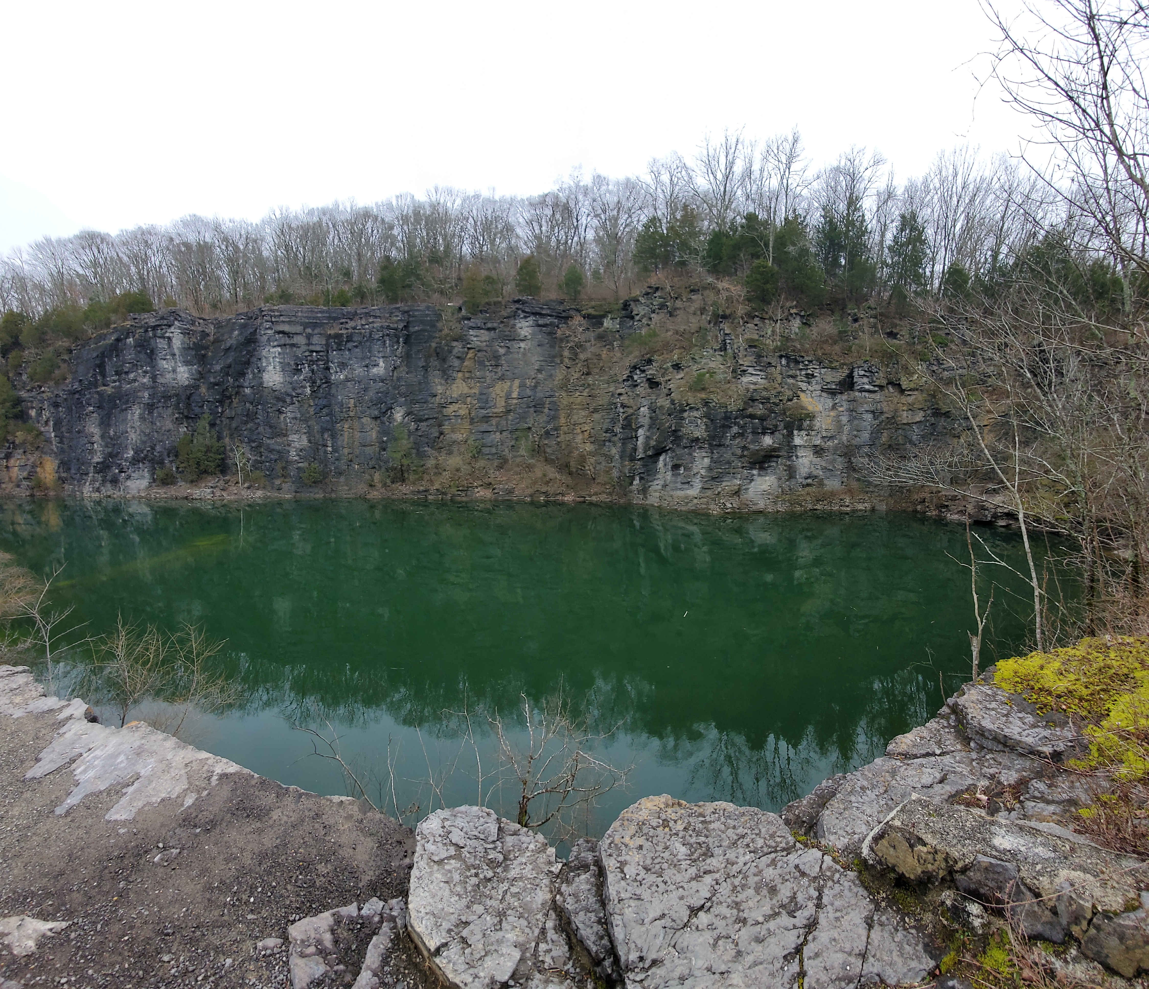
The Quarry Hiking Trail
Dirt and Rocky
Hilly with Rocky Steps
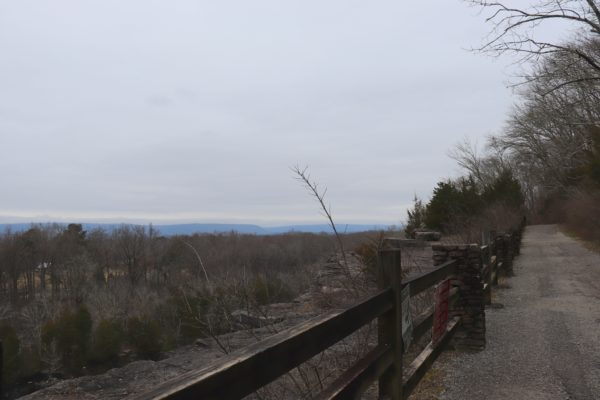
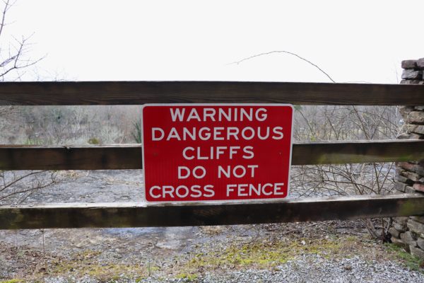
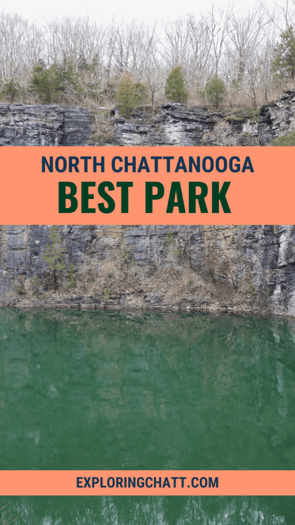
This short trail also has no name, but it goes across a small ridge that separates the quarry from North Chickamauga Creek. You can access this trail at the beginning of the second part of the main trail, right before it takes you uphill above the quarry. From here you’ll get the best high-up views of the quarry below. Be respectful of the property and do not cross any fencing or wander off trail. At the end you’ll find yourself at the bottom of the quarry trail.
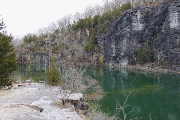
The Quarry Trail
Gravel
Steep Incline
If you’re approaching the quarry from the hiking trail, you’ll already be near the base of the quarry. To exit, simply go uphill and you’ll be back on the Main Trail. But if you’re approaching from the Main Trail, turn right as soon as you come back down the asphalt hill. There’s a gravel trail that goes down to the base of the quarry this way.
The bright blue, green water will look inviting, but “no swimming” signs will warn you not to enter the water. If you look up at the backdrop of this beautiful pond, you’ll see the main trail and where it crosses the ridge.
This old quarry was used to provide limestone for the construction of the Chickamauga Dam. The dam is nearly a mile away and some of the Main Trail crosses over the haul road they used to transport the stone to the site. If you take the Main Trail all the way to the old entrance, you’ll actually see the entrance that’s now closed due to construction. This construction is at the Chickamauga Dam itself.
Ropes Course Trail
Dirt and Rocky
Steep Incline with Rocky Steps
This dirt trail is for hiking only and starts near the top of the ridge above the quarry. The Ropes Course Trail takes you to the top of Big Ridge and back down again to meet up with the Main Trail at the other end of the quarry, still on top of the ridge. I’ve only hiked this trail once and actually got lost because it’s not well-marked. I ended up coming out on the street after crawling through some undergrowth. So, I always warn people to keep this in mind when attempting this trail. Hopefully I can figure out which way to actually go on the trail soon and I’ll update this post with more tips then.
Boy Scout Trail
Dirt and Rocky
Steep Incline with Rocky Steps
Just past the quarry is the section of trail that splits into two parallel trails. At the end of this is the start of Boy Scout Trail. This loop trail is just over a mile long and exists at the same starting point. You can find this trail marked with a map and name. Again, this trail is dirt and for hiking only as it also takes you further to the top of Big Ridge. I haven’t hiked this trail fully yet, but when I do I’ll update this post to share any more details that are necessary.
North Chickamauga Creek Access
The North Chickamauga Creek ends at the Tennessee River just outside Greenway Farms. Within the park though, are a few launch points for kayaks, canoes, or paddleboards to enjoy this calm section of the North Chickamauga Creek. This section of the creek can rise and fall with the changes of the Chickamauga Dam flow that’s immediately next to the park. With this fluctuation of the water, the creek will sometimes flow backwards in this area, or faster downstream. Be mindful of this if you plan to paddle here. Numerous trees line the banks of the creek so it’s common to encounter fallen trees partially submerged in the water or closely hanging overhead. For this reason, I would suggest only using hard-bodied paddle vessels.
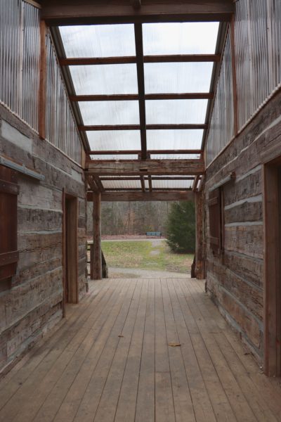
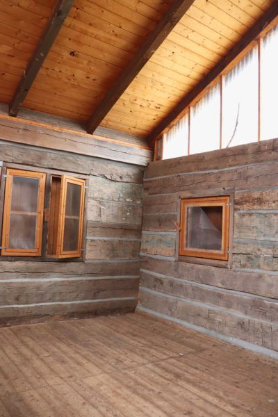
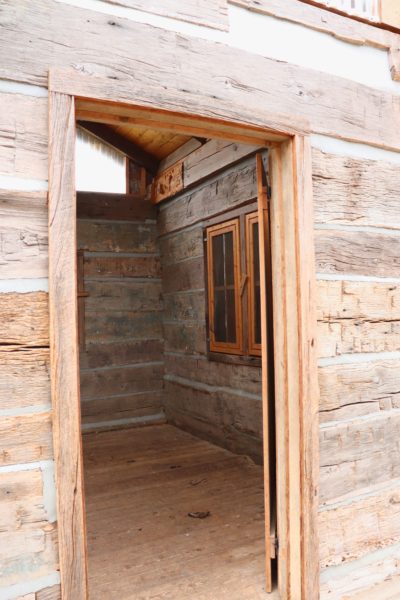
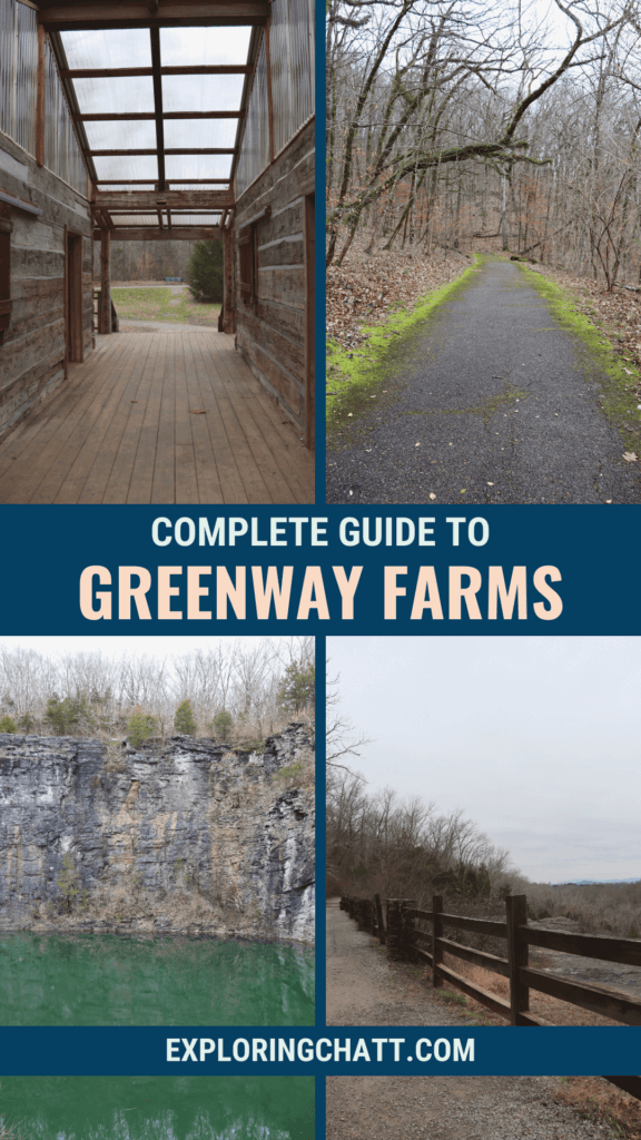
The Greenway Farms Cabin Shelter
Right before the Main Trail starts, you’ll notice this cabin to the right (pictured below). It was built here in 2011 from the wood of the original Sniteman Cabin. The Snitemans were pioneers who established farmland in this area, including the land where Greenway Farms sits. There’s also a plaque out front of the present day cabin shelter with a little more info about the Sniteman family.
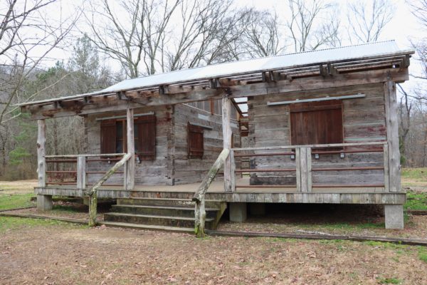
The shelter features a covered porch on either side, a covered walkway down the center, and two enclosed rooms. The rooms have screened windows and wooden doors which are open for you to wander through and enjoy. Throughout the year, various performances are held at this spot in the park from theatrical acts to live concerts.
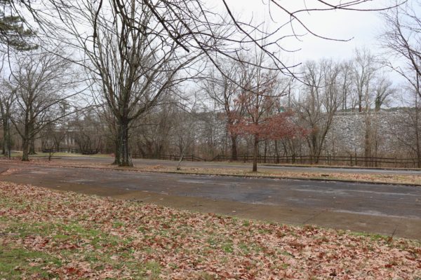
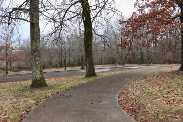
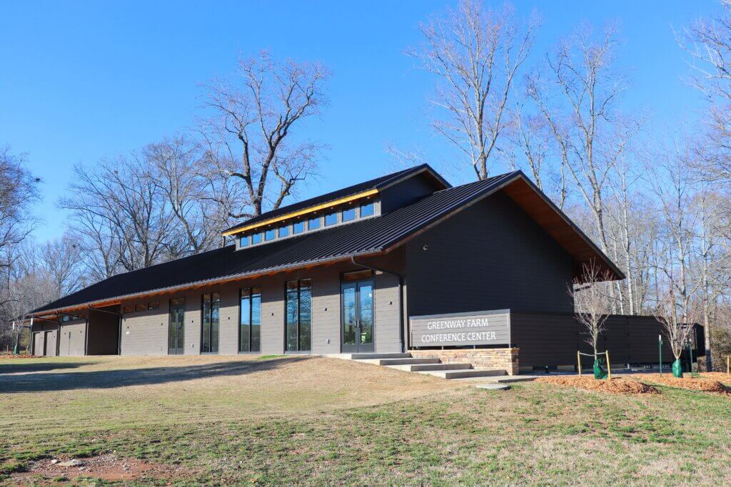
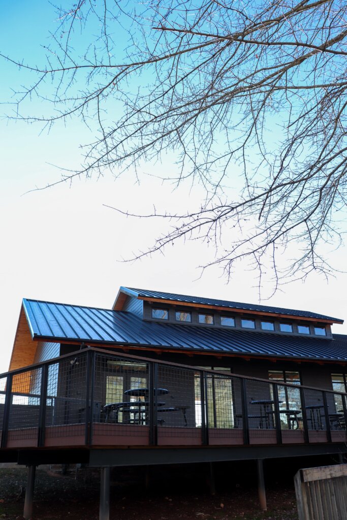
Greenway Farms Conference Center
The Greenway Farms Conference Center was recently rebuilt and opened in 2022 after a major remodel. The new space includes a full kitchen and large conference area that can be rented as an event venue for parties, special events, or business meetings. Across a covered walkway are restrooms that are open for park use as well. And on the backside is an open patio with round picnic tables. You can reserve this space on the Chattanooga Parks and Outdoors website.
Tips for Your Visit to Greenway Farms
Greenway Farms is owned and operated by the City of Chattanooga. Be respectful and obey all signs. They are put in place for your safety and allow this park to be open to the public.
As mentioned earlier, the park has other trails and even a fenced-in dog park. The main entrance into the park is off of Hamill Road. This will take you through two small parking areas by the first part of the Main Trail, the creek, restrooms, and dog park.
Personally I prefer to go in the back entrance, or maintenance entrance, off Gann Store Road. Follow the one way loop around the field and find a parking spot. There’s parking at the back of the loop and on the far side as well. The second part of the Main Trail starts down the gravel trail to the left of this entrance. The gravel trail leading up to it circles around and takes you to the front of the park.
In Closing
That about sums up Greenway Farms and why it’s the best park in North Chattanooga. This is an outdoor recreation haven where anyone can get out and enjoy the outdoors. Check out my other blog post if you want to learn more about some of my other favorite North Chattanooga parks.
Let me know in the comments below if you’ve been to this park before and what your favorite part of it is. And if you haven’t been yet, what part makes you most excited to visit. I’d really love to know! For a video tour of one of my hikes down the “Main Trail” after it rained, you can watch it on YouTube. Until next time, enjoy exploring Chatt!

The Best of Chattanooga:
- Best Chattanooga Pizza Spots
- Best Chattanooga Drive-Thru Coffee Shops
- Best Chattanooga Winter Waterfalls
Inspired? Pin this post for later:
Thanks for all the good information. I like to see places that we can check out if we are about 69 years old and want to stay safe, and not fall, etc. We moved here about 1 1/2 years ago and want to explore more. We would like to see maybe a waterfall that is not too far from a safe road (we have a car, not a truck!). Thanks again!
Thanks Holly! Greenway Farms is perfect for y’all. However, if you’re looking for waterfalls, I would highly recommend Fall Creek Falls State Park. In fact I have a one day itinerary that tells you where to go and most of the waterfalls are easily accessible: https://exploringchatt.com/enjoy-fall-creek-falls-state-park-in-just-one-day/
And this other spot is basically a flat hike in Soddy Daisy. If you go after a good amount of rain you’ll find a waterfall right on the trail: https://exploringchatt.com/winter-hike-to-see-after-rain-waterfalls/