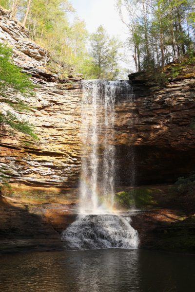
It’s been a life-long dream of mine to walk behind a waterfall. And I can gladly say that I finally got to! If walking behind a waterfall is on your bucket list too, then you need to add Piney Falls to your list of places to explore.
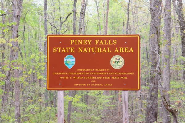
Piney Falls State Natural Area
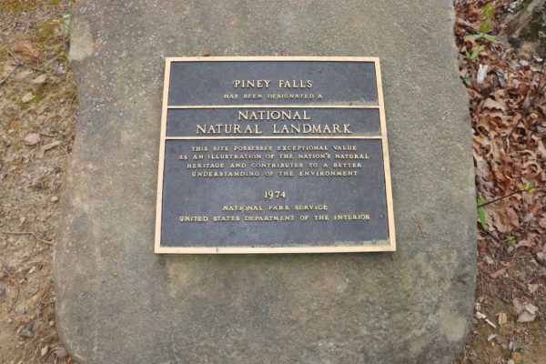
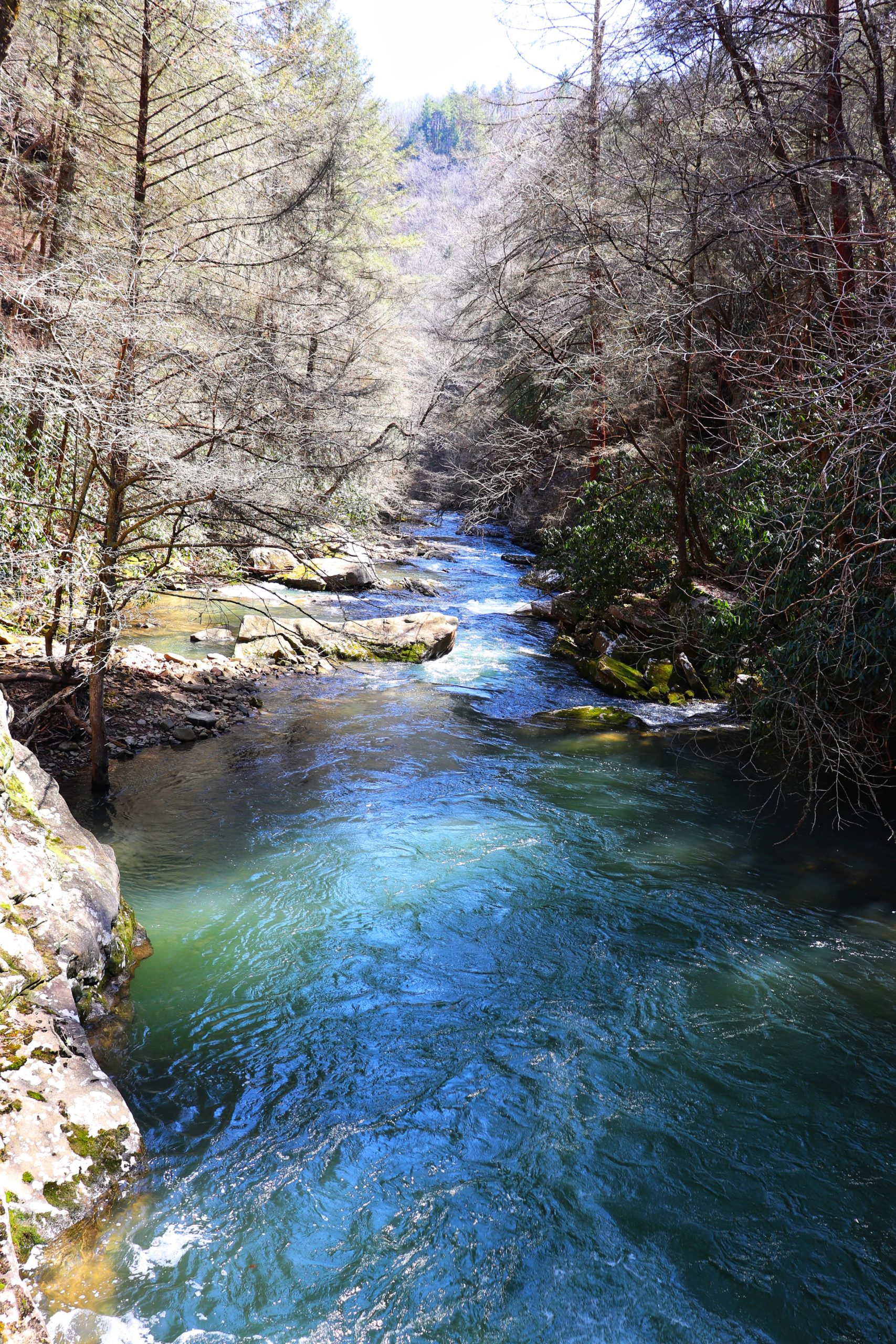
Piney Falls is comprised of two separate waterfalls, Upper and Lower Piney Falls. Both waterfalls are sourced by Little Piney Creek encompassed by 818 acres of state natural area. The area is a National Natural Landmark and is 1 of only 14 in the state of Tennessee. It has received this title due to the numerous old trees and geological features that fill the area.
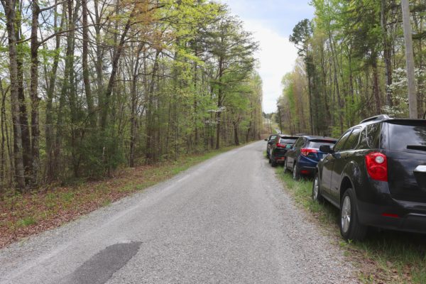
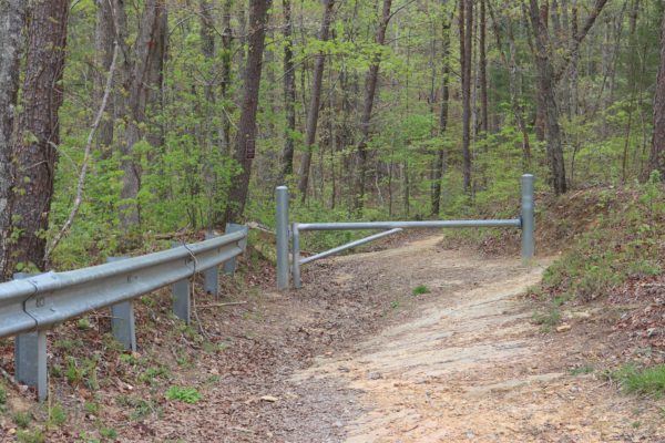
Piney Falls is easy to locate, just outside of Spring City, TN. It’s an hour and a half drive north of Chattanooga but the drive is worth it. The easiest way to get there is to take Highway 27 into Spring City, then take the rounded on ramp onto Highway 68. From here you’ll go up the mountain and pass by some beautiful scenic views. There are pull-offs here with picnic tables to enjoy too. Next time I plan to take advantage of this before heading to the trail. Right after the pull-off areas you’ll arrive to Emergency Road on the left, right after Firetower Road. The trailhead is on Firetower Road, but coming from this direction, it’s easiest to take Emergency Road which connects to Firetower Road behind the Grandview Opry. The trailhead is on the right after a short drive down Firetower Road. For exact location, click HERE.
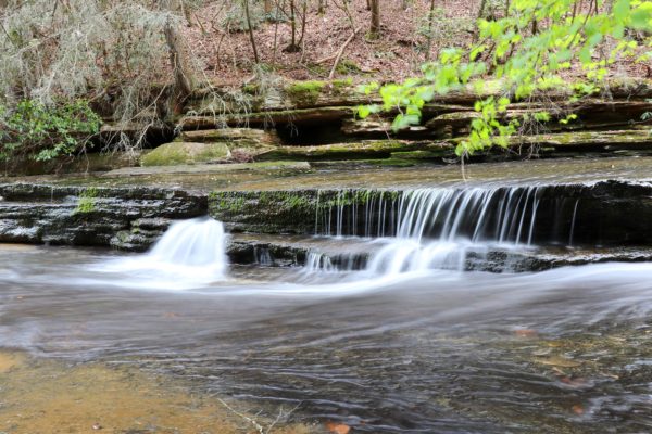
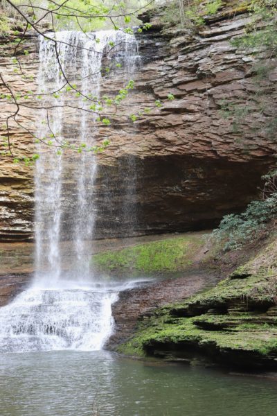
The Lower Piney Falls
Lower Piney Falls is the first waterfall we went to. Now, I had read beforehand some tips for this hike and got confused on where to start because of this. In hindsight, we should have just followed the tips instead. So, to avoid making the same mistakes we did, be sure to make note of my map and tips in the last section of this post.
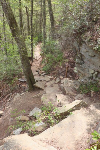
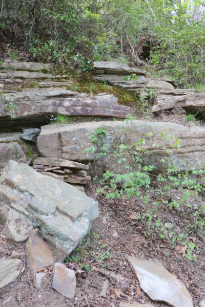
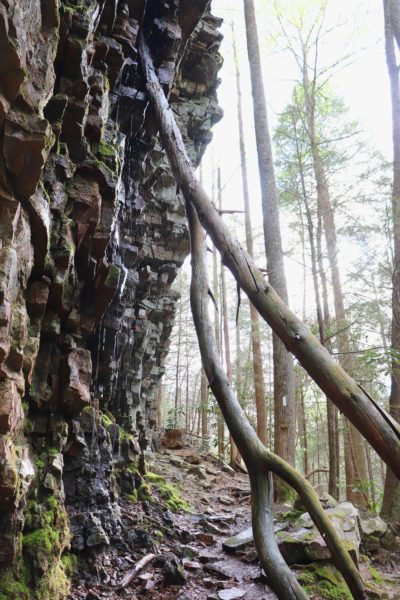
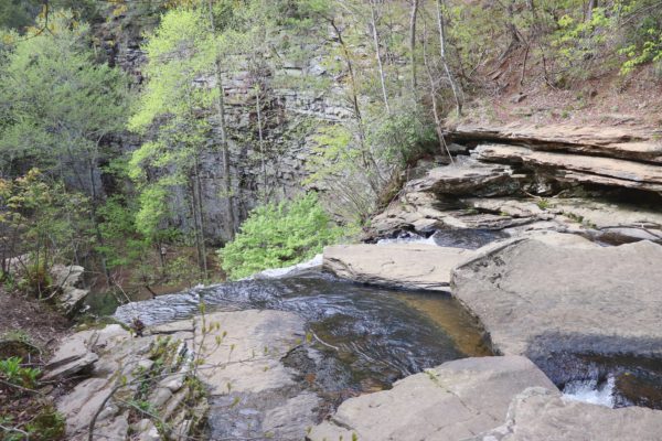
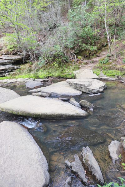
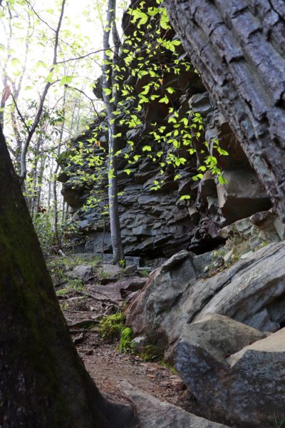
Anyways, the Lower Piney Falls are a short hike from the trailhead. Overall the trek is just over half a mile down to the falls. The hike is easy for the first three-quarters until you reach these giant rock steps that take you down to the next portion of the trail (see first two photos below). Soon after this, you’ll come up to a spur trail to the left which is wide and very steep. I found this stretch to be the most dangerous of our entire hike. You have to carefully navigate tree roots as steps and there’s not many trees or rocks to steady yourself as you descend.
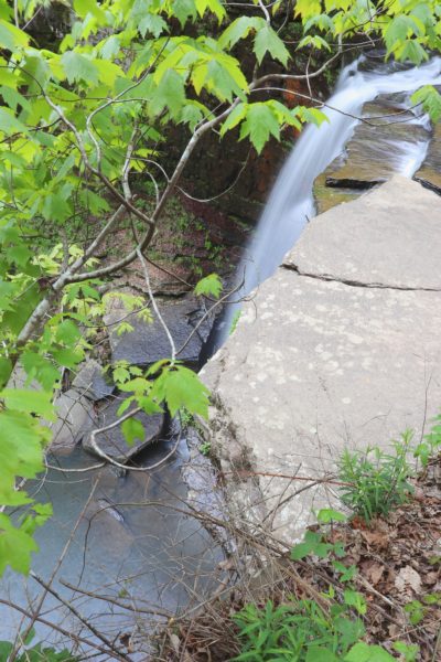
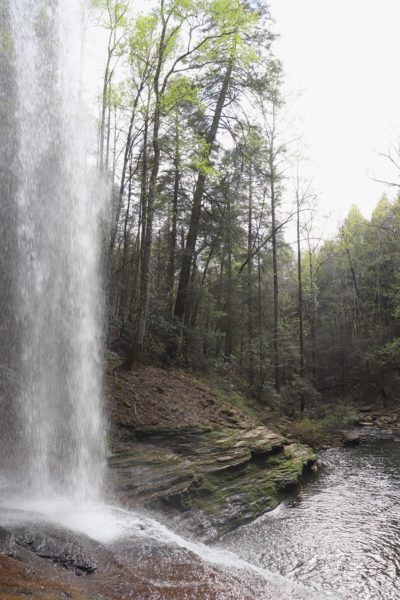
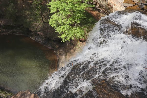
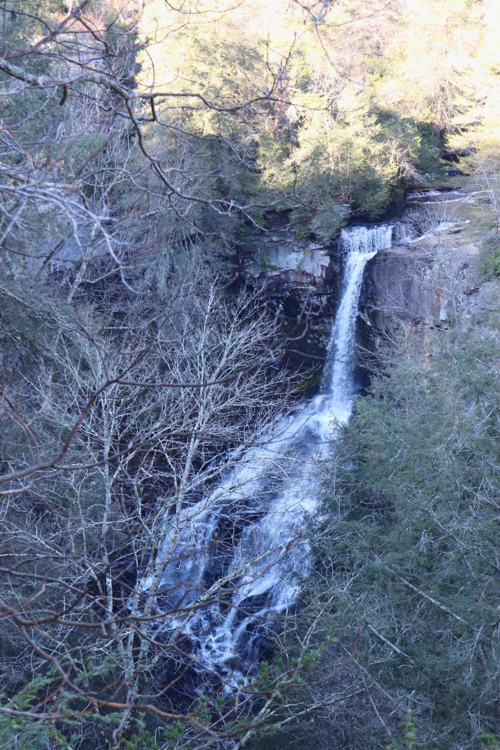
But the views of the top of Lower Piney Falls are well worth it. Just take your time and use caution and you’ll be fine. Once you reach the creek you’ll see various small cascades leading up to the edge of the Lower Piney Falls. If you’re careful, you can walk close to the edge and overlook the waterfall and pool below. There is no trail leading down to the bottom though so enjoy this area while you can before you move on to the star of the show, Upper Piney Falls.
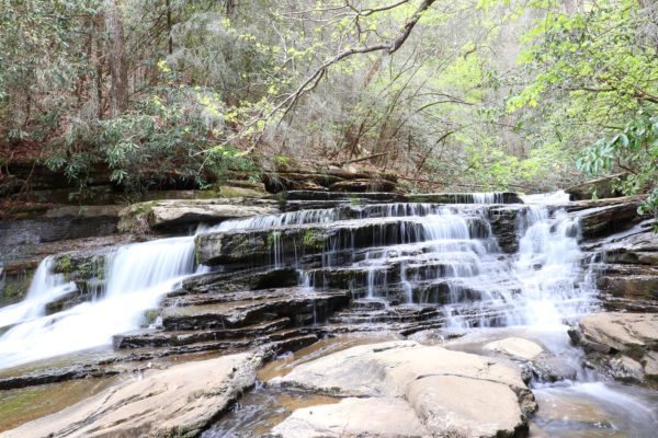
The Upper Piney Falls
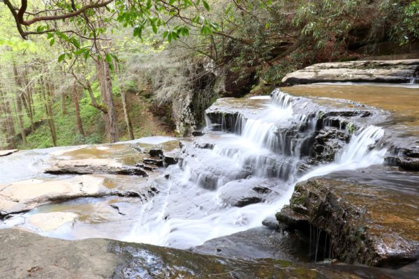
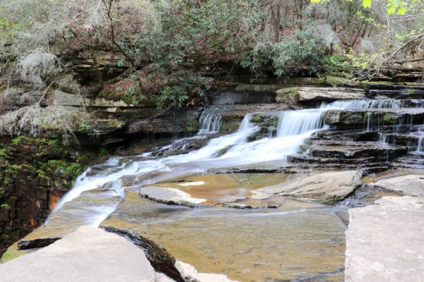
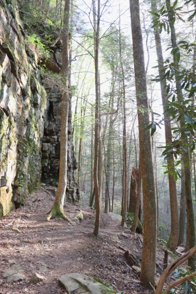
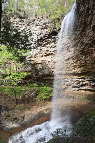
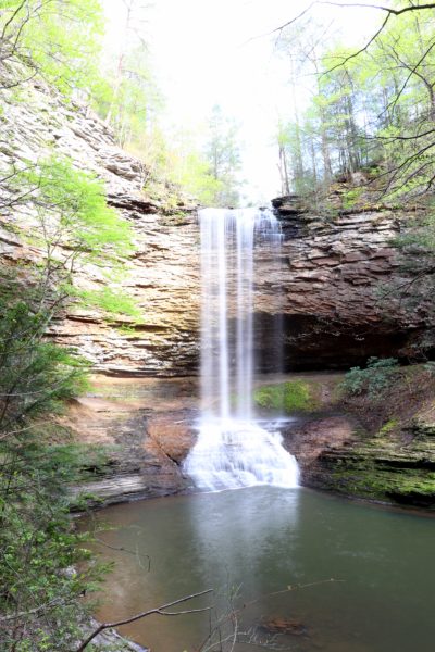
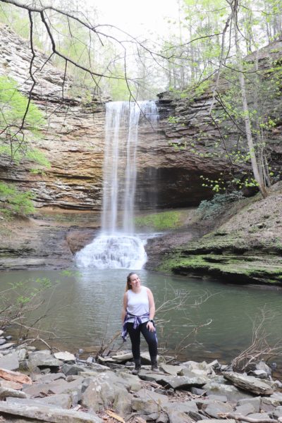
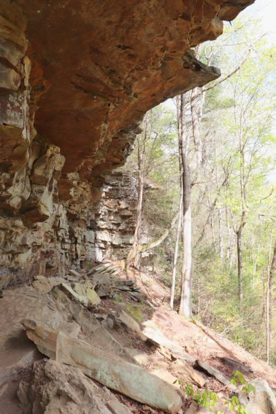
I consider Upper Piney Falls the main attraction because you can hike to both the top and bottom of the waterfall. And the best part is that you can even walk behind it. There aren’t many waterfalls around here that boast this amazing experience. The best way to get to the bottom of Upper Piney Falls is to head there immediately after you visit the lower falls. After you climb up the steep spur trail away from the lower falls, go left. Continue this trail about a third of a mile and you’ll reach the waterfall. Note that you need to stay close against the rock bluff the entire way. We went off trail a little on accident because against the rock bluff didn’t look like the trail when it was.
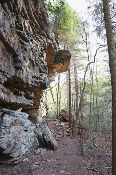
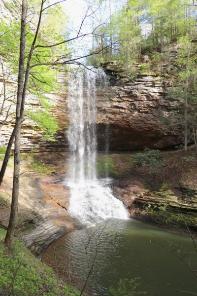
You can continue to hike beyond the waterfall and it will loop up to the top of Upper Piney Falls. We did not go this way though because this is the most challenging section of the trail. There’s a steep spot that has a cable to help you up. We intended on trying this direction, however I got mixed up and we ran out of time after going back and forth between waterfall overlooks. If you want to see the top of Upper Piney Falls without the challenge of the cable part of the trail, I suggest taking the trail to the right of the junction at the beginning of the initial hike. From the trailhead to the top of Upper Piney Falls is just over half a mile. And this brings me to key tips for your visit.
Key Tips for Your Visit
I had read before our hike that it’s best to visit the top of Upper Piney Falls first, then turn around and take the rest of the loop going clockwise. See the map below for reference. Start on the purple and go to the top of Upper Piney Falls. The green is coming back from that point down to Lower Piney Falls. And the blue is going the rest of the way to the bottom of Upper Piney Falls. Then you can hike back the way you came to go back to the trailhead. The part of the trail that we did not cover includes the steep cable part. This section is roughly a third of a mile in length.
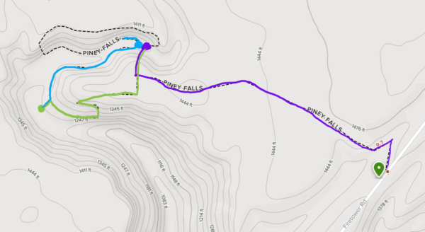
Initially, I wanted to do the entire loop including the cable part. However, I got confused after we stopped at Lower Piney Falls and it went downhill from there. We ended up going back and forth along the first half of the loop a few times before we finally made it to the bottom of Upper Piney Falls. So, if you want to do the full loop, I suggest (based on other’s experiences) that you do the loop clockwise, starting to the left of the junction. This will take you up the cable part instead of down, which should be easier.
Another item to note is the weather. Waterfalls fluctuate based on rain patterns. If it has rained recently you’ll see bigger waterfalls. However, I do not recommend hiking at Piney Falls after it’s rained. If the trail is wet, it will be very dangerous and difficult on the steep parts. This includes the spur trail down to Lower Piney Falls as well as the back part of the loop trail.
I love this short, yet somewhat challenging, hike. I can’t wait to visit again. My favorite part is definitely being able to walk behind the waterfall. And just for that, I highly recommend this spot. To watch the video from this hike, click HERE. Until next time, have fun Exploring Chatt!

I would like permission to print one of these images of Piney Falls. Please let me know if they are in the public domain or I’m happy to pay a fee I am a displaced Rhea County girl. I want to create a mural for my wall.
Oh that sounds beautiful! I’ll send you email about the photos shortly.
Hello again! Reno is almost finished so I’m ready to tackle this wall project. The photo I finally decided on is the very first full screen shot from the article “Go behind a waterfall”. I plan to create a mural above my bathtub. I will need a high res photo and I’m not sure downloading from your post will be enough. I will only use it once and promise to send pictures of the results. Please give me instructions as to procedure and cost. 🤞🙏
I sent you an email with what you need and can’t wait to see the finished product! Thanks for reaching out and allowing me to be a small part of your home project!