The Hiwassee River area is full of outdoor recreational activities. But Gee Creek is a hidden gem among these. It features a short and fairly easy hiking trail with multiple points of access to the refreshing creek. Keep reading to learn some hiking tips and history about Gee Creek.
Gee Creek Trail
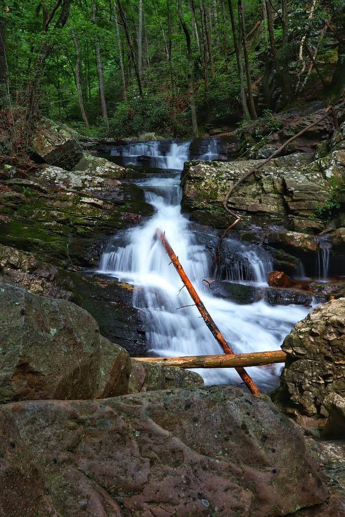
The Gee Creek Trail is a short there-and-back style trail. Its full length is just over a mile long although most people end about a mile in at what is commonly known as “Gee Creek Falls” or the “Twin Falls.” Beyond the falls is less traveled and more overgrown so it’s hard to say where the trail really is past here. Along the hike is Gee Creek itself which features numerous swimming holes, small waterfalls, and shallow streams. There are many points along the trail where you can venture down to the creek to enjoy the cool water. This is a favorite of mine, especially during the hot, summer months.
Gee Creek Wilderness
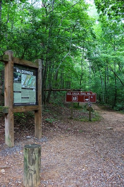
A part that confused me was the “Gee Creek Wilderness” sign that we passed about a quarter mile into our hike. This is because the trailhead and first portion of the hike are actually within the Cherokee National Forest. Whereas the remainder of the trail is within the Gee Creek Wilderness. The wilderness is comprised of over 2,500 acres that was established by Congress in 1975.

“What’s the difference?” You may ask. Well, national forests are protected but allow for camping and natural resources by the government. They typically surround national parks as a protection barrier for the park. For example, the Cherokee National Forest buffers the Smoky Mountain National Park. However, there are areas of wilderness that have been set aside to be just that. Wilderness areas are protected by the government from any sort of human subtraction, including camping. For example, you can camp in the Cherokee National Forest, in fact you’ll see a campsite along this first section of the trail. But just ahead is Gee Creek Wilderness where camping is not permitted. The point of the wilderness is to enjoy it as it is and not to mutilate or harm it in any way.

History of Gee Creek
Gee Creek is located near the Copper Basin. Copper was discovered in the basin and mined for in the 1850s. This led to the construction of the “Old Copper Road” which is now part of modern day U.S. Route 64. When copper ore is mined it has to be smelted. And in order to run the smelters they needed to utilize all the surrounding forests for lumber. Gee Creek was one of the forest areas that fell victim to the heavy lumber use.
During the smelting process silica is often used to bind with the impurities and extract them leaving the copper behind. Silica is often found in nature in the form of quartz. This is where Gee Creek comes in. The remaining concrete in the wilderness area are what’s left of the quartz mining flume (see photos below). This flume tunnels the water downstream and is often used with mining minerals.
How Nature is Affected by the Mining
In the early 1900s the Tennessee Copper Company came on scene and purchased almost all of the current mining companies in the Copper Basin. With this they built a smelter in Copperhill, TN which unfortunately caused devastation to its surroundings. This smelting process created an exhaust in the form of sulfur dioxide which turned into acid rain and killed what nature was left in the area. Due to this damage, lawsuits forced the company to find other alternatives. They quickly decided to use the exhaust and turn it into sulfuric acid to sell instead. It was a win-win for everyone, although at this point, so much damage had already been done. Over 32,000 acres had been affected by the copper mining and it showed in lack of plants, erosion, and lack of wildlife on both land and in the water.
Following the spiked demand for copper from World War II, came the massive decline in the 1950s. Mines were closed one by one with the final mine closing in 1987. Despite the ruin that was caused in the Copper Basin, the Tennessee Copper Company worked with TVA (Tennessee Valley Authority) in the 1930s to begin planting new trees and treating the earth with lime to absorb the remaining acid. By the turn of the century most of the area was reversed. Returned as well as possible to its pre-mining state. Cherokee National Forest and the surrounding wooded areas are what we enjoy today thanks to this restoration effort.
Tips for Hiking Gee Creek Trail
First of all, this trail is extremely easy for the first three-quarters of a mile. It’s part of the old logging and mining road so the trail is wide and mostly flat with the only steep elevation appearing in the form of rocks or tree roots that take you up about four feet at most. There’s only one creek crossing in this beginning section and it has a bridge. For all these reasons I would rate this trail as easy as Benton Falls or the Harrison Bay State Park Loop. Those being the two easiest trails I’ve hiked here in Tennessee.

You can easily hike this trail without getting wet, but I would suggest making the most of it and planning to at least wade in the water some. You can even walk through the creek by the bridge (which is how we crossed on our hike back).

How to be Safe When You Hike
Now for the bad news. Around the three-quarter mile is where things get more dicey. This is where you’ll see the remains of the quartz flume. With Gee Creek to your immediate left and a sheer rock face to your right, the trail forces you to carefully navigate broken boulder cliffs between the two. My friend did not feel comfortable attempting this so this is the point where we turned around to enjoy a spot in the creek further downstream.

I cannot stress this enough. Don’t do something you’re not comfortable with. I would have loved to go past this point to see the main attraction, but saftey was an issue. If you FEEL unsafe at some point while hiking, then you ARE unsafe. Just because others can get past an obstacle doesn’t mean you can too. In fact, many people choose this spot to turn around, we weren’t the only ones. This is crucial to understand because hiking is dangerous and you need to be confident in your skills. If you cannot confidently cross a point and there’s potential for injury, DON’T DO IT. That’s how people get seriously injured or even killed.

Now that I’ve scared you, let me reiterate that this spot is not impassible. In fact, I would have done it fine but I didn’t feel safe going ahead by myself so I chose not to. Trust your own judgement when it comes to hiking so that you stay safe. And remember there’s no shame in staying alive and unhurt!
Where is Gee Creek?
Gee Creek is a little off the beaten path so be sure to follow your GPS by using its exact location HERE. Also note that the last mile of road is rough asphalt and eventually gravel. If it’s rained recently there may even be big mud puddles to navigate as well. I had no issues getting to the trailhead in my vehicle though. There’s plenty of parking at the end of the road which is where the trailhead begins. Note there’s another trailhead here as well that takes you up Starr Mountain. We’ll have to save that hike for another time though.

When to go to Gee Creek
We visited Gee Creek on a Sunday afternoon and although there were other people there I would not say it was busy. That being said, I believe this trail is more off the beaten path so you can really visit at any time, for now. That could change later on though.
I also suggest visiting in the warmer months so you can take advantage of the easy creek access. If you make it up to the Gee Creek Falls there’s a deep enough hole to swim in. I believe some of the smaller holes downstream are deep enough too though. Of course, you can visit any time of the year if you want.
In Closing
I would like to go back and make it just a quarter of a mile further upstream to see Gee Creek Falls. One day I will, hopefully. But even if not it’s still worth the trip to enjoy a day by the creek. So even if you don’t go further than we did, know that it’s still well-worth it for an easy hike to enjoy nature and Gee Creek.
To watch the video of this hike, click HERE.
Let me know when you visit Gee Creek. I’d love to know what you think. Until then, enjoy Exploring Chatt!


