Chattanooga’s favorite spot to cool off in the summer is lovingly called the “Blue Hole,” but there are numerous hiking trails, picnic spots, great fishing, and more to be enjoyed in this Tennessee state park, North Chickamauga Creek Gorge.
The North Chickamauga Creek Gorge State Park is located on the south end of Soddy Daisy, TN. This once state natural area, now upgraded to a Tennessee state park, is full of hiking trails, but in the heat of a Chattanooga summer, you’ll find everyone rushing to their favorite swimming holes. Continue reading to learn more about this local favorite, how to navigate the trails, additional activities to enjoy here, and tips for your visit.
Important update for 2026: This park will be closed for some major renovations. Access to the swimming spots listed in this post will be closed until the renovations are complete. If you’re looking for somewhere to swim this summer, check out my guide on the 6 Best Chattanooga Swimming Holes.
PLEASE BE RESPONSIBLE. When you use outdoor spaces, take out what you bring in. Do not litter or alter nature in any way. Let’s keep these beautiful places amazing so that we can all enjoy them for years to come.
North Chickamauga Creek Gorge
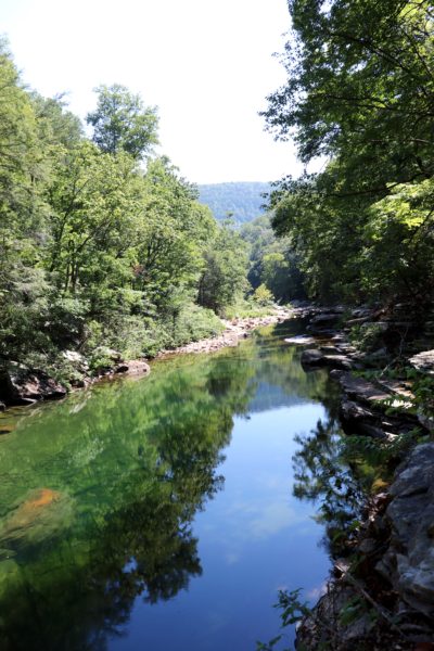
The North Chickamauga Creek Gorge was first a state natural area founded in 1999. The North Chickamauga Creek is popular for fishing, whitewater kayaking, and swimming in the summer months. With nearly 6,000 acres, 10 miles of creek, and 20 miles of hiking trails, this park is home to a variety of plants and animals.

Eventually, it became a popular trailhead in the Cumberland Trail system. Just a few years ago, it was adopted to be part of Tennessee’s State Park system. This is great for the park and its visitors because that means there is now more funding and resources available to improve and upkeep this high-traffic area.

The park is host to numerous activities in addition to hiking and swimming. It’s also a popular spot for fishing, white-water paddling, and rock climbing. Plus, there are a few backcountry campsites to enjoy along the Cumberland Trail segment that goes through the park. And if you’re willing to hike, there are a few waterfalls and overlooks to take in the scenery as well. You can learn more about the activities not detailed here (fishing, white-water paddling, and rock climbing) on the North Chickamauga Creek Gorge State Park website.
The Trails of the North Chickamauga Creek Gorge State Park
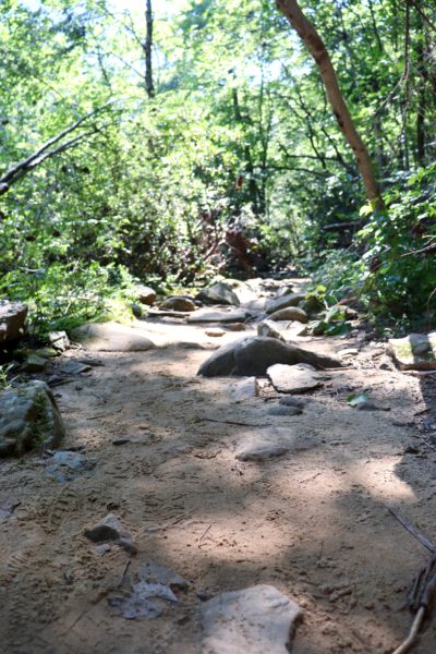
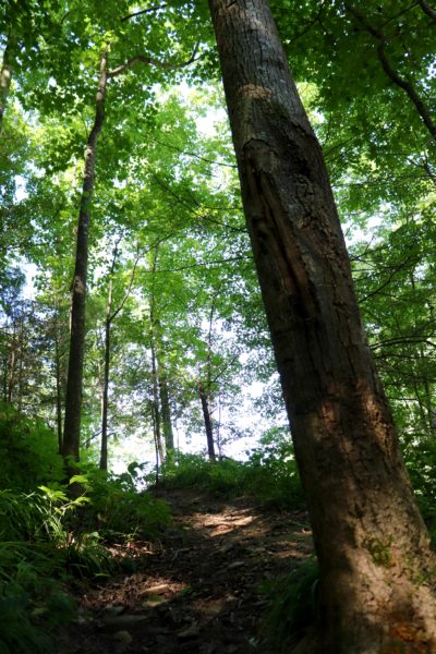
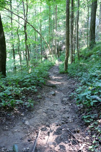
The North Chickamauga Creek Gorge State Park is home to 20 miles of hiking trails, although most summer visitors only come for the “Blue Hole.” Apart from that, there is more to see and explore along the portion of the Cumberland Trail that runs through this park. And now that this is a state park, that means we have the luxury of color-coded trails. If you look at the North Chickamauga Trail Map, you’ll see that each trail has its own color. These colors correspond with the colors of the blazes on each trail, making it easy to identify where you are at any given time.
Springfield Trail (purple)
This 1.45-mile trail goes backwards from the lower parking lot. It does require a wet-creek crossing that you might be able to rock-hop. On the other side, the trail continues uphill a little bit, but all along follows the North Chickamauga Creek. It ends at the main road outside the park, Dayton Pike. Although accessing this trail would seem feasible from Dayton Pike, there is no parking allowed here. There is also a school across the street that regularly uses this trail, so please be mindful of that.
Hogskin Loop (red)
The main trail from the upper parking lot is technically part of the Hogskin Loop. If you were to complete the marked loop, it would be a 1.5-mile hike. The trail is wide with minimal elevation change, but littered with rocks and tree roots. That is, just the base part, which is the main trail. Eventually, you’ll see the split with the trail sign that shows Hogskin Loop departs upwards to run parallel with the trail below. And eventually it will meet back up with the main trail after a little over half a mile. From there, it descends back down with some stone steps.
Blue Hole Trail (blue)
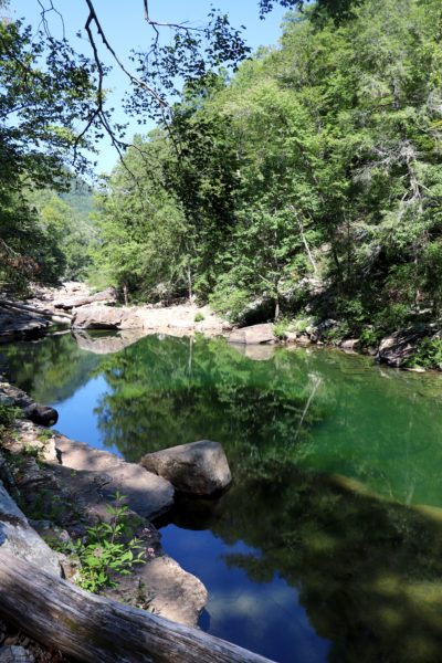
The Blue Hole Trail is only .7 miles long, but to get to it, you still have to hike nearly half a mile on the main trail. The Blue Hole Trail technically starts at the creek crossing, easily found by its signage. Here you will have to wet-cross or rock-hop the creek. On the other side, the trail remains close to the creek, where you can stop at any time and enjoy a swimming spot. The trail ends at the most famous of the swimming spots, the “Blue Hole.” It will be evident when you’ve made it this far.
Barker Camp Access Trail (orange)
At the back of the park is another trailhead, the Barker Camp Access Trail, with a 1.4-mile-long trail that connects the trailhead to the Cumberland Trail. This trailhead might be difficult for some vehicles to reach as it’s at the end of some long, rough roads. But if you can park here, this makes for a slightly shorter hike to the backcountry campsites, and it’s a good starting point if you still want to hike in the park while the main trailhead is closed for renovations. Please register ahead of time and follow the rules put in place for using the North Chickamauga Creek Gorge State Park backcountry campsites.
The Cumberland Trail (white)
As mentioned before, the Cumberland Trail also treks through this park. The North Chickamauga Segment is 16.35 miles long. It starts at the main trailhead within the park and continues up Signal Mountain, where it ends near U.S. Highway 127. There is also a trailhead on Hall Road on Signal Mountain to start at the far end if you wish. However, this trailhead is at the end of a gravel road and may be difficult to access for some vehicles. There are also designated camping spots along this segment of the Cumberland Trail. Please register ahead of time and follow the rules put in place for using the North Chickamauga Creek Gorge State Park backcountry campsites.
Waterfalls and Overlooks
Along the Cumberland Trail in this park, there are two waterfalls and two overlooks.
Stripmine Falls is a tall, but narrow, cascading waterfall that flows down into the North Chickamauga Creek. It’s the only waterfall I’ve been to in this park so far because the hike to it is short enough for a small day hike. However, I can say the trail is challenging with lots of ups and downs and narrow passageways along the edge of the ridges.
Beyond Stripmine Falls, about a mile is the Boston Branch Overlook. I hope to visit this spot soon because I love overlook spots on hikes.
Next would be the Stevenson Branch Falls, which are significantly larger than the Stripmine Falls, and end in a pool of water at the bottom that you could also swim in. This is also a popular backcountry campsite area. I have yet to explore this far back, though.
Lastly, there is the Panther Branch Overlook. Just like the previous overlook, it offers mountain-top views of the North Chickamauga Creek below with Signal Mountain in the background.
Flipper Bend (white)
On Signal Mountain, there is the Flipper Bend Trailhead. This gives you access to the 7.5 miles of hiking and biking trails that are part of the North Chickaumaga Creek Gorge State Park, but do not connect to the rest of the trail system. Within this area are 3 trails that connect to each other. The Flipper Bend Access Trail (2.3 miles) connects the trailhead to the Flipper Bend Loop (3.5 miles) and the Clear Branch Loop (1.75 miles). The Flipper Bend Trailhead is a small parking area, but easily accessible for most vehicles. Note, this is the only area of the park where bike riding is allowed.
Swimming at North Chickamauga Creek Gorge State Park
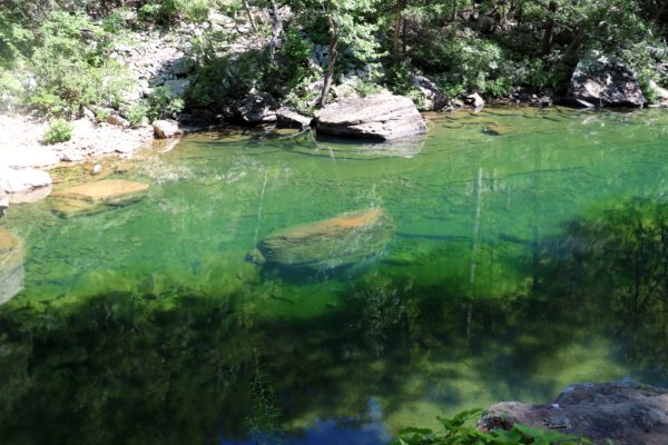
Undoubtedly, North Chickamauga Creek Gorge State Park is best known for the “Blue Hole” and all the swimming spots along the creek. There are multiple swimming holes, and depending on the time of the year and how much rain has fallen, there are both deep and shallow swimming holes to choose from. Please note that accessing these swimming spots can be difficult for some people, as it requires a hike of half a mile up to over a mile just to get out to the swimming holes. And these hikes require rock-hopping or wet-creek crossing as well as some rough terrain.
Tips for Visiting North Chickamauga Creek Gorge State Park
Safety
Whether you’re planning to swim, hike, rock climb, or just fish, it’s important to understand the natural dangers of this park. Please be sure to obey all signs as they are put there for your safety and protection, as well as the safety and protection of the people and wildlife around you. The North Chickamauga Creek can be high and raging if the conditions are just right. For this reason, the park has added a closure rating system. You’ll find this board at the main trailhead and again at the creek crossing for the Blue Hole Trail. Please abide by the rules given and enforced by park staff.
It’s also recommended that you wear the proper attire. If you’re hiking, be sure to wear sturdy shoes for the strenuous trails. If you are swimming, be sure to wear appropriate water shoes or secure sandals. If you need some recommendations on what I suggest for footwear and other hiking gear, check out my Hiking Essentials Guide.

Also note that rocks are slippery when wet, and the North Chickamauga Creek is full of rocks. It’s fun to climb onto the large boulders and jump into the deep “Blue Hole” below, but be careful when doing this. Make sure you don’t slip and injure yourself, and make sure the water is deep enough before you jump. Personally, I have jumped from these boulders a few times and have never had an issue. As long as you’re paying attention to what you’re doing, it’s a thrilling and fun experience.
I also suggest planning ahead and having a map ready for your visit. The trails are all well-marked and easy to navigate, but it’s always wise to be prepared with the North Chickamauga Gorge Creek Trail Map.
When to Visit
Despite the “Blue Hole” being the main attraction at this park, the North Chickamauga Creek Gorge State Park is fun to visit year-round. However, if you are planning on a summer visit, plan ahead and be prepared for busyness. I suggest arriving as soon as the place opens, as you may not be able to enter otherwise. People used to park on the main road outside the park, but there are signs clearly stating not to do this. If the parking lot is full, please move on to another place to swim. Again, I have other ideas for you in my 6 Best Chattanooga Swimming Holes.
This same rule applies to other peak times of the year, such as fall. This park has some amazing fall colors, as I share in my Fall Day on Mowbray Mountain Guide. The winter brings more of a lull, but the waters are usually higher, allowing you to enjoy more of the pretty blue hues as they flow over the rocks and pool in the creek. And in the spring, you’ll see some beautiful spring flowers along your hikes.
My Experiences at the North Chickamauga Creek Gorge State Park
I’ve been visiting this park for years, long before it was a state park. I’ve hiked to Stripmine Falls a few times as well as out to the “Blue Hole” and other swimming spots on the creek. My friends and I have always had a safe and fun adventure out here. If you want to watch our hiking and swimming adventure from the summer of 2020, you can watch it on YouTube.
Conclusion
I highly recommend visiting the North Chickamauga Creek Gorge “Blue Hole” to cool off in the summer, enjoy fall colors, or just enjoy nature right outside of Chattanooga. There’s plenty of room for everyone to have their space and enjoy their time at these swimming holes and along the creek in general. And with its close proximity to downtown Chattanooga, it’s clear why this is the locals’ favorite swimming hole spot.
Comment below if you’ve adventured out to any of these swimming holes. Or have you backpacked and camped by Stevenson Branch Falls? I’d love to know your thoughts! Until next time, enjoy exploring Chatt!