Enjoy panoramic views from the Cumberland Plateau via an easy hike on Black Mountain in Tennessee.
Black Mountain is located on the Cumberland Plateau in middle Tennessee. At the top is a big loop trail, an amazing bluff overlook, climbing spots, historical structures, and the Cumberland Trail that passes through. Keep reading to learn all the details about this hidden Tennessee gem.
In a hurry? Pin this post for later:


Black Mountain in Tennessee
Located in Crab Orchard,TN, Black Mountain is part of the Cumberland Trail State Park. Not only does the trail go over Black Mountain, but you can also drive to the top. There’s a mountain road that will take you up to a parking lot at the top where you can get out and hike a short distance to see historic remains and breathtaking views.
Black Mountain is nearly 3,000-ft. tall. The TennGreen Land Conservancy worked with the Cumberland Trail State Park to capture 518 acres atop the mountain to protect and allow the public to use for recreation. There’s miles of trails and ample rock climbing opportunities along the bluffs.
History: Who lived on Black Mountain in Tennessee?
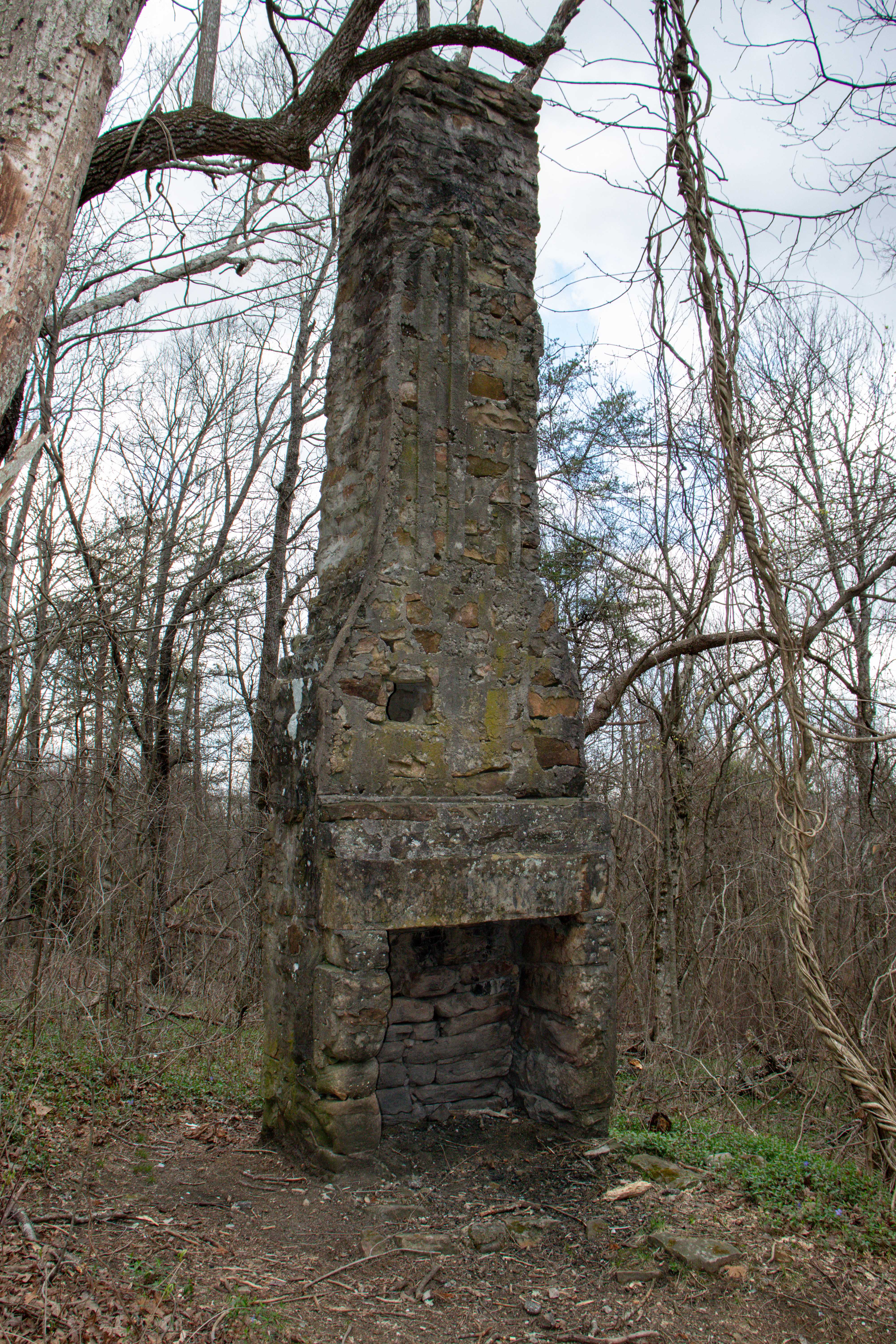
When you visit Black Mountain in Tennessee, you’ll notice the remains of a chimney and a spring house. From what I can tell, this is what remains of the summer house Dr. A.C. Gill and his wife Ella had in the late 1800s. When the Doctor passed away, Ella donated the property to Cumberland Mountain School for preservation and use in study, recreation, and worship.
Over the years, the Tennessee Annual Conference of the United Methodist Church became the owners of the land and continued the preservational use of the property. They first donated part of the property to TennGreen. In 2002, TennGreen was able to purchase the rest of the property on Black Mountain to make it what it is today.
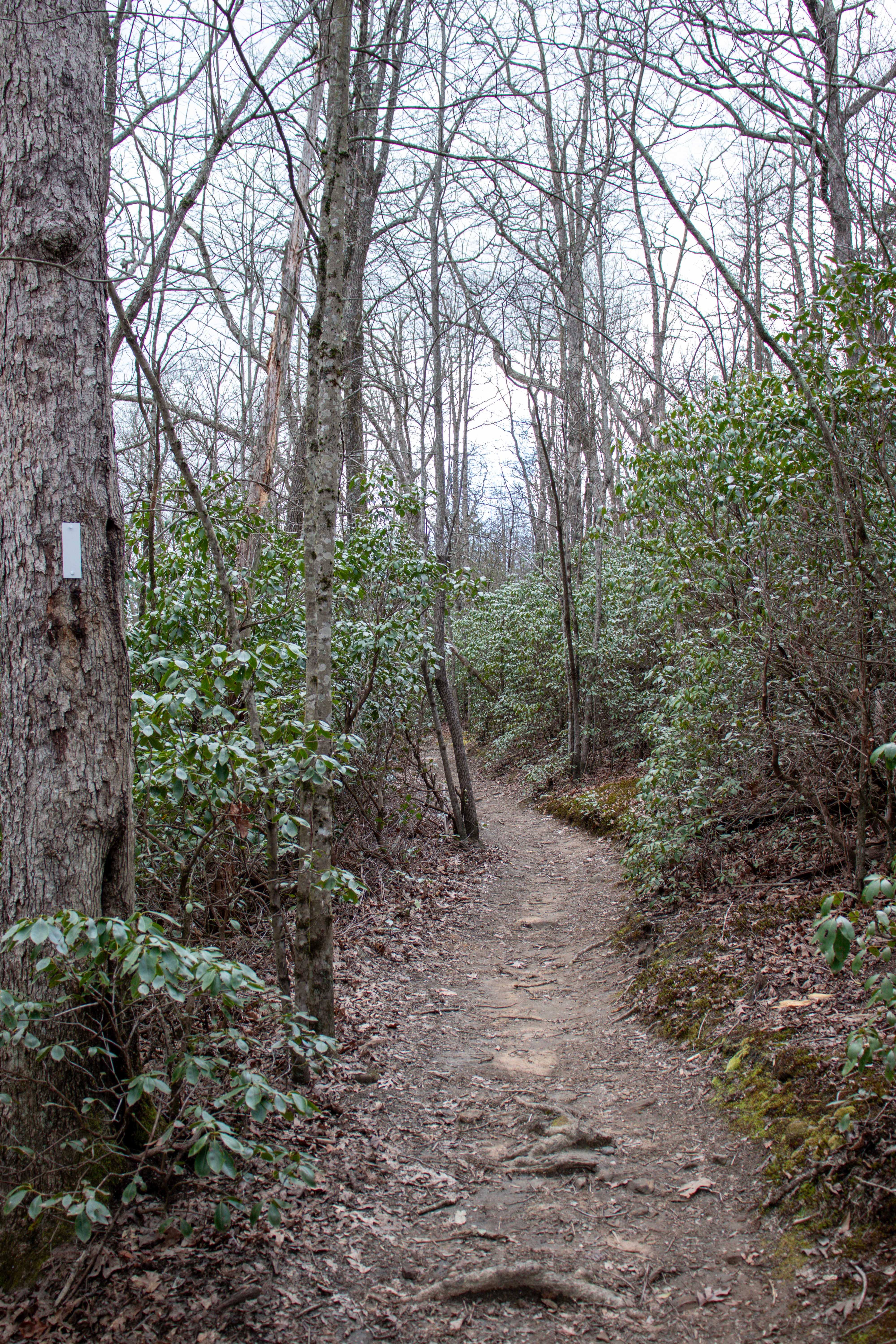
Hiking on Black Mountain in Tennessee
There’s various hiking options for Black Mountain so here’s a breakdown of each trail.
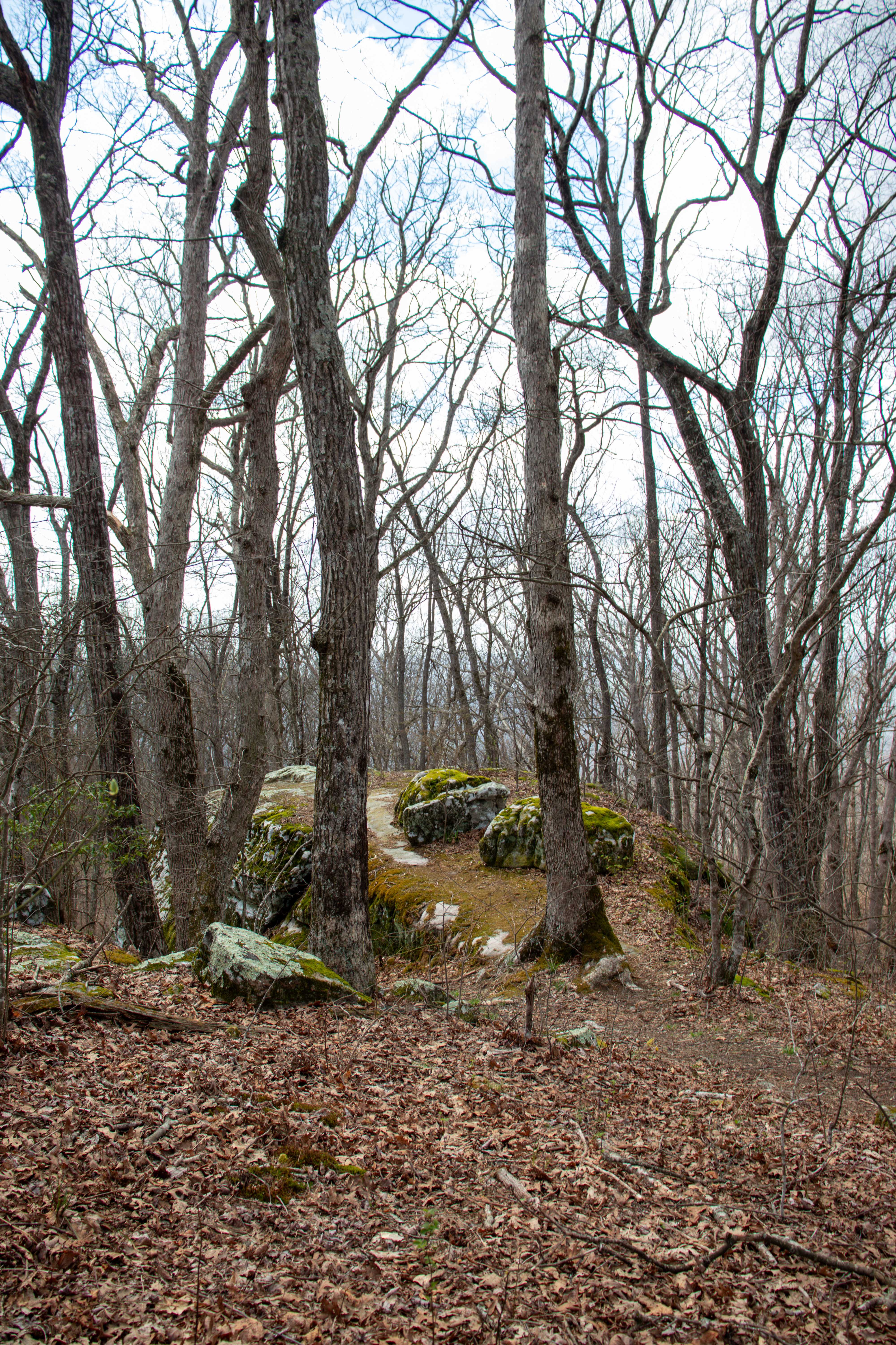
The main attraction of Black Mountain is probably the nearly 2-mile hiking loop at the top. Driving to the parking lot at the top is easy to access and the loop trails encompass the parking lot and towers that sit atop the mountain.
South Loop Trail
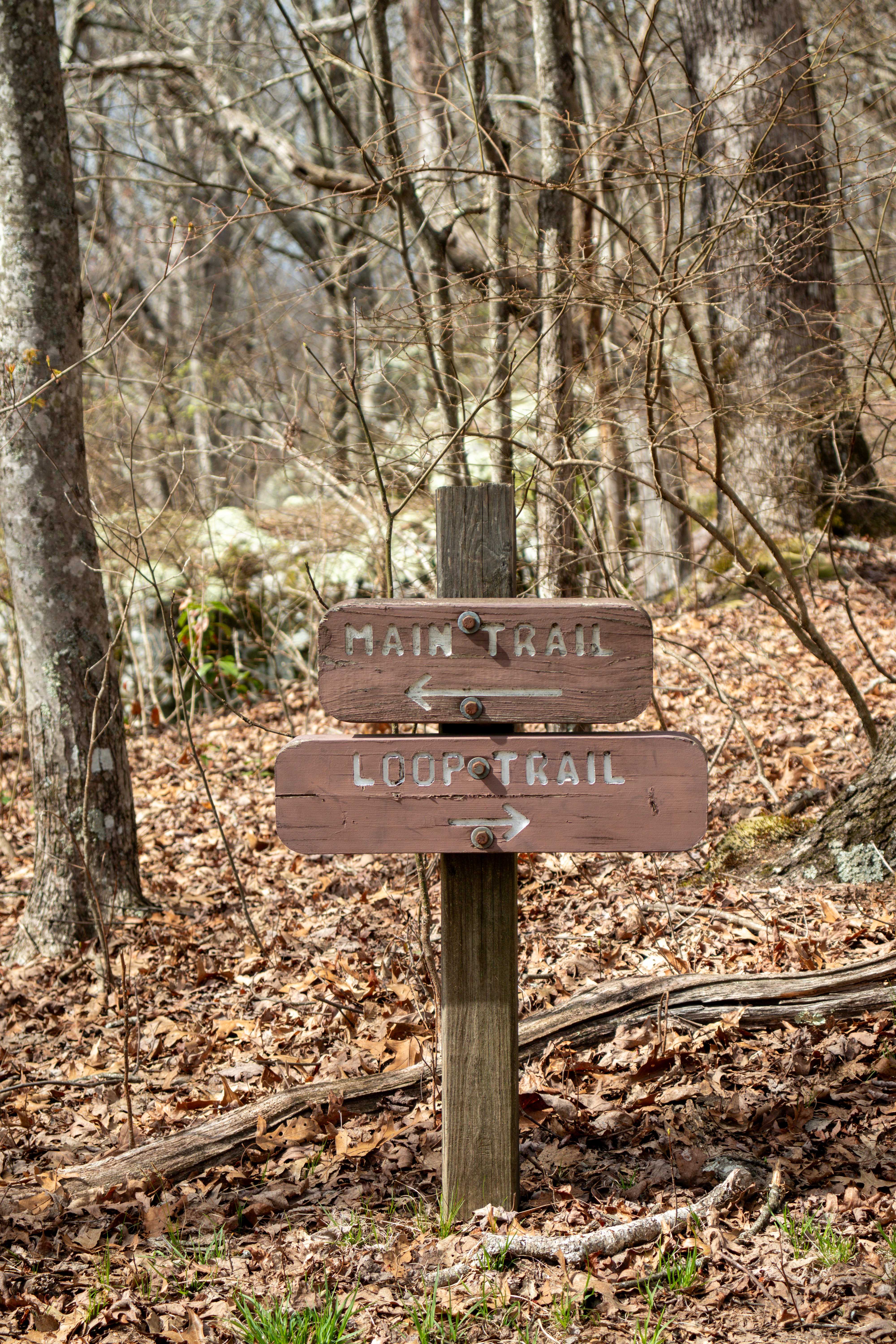
Start by heading down the trail from the parking lot that quickly crosses the road. Continue down this trail and eventually you’ll reach the trailhead kiosk. From here you’ll see the map of your options, and the spring house and chimney ruins. To continue on the South Loop Trail, just follow the trail sign for the Main Trail.
Below the Bluff Trail
If you’d rather hike below the bluff and go down the mountain a ways, you’ll take this trail from the kiosk. It starts just beyond the spring house. This trail is a little more than a half mile long and ends at the Cumberland Trail (Brady Mountain end).
Cumberland Trail (Brady Mountain end)
If you hiked below the bluff, you can turn right onto the Cumberland Trail to climb back up Black Mountain and be on the North Loop Trail. Or, if you want to continue down the mountain on the Cumberland Trail, you’ll turn left and head towards Brady Mountain. This is a nearly 6-mile trail down to the S.R. 68 trailhead.
North Loop Trail
Back on top of Black Mountain, the South Loop Trail turns into the North Loop Trail. This is also simultaneously the Cumberland Trail that goes over the top of Black Mountain. Once the trail reaches the road again, you can cross and continue your loop on the South Loop Trail again, or continue on the Cumberland Trail (Ozone Falls end).
Cumberland Trail (Ozone Falls end)
This trail continues down the other end of Black Mountain where it heads basically straight for Ozone Falls. This is a nearly 7-mile hike to Ozone Falls.
What I Suggest Hiking on Black Mountain in Tennessee
Full Tour
- Total Mileage: 1.8 mi.
- Elevation Change: 150 ft.
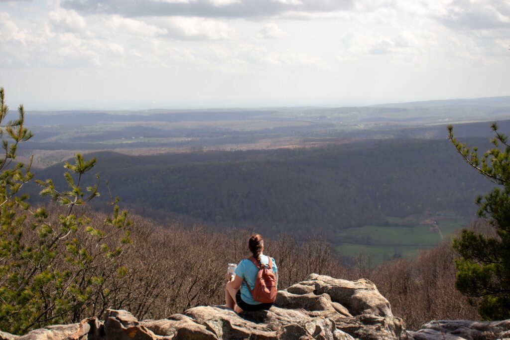
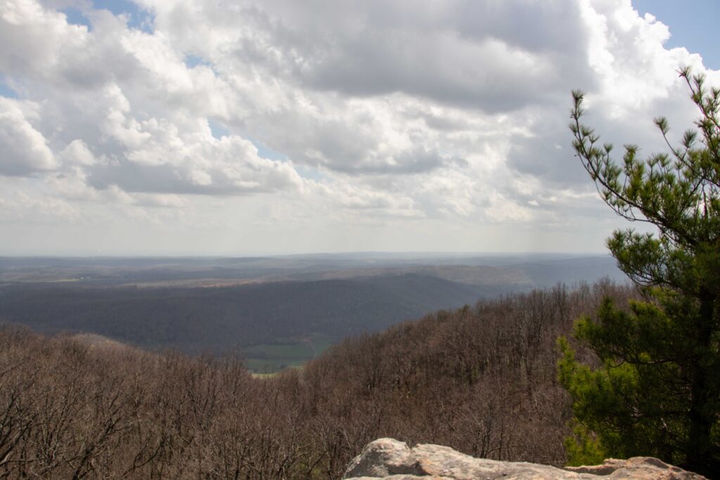
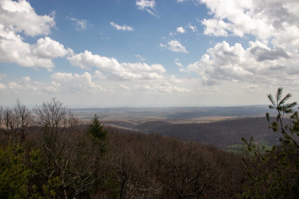
Since the Cumberland Trail intersects at multiple places and there’s a few different trails, this area can be a little confusing. If you’re here for a day hike, I suggest doing just the nearly 2-mile loop trails. Start at the parking lot, make your way to the trailhead kiosk, and continue on the South Loop Trail. Soon you’ll come across the South Overlook and enjoy the amazing views. Continue your hike around the mountain top and soon you’ll be on the North Loop Trail. Keep circling around and eventually you’ll reach the North Overlook. After this, the trail continues and eventually meets the road again. Cross, take the stairs, and you’ll be headed back towards the kiosk on the South Loop Trail where you can head back to the parking lot and end your hike.
Highlight Version
- Total Mileage: .8 mi.
- Elevation Change: 100 ft.
If you’re short on time or not up for a long hike, I suggest taking this route instead. Start from the parking lot and make your way to the trailhead kiosk by following the trail as it crosses the road. From the kiosk, check out the historic remains of the spring house, then continue on the “Main Trail” and head to the South Overlook. Enjoy the views, and when you’re ready, simply hike back the way you came.
The North Overlook is mostly blocked by trees so it’s really not worth the effort to visit if you’re short on time or unable to hike the extra distance.

Cumberland Trail
If you’re looking to backpack or do a long, strenuous day hike, then you should consider the Cumberland Trail. The Cumberland Trail is a partially completed trail that will span from the southern end of Tennessee and go north along the Cumberland Plateau to the Cumberland Gap National Historical Park in Kentucky. For the Black Mountain area you have the option to start at the S.R. 68 trailhead and hike north up Black Mountain, or start at the Ozone Falls trailhead and hike south up Black Mountain. Learn more about the Cumberland Trail and its various trailheads in my Complete Guide of the Cumberland Trail.
Rock Climbing on Black Mountain in Tennessee
There are numerous climbing points on the South Overlook. There’s a trail to access them below the man-made bridge at the overlook. With the beautiful views and many rock climbing options, I could see this being a popular spot for the sport. But before you set out to climb here, first check the Southeastern Climbers Coalition webpage for Black Mountain Tennessee.
Black Mountain Location and Directions
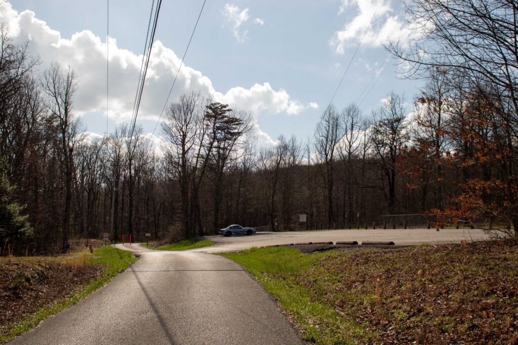
The Black Mountain parking lot is easy to find. Simply follow the directions from Google Maps. There’s brown park signs to help lead the way as well.
The road up the mountain is paved and easy to navigate, however it’s narrow so go slow and watch for oncoming traffic to make space. The parking lot is also easy to find right by a tower.
Tips for Your Hike on Black Mountain
Most likely you’ll have spotty cell service at best, so keep this in mind. Also plan ahead because there are no restrooms and the nearest public restrooms are a long drive from here.
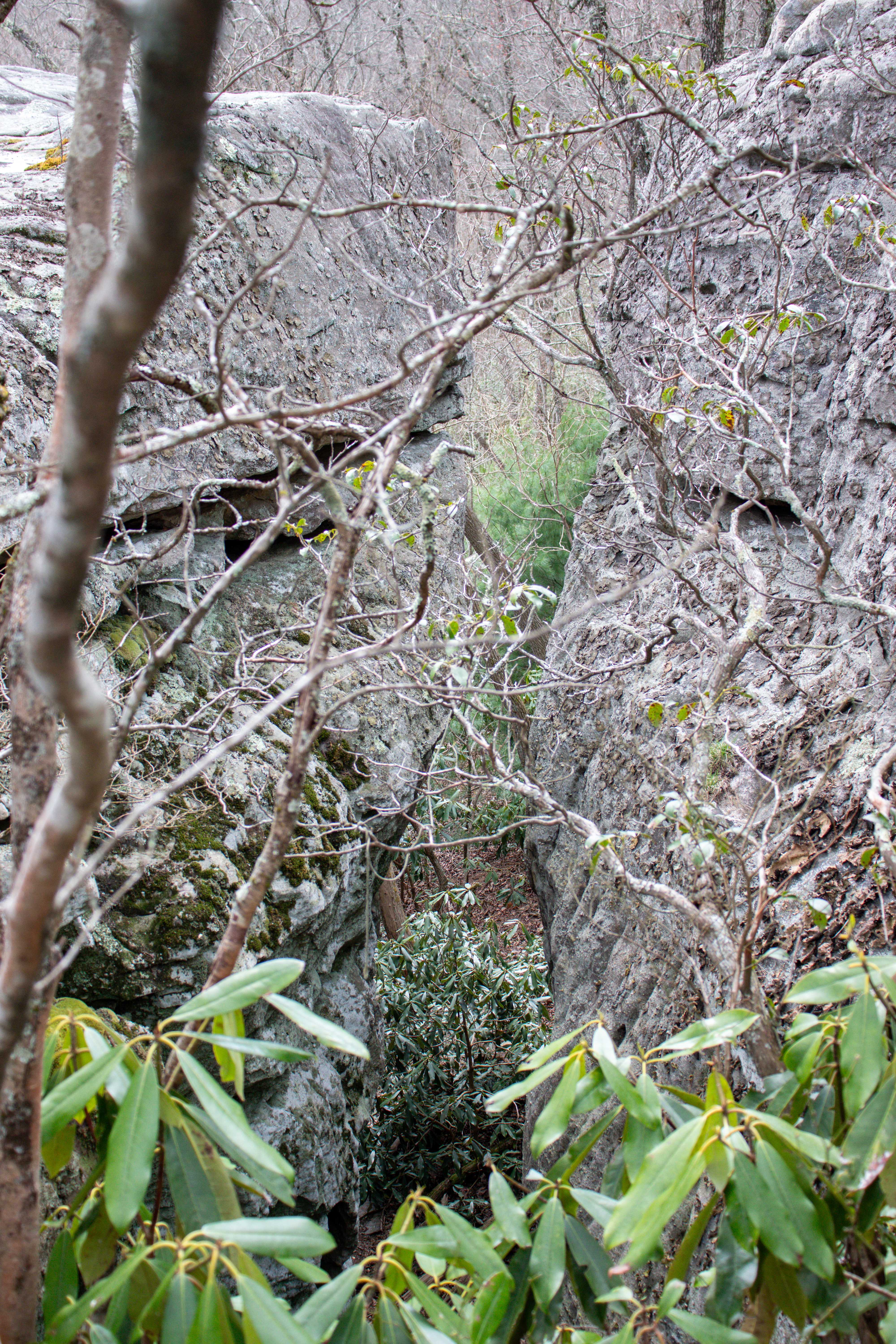
Be cautious of the South Overlook. It’s a series of bluffs with deep crevices in between. There are numerous trails and some are dead ends. Just be careful while exploring this area.
If you take the “Full Tour” hiking route that I suggested, you can also cut the hike a little bit shorter by taking the road back up to the parking lot instead of crossing the road and finishing the South Loop Trail back to the kiosk. However, I suggest you complete the hike via the trail for safety. You’ll see we did this cut in my YouTube video of the hike.
Closing Thoughts
Black Mountain is an easy hiking location with breathtaking views from the South Overlook. I highly recommend visiting the next time you’re staying in the area or near Crossville, TN.
Be sure to watch my YouTube video of the hike to really get a picture of what to expect here. And let me know in the comments below if you’ve hiked here or somewhere else nearby. I’d love to hear your thoughts! Until next time, enjoy exploring Chatt!

Explore More Near Crossville, TN:
- Historic Cabin Stay at Cumberland Mountain State Park
- Day Trip Guide to Crossville, TN
- See the Head of Sequatchie
Inspired? Pin this post for later: