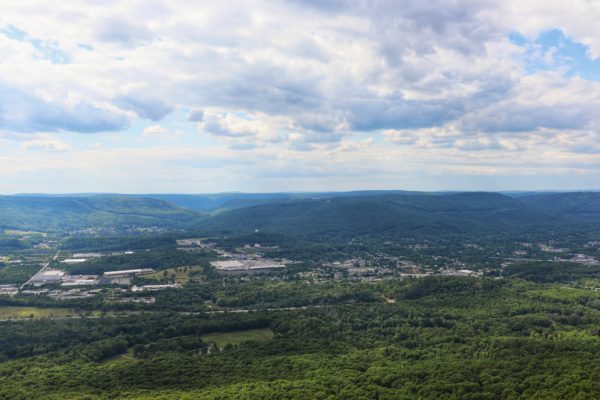
In short, yes, hiking to Sunset Rock is better than driving there. “But why?” You ask. And the reason is actually quite simple.
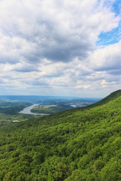
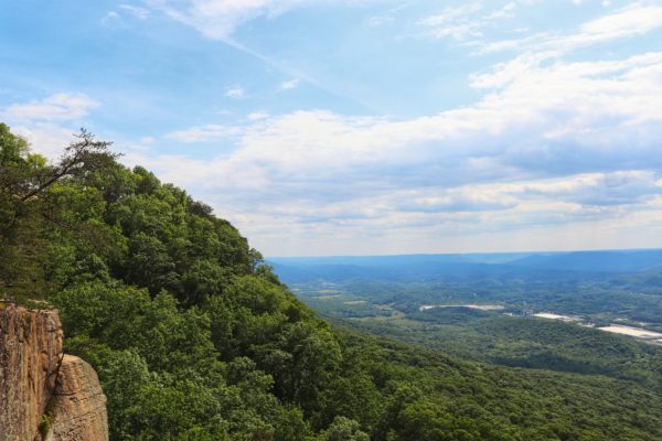
Sunset Rock is a very popular Chattanooga vista. Because of this, the small parking lot is almost always full. But, you can hike to the same spot and enjoy additional views and the beauty of nature along the way. Continue reading to learn how to hike here, all the trail options, and tips for your adventure. By the end, you’ll understand why hiking to Sunset Rock is better than driving there.
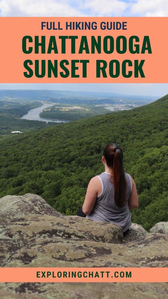
In a hurry? Pin this post for later:
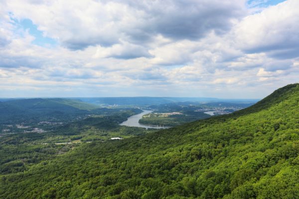
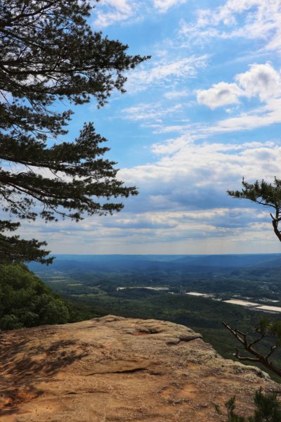
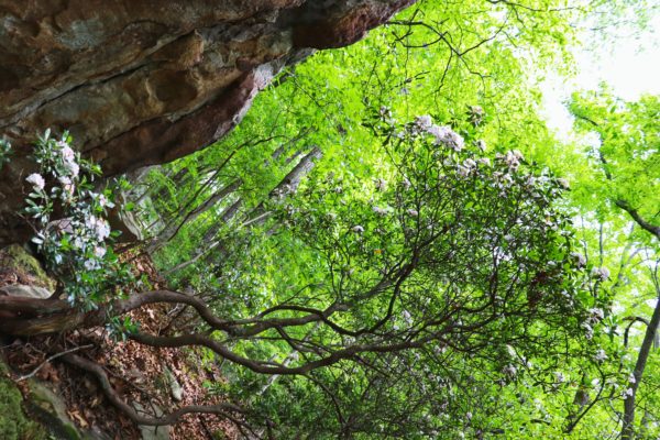
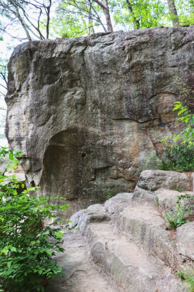
Sunset Rock
Sunset Rock can also be accessed by car and a short hike of .2 miles. But the parking lot for this spot is hard to use. It’s a tiny lot and is almost always full. Not only is it easier to find a parking spot at a different trailhead and hike to Sunset Rock, it’s also more rewarding. There’s something about working hard for something that makes you appreciate it more than if you didn’t have to work much for it in the first place. Sunset Rock is the perfect example of this. But, if you insist on driving to it, you can learn how in my Chattanooga Sunset Guide.

Trailheads for Hiking to Sunset Rock
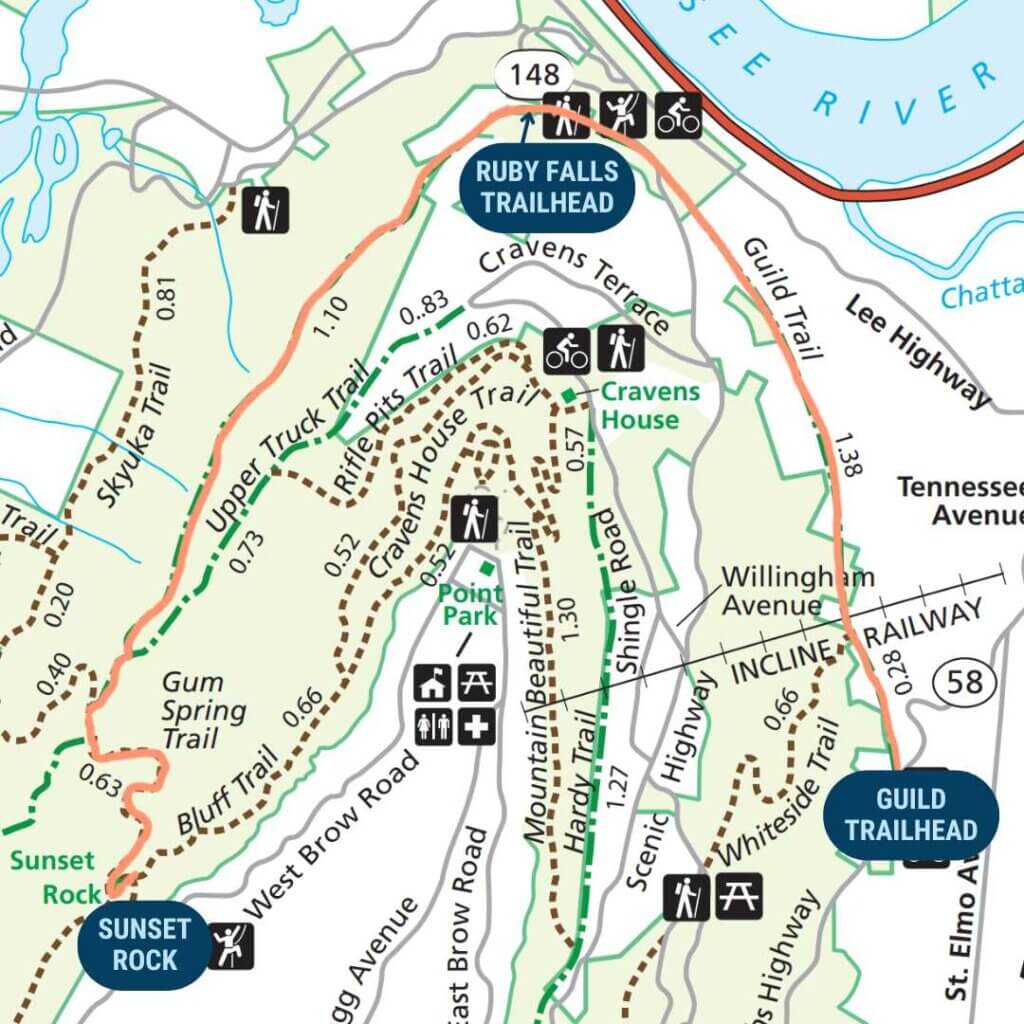
There are 3 main trailheads that you can utilize for your hike to Sunset Rock, depending on how long of a hike you want to do. From 2 of these trailheads, there’s 2 additional trail options depending on how steep of a hike you want. I’ll go into detail with all of these options below.
Guild Trailhead
Distance to Sunset Rock (route): 3.40 miles
Distance to Sunset Rock (route): 5.35 miles
Elevation Change: 1,270 feet
Location: Guild Trailhead
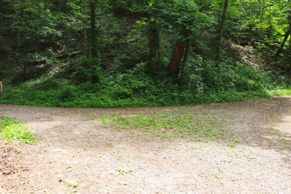
Hiking to Sunset Rock from the Guild Trailhead is the longest and most strenuous hiking option. It starts near the base of Lookout Mountain in St. Elmo. The parking lot is of ample size, but it’s right next to one of the main roads up the mountain so it can get busy. Also note, that if you choose to hike from here, not only will have to cross this busy road at the start of your hike, but you’ll also have to cross the other busy, main mountain road in front of Ruby Falls as well. If you’re concerned about safety and road crossings scare you, this will not be a good starting point for you.
Ruby Falls Trailhead
Distance to Sunset Rock (short route): 1.80 miles
Distance to Sunset Rock (long route): 3.70 miles
Elevation Change: 900 feet
Location: Ruby Falls Trailhead
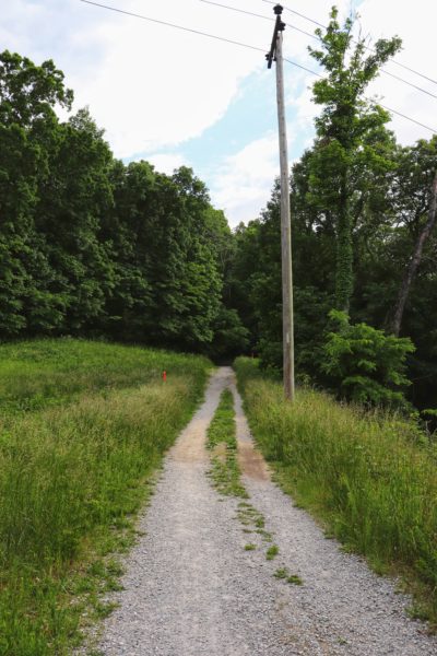
Starting at the trailhead located beside Ruby Falls is a good middle length hike option. The parking area is of ample size and it’s not visible from the road. To access the trailhead, you just need to drive as if you’re going to Ruby Falls. Turn into the main parking lot that goes in front of the building. Drive through and at the end you’ll come across a gravel road. Here you’ll turn left and park in the gravel lot at the trailhead. To leave simply follow the gravel road out. This road is a one way street which is why you must access it via the Ruby Falls parking lot.
Craven’s House Trailhead
Distance to Sunset Rock: 1.20 miles
Elevation Change: 450 feet
Location: Craven’s House Trailhead
If you want the shortest hiking option and to start further up the mountain, you’ll need to start at the Craven’s House Trailhead. This option will save you time and effort. There’s also plenty of parking at this spot. The parking lot above has plenty of spaces, but if it’s full, there’s a few spots hidden below the house along the road too.
Lookout Mountain Trails to Get to Sunset Rock
If you choose to start at the Ruby Falls Trailhead or the Guild Trailhead, you’ll need to plan if you want to take the short, but steeper hike up the mountain, or the longer, zig-zagging trails to Sunset Rock. Below are the trails you can expect to hike.
Short Route
Total Length from Ruby Falls Trailhead: 1.80 miles
Total Length from Guild Trailhead: 3.40 miles
This includes only 4 trails to reach Sunset Rock from Ruby Falls Trailhead and the Guild Trailhead. Granted only 2 of them you’re on for a very short distance. Although a shorter option, this includes a steeper trail that goes up the mountain (Gum Spring Trail).
Guild Trail
Length from Ruby Falls Trailhead: 1.10 miles
Length from Guild Trailhead: 2.75 miles
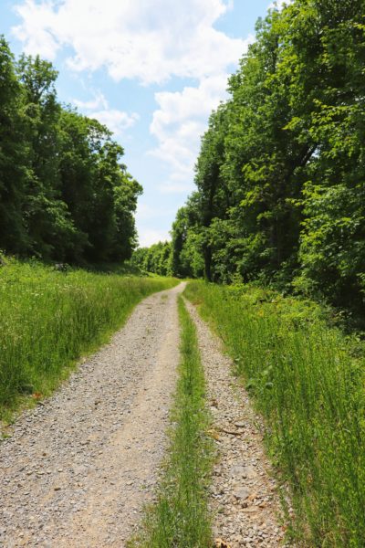
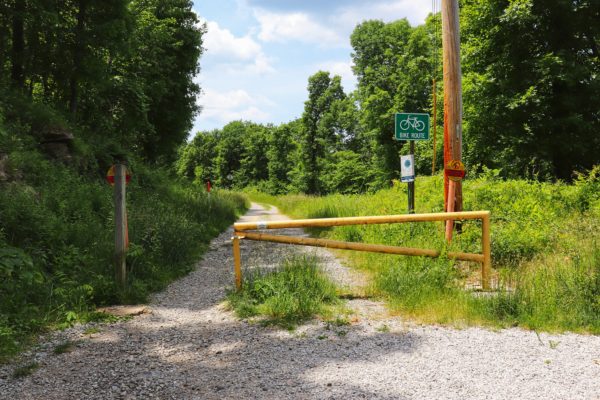
The Guild Trail is a wide gravel trail with minor elevation changes. Due to its nature, it’s a popular bike trail so please be aware and watch out for cyclists on this trail. I’ve biked part of this trail and have seen other cyclists while hiking here. But, since it’s a wide trail, there’s plenty of room for both cyclists and hikers to pass easily.
Upper Truck Trail
Length: less than a tenth of a mile
As the Guild Trail comes to an end, you will meet the Upper Truck Trail. At this fork you will go right to hike the Short Route. This trail is also a wide, grave, bike friendly path.
Gum Spring Trail
Length: .63 mile
You’ll see a sign for the Gum Spring Trail, which you will want to turn left onto and start heading up the mountain. This is a strenuous, steep trail. The Long Route also has a steep trail in it, but it’s not as steep as this one. This trail is also more narrow and simply for hiking.
Bluff Trail
Length: less than a tenth of a mile
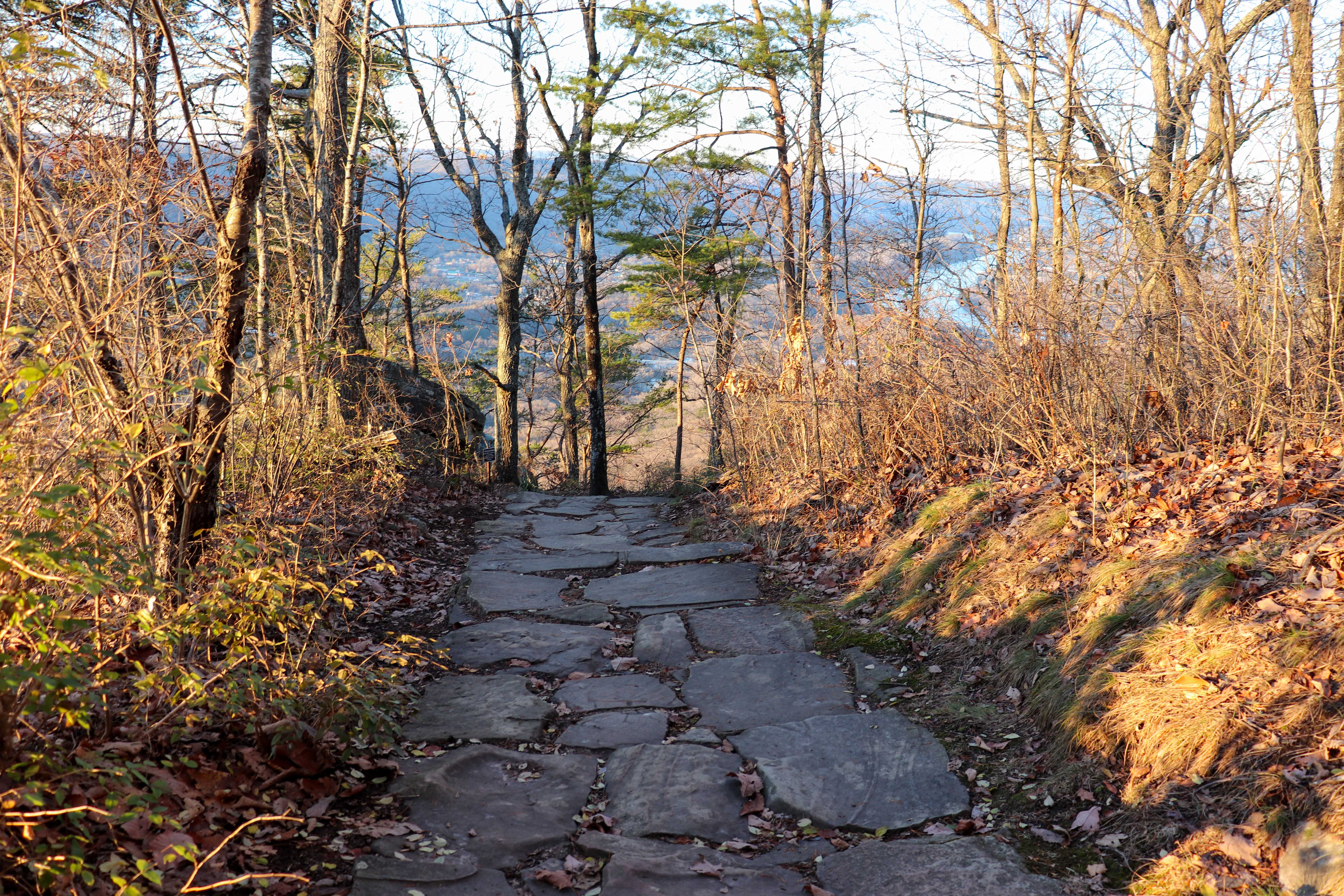
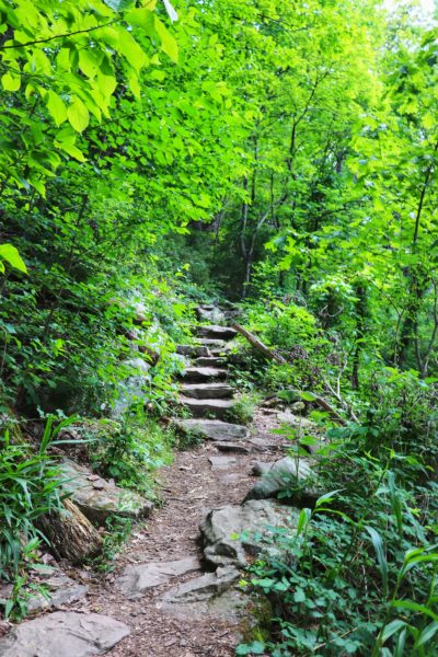
At the top of Gum Spring Trail, you’ll be at the intersection of the Bluff Trail. From here it’s just a short hike after turning left. Soon you’ll see the sign and rock steps on the right that take you up to Sunset Rock.
Long Route
Total Length from Ruby Falls Trailhead: 3.70 miles
Total Length from Guild Trailhead: 5.35 miles
This includes 5 trails to reach Sunset Rock from Ruby Falls. Although longer, it’s a much more gradual incline route.
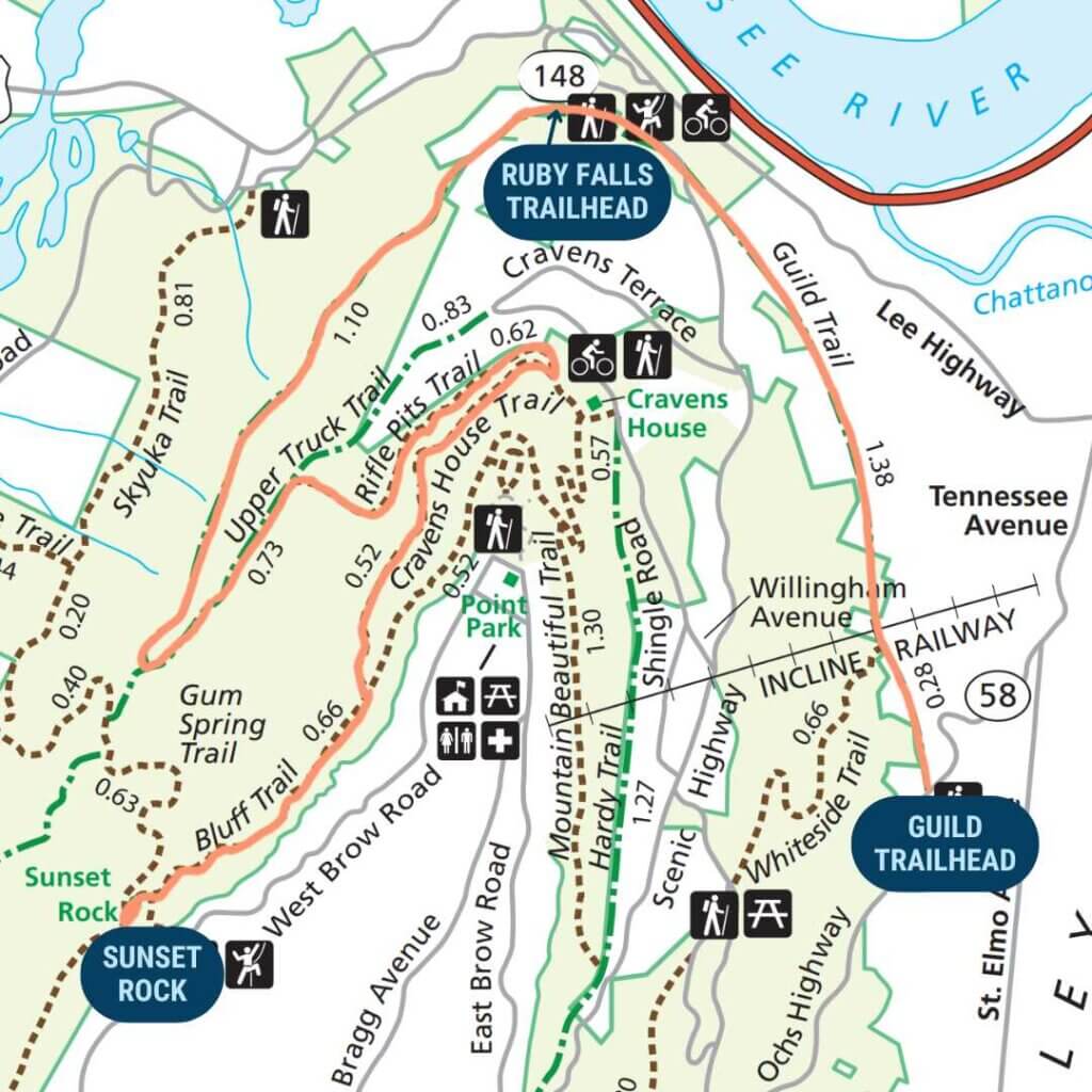
Guild Trail
Length from Ruby Falls: 1.10 miles
Length from Guild Trailhead: 2.75 miles
This is the same as shared above in the Short Route.
Upper Truck Trail
Length: .73 mile
As the Guild Trail comes to an end, you will meet the Upper Truck Trail. At this fork you will go left to hike the Long Route. This trail is also a wide, grave, bike friendly path.
Rifle Pits Trail
Length: .62 mile
The Rifle Pits Trail has some steepness to it, but it’s not as aggressive as the Gum Spring Trail from the Short Route. This trail is also more narrow and simply for hiking.
Craven’s House Trail
Length: .45 mile
At the end of the Rifle Pits Trail, you’ll reach an intersection on the Craven’s House Trail. To keep heading up the mountain toward Sunset Rock, you’ll basically need to make a U-turn to turn right onto Craven’s House Trail.
Bluff Trail
Length: .70 mile
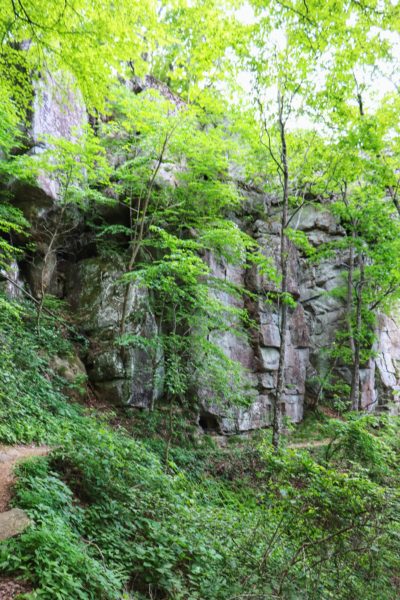
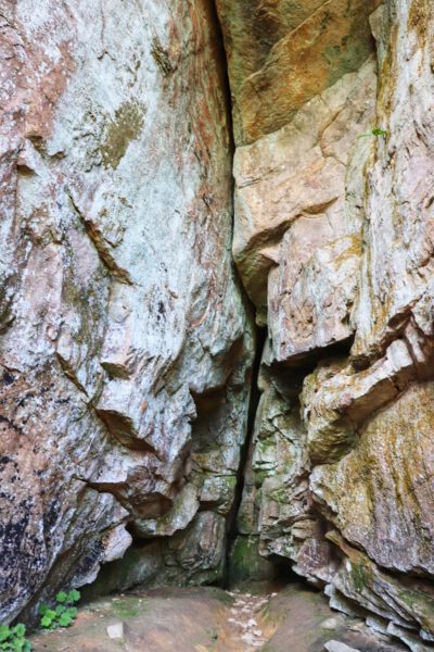
Once you reach the end of Craven’s House Trail, you’ll turn right onto the Bluff Trail. Unlike in the Short Route where you’re on this trail for a short distance, you’ll spend nearly three-quarters of a mile on this trail. But, it’s one of the most scenic parts of this hike. The trail is fairly flat, wide in most places, and has minimal elevation change. Be on the lookout for the sign and rock steps to Sunset Rock on your left.
Craven’s House Trailhead
Total Length: 1.20 mile
This is the shortest and easiest hiking option to reach Sunset Rock. It only has 2 trails.
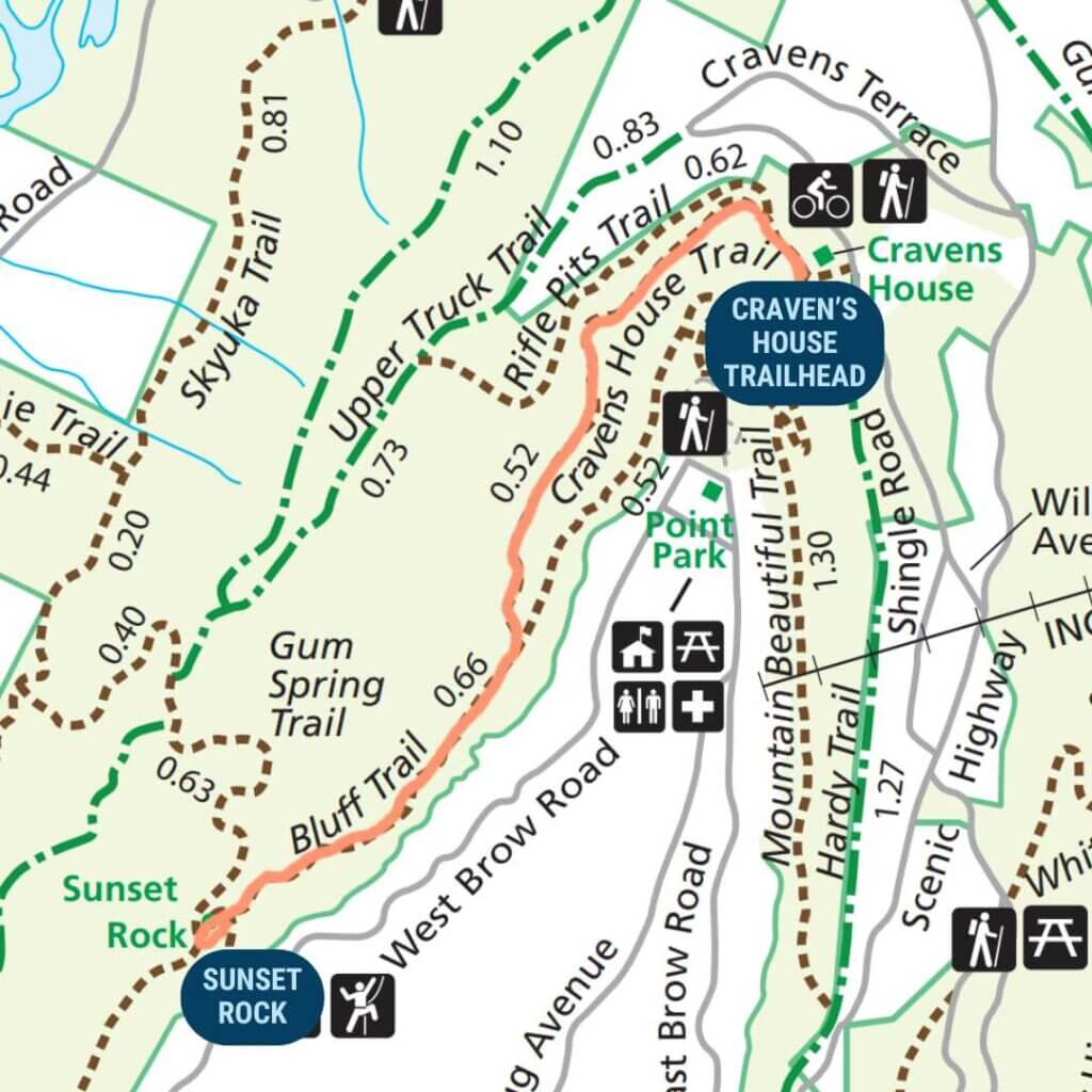
Craven’s House Trail
Length: .52 mile
Starting at Craven’s House on this trail will end up being the same as the Long Route after the initial tenth of a mile. The start of this trail is fairly wide and easy, with a few spots of elevation changes before the Bluff Trail intersection.
Bluff Trail
Length: .70 mile
This is the same as shared above in the Long Route.
Tips for Hiking to Sunset Rock
Lookout Mountain is covered in intersecting trails so it’s easy to lose your bearing if you’re not careful. I highly recommend downloading a copy of the Lookout Mountain Trails Map before you embark on your adventure to make sure you don’t get lost.
There are no restrooms at any of the trailheads, so be prepared for this.
Since all these hikes are on Lookout Mountain and close to Chattanooga, you should have good cell phone coverage during your hike.
If you opt to do one of the longer hikes, just remember that the mileage listed above is one-way so you’ll need to double it for your round-trip total. Or, feel free to mix and match between the routes. Try doing the Short Route there and the Long Route back. This will make the hike even more interesting with different scenery throughout half of it.
In Closing
I hope to hike to Sunset Rock more often now that I know how much more rewarding it is. Have you hiked to Sunset Rock instead of driving there? Let me know in the comments below.
To watch a more visual summary of a hike from the Ruby Falls Trailhead, check out the YouTube video. Until next time, enjoy exploring Chatt!

More Chattanooga Area Hikes to Explore:
- Chattanooga Hikes for Beginners
- Chattanooga Hikes with Views
- Hike to the Best View of Downtown Chattanooga
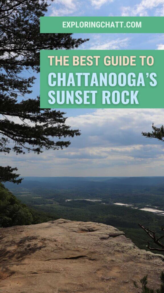
Inspired? Pin this post for later:


Nice job, Amanda. Appreciate the guidance.
Thanks Stuart!